The River Allen in north Cornwall is one of two rivers in Cornwall which share this name. In this case the name is the result of a mistake made in 1888 by Ordnance Survey, replacing the name Layne with Allen which is the old name for the lower reaches of the Camel. The other River Allen runs through Truro.

Troon is a village in Cornwall, UK, 1+1⁄2 miles southeast of Camborne. The village lies at around 560 feet (170 m) above sea level. An electoral ward named Troon and Beacon covers the area north from Troon to the outskirts of Camborne. The population at the 2011 census was 5,410.

Brea is a village in Cornwall, England, UK, between the towns of Camborne and Redruth. It is in the civil parish of Carn Brea and consists of Brea, Lower Brea, and Higher Brea. A small stream, the Red River, flows through the village and a hill, Carn Brea dominates the landscape to the east, along with its monument to Francis Basset.
Higher Bal is a hamlet in the parish of St Agnes, Cornwall, England.
Higher Boscaswell is a hamlet near Pendeen in west Cornwall, England. It is east of Pendeen and on the B road from St Ives to St Just. Higher Boscaswell is included in the St Just in Penwith division on Cornwall Council.
Higher Cransworth is a hamlet in the parish of St Breock, Cornwall, England. It is in the civil parish of St Wenn

Higher Downs is a moorland in the parish of Morvah in west Cornwall, England.

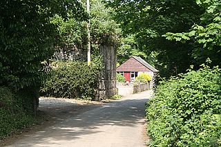
Higher Menadew is a farm west of Luxulyan in Cornwall, England.
Higher Tremarcoombe is a hamlet in the parish of St Cleer, Cornwall, England.
Lane is a hamlet in the parish of Colan, Cornwall, England. Its immigrant population is lower than the UK's national average. It also has 20% lower higher and Intermediate managerial, administrative or professional households than the UK's national average.

Latchley is a village in the Tamar Valley in Cornwall, England, UK. It is in the parish of Calstock.

Lower Porthpean is a coastal hamlet in Cornwall, England, UK. It is close to Higher Porthpean and one mile (1.6 km) south of St Austell.

Lower Tregantle is a hamlet in Cornwall, England, UK. It is about half a mile south of Antony; Higher Tregantle is about a quarter of a mile further south. It should be distinguished from Lower Tregantle, a farm near Luxulyan.

Higher Ninnes and Lower Ninnes are hamlets, south of Mulfra Hill in the civil parish of Madron in west Cornwall, England, UK.
Norris Green is a village in Cornwall, England, UK. It was enlarged from a farming hamlet so that it now adjoins the neighbouring village of Higher Metherell. Both settlements are within the civil parish of Calstock which borders the River Tamar, the county boundary with Devon in south-east Cornwall.

Pencuke is a hamlet near Higher Crackington in northeast Cornwall, England, UK.
Rosecare is a hamlet in the parish of St Gennys, Cornwall, England. Rosecare is east of Higher Crackington.
Mulberry Downs Quarry is a disused opencast tin mine in Cornwall, England, UK. Today the site is described as a 'chasm' being a steep or sheer-sided pit 700 foot (210 m) long and up to 100 foot (30 m) deep, and the quarry and immediate surroundings are heavily wooded. The quarry was designated as a Site of Special Scientific Interest (SSSI) in 1973 for its geological interest.

Camborne Treslothan was an electoral division of Cornwall in the United Kingdom which returned one member to sit on Cornwall Council between 2013 and 2021. It was abolished at the 2021 local elections, being succeeded by Four Lanes, Beacon and Troon.