
Higher Downs is a moorland in the parish of Morvah in west Cornwall, England. [1] [2]
Higher Downs is a moorland in the parish of Morvah in west Cornwall, England. [1] [2]

Blowinghouse is the name of two settlements in Cornwall, England, United Kingdom.
Cambrose is a hamlet east of Portreath in west Cornwall, England, UK.

Clowance Wood is a hamlet in the civil parish of Crowan in west Cornwall, England. Clowance Wood is situated 1 mile (1.6 km) east of Leedstown and 4.7 miles (7.6 km) north-west of Helston.
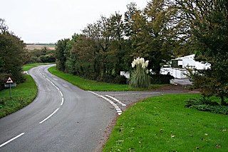
Cockwells is a hamlet in the civil parish of Ludgvan in Cornwall, England and situated on the A30 road north-east of the village of Crowlas.

Crelly is a moorland in the parish of Wendron in Cornwall, England. On the edges of the moor are Crelly Farm, Crelly Barton and Higher Crelly Farm.
Highway is a hamlet in the parish of Redruth, Cornwall, England.

Kerthen Wood, or Kirthen Wood, is a hamlet near Townshend in Cornwall, England. It is in the civil parish of Crowan

Lower Boscaswell is a hamlet near Pendeen in Cornwall, England.

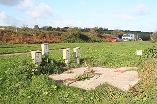
Medlyn is a site of disused mines near Porkellis in Cornwall, England.

Nanceddan is a farm north of Ludgvan in west Cornwall, England.
Newtown is a hamlet in the parish of Germoe, Cornwall, England.
Paul's Green is a hamlet between Leedstown and Townshend in west Cornwall, England, UK.
Paynter's Lane End is a hamlet in the parish of Illogan, Cornwall, England.

Penbeagle is a hamlet near St Ives in Cornwall, England, UK.
Pengegon is a residential area east of Camborne, Cornwall, England, which has a fish and chip shop, a newsagent, a children's play park and a basketball/football court.
Penhale Jakes is a hamlet west of Breage in west Cornwall, England, UK.

Penhallick is a hamlet near Pool in Cornwall, England, UK. Penhallick House was built in 1892 by Richard Cowlin the local miller and grocer who owned Cowlin Mill. The mill was converted in the 1980s by Kerrier Groundwork and is now offices for Cornwall Council.
Penrose Hill is a hamlet near Porthleven, Cornwall, England, UK.

Wheal Alfred is the site of a former copper and lead mine and a designated Site of Special Scientific Interest (SSSI) in west Cornwall, England, UK. The mine is located 1 mile (1.6 km) east of the town of Hayle and is also a Geological Conservation Review site. The mine is famous to geologists for its important mineral specimens such as mimetite and pyromorphite.
Loggans Moor is a nature reserve and Site of Special Scientific Interest, noted for its biological characteristics, in west Cornwall, England, UK. It is located 1 mile north-east of the town of Hayle, off the A30 road.
Coordinates: 50°08′46″N5°38′20″W / 50.146°N 5.639°W
| Unitary authorities | |
|---|---|
| Major settlements |
|
| Rivers | |
| Topics | |
| This Cornwall location article is a stub. You can help Wikipedia by expanding it. |