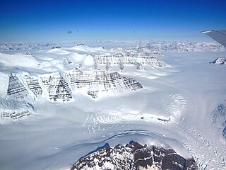
A glacier is a persistent body of dense ice that is constantly moving downhill under its own weight. A glacier forms where the accumulation of snow exceeds its ablation over many years, often centuries. It acquires distinguishing features, such as crevasses and seracs, as it slowly flows and deforms under stresses induced by its weight. As it moves, it abrades rock and debris from its substrate to create landforms such as cirques, moraines, or fjords. Although a glacier may flow into a body of water, it forms only on land and is distinct from the much thinner sea ice and lake ice that form on the surface of bodies of water.
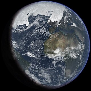
An ice age is a long period of reduction in the temperature of Earth's surface and atmosphere, resulting in the presence or expansion of continental and polar ice sheets and alpine glaciers. Earth's climate alternates between ice ages, and greenhouse periods during which there are no glaciers on the planet. Earth is currently in the ice age called Quaternary glaciation. Individual pulses of cold climate within an ice age are termed glacial periods, and intermittent warm periods within an ice age are called interglacials or interstadials.

The Karakoram is a mountain range in the Kashmir region spanning the border of Pakistan, China, and India, with the northwestern extremity of the range extending to Afghanistan and Tajikistan. Most of the Karakoram mountain range falls under the jurisdiction of Gilgit-Baltistan, which is controlled by Pakistan. Its highest peak, K2, is located in Gilgit-Baltistan, Pakistan. It begins in the Wakhan Corridor (Afghanistan) in the west, encompasses the majority of Gilgit-Baltistan, Pakistan and extends into Ladakh and Aksai Chin. It is part of the larger Trans-Himalayan mountain ranges.

A glacial erratic is a glacially deposited rock differing from the type of rock native to the area in which it rests. Erratics, which take their name from the Latin word errare, are carried by glacial ice, often over distances of hundreds of kilometres. Erratics can range in size from pebbles to large boulders such as Big Rock in Alberta.

Borith Lake is a lake in the Hunza Valley in the Gilgit–Baltistan region of northern Pakistan. Borith lies about 2,600 metres (8,500 ft) above sea level.
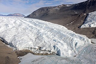
The Taylor Glacier is a glacier in Antarctica about 35 nautical miles long, flowing from the plateau of Victoria Land into the western end of Taylor Valley, north of the Kukri Hills. It flows to the south of the Asgard Range. The middle part of the glacier is bounded on the north by the Inland Forts and on the south by Beacon Valley.

Glacial motion is the motion of glaciers, which can be likened to rivers of ice. It has played an important role in sculpting many landscapes. Most lakes in the world occupy basins scoured out by glaciers. Glacial motion can be fast or slow, but is typically around 25 centimetres per day (9.8 in/d).

A moulin is a roughly circular, vertical well-like shaft formed where a surface meltstream exploits a weakness in the ice. The term is derived from the French word for mill.
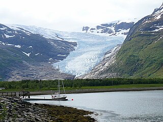
Svartisen is a collective term for two glaciers located in Nordland county in northern Norway. It is part of Saltfjellet-Svartisen National Park, located in the Saltfjell mountain range. The glaciers are located in the municipalities of Beiarn, Meløy, Rana, and Rødøy. Svartisen consists of two separate glaciers that are separated by the 1-kilometre (0.62 mi) long Vesterdalen valley. The two glaciers are:
The Biarchedi Glacier is located on the northeast of Biarchedi Peak in Gilgit-Baltistan, Pakistan. It flows north into the Baltoro Glacier.
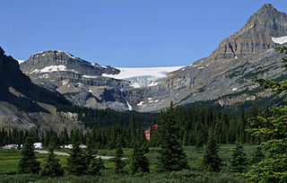
Bow Glacier is located in Banff National Park, Alberta, Canada, approximately 37 km (23 mi) northwest of Lake Louise. It can be viewed from the Icefields Parkway. Bow Glacier is an outflow glacier from the Wapta Icefield, which rests along the Continental Divide. Runoff from the glacier supplies water to Bow Lake and the Bow River. The glacier is credited for creating the Bow Valley before retreating at the end of the last glacial maximum.
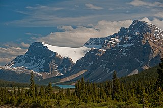
Crowfoot Glacier is located in Banff National Park, Alberta, Canada, 32 km (20 mi) northwest of Lake Louise, and can be viewed from the Icefields Parkway. The glacier is situated on the northeastern flank of Crowfoot Mountain.
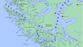
Almirantazgo Fjord, also known as Almirantazgo Sound or Admiralty Sound, is a Chilean fjord located in the far south of the country at 54°19′S69°30′W. The fjord cuts deeply into the west coast of the Isla Grande de Tierra del Fuego, extending southeastwards from the Whiteside Channel, which separates Isla Grande from Dawson Island. On its south side several smaller fjords and bays make significant indentations into the north coastline of the Cordillera Darwin. One of these, Ainsworth Bay, is home to a colony of elephant seals. Azopardo River empties into the head of the fjord.

Wedge Mountain, 2,895 m (9,498 ft) prominence: 2,249 m (7,379 ft), often locally referred to as The Wedge or simply "Wedge", is the highest summit in the Garibaldi Ranges and therefore also Garibaldi Provincial Park, and is among the nearest of the many peaks visible from the Whistler Blackcomb Ski Area, lying north across the valley of Billygoat Pass from the Spearhead Range, which includes one of that resort's two flagship mountains, Blackcomb. It was named for its distinctive wedge shape by the Garibaldi Park Board in 1932 in preference to Mount Vancouver, which had been submitted earlier. It is part of an unnamed range forming the most northerly group of peaks in the Garibaldi Ranges, the other two most notable being Mount Weart, known as the Armchair because of its shape, and Mount Currie, which overlooks the First Nations Reserve of the same name and the neighbouring town of Pemberton. Wedge's very high prominence is defined by the divide between the Green and Cheakamus Rivers at a locality at the south end of Alta Lake known as Tokum Corners.

The Nordenskjöld is a lake in Torres del Paine National Park in the Magallanes Region, southern Chile. The lake is named after the Swede Otto Nordenskjöld, who explored the region at the beginning of the 20th century. The outfall of Nordenskjöld Lake consists of a waterfall known as Salto Grande. At this western end of the lake on the southern side is an abundance of wildlife, including grazing guanaco.

Grey Glacier is a glacier in the Southern Patagonian Ice Field, just west of the Cordillera del Paine. It flows southward into the lake of the same name. Before dividing in two at its front end, the glacier is 6 kilometers wide and over 30 meters high. In 1996, it occupied a total area of 270 km2 (100 sq mi) and a length of 28 km (17 mi). In November 2017 a large iceberg broke off the glacier.

Italia Glacier is a tidewater glacier located in Alberto de Agostini National Park, Chile. It flows down in a southwest direction to its terminus in the Beagle Channel.

Mount Dawson, elevation 3,377 metres (11,079 ft), is a massif in the Selkirk Mountains of British Columbia, Canada, located in Glacier National Park to the southeast of Rogers Pass. It is a double summit, the highest of which is Hasler Peak, the second peak being Feuz Peak, with Hasler Peak's elevation making it the highest summit in Glacier National Park and the second highest in the Selkirks. Mount Dawson is ranked as the 58th highest mountain in British Columbia. The Dawson Glacier is located on its eastern flank.


