Light Regional Council is a local government area north of Adelaide in South Australia. It is based in the town of Kapunda, and includes the towns of Freeling, Greenock, Hansborough, Hewett, Roseworthy and Wasleys.
Hamilton is a small township in the Mount Lofty Ranges in South Australia. It is about 120 km northeast of Adelaide, South Australia, about 23 km north of Kapunda. Once a stop for the mining carts going from Adelaide to Burra, but now just a small agricultural district.

Marrabel is a township and locality beside the Light River in South Australia's Mid North. It is in the Clare and Gilbert Valleys Council local government area, 100 kilometres (62 mi) north west of the state capital, Adelaide. At the 2021 census, Marrabel had a population of 101.

Hansborough is a locality along the former Morgan railway line adjacent to the Thiele Highway, in South Australia's Mid North region. It is situated 9 kilometres south-west of Eudunda and 18 kilometres north-east of Kapunda. The Light River runs through the locality.

The Light River, commonly called the River Light, is a seasonal and significant river in the Mid North region of the Australian state of South Australia named for early surveyor William Light.

Barossa zone is a wine zone located in central South Australia west of the Murray River and which occupies the Barossa Valley, the Eden Valley and some adjoining land. The zone which is enclosed by the Mount Lofty Ranges zone on three sides and by the Lower Murray zone to its east, contains two wine regions which have received appellation as Australian Geographical Indications (AGI). These are the Barossa Valley and Eden Valley regions. The Barossa zone also includes a broader area around these two defined regions. The zone received AGI in 1996.

St Johns is a locality southeast of Kapunda in the northern Barossa Valley, South Australia. Originally a private subdivision on sections 1450, 1451 and 1533 of the Hundred of Belvidere, the boundaries of the locality were formalised in 2000 and the name formally adopted based on long-established use.

Ebenezer is a locality in the northern Barossa Valley of South Australia. It includes the historic Ebenezer settlement settled by 72 Wendish Lutherans who had migrated from Silesia in January 1852.

The County of Hindmarsh is one of the 49 cadastral counties of South Australia. It was proclaimed by Governor George Grey in 1842 and named for Governor John Hindmarsh.

The County of Light is one of the 49 cadastral counties of South Australia. It was proclaimed by Governor George Grey in 1842 and named for the River Light, the river being named after Colonel William Light, the first Surveyor-General of South Australia. It covers the modern region of the Barossa Valley and a portion of the northern Mt Lofty Ranges. It is bounded by the upper Wakefield River in the north, the approximate path of Horrocks Highway in the west, and the North Para River in the south, and is bisected east to west by the River Light.

The Hundred of Strathalbyn is a cadastral division of the County of Hindmarsh in South Australia. It lies west of the Adelaide Hills and east of Lake Alexandrina and includes at its southwestern extremity the town of Strathalbyn. Its name is derived from that used for a sub-division granted in 1841. No definitive derivation for the subdivision of Strathalbyn name is known but it is deemed probable that John Rankine or his brother William provided the name with the meaning given as "white valley" from the Scottish srath and albion. Mount Barker Creek forms much of the northern hundred boundary while the Bremer River forms the eastern border.
The Hundred of Jellicoe is a cadastral hundred in the County of Eyre in South Australia. It is located on the east Mount Lofty Ranges foothills. The Hundred of North Rhine was proclaimed in 1851 but the name was changed in 1918 to the current, after Admiral John Jellicoe, as part of a process to remove "names of enemy origin" at the time of World War I.
The Hundred of Gilbert is a cadastral unit of hundred in the northern Mount Lofty Ranges including the town of Riverton. It is one of the nine hundreds of the County of Light. It was proclaimed in 1851 by Governor Henry Young and named after the Gilbert River, which flows from north to south through the hundred. The river, in turn, was named in honour of South Australian pioneer Thomas Gilbert.
The District Council of Light was a local government area in South Australia from 1867 to 1892.
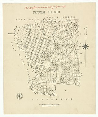
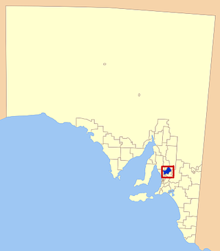
The Hundred of Jutland is a hundred of the County of Sturt in South Australia. It is located on the east Mount Lofty Ranges foothills. The Hundred of South Rhine was proclaimed in 1851 but the name was changed in 1918 to the current, after the Battle of Jutland which took place off the coast of Denmark in 1916. The name change was part of a process to remove "names of enemy origin" at the time of World War I.
The Belvidere Range is a mountain range of the Northern Mount Lofty Ranges in South Australia.

The Hundred of Kapunda is a cadastral unit of hundred in the County of Light, South Australia in the lower Mid North just north of the Barossa Valley. Named for the Kapunda copper mine in the 1850s which in turn is thought to have been a corruption of the indigenous word cappieoonda, referring to the spring which supplied water to the town. The hundred is bounded on the south by the River Light

The Hundred of Nuriootpa is a cadastral unit of hundred in the County of Light, South Australia split between in the eastern Adelaide Plains and western Barossa Valley. Named in 1847 for an indigenous term officially thought to mean "bartering place" and traditionally used as neutral ground for trading between various indigenous tribes, it is bounded on the south and east by the North Para River.
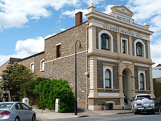
The District Council of Kapunda was a local government area in South Australia from 1866 to 1996. The Kapunda town corporation was formed a year earlier in 1865 and ultimately amalgamated into the district council.

The District Council of Belvidere was a local government area in South Australia. It was created to provide local government in the Hundred of Belvidere on 13 December 1866 and combined into the District Council of Kapunda on 12 May 1932.

