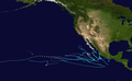
Hurricane Olaf (2003)

Last updated

Map key
  Tropical depression (≤38 mph, ≤62 km/h)
  Tropical storm (39–73 mph, 63–118 km/h)
  Category 1 (74–95 mph, 119–153 km/h)
  Category 2 (96–110 mph, 154–177 km/h)
  Category 3 (111–129 mph, 178–208 km/h)
  Category 4 (130–156 mph, 209–251 km/h)
  Category 5 (≥157 mph, ≥252 km/h)
  Unknown
Storm type
Disc Plain black.svg Tropical cyclone
Solid black.svg Subtropical cyclone
ArrowUp.svg Extratropical cyclone, remnant low, tropical disturbance, or monsoon depression

Olaf originated from a tropical wave that exited the coast of Africa on September 17. Over the next two weeks, it moved westbound into the northeastern Pacific Ocean. [1] Initially, the wave was not in an environment conductive for further development. [2] However, on October 2, a low-level circulation was noted on satellite imagery. This circulation quickly became better defined over the next several hours while located 400 mi (645 km) south of Acapulco. [1] The next day, Dvorak Classifications, a tool that estimates a tropical cyclone intensity, were placed at T1.5/30 mph (50 km/h). In addition, a ship nearby reported winds of 35 mph (45 km/h). Microwave imagery also indicated that the center was near the associated convection. Based on this, the system was upgraded into a tropical depression. [3]

Initially, wind shear from nearby Tropical Storm Nora was expected to weaken the system but this did not occur. , the depression was soon upgraded into a tropical storm. [4] Moving northwest, it steadily intensified into a moderate tropical storm late on October 3. The next day, Olaf weakened slightly, [1] only to resume intensification roughly 24 hours later. [1] At that time, it was noted that additional intensification was likely. [5] On October 5, radar imagery indicated a partial eyewall. Based on this, Olaf was upgraded into a minimal hurricane. At the same time, reached it peak intensity at 75 mph (120 km/h) and a barometric pressure of 987 millibars. Olaf was hurricane for only six hours, [1] but operationally it was believed had been a hurricane for much longer. This is Because that the center was operationally believed to be further north, closer to the deep convection, Olaf was operationally believed to have been a hurricane for much longer. [6]

Shortly after reaching its peak, Olaf began to become less organized, resulting in steady weakening while the storm's motion slowed. By early October 6, Olaf was only a minimal tropical storm as the system recurved northwest. [1] However, Olaf rapidly reorganized that afternoon and the National Hurricane Center re-assessed the intensity at 50 mph (80 km/h) based on increased banding features. [7] Continued restrengthening occurred, and by October 8, Olaf made landfall with winds of 60 mph (97 km/h) near Manzanillo. Olaf weakened rapidly over the high terrain of the coast. Within 24 hours, Olaf had dissipated inland. [1]

Preparations and impact

Rainfall map with Nora Olaf-Nora2003filledrainblk.gif
Rainfall map with Nora

While Olaf was at peak strength, a tropical storm warning issued for Punta San Telmo to Lazaro Cardenas and a hurricane warning was issued from Punta San Telmo to San Blas, including the Islas Marias. The next day, the tropical storm warning was extended to include Manzanillo. At that same time, a hurricane watch was issued from San Blas to Mazatlán. In addition, hurricane warning was extended to include areas from Manzanillo to San Blas including the Islas Marias. Three hours later, when Olaf was revealed to be much weaker, the hurricane warnings and hurricane watches were canceled. However, the tropical storm warnings remained in effect until October 7. [1] A yellow alert was declared in the Mexican states of Michoacán, Colima, and Jalisco, and a green alert was declared in Baja California Sur, Sinaloa, Nayarit, and Guerrero. [8] Local authorities also opened shelters. [9]

Olaf was a part of a rainy year in Mexico, [1] producing more rain than Hurricane Nora. [10] One person was killed, [11] and flooding caused serve damage to roadways and crops in the Mexican state of Jalisco. In the same state, more than 12,000 homes were damaged. [1] In the state of Guanajuato, an estimated total of 15,000 people were impacted from the floods. In addition, two communities were isolated. After the hurricane, a program wanted donation from food to basic home supplies. [12] Moisture from the remnants of Nora and Olaf interacted with an upper-level low to produce heavy rainfall across Texas, producing flooding near Waco that forced a family to evacuate in McGregor. The floodwaters closed portions of Interstate 35, U.S. Route 84, and Texas State Highway 36. [13] It also spawned a tornado in Sugar Land that damaged four buildings, including a school. [14]

See also

Related Research Articles

<span class="mw-page-title-main">Hurricane Kenna</span> Category 5 Pacific hurricane in 2002

Hurricane Kenna was the fourth-most intense tropical cyclone on record in the Eastern Pacific basin, and at the time the third-most intense Pacific hurricane to strike the west coast of Mexico. Kenna was the sixteenth tropical depression, thirteenth tropical storm, seventh hurricane, sixth major hurricane, and third Category 5 hurricane of the 2002 Pacific hurricane season. After forming on October 22 to the south of Mexico from a tropical wave, forecasters consistently predicted the storm to strengthen much less than it actually did. Moving into an area of favorable upper-level conditions and warm sea surface temperatures, Kenna quickly strengthened to reach peak winds of 165 mph (270 km/h) as a Category 5 hurricane, on October 25, while located about 255 mi (410 km) southwest of Puerto Vallarta, Jalisco. Weakening as it turned to the northeast, the hurricane made landfall near San Blas, Nayarit as a Category 4 hurricane, with sustained winds of 140 mph (220 km/h), before dissipating on October 26 over the Sierra Madre Occidental mountains.

<span class="mw-page-title-main">2003 Pacific hurricane season</span> Hurricane season in the Pacific Ocean

The 2003 Pacific hurricane season was the first season to feature no major hurricanes – storms of Category 3 intensity or higher on the Saffir–Simpson hurricane wind scale (SSHWS) – since 1977. The dates conventionally delimiting the period when most tropical cyclones form in the Pacific Ocean are May 15 in the Eastern Pacific Ocean and June 1 in the Central Pacific, with both seasons ending on November 30. The 2003 season featured 16 tropical storms between May 19 and October 26; 7 of these became hurricanes, which was then considered an average season. Damage across the basin reached US$129 million, and 23 people were killed by the storms.

<span class="mw-page-title-main">1998 Pacific hurricane season</span> Hurricane season in the Pacific Ocean

The 1998 Pacific hurricane season was a fairly average Pacific hurricane season. Despite this, it had nine hurricanes and six major hurricanes, which was well above average. The season officially started on May 15 in the eastern Pacific and on June 1 in the central Pacific, and ended on November 30; these dates conventionally delimit the period during which most tropical cyclones form in that region. The first tropical cyclone developed on June 11, about ten days later than the normal start of the season. The final storm of the year, Hurricane Madeline, dissipated on October 20. Storm activity in the Central Pacific Hurricane Center's warning zone was low, with just one tropical depression observed in the region. Two tropical cyclones from the eastern Pacific also entered the central Pacific; the former did so as a hurricane.

<span class="mw-page-title-main">1997 Pacific hurricane season</span> Hurricane season in the Pacific Ocean

The 1997 Pacific hurricane season was a very active hurricane season. With hundreds of deaths and hundreds of millions of dollars in damage, this was one of the deadliest and costliest Pacific hurricane seasons on record. This was due to the exceptionally strong 1997–98 El Niño event. The season officially started on May 15, in the eastern Pacific, and on June 1, in the central Pacific, and lasted until November 30. These dates conventionally delimit the period of each year when almost all tropical cyclones form in the northeastern Pacific Ocean.

<span class="mw-page-title-main">1996 Pacific hurricane season</span> Hurricane season in the Pacific Ocean

The 1996 Pacific hurricane season is tied with 2021 for the most Pacific hurricanes to make landfall on Mexico in one year, with four striking the country. It was a below average season that produced 9 tropical storms, 5 hurricanes and 2 major hurricanes. With 9 tropical storms, 1996 ranks as the second-least active Pacific hurricane season on record. It officially began May 15, 1996, in the eastern north Pacific and on June 1, 1996, in the central north Pacific. It ended on November 30, 1996. These dates conventionally delimit the period of each year when most tropical cyclones form in the northeastern Pacific Ocean. The season slightly exceeded these bounds when tropical storm One-E formed on May 13.

<span class="mw-page-title-main">1995 Pacific hurricane season</span> Hurricane season in the Pacific Ocean

The 1995 Pacific hurricane season was the least active Pacific hurricane season since 1979, and marked the beginning of a multi-decade period of low activity in the basin. Of the eleven tropical cyclones that formed during the season, four affected land, with the most notable storm of the season being Hurricane Ismael, which killed at least 116 people in Mexico. The strongest hurricane in the season was Hurricane Juliette, which reached peak winds of 150 mph (240 km/h), but did not significantly affect land. Hurricane Adolph was an early-season Category 4 hurricane. Hurricane Henriette brushed the Baja California Peninsula in early September.

<span class="mw-page-title-main">1992 Pacific hurricane season</span> Hurricane season in the Pacific Ocean

The 1992 Pacific hurricane season is the most active Pacific hurricane season on record, featuring 27 named storms, and the third-costliest Pacific hurricane season in history, behind the 2013 season. The season also produced the second-highest ACE value on record in the basin, only surpassed by the 2018 season. The season officially started on May 15 in the eastern Pacific, and on June 1 in the central Pacific, and lasted until November 30. These dates conventionally delimit the period of each year when most tropical cyclones form in the northeastern Pacific Ocean. However, these bounds were easily exceeded when Hurricane Ekeka formed on January 28 and again a couple months later with Tropical Storm Hali.

<span class="mw-page-title-main">1991 Pacific hurricane season</span> Hurricane season in the Pacific Ocean

The 1991 Pacific hurricane season was a near-average Pacific hurricane season. The worst storm this year was Tropical Storm Ignacio, which killed 23 people in Mexico and injured 40 others. Elsewhere, Hurricane Fefa caused flooding in Hawaii. Hurricane Kevin was the strongest system of the season and became the then longest-lasting hurricane in the eastern north Pacific basin at the time, and Hurricane Nora was the strongest November storm to that point. The season officially started on May 15, 1991, in the eastern Pacific, and on June 1, 1991, in the central Pacific. It lasted until November 30, 1991, in both basins. These dates conventionally delimit the period of each year when most tropical cyclones form in the northeastern Pacific Ocean.

<span class="mw-page-title-main">Hurricane Hernan (1996)</span> Category 1 Pacific hurricane in 1996

Hurricane Hernan was fourth and final tropical cyclone to strike Mexico at hurricane intensity during the 1996 Pacific hurricane season. The thirteenth tropical cyclone, eighth named storm, and fifth hurricane of the season, Hernan developed as a tropical depression from a tropical wave to the south of Mexico on September 30. The depression quickly strengthened, and became Tropical Storm Hernan later that day. Hernan curved north-northwestward the following day, before eventually turning north-northeastward. Still offshore of the Mexican coast on October 2, Hernan intensified into a hurricane. Six hours later, Hernan attained its peak as an 85 mph (140 km/h) Category 1 hurricane on the Saffir-Simpson Hurricane Wind Scale (SSHWS). After weakening somewhat, on 1000 UTC October 3, Hurricane Hernan made landfall near Barra de Navidad, Jalisco, with winds of 75 mph (120 km/h). Only two hours after landfall, Hernan weakened to a tropical storm. By October 4, Tropical Storm Hernan had weakened into a tropical depression, and dissipated over Nayarit on the following day.

<span class="mw-page-title-main">Tropical Storm Norman (2000)</span> Pacific tropical storm in 2000

Tropical Storm Norman was a tropical cyclone that hit Mexico in September 2000. The sixteenth cyclone and fourteenth named storm of the 2000 Pacific hurricane season, Norman originated in a tropical wave that emerged from the coast of Africa on September 4, and moved westward across the Atlantic Ocean; the wave entered the Pacific on September 16. The disturbance organized into a tropical depression on early on September 20, and later that day the storm reached its peak intensity of 50 mph (80 km/h), and subsequently made landfall to the west of Lázaro Cárdenas, Michoacán. After weakening to a tropical depression over land, the storm re-emerged over open waters, and made a second landfall before dissipating shortly thereafter. The storm produced heavy rain that resulted in flooding and mudslides, killing about nine people.

<span class="mw-page-title-main">Hurricane Nora (2003)</span> Category 2 Pacific hurricane in 2003

Hurricane Nora was the fourth of five tropical cyclones to make landfall in Mexico during the 2003 Pacific hurricane season. The fourteenth named storm and fifth hurricane of the season, Nora developed on October 1 from a tropical wave. It slowly intensified as it moved northwestward, intensifying into a hurricane on October 4. That day, Nora rapidly intensified to its peak of 100 mph (160 km/h), but the larger Hurricane Olaf to its east prevented further strengthening. An approaching trough turned the rapidly weakening system to the east toward Mexico. By October 7, it was downgraded to a tropical depression. Although it no longer met the criteria for being a tropical cyclone, the National Hurricane Center continued issuing advisories due to the cyclone's proximity with land. Nora unexpectedly redeveloped an area of thunderstorms and moved ashore near Mazatlán, Sinaloa on October 9 before dissipating. The depression dropped locally heavy rainfall in western Mexico, but there were no reports of damage. Later, the remnants combined with Olaf and an upper-level low to produce flooding and a tornado in central Texas.

<span class="mw-page-title-main">2009 Pacific hurricane season</span> Hurricane season in the Pacific Ocean

The 2009 Pacific hurricane season was the most active Pacific hurricane season since 1997. The season officially started on May 15 in the East Pacific Ocean, and on June 1 in the Central Pacific; they both ended on November 30. These dates conventionally delimit the period of each year when most tropical cyclones form in the Eastern Pacific tropical cyclone basin; however, tropical cyclone formation is possible at any time of the year. The first system of the season, Tropical Depression One-E, developed on June 18, and the last, Hurricane Neki, dissipated on October 27, keeping activity well within the bounds of the season.

<span class="mw-page-title-main">Hurricane Andres (2009)</span> Category 1 Pacific hurricane in 2009

Hurricane Andres was the first named storm and hurricane of the 2009 Pacific hurricane season. Forming on June 21, Andres gradually intensified as it tracked along the Mexican coastline. Deep convection developed around the center of circulation and by June 23, the storm attained hurricane-status, peaking with winds of 80 mph (130 km/h). Upon attaining this intensity, the storm featured a developing eyewall within a central dense overcast. Within 36 hours, the storm rapidly degenerated, having most of the convection being displaced by high wind shear, becoming a non-tropical trough during the afternoon of June 24.

<span class="mw-page-title-main">Tropical Storm Olaf (1997)</span> Pacific tropical storm in 1997

Tropical Storm Olaf was an erratic and long-lived tropical cyclone that brought heavy rainfall to regions of Mexico, which would be devastated by Hurricane Pauline a week later. The sixteenth named storm of the 1997 season, Olaf formed on September 26 off the southern coast of Mexico. It moved northward and quickly intensified, reaching peak winds of 70 mph (110 km/h) before weakening and hitting Oaxaca as a tropical depression. In Mexico, El Salvador, and Guatemala, the system brought heavy rainfall, which killed 18 people and caused flooding and damage. It was originally thought that Olaf dissipated over Mexico, although its remnants continued westward for a week. It interacted with Hurricane Pauline, which caused Olaf to turn to the southeast and later to the north to strike Mexico again, finally dissipating on October 12.

<span class="mw-page-title-main">2015 Pacific hurricane season</span> Hurricane season in the Pacific Ocean

The 2015 Pacific hurricane season is the second-most active Pacific hurricane season on record, with 26 named storms, only behind the 1992 season. A record-tying 16 of those storms became hurricanes, and a record 11 storms further intensified into major hurricanes throughout the season. The Central Pacific, the portion of the Northeast Pacific Ocean between the International Date Line and the 140th meridian west, had its most active year on record, with 16 tropical cyclones forming in or entering the basin. Moreover, the season was the third-most active season in terms of accumulated cyclone energy, amassing a total of 290 units. The season officially started on May 15 in the Eastern Pacific and on June 1 in the Central Pacific; they both ended on November 30. These dates conventionally delimit the period of each year when most tropical cyclones form in the Northeast Pacific basin. However, the formation of tropical cyclones is possible at any time of the year. This was shown when a tropical depression formed on December 31. The above-average activity during the season was attributed in part to the very strong 2014–16 El Niño event.

<span class="mw-page-title-main">2016 Pacific hurricane season</span> Hurricane season in the Pacific Ocean

The 2016 Pacific hurricane season was tied as the fifth-most active Pacific hurricane season on record, alongside the 2014 season. Throughout the course of the year, a total of 22 named storms, 13 hurricanes and six major hurricanes were observed within the basin. Although the season was very active, it was considerably less active than the previous season, with large gaps of inactivity at the beginning and towards the end of the season. It officially started on May 15 in the Eastern Pacific, and on June 1 in the Central Pacific ; they both ended on November 30. These dates conventionally delimit the period of each year when most tropical cyclones form in these regions of the Pacific Ocean. However, tropical development is possible at any time of the year, as demonstrated by the formation of Hurricane Pali on January 7, the earliest Central Pacific tropical cyclone on record. After Pali, however, no tropical cyclones developed in either region until a short-lived depression on June 6. Also, there were no additional named storms until July 2, when Tropical Storm Agatha formed, becoming the latest first-named Eastern Pacific tropical storm since Tropical Storm Ava in 1969.

<span class="mw-page-title-main">Hurricane Winifred</span> Category 3 Pacific hurricane in 1992

Hurricane Winifred was the last tropical cyclone to make landfall in the record-breaking 1992 Pacific hurricane season. Impacting western Mexico, especially Colima and Michoacán, Hurricane Winifred brought heavy rain and destruction to the area. Rains flooded farms and roads, and caused more than $5 million in damage and a total of three people were killed.

<span class="mw-page-title-main">Hurricane Jova (2011)</span> Category 3 Pacific hurricane in 2011

Hurricane Jova was a powerful Category 3 Pacific hurricane that made landfall on southwestern Mexico in October 2011. The tenth named storm, ninth hurricane and fifth major hurricane of the 2011 Pacific hurricane season, Jova developed from a tropical disturbance that initially formed on October 5, 2011. The disturbance steadily organized and acquired more thunderstorm activity over the following hours, and it became a tropical depression early on October 6. The depression strengthened into Tropical Storm Jova later that day. Moving generally northward, wind shear initially inhibited Jova from strengthening much until the establishment of more favorable conditions on October 8 allowed Jova to begin to intensify. It reached hurricane strength that day as it drifted eastwards, and major hurricane status on October 10 after a period of steady intensification. Jova reached peak intensity the following day as a high-end Category 3 hurricane, with maximum sustained winds of 125 mph (205 km/h), and a minimum barometric pressure of 955 mbar (28.20 inHg). Jova weakened somewhat as it approached the Pacific coast of Mexico, and made landfall near Barra de Navidad, Jalisco on October 12 as a still-powerful Category 2 hurricane. The storm rapidly weakened as it moved inland and dissipated later that day.

<span class="mw-page-title-main">Hurricane Bud (2012)</span> Category 3 Pacific hurricane in 2012

Hurricane Bud was a rare May major hurricane that skirted areas of the western Mexican coast. The second tropical cyclone and named storm of the 2012 Pacific hurricane season, Bud developed slowly into a tropical depression from a low-pressure area, centered well south of Mexico on May 20. It moved generally west-northwestward and by the following day, strengthened into Tropical Storm Bud. Thereafter, further intensification was slow. By late on May 23, Bud reached winds of 65 mph (105 km/h). On the following day, however, rapid deepening commenced, with the storm becoming a hurricane on that day. Bud peaked as a 115 mph (185 km/h) Category 3 hurricane on May 25. Several hours after reaching that intensity, the storm began to quickly weaken as it moved near Western Mexico. Bud continued to weaken, eventually dissipating the next day.

<span class="mw-page-title-main">2021 Pacific hurricane season</span> Hurricane season in the Pacific Ocean

The 2021 Pacific hurricane season was a moderately active Pacific hurricane season, with above-average activity in terms of number of named storms, but below-average activity in terms of major hurricanes, with 19 named storms, 8 hurricanes, and 2 major hurricanes forming in all. It also had a near-normal accumulated cyclone energy (ACE). The season officially began on May 15, 2021 in the Eastern Pacific Ocean, and on June 1, 2021, in the Central Pacific in the Northern Hemisphere. The season ended in both regions on November 30, 2021. These dates historically describe the period each year when most tropical cyclogenesis occurs in these regions of the Pacific and are adopted by convention. However, the formation of tropical cyclones is possible at any time of the year, as illustrated by the formation of Tropical Storm Andres on May 9, which was the earliest forming tropical storm on record in the Eastern Pacific. Conversely, 2021 was the second consecutive season in which no tropical cyclones formed in the Central Pacific.

References

  1. 1 2 3 4 5 6 7 8 9 10 National Hurricane Center (2003). "Tropical Cyclone Report: Hurricane Olaf" (PDF). National Oceanic and Atmospheric Administration . Retrieved 2015-05-22.
  2. John Brown/Lawrence (2010-10-02). "Tropical Weather Outlook". National Hurricane Center . Retrieved 2010-07-01.
  3. Franklin, James (2010-10-03). "Tropical Depression Eighteen-E Discussion 1". National Hurricane Center . Retrieved 2010-06-29.
  4. Franklin, James (2003). "Tropical Storm Olaf Discussion 2". National Hurricane Center . Retrieved 2010-06-29.
  5. Jarrvien (2003-10-04). "Tropical Storm Olaf Discussion 7". National Hurricane Center . Retrieved 2010-06-29.
  6. Franklin, James (2010-10-06). "Hurricane Olaf Discussion 13". National Hurricane Center . Retrieved 2010-06-30.
  7. Franklin, James (2003-10-06). "Tropical Storm Olaf Discussion 15". National Hurricane Center . Retrieved 2010-06-30.
  8. "Pacific hurricanes Nora and Olaf". OffGuard. 2003-10-06. Archived from the original on 2011-06-15. Retrieved 2010-06-03.
  9. Staff Writer (2003-10-06). "Mexicans prepare for hurricane Olaf" (in Spanish). Archived from the original on 2013-02-04. Retrieved 2010-07-02.
  10. David M. Roth. "Hurricanes Nora/Olaf - October 3–8, 2003". Hydrometeorological Prediction Center . Retrieved 2008-10-31.
  11. Sistema Nacional de Protección Civil: Centro Nacional de Prevención de Desastres (March 2004). Informe de la Temporada de Ciclones Tropicales del 2003 (PDF) (Report) (in Spanish). El Secretario de Gobernación de Mexico. Retrieved January 1, 2022.
  12. Staff Writer (2003-06-23). "Post-hurricane appeal". Reliefweb.com. Retrieved 2010-07-02.
  13. Staff Writer (2003-10-09). "Possible tornado hits Houston suburb; floods hit Waco area". Beaumont Enterprise. Associated Press. Retrieved 2011-06-26.
  14. Staff Writer (2003-10-11). "Tornadoes Hit Part of Texas". Reading Eagle. Associated Press. Retrieved 2011-06-26.
Hurricane Olaf
Olaf 2003-10-05 0900Z.jpg
Hurricane Olaf approaching Mexico at peak intensity on October 5