Hurstville Grove, New South Wales

Last updated

Hurstville Grove
Sydney,  New South Wales
HurstvilleGrove2.jpg
Hurstville Grove, Moore Reserve Wetland
Australia New South Wales location map blank.svg
Red pog.svg
Hurstville Grove
Coordinates 33°58′47″S151°5′35″E / 33.97972°S 151.09306°E / -33.97972; 151.09306 Coordinates: 33°58′47″S151°5′35″E / 33.97972°S 151.09306°E / -33.97972; 151.09306
Population2,663 (2016 census) [1]
Postcode(s) 2220
Location19 km (12 mi) south of Sydney CBD
LGA(s) Georges River Council
State electorate(s) Oatley
Federal Division(s) Banks
Suburbs around Hurstville Grove:
Penshurst Penshurst Hurstville
Oatley Hurstville Grove South Hurstville
Oatley Connells Point Connells Point

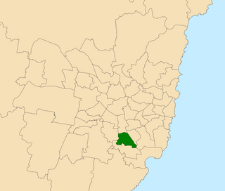
Hurstville Grove is a suburb in southern Sydney, in the state of New South Wales, Australia. It is located 19 kilometres south of the Sydney central business district and is part of the local government area of the Georges River Council, in the St George area.

Suburb Human settlement that is part of or near to a larger city

A suburb is a mixed-use or residential area, existing either as part of a city or urban area or as a separate residential community within commuting distance of a city. In most English-speaking countries, suburban areas are defined in contrast to central or inner-city areas, but in Australian English and South African English, suburb has become largely synonymous with what is called a "neighborhood" in other countries and the term extends to inner-city areas. In some areas, such as Australia, India, China, New Zealand, the United Kingdom, and parts of the United States and Canada, new suburbs are routinely annexed by adjacent cities. In others, such as Saudi Arabia, France, and much of the United States and Canada, many suburbs remain separate municipalities or are governed as part of a larger local government area such as a county. In the United States, beyond the suburbs are exurbs, or "exurban areas", with less density but linked to the metropolitan area economically and by commuters.

Sydney State capital of New South Wales and most populous city in Australia and Oceania

Sydney is the state capital of New South Wales and the most populous city in Australia and Oceania. Located on Australia's east coast, the metropolis surrounds Port Jackson and extends about 70 km (43.5 mi) on its periphery towards the Blue Mountains to the west, Hawkesbury to the north, the Royal National Park to the south and Macarthur to the south-west. Sydney is made up of 658 suburbs, 40 local government areas and 15 contiguous regions. Residents of the city are known as "Sydneysiders". As of June 2017, Sydney's estimated metropolitan population was 5,230,330 and is home to approximately 65% of the state's population.

New South Wales State of Australia

New South Wales is a state on the east coast of Australia. It borders Queensland to the north, Victoria to the south, and South Australia to the west. Its coast borders the Tasman Sea to the east. The Australian Capital Territory is an enclave within the state. New South Wales' state capital is Sydney, which is also Australia's most populous city. In December 2018, the population of New South Wales was over 8 million, making it Australia's most populous state. Just under two-thirds of the state's population, 5.1 million, live in the Greater Sydney area. Inhabitants of New South Wales are referred to as New South Welshmen.

Contents

Moore Park, view from Hurstville Road HurstvilleGrove1.jpg
Moore Park, view from Hurstville Road

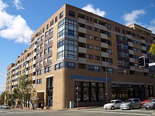
Hurstville Grove stretches from Hillcrest Avenue to the shore of Oatley Bay, on the Georges River. It is mainly residential with a few shops located on Hillcrest Avenue. Hurstville and South Hurstville are separate suburbs located to the northeast.

Oatley Bay bight in Australia

Oatley Bay is a bay located in the Georges River Council, surrounded by the suburbs of Oatley, Hurstville Grove and Connells Point. The bay is part of the Georges River waterway. It is popular for boating, fishing, picnicking and bush walking, and is surrounded by waterfront properties. It also has the largest number of plants and animals in the Municipality of Kogarah protected in its reserves/parks, which include: Poulton Park, Redin Place Reserve, Oatley Point Reserve, Oatley Pleasure Grounds and Moore Reserve.

Georges River river

The Georges River, formerly known as Tucoerah River, is an intermediate tide dominated drowned valley estuary, located to the south and west of Sydney, New South Wales, Australia.

Hurstville, New South Wales Suburb of Sydney, New South Wales, Australia

Hurstville is a suburb in southern Sydney, New South Wales, Australia. It is 16 kilometres south of the Sydney CBD and is part of the St George area. Hurstville is the administrative centre of the local government area of the Georges River Council.

History

Hurstville Grove, view from Oatley Bay HurstvilleGrove.JPG
Hurstville Grove, view from Oatley Bay

The Hurstville area was granted to Captain John Townson and his brother Robert Townson in 1808; Captain Townson was granted 1,950 acres (7.9 km2) which was on the land now occupied by the suburb of Hurstville and parts of Bexley, while Robert was granted the land which is now occupied by Penshurst, Mortdale, and parts of Peakhurst. The next year, Captain Townson was granted an additional 250 acres (1.0 km2) in the area now occupied by Kingsgrove and Beverly Hills. The Townson brothers, however, were not happy with the heavily timbered land that they were given because it was not suitable for the farming of sheep for wool; consequently, it is likely that the brothers never occupied their land.

Robert Townson (natural historian) British botanist

Dr Robert Townson MD FRSE LLD (1762–1827) was an English natural historian and traveller, known also a mineralogist and medical man. In 1806 he emigrated to New South Wales.

Bexley, New South Wales Suburb of Sydney, New South Wales, Australia

Bexley is a suburb in southern Sydney, in the state of New South Wales, Australia. Bexley is located 14 kilometres south of the Sydney central business district, in the local government area of the Bayside Council and is part of the St George area.

Penshurst, New South Wales Suburb of Sydney, New South Wales, Australia

Penshurst is a suburb in southern Sydney, in the state of New South Wales, Australia. Penshurst is located 17 kilometres south of the Sydney central business district and is part of the St George area.

The land was sold to a wealthy merchant named Simeon Lord (1771–1840) in 1812, who called his land Lord's Bush. When Simeon Lord died, the land became the property of John Rose Holden and James Holt of the Bank of N.S.W.

Simeon Lord Australian businessman

Simeon Lord was a pioneer merchant and a magistrate in Australia. He became a prominent trader in Sydney, buying and selling ship cargoes. Despite being an emancipist Lord was made a magistrate by Governor Lachlan Macquarie, and he became a frequent guest at government house. His business dealings were extensive. He became one of Sydney's wealthiest men. He was at various times a retailer, auctioneer, sealer, pastoralist, timber merchant and manufacturer. He is mentioned in many Australian History books, in particular regarding his status as an emancipist.

Bank of New South Wales former banking company

The Bank of New South Wales (BNSW), also known commonly as The Wales, was the first bank in Australia, being established in Sydney in 1817 and situated on Broadway. During the 19th and early 20th century, the Bank opened branches first throughout Australia and Oceania. It merged with many other financial institutions, finally merging with the Commercial Bank of Australia in 1982 to form the Westpac Banking Corporation.

The land was sold to Michael Gannon (1800–61) in 1850 and became known as Gannon's Forest. The Gannon's Forest post office opened in 1881. The local school was known as Hurstville by School Inspector MacIntyre in 1876. When the railway arrived in 1884, the station took the name "Hurstville" from the school. Hurstville municipality was incorporated in 1887. [2]

Churches

Parks and waterways

Population

According to the 2011 census, there were 2,392 residents in Hurstville Grove. 34.5% stated they were born overseas with the top countries of birth being China 7.8%, Hong Kong 3.1%, and Croatia 1.8%. English was stated as the only language spoken at home by 53.7% of residents and the most common other languages spoken were Cantonese 10.0%, Greek 9.2% and Mandarin 5.8%. The most common responses for religious affiliation were Catholic 28.7%, Orthodox 17.5%, and No Religion 16.0%. [1]

Related Research Articles

Arncliffe, New South Wales Suburb of Sydney, New South Wales, Australia

Arncliffe is a suburb in southern Sydney, in the state of New South Wales, Australia. Arncliffe is located 11 kilometres south of the Sydney central business district, in the local government area of the Bayside Council. Arncliffe is part of the St George area.

Oatley, New South Wales Suburb of Sydney, New South Wales, Australia

Oatley is a suburb in Southern Sydney in the state of New South Wales, Australia. It is located 18 kilometres south of the Sydney central business district and is part of the St George area. Oatley lies in the local government area of Georges River Council. It lies on the northern side of the tidal estuary of the Georges River and its foreshore includes part of all of Oatley Bay, Neverfail Bay, Gungah Bay, Jewfish Bay and Lime Kiln Bay.

St George (Sydney) Region in New South Wales, Australia

St George Area refers to an old County Council formed by the local councils of several southern suburbs in Sydney, in the state of New South Wales, Australia. The area includes all the suburbs in the local government area of Georges River Council and the part of Bayside Council which was Rockdale City prior to 2016. The eastern boundary of the district is Lady Robinson Beach on Botany Bay.

Allawah, New South Wales Suburb of Sydney, New South Wales, Australia

Allawah is a suburb in southern Sydney, in the state of New South Wales, Australia. Allawah is 16 kilometres south of the Sydney central business district and is part of the St George area. Allawah lies in the local government area of the Georges River Council. The postcode is 2218, which is shared by the neighbouring suburb of Carlton.

Oatley railway station railway station in Sydney, New South Wales, Australia

The Oatley railway station is a heritage-listed railway station located on the Illawarra line, in the Sydney suburb of Oatley in the Georges River Council local government area of New South Wales, Australia. The station is served by Sydney Trains T4 line services. It was designed and built by the NSW Government Railway and from 1905 to 1992. It is also known as the Oatley Railway Station group. The property is owned by RailCorp, an agency of the Government of New South Wales. It was added to the New South Wales State Heritage Register on 2 April 1999.

Peakhurst, New South Wales Suburb of Sydney, New South Wales, Australia

Peakhurst is a suburb in Southern Sydney, or the St George Area, in the state of New South Wales, Australia 21 kilometres south of the Sydney central business district. Peakhurst is in the local government area of the Georges River Council.

South Hurstville, New South Wales Suburb of Sydney, New South Wales, Australia

South Hurstville is a suburb in southern Sydney, in the state of New South Wales, Australia 18 kilometres south of the Sydney central business district. It is part of the St George area. South Hurstville is in the local government area of the Georges River Council. Hurstville and Hurstville Grove are separate neighbouring suburbs.

Mortdale, New South Wales Suburb of Sydney, New South Wales, Australia

Mortdale is a suburb located in southern Sydney, in the state of New South Wales, Australia. Mortdale is located 20 kilometres south of the Sydney central business district and is part of the St George area. Mortdale lies across the local government area of Georges River Council. Mortdale extends south to Lime Kiln Bay, on the Georges River. Mortdale Heights is a locality in the western corner of the suburb.

Kingsgrove, New South Wales Suburb of Sydney, New South Wales, Australia

Kingsgrove is a suburb in southern Sydney, in the state of New South Wales, Australia. Kingsgrove is 13 kilometres (8.1 mi) south of the Sydney central business district and lies across the local government areas of the Canterbury-Bankstown Council, Bayside Council and the Georges River Council.

Peakhurst Heights, New South Wales Suburb of Sydney, New South Wales, Australia

Peakhurst Heights is a suburb in southern Sydney, in the state of New South Wales, Australia. Peakhurst Heights is located 22 kilometres south of the Sydney central business district and is part of the St George area. Peakhurst Heights is in the local government area of the Georges River Council.

Carlton, New South Wales Suburb of Sydney, New South Wales, Australia

Carlton is a suburb in southern Sydney, in the state of New South Wales, Australia. Carlton is located 15 kilometres south of the Sydney central business district and is part of the St George area. Carlton lies across the boundary of two local government areas, the Georges River Council and the Bayside Council.

Connells Point, New South Wales Suburb of Sydney, New South Wales, Australia

Connells Point is a suburb in southern Sydney, in the state of New South Wales, Australia. Connells Point is 20 kilometres south of the Sydney central business district and is part of in the local government area of the Georges River Council, in the St George area.

Electoral district of Oatley state electoral district of New South Wales, Australia

Oatley is an electoral district of the Legislative Assembly in the Australian state of New South Wales in Sydney's St George district. It is currently held by Mark Coure of the Liberal Party.

James Oatley Snr was a British-born colonial Australian watch and clock maker and one-time convict. Oatley, allegedly from Stafford and aged 44, was sentenced to penal transportation for life at Hampshire Assizes on 7 March 1814. James had a number of convictions, dating back to 1806, when he had stolen one ton of cheese. He was sent to Australia for stealing shirts and bedding: Hampshire Chronicle Monday 14 March 1814 p3 [6, 7, 8, 16]

Lugarno, New South Wales Suburb of Sydney, New South Wales, Australia

Lugarno is a suburb in southern Sydney, in the state of New South Wales, Australia. The common misperception is that Lugarno is a part of The Surtherland Shire, however Lugarno is located in the local government area of the Georges River Council, 23 kilometres south of the Sydney central business district and is part of the St George area.

Georges River Council Local government area in New South Wales, Australia

The Georges River Council is a local government area located in the St George region of Sydney located south of the CBD, in New South Wales, Australia. The Council was formed on 12 May 2016 from the merger of the Kogarah City Council and Hurstville City Council.

Old Como railway bridge

The Old Como railway bridge is a heritage-listed former railway bridge and now footbridge and water main carrier over the Georges River in Oatley in the Georges River Council local government area of New South Wales, Australia. It was designed by John Whitton and Dept of Railways and built from 1883 to 1885 by C. and E. Millar. The property is owned by Sydney Water, an agency of the Government of New South Wales. It was added to the New South Wales State Heritage Register on 15 November 2002.

References

  1. 1 2 Australian Bureau of Statistics (27 June 2017). "Hurstville Grove (State Suburb)". 2016 Census QuickStats. Retrieved 11 April 2018. OOjs UI icon edit-ltr-progressive.svg
  2. Pollon, F. (1990.) The Book of Sydney Suburbs, Angus & Robertson Publishers, Sydney, pg. 130.