Hyptis alata

Last updated

Musky mint
Musky mint (Hyptis alata).jpg
Status TNC G5.svg
Secure  (NatureServe)
Scientific classification OOjs UI icon edit-ltr.svg
Kingdom: Plantae
Clade: Tracheophytes
Clade: Angiosperms
Clade: Eudicots
Clade: Asterids
Order: Lamiales
Family: Lamiaceae
Genus: Hyptis
Species:
H. alata
Binomial name
Hyptis alata
Synonyms [1]
  • Pycnanthemum alatum Raf.
  • Clinopodium rugosumL.
  • Hyptis radiataWilld., illegitimate superfluous name
  • Mesosphaerum radiatumKuntze
  • Hyptis floridanaGand.
  • Hyptis leiocephalaGand.
  • Hyptis tracyiGand.
  • Hyptis latidensUrb.
  • Hyptis rugosulaBriq.

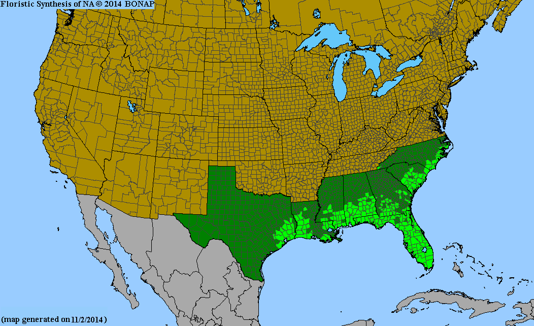
Hyptis alata, the musky mint or clustered bushmint, is a shrub species of flowering plant in the Lamiaceae, the mint family. The genus Hyptis is commonly known as the bushmints. [2] Hyptis alata is the southeastern United States analog to the Southwestern deserts H. emoryi, the desert lavender. [3] USDA: NRCS: Plants Profile Hyptis alata

Contents

Varieties [1]
  1. Hyptis alata subsp. alata - United States and Cuba
  2. Hyptis alata subsp. rugosula(Briq.) Harley - South America

Description

H. alata can reach up to 4 feet in height and possesses round flower heads. Its leaves are simple and lanceolate in shape. They have serrated leaf margins. Individuals give off a musky mint scent, the origin of its common name. [4]

Distribution and Habitat

This species' native range extends throughout the southeastern United States from Texas to North Carolina, as well as in Cuba, Argentina, southern Brazil, and Paraguay. [1] [5]

It is found in wetlands, prairies, pond margins and wet flatwoods.

References

  1. 1 2 3 Kew World Checklist of Selected Plant Families
  2. "Clustered bushmint (Hyptis alata)_EOL".
  3. Photo-Flowers, close-up; Article & photo gallery Archived 2008-02-20 at the Wayback Machine - "Aquatic, Wetland, and Invasive PlantsHyptis alata"
  4. "Lady Bird Johnson Wildflower Center - The University of Texas at Austin". www.wildflower.org. Retrieved 2025-08-01.
  5. Biota of North America Program 2013 county distribution map