Iitti

Last updated • 4 min readFrom Wikipedia, The Free Encyclopedia

Iitti
Itis
Municipality
Iitin kunta
Itis kommun
Iitti church 2 AB.jpg
Church
Iitti.vaakuna.svg
Iitti sijainti Suomi.svg
Location of Iitti in Finland
Coordinates: 60°53′N026°20′E / 60.883°N 26.333°E / 60.883; 26.333
CountryFlag of Finland.svg  Finland
Region Päijänne Tavastia
Sub-region Lahti sub-region
Charter 1865
Seat Kausala
Government
  Municipality managerJarkko Salonen
Area
 (2018-01-01) [1]
  Total
687.09 km2 (265.29 sq mi)
  Land589.81 km2 (227.73 sq mi)
  Water97.27 km2 (37.56 sq mi)
  Rank 142nd largest in Finland
Population
 (2024-10-31) [2]
  Total
6,437
  Rank 142nd largest in Finland
  Density10.91/km2 (28.3/sq mi)
Population by native language
[2]
   Finnish 97.3% (official)
   Swedish 0.2%
  Others2.4%
Population by age
[3]
  0 to 1414%
  15 to 6454.5%
  65 or older31.5%
Time zone UTC+02:00 (EET)
  Summer (DST) UTC+03:00 (EEST)
Climate Dfc
Website www.iitti.fi

Iitti (Finnish: [ˈiːtːi] ; Swedish : Itis) is a municipality of Finland. It is located in the province of Southern Finland and is part of the Päijänne Tavastia region. [4] The municipality has a population of 6,437 (31 October 2024) [2] and covers an area of 687.09 square kilometres (265.29 sq mi) of which 97.27 km2 (37.56 sq mi) is water. [1] The population density is 10.91 inhabitants per square kilometre (28.3/sq mi). Neighbour municipalities are Heinola, Kouvola, Lapinjärvi, Lahti and Orimattila. The municipality is unilingually Finnish.

Contents

The current administrative center of Iitti is in the village of Kausala. In 1990, the historical center of Iitti, which surrounds the old parish church, was voted the most attractive kirkonkylä ("church village") in Finland. [5]

In the coat of arms of Iitti, the gray wavy fess refers to Kymi River and the key above it to the municipality's central position along the river. The coat of arms was designed by heraldist Ahti Hammar, and was officially confirmed for use on 3 March 1953. [6]

The Kymi Ring motor sport center is located in Iitti, right next to the border of Kouvola. [7]

History

Mankala hydropower plant Mankalan voimalaitos.jpg
Mankala hydropower plant

The surroundings of lakes Urajärvi and Pyhäjärvi have been known to be exploited as wilderness since the Stone Age, although no signs of permanent habitation from the era have been found, and the area is presumed to have been entirely uninhabitated in the interim between the Stone Age and the conversion of Finland to Christianity. By the end of paganism, Iitti had gained its first permanent inhabitants first from Hauho and Vanaja, as well as later on from Hollola. [8]

The oldest village in Iitti is presumed to be Kauramaa, though several others are mentioned in documents dating to the Middle Ages. Administratively, Iitti was a chapel subordinated to the parish of Hollola until 1539, after which it became an independent parish that also included Nastola, Jaala, Valkeala and parts of Mäntyharju, by proclamation from Gustav I. At this time, Iitti had 14 villages and 89 estates. [8]

Iitti suffered greatly over the Russo-Swedish War of 1788–1790, becoming a battleground as well as a headquarters for Swedish forces. The battle of Tillolankangas was one of the bloodiest over the entire war in Finland; the Swedes' victory cemented the liberation of the villages around river Kymi. Over the course of the war, 13 villages were destroyed in Iitti. [8]

Until 2021, Iitti was part of the Kymenlaakso region before it became part of Päijänne Tavastia. [9]

Geography

Villages

In 1968, Iitti had the following villages: [8]

  • Haapakimola
  • Kauramaa
  • Kausala
  • Kimola
  • Iitti
  • Koliseva
  • Koskenniska
  • Lyöttilä
  • Kymentaka
  • Muikkula
  • Niinimäki
  • Perheniemi
  • Radansuu
  • Saaranen
  • Sitikkala
  • Säyhde
  • Sääskjärvi
  • Taasia
  • Tapola
  • Vuolenkoski

Demographics

In 2020, 14.0% of the population of Iitti was under the age of 15, 55.2% were aged 15 to 64, and 31.5% were over the age of 64. The average age was 48.8, above the national average of 43.4 and regional average of 46.4. Speakers of Finnish made up 97.9% of the population and speakers of Swedish made up 0.2%, while the share of speakers of foreign languages was 1.9%. Foreign nationals made up 1.4% of the total population. [10]

At the end of March 2021, the population of Iitti was 6,590. The chart below, describing the development of the total population of Iitti from 1975 to 2020, encompasses the municipality's area as of 2021.

Historical population
YearPop.±% p.a.
1975 7,995    
1980 7,770−0.57%
1985 7,690−0.21%
1990 7,889+0.51%
1995 7,687−0.52%
YearPop.±% p.a.
2000 7,534−0.40%
2005 7,265−0.72%
2010 7,005−0.73%
2015 6,910−0.27%
2020 6,625−0.84%
Source: Statistics Finland [11]

Urban areas

In 2019, out of the total population of 6,711, 3,946 people lived in urban areas and 2,705 in sparsely populated areas, while the coordinates of 60 people were unknown. This made Iitti's degree of urbanization 59.3%. [12] The urban population in the municipality was divided between two urban areas as follows: [13]

#Urban areaPopulation
1 Kausala 3,702
2 Iitti parish village 244

Economy

In 2018, 10.2% of the workforce of Iitti worked in primary production (agriculture, forestry and fishing), 35.9% in secondary production (e.g. manufacturing, construction and infrastructure), and 50.8% in services. In 2019, the unemployment rate was 9.2%, and the share of pensioners in the population was 35.8%. [14]

The ten largest employers in Iitti in 2019 were as follows: [15]

  1. Halton Oy, 257 employees
  2. Municipality of Iitti, 199 employees
  3. Päijät-Häme Health Care Municipal Consortium, 149 employees
  4. Kiitokori Oy, 61 employees
  5. Kymen Seudun Osuuskauppa, 46 employees
  6. SharpCell Oy, 42 employees
  7. Dinair Clean Air Oy, 40 employees
  8. Iitin Ehtookotiyhdistys ry, 31 employees
  9. Kausalan Matkakeidas Oy, 29 employees
  10. Kaupe Oy, 21 employees

Culture

Saukonkallio dance hall Saukonkallion lava.JPG
Saukonkallio dance hall

Events

The Iitti Music Festival (Iitin musiikkijuhlat), which focuses on both classical and contemporary music, is held annually in Iitti's church village. [16] [17]

Food

In the 1980s, a lamb meat called lampahkäppä, a sweetened potato casserole called potaattiloota, a rye lingonberry pastries baked with cabbage leaves called lehikäiset served with plum saftsuppe, and a local baked cheese were named traditional dishes of Iitti parish. [18]

Media

Iitti has its own local newspaper called Iitinseutu, whose editorial office is located in Kausala. [19]

The 2023 Finnish slasher horror film The Island of Doom (Tuomion saari), directed by Keke Soikkeli, was shot in Iitti. [20] [21] [22]

Notable residents

Related Research Articles

<span class="mw-page-title-main">Heinola</span> Town in Päijänne Tavastia, Finland

Heinola is a town and a municipality of 17,838 inhabitants located in the eastern part of the Päijänne Tavastia region, Finland, near the borders of the South Savonia region and the Kymenlaakso region. It is the third largest municipality in the region in terms of population after Lahti and Hollola. The neighbour municipalities of Heinola are Asikkala, Hartola, Iitti, Kouvola, Mäntyharju, Nastola, Pertunmaa and Sysmä.

<span class="mw-page-title-main">Hämeenlinna</span> City in Tavastia Proper, Finland

Hämeenlinna is a city in Finland and the regional capital of Kanta-Häme. It is located in the southern interior of the country and on the shores of Lake Vanajavesi. The population of Hämeenlinna is approximately 68,000, while the sub-region has a population of approximately 94,000. It is the 15th most populous municipality in Finland, and the 14th most populous urban area in the country.

<span class="mw-page-title-main">Alavieska</span> Municipality in North Ostrobothnia, Finland

Alavieska is a municipality of Finland. It is located in the province of Oulu and is part of the Northern Ostrobothnia region. The municipality has a population of 2,431 and covers an area of 253.02 square kilometres (97.69 sq mi) of which 1.66 km2 (0.64 sq mi) is water. The population density is 9.67 inhabitants per square kilometre (25.0/sq mi).

<span class="mw-page-title-main">Alavus</span> Town in Southern Ostrobothnia, Finland

Alavus is a town and municipality of Finland. It is located in the province of Western Finland and is part of the Southern Ostrobothnia region, 52 kilometres (32 mi) southeast of Seinäjoki, 138 kilometres (86 mi) north of Tampere and 319 kilometres (198 mi) north of Helsinki. The town has a population of 10,834 and covers an area of 1,151.46 square kilometres (444.58 sq mi) of which 52.31 km2 (20.20 sq mi) is water. The population density is 9.96 inhabitants per square kilometre (25.8/sq mi). Neighbouring municipalities are Alajärvi, Kuortane, Seinäjoki, Virrat and Ähtäri.

<span class="mw-page-title-main">Asikkala</span> Municipality in Päijänne Tavastia, Finland

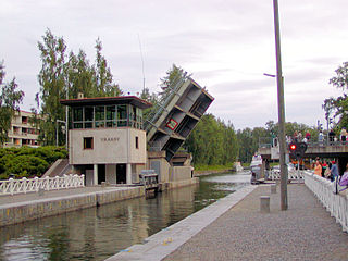
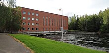
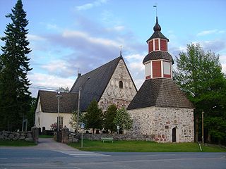
Asikkala is a municipality of Finland. Its seat is in Vääksy, at the shores of the Lake Päijänne. It is located in the province of Southern Finland and is part of the Päijänne Tavastia region. Asikkala's neighboring municipalities are Hämeenlinna, Heinola, Hollola, Lahti, Padasjoki and Sysmä.

<span class="mw-page-title-main">Askola</span> Municipality in Uusimaa, Finland

Askola is a municipality of Finland. It is located in the Uusimaa region. The municipality has a population of 4,667 and covers an area of 218.03 square kilometres (84.18 sq mi) of which 5.61 km2 (2.17 sq mi) is water. The population density is 21.97 inhabitants per square kilometre (56.9/sq mi). Monninkylä is the largest village of the municipality in terms of population. Neighbouring municipalities are Myrskylä, Mäntsälä, Pornainen, Porvoo and Pukkila.

<span class="mw-page-title-main">Aura, Finland</span> Municipality in Southwest Finland, Finland

Aura is a municipality of Finland. The name derives from the river Aura and the plough reminiscent shape of the municipality. The municipality was established in 1917 from parts of Lieto and Pöytyä.

<span class="mw-page-title-main">Kouvola</span> City in Kymenlaakso, Finland

Kouvola is a city in Finland and the administrative capital of Kymenlaakso. It is located in the southeastern interior of the country. The population of Kouvola is approximately 79,000. It is the 12th most populous municipality in Finland, and the 17th most populous urban area in the country.

<span class="mw-page-title-main">Hausjärvi</span> Municipality in Tavastia Proper, Finland

Hausjärvi is a municipality of Finland. Its seat is in Oitti.

<span class="mw-page-title-main">Janakkala</span> Municipality in Tavastia Proper, Finland

Janakkala is a municipality of Finland. Its administrative centre is in Turenki. Janakkala is located along Highway 3 (E12) in the province of Southern Finland and is part of the Tavastia Proper region. To the south Janakkala shares a boundary with Riihimäki, the northern neighbour being Hämeenlinna. It is 16 kilometres (9.9 mi) from Turenki to Hämeenlinna, 94 kilometres (58 mi) to Tampere, and 96 kilometres (60 mi) to Helsinki.

<span class="mw-page-title-main">Jokioinen</span> Municipality in Tavastia Proper, Finland

Jokioinen is a municipality of Finland.

<span class="mw-page-title-main">Hämeenkoski</span> Former municipality in Päijänne Tavastia, Finland

Hämeenkoski is a former municipality of Finland. It was merged to the municipality of Hollola on 1 January 2016.

<span class="mw-page-title-main">Kärkölä</span> Municipality in Päijänne Tavastia, Finland

Kärkölä is a municipality of Finland. It is located in the province of Southern Finland and is part of the Päijänne Tavastia region. The municipality has a population of 4,094 and covers an area of 259.30 square kilometres (100.12 sq mi) of which 2.84 km2 (1.10 sq mi) is water. The population density is 15.96 inhabitants per square kilometre (41.3/sq mi). Its seat is in Järvelä, which is located along the Riihimäki–Lahti railway.

<span class="mw-page-title-main">Kärsämäki</span> Municipality in North Ostrobothnia, Finland

Kärsämäki is a municipality of Finland. It is located in the province of Oulu and is part of the Northern Ostrobothnia region. The municipality has a population of 2,378 and covers an area of 700.91 square kilometres (270.62 sq mi) of which 6.06 km2 (2.34 sq mi) is water. The population density is 3.41 inhabitants per square kilometre (8.8/sq mi). Kärsämäki is a significant road junction where Highway 4 (Helsinki–Oulu–Utsjoki) and Highway 28 (Kokkola–Kajaani) intersect and where Highway 58 leading to Kangasala begins. The distance to the regional capital Oulu is 123 kilometres (76 mi).

<span class="mw-page-title-main">Päijät-Häme</span> Region of Finland

Päijät-Häme is a region in Southern Finland south of the lake Päijänne. It borders the regions of Uusimaa, Kanta-Häme, Pirkanmaa, Central Finland, South Savo and Kymenlaakso. The biggest city in the region is Lahti.

<span class="mw-page-title-main">Mäntyharju</span> Municipality in Southern Savonia, Finland

Mäntyharju is a municipality of Finland. It is located in the Southern Savonia region, about 40 kilometres (25 mi) southwest of Mikkeli. The municipality has a population of 5,518 (31 October 2024) and covers an area of 1,210.98 square kilometres (467.56 sq mi) of which 229.23 km2 (88.51 sq mi) is water. The coastline is almost 1,520 kilometers (940 mi). The population density is 6.2 inhabitants per km².

<span class="mw-page-title-main">Nastola</span> Former municipality in Päijät-Häme, Finland

Nastola is a former municipality of Finland. It was merged with the city of Lahti on 1 January 2016.

<span class="mw-page-title-main">Pertunmaa</span> Municipality in Southern Savonia, Finland

Pertunmaa is a municipality of Finland located in the Southern Savonia region. The municipality has a population of 1,541 and covers an area of 454.20 square kilometres (175.37 sq mi) of which 79.7 km2 (30.8 sq mi) is water. The population density is 4.12 inhabitants per square kilometre (10.7/sq mi). The language of the municipality is Finnish.

<span class="mw-page-title-main">Kausala</span> Village in Päijänne Tavastia, Finland

Kausala is a village and administrative center in Iitti municipality in Päijänne Tavastia, Finland. Kausala has a population of 3,775, which makes it the largest village of the municipality in terms of population. The significance of Kausala for the municipality is largely due to its central location along the highway, Finnish national road 12 (Vt12), and the Lahti–Kouvola railway passing through the village. The nearest lakes are Lake Leininselkä and Lake Urajärvi in the northern part of the village.

<span class="mw-page-title-main">Herrala railway station</span> Railway station in Finland

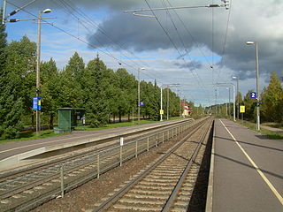
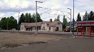
The Herrala railway station is located in Hollola, Finland, in the village and urban area of Herrala. It is located along the Riihimäki–Lahti line, and its neighboring stations are Järvelä in the west and Lahti in the east.

References

  1. 1 2 "Area of Finnish Municipalities 1.1.2018" (PDF). National Land Survey of Finland. Retrieved 30 January 2018.
  2. 1 2 3 "Finland's preliminary population figure was 5,635,560 at the end of October 2024". Population structure. Statistics Finland. 19 November 2024. ISSN   1797-5395 . Retrieved 22 November 2024.
  3. "Population according to age (1-year) and sex by area and the regional division of each statistical reference year, 2003–2020". StatFin. Statistics Finland . Retrieved 2 May 2021.
  4. Päijät-Häme 2021 (in Finnish)
  5. Käyhty, Aila (1 October 1990). "Iitin kirkonkylä on Suomen kaunein" . Helsingin Sanomat (in Finnish). Retrieved 31 December 2023.
  6. Suomen kunnallisvaakunat (in Finnish). Suomen Kunnallisliitto. 1982. ISBN   951-773-085-3.
  7. "Home". Kymi Ring . Retrieved 31 December 2023.
  8. 1 2 3 4 Soikkanen, Mauri; Erävuori, Jukka; Korpela, Kalevi; Penttilä, Antero; Mäkinen, Vesa (1968). "Iitti". Suomenmaa 2: maantieteellis-yhteiskunnallinen tieto- ja hakuteos. 2: Heinola–Kaavi. Helsinki: WSOY.
  9. Korhonen, Antti-Jussi (31 December 2020). "Iitti vaihtaa maakuntaa huomenna – kaikkiaan viisi kuntaa vaihtaa maakuntaa". Yle (in Finnish). Retrieved 26 September 2022.
  10. "Key figures on population by region, 1990-2020". StatFin. Statistics Finland. Archived from the original on 6 April 2019. Retrieved 28 April 2021.
  11. "Population according to age (1-year) and sex by area, 1972-2020". StatFin. Statistics Finland. Archived from the original on 25 May 2019. Retrieved 27 April 2021.
  12. "Degree of urbanisation by area, 2019". StatFin. Statistics Finland. Archived from the original on 26 November 2019. Retrieved 26 April 2021.
  13. "Population in urban settlements and sparsely populated areas by age, sex and municipality, 2019". StatFin. Statistics Finland. Archived from the original on 26 November 2019. Retrieved 26 April 2021.
  14. "Municipal key figures 1987-2020 (with the 2021 regional division)". StatFin. Statistics Finland. Archived from the original on 26 April 2021. Retrieved 26 April 2021. (2018, 2019 and 2020)
  15. "Kunnittainen toimipaikkatilasto" (in Finnish). Statistics Finland . Retrieved 29 April 2021.
  16. "Home". Iitti Music Festival. Retrieved 31 December 2023.
  17. "Iitti Music Festival". Finland Festivals. Retrieved 22 December 2024.
  18. Kolmonen, Jaakko (1988). Kotomaamme ruoka-aitta: Suomen, Karjalan ja Petsamon pitäjäruoat (in Finnish). Helsinki: Patakolmonen. p. 99. ISBN   951-96047-3-1.
  19. "Etusivu". Iitinseutu (in Finnish). Retrieved 31 December 2023.
  20. Mannonen, Tuomo (24 February 2023). "Kouvolassa ja Iitissä kuvataan elokuvateatterilevitykseen tuleva kauhuelokuva – Mukana on tv:stä tuttuja näyttelijöitä ja paikallisia harrastajia" . Etelä-Suomen Sanomat (in Finnish). Retrieved 31 December 2023.
  21. Sironen, Elina (31 May 2023). "Konsta Hietanen elää kauhun ja humoristisuuden tasapainossa Tuomion saari -elokuvan kuvauksissa" . Hämeen Sanomat (in Finnish). Retrieved 31 December 2023.
  22. Niemeläinen, Johannes (30 December 2023). "Tuomion saari on ohjaajansa työnäyte" . Iitinseutu (in Finnish). Retrieved 31 December 2023.