
Noshiro is a city located in Akita Prefecture, Japan. As of 28 February 2023, the city had an estimated population of 49,150 in 24,079 households, and a population density of 120 persons per km2. The total area of the city is 426.95 square kilometres (164.85 sq mi).

Yokote is a city located in Akita Prefecture, Japan. As of 30 April 2024, the city had an estimated population of 81,617 in 33,876 households, and a population density of 120 persons per km². The total area of the city is 692.80 km2 (267.49 sq mi).

Yuzawa is a city located in Akita Prefecture, Japan. As of 31 January 2023, the city had an estimated population of 41,404 in 17551 households and a population density of 52 persons per km2. The total area of the city is 790.91 km2 (305.37 sq mi). Yuzawa claims to be the birthplace of the famous Heian period poet Ono no Komachi.

Kazuno is a city located in Akita Prefecture, Japan. As of 28 March 2023, the city had an estimated population of 28,329 in 12,570 households, and a population density of 40 persons per km2. The total area of the city is 707.52 square kilometres.

Miyota is a town located in Nagano Prefecture, Japan. As of 1 April 2019, the town had an estimated population of 15,562 in 6897 households, and a population density of 260 persons per km2. The total area of the town is 58.79 square kilometres (22.70 sq mi).

Ibaraki is a town located in Ibaraki Prefecture, Japan. As of 1 July 2020, the town had an estimated population of 31,596 in 12,052 households and a population density of 260 inhabitants per square kilometre (670/sq mi). The percentage of the population aged over 65 was 34.9%. The total area of the town is 121.58 square kilometres (46.94 sq mi).

Miharu is a town located in Fukushima Prefecture, Japan. As of 1 March 2020, the town had an estimated population of 17,471 in 6348 households, and a population density of 240 persons per km2. The total area of the town was 72.76 square kilometres (28.09 sq mi).
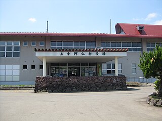
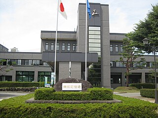
Kamikoani is a village located in Akita Prefecture, Japan. As of 28 February 2023, the village had an estimated population of 2,012 in 1097 households, and a population density 7.8 persons per km2. The total area of the village is 256.72 square kilometres (99.12 sq mi).

Fujisato is a town located in Akita, Japan. As of 28 February 2023, the town had an estimated population of 2,890 in 1315 households, and a population density of 10 persons per km2. The total area of the town is 281.98 square kilometres (108.87 sq mi).
Gojōme is a town located in Akita, Japan. As of 28 February 2023, the town had an estimated population of 8317 in 3870 households and a population density of 39 persons per km2. The total area was 214.92 square kilometres (82.98 sq mi).

Hachirōgata is a town located in Akita, Japan. As of 1 February 2023, the town had an estimated population of 5603 in 2465 households, and a population density of 330 persons per km2. The total area is 17.00 square kilometres (6.56 sq mi). It is the smallest municipality in Akita Prefecture in terms of surface area.

Ōgata is a village located in Akita Prefecture, Japan. As of 1 March 2023, the village had an estimated population of 2,991 in 1115 households, and a population density 19 persons per km2. The total area of the village is 170.11 square kilometres (65.68 sq mi).

Minamiakita District is a rural district located in Akita Prefecture, Japan.
Semboku is a city located in Akita Prefecture, Japan. As of 31 January 2023, the city had an estimated population of 24,045 in 10,398 households, and a population density of 22 persons per km2. The total area of the city is 1,093.56 square kilometers (422 sq mi).

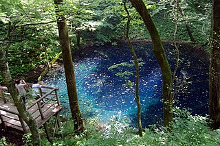
Higashinaruse is a village located in Akita Prefecture, Japan. As of 28 February 2023, the village had an estimated population of 2,363 in 944 households, and a population density of 12 persons per km2. The total area is of the village is 293.57 square kilometres (113.35 sq mi). In 1999, Higashinaruse was selected as one of The Most Beautiful Villages in Japan.
Fukaura is a town located in Aomori Prefecture, Japan. As of 31 January 2023, the town had an estimated population of 7,268 in 3553 households, and a population density of 15 persons per km2. The total area of the town is 488.85 km2 (188.75 sq mi).
Misato is a town located in Akita Prefecture, Japan. As of 31 February 2023, the town had an estimated population of 18,151 in 6603 households and a population density of 110 persons per km2The total area was 168.34 square kilometres (65.00 sq mi).

Katagami is a city located in Akita Prefecture, Japan. As of 28 February 2023, the city had an estimated population of 31,775 in 14162 households, and a population density of 330 persons per km². The total area of the city is 97.72 square kilometres (37.73 sq mi).

Mitane is a town located in Akita Prefecture, Japan. As of 28 February 2023, the town had an estimated population of 14,936, in 6729 households, and a population density of 60 persons per km2 The total area of the town is 247.98 square kilometres (95.75 sq mi).

Happō is a town located in Akita, Japan. As of 31 January 2023, the town had an estimated population of 6,466 in 2981 households, and a population density of 28 persons per km2. The total area of the town is 234.14 square kilometres (90.40 sq mi).


