Related Research Articles
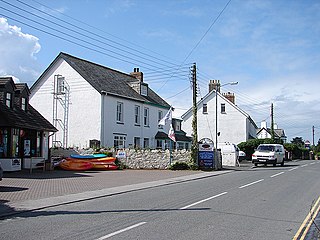
Splatt is a small settlement in north Cornwall, England, United Kingdom at grid reference SW 945 763. It is situated between Pityme and Rock although the buildings along the Rock Road are continuous.

The River Allen in north Cornwall is one of two rivers of the same name in Cornwall which share this name. In this case the name is the result of a mistake made in 1888 by Ordnance Survey, replacing the name Layne with Allen which is the old name for the lower reaches of the Camel. The other River Allen runs through Truro.
Cambrose is a hamlet east of Portreath in west Cornwall, England, UK.

Churchbridge is a hamlet in Cornwall, England. It is a mile west of Duloe, and is situated on the West Looe River. Both banks of the river are wooded, and to the north of the bridge is a disused quarry and Tremadart Mills, marked as a corn mill on the 1882 map.

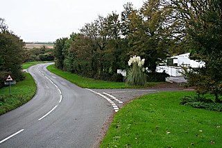
Congdon's Shop is a hamlet in the parish of North Hill, Cornwall, England. It is at the junction of the B3254 Launceston to Liskeard road and the B3257 road from Plusha to Callington.

Hick's Mill is a hamlet in Cornwall, England. It is about a mile southeast of Trewen on the River Inny. It is in the civil parish of Gwennap
Muchlarnick is a hamlet in Cornwall, England. It is about two miles east of Lanreath in the civil parish of Pelynt.
Newtown-in-St Martin is a hamlet in the parish of St Martin-in-Meneage, Cornwall, England. Newtown is south-southeast of St Martin's Green.

Paramoor is a hamlet near St Mewan in Cornwall, England. Paramoor is southwest of Sticker and Paramoor Wood is nearby.
Paul's Green is a hamlet between Leedstown and Townshend in west Cornwall, England, UK.

Paynter's Cross is a hamlet on the A388 main road southeast of St Mellion in southeast Cornwall, England, UK.
Penelewey is a hamlet southeast of Playing Place in Cornwall, England, UK. Penelewey is on the B3289 road.
Penpillick is a hamlet in Cornwall, England, UK. It is about two miles north of St Blazey on the A390 road.
Penpont is a hamlet in the parish of St Breward, in north Cornwall, England, UK, in the Camel Valley.
Redmoor is a hamlet in Cornwall, England, United Kingdom.

Trefanny Hill is a hamlet in the parish of Duloe, Cornwall, England, United Kingdom. The hamlet was formerly called Hille or Hill.

Tremar is a hamlet in the parish of St Cleer, Cornwall, England, United Kingdom. It is about 1 km south of Darite and includes Lower Tremar and Venland Cross.

The River Kensey is a river in east Cornwall, England, UK which is a tributary of the River Tamar.

The River Seaton is a river in east Cornwall, England, UK which flows southwards for 11 miles (17 km) into the English Channel.

The River Lerryn is a river in east Cornwall, England, UK, a tributary of the River Fowey. The Lerryn is the largest of the tributaries which enter the estuary of the Fowey. The river is tidal up to the village of Lerryn. The landscape of the Lerryn catchment is rural and includes heathland, moorland and rough pasture in the upper reaches and broadleaf, coniferous and mixed plantation woodland in the lower. This catchment includes four SSSIs, including Redlake Meadows & Hoggs Moor. The Lerryn rises at Fairy Cross on the southern slopes of Bodmin Moor and flows south-southwest until it enters the Fowey estuary.
References
- ↑ Ordnance Survey: Landranger map sheet 200 Newquay & Bodmin (Map). Ordnance Survey. ISBN 978-0-319-22938-5.
- ↑ Inchs; Explore Britain
| Unitary authorities | |
|---|---|
| Major settlements |
|
| Rivers | |
| Topics | |
Coordinates: 50°26′30″N4°49′18″W / 50.4416845°N 4.821578°W
| This Cornwall location article is a stub. You can help Wikipedia by expanding it. |