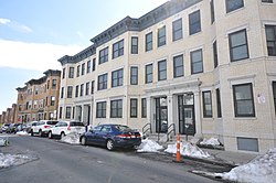
Dorchester is a neighborhood comprising more than 6 square miles (16 km2) in the City of Boston, Massachusetts, United States. Originally, Dorchester was a separate town, founded by Puritans who emigrated in 1630 from Dorchester, Dorset, England, to the Massachusetts Bay Colony. This dissolved municipality, Boston's largest neighborhood by far, is often divided by city planners in order to create two planning areas roughly equivalent in size and population to other Boston neighborhoods.

Morton Street is a street in southern Boston, Massachusetts, United States. It extends from the southeastern end of the Arborway in Jamaica Plain to Washington Street in the Lower Mills Village of Dorchester. Most of the road is a connecting parkway, signed as part of Massachusetts Route 203, that provides access to Boston's Emerald Necklace of parks. That portion of the road was listed on the National Register of Historic Places in 2005.
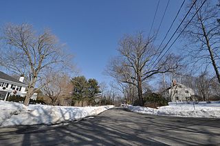
The Jewell Town District of South Hampton, New Hampshire, encompasses a colonial-era industrial village with a history dating to 1687. It is centered at the junction of West Whitehall and Jewell Streets, which is just south of a bend in the Powwow River, the source of the power for the mills that were built here. The area was settled in 1687 by Thomas Jewell, and by the early 19th century included a variety of mills as well as a bog iron works. The district now includes only remnants of its industrial past, and features a collection of 18th and early-19th century residential architecture. The district was listed on the National Register of Historic Places in 1983.
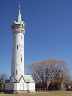
Fort Hill is a 0.4 square mile neighborhood and historic district of Roxbury, in Boston, Massachusetts. The approximate boundaries of Fort Hill are Malcolm X Boulevard on the north, Washington Street on the southeast, and Columbus Avenue on the southwest.

The Francis Street–Fenwood Road Historic District encompasses a small but cohesive early 20th-century residential area and streetcar suburb in the Longwood area of Boston, Massachusetts. Bounded by Huntington Avenue, Francis Street, Vining Avenue, Fenwood Road, and St. Albans Road, it includes a collection of two and three-family houses, as well as two apartment houses, a school, and one commercial building, all of which predate the large medical complexes that dominate the Longwood area. The district was listed on the National Register of Historic Places in 2016.

The Columbia Road–Bellevue Street Historic District encompasses a collection of brick residential apartment houses on Columbia Road and Bellevue Street in the Dorchester neighborhood of Boston, Massachusetts. Arrayed mainly on Columbia Road between Wheelock Avenue and Bodwell Street, south of the Uphams Corner commercial area, area collection of primarily late 19th and early 20th-century multiunit residential buildings, built when the area was developed as a streetcar suburb. Most of these are Colonial Revival masonry or frame buildings three and four stories in height, although some exhibit Queen Anne features. There are a few older Greek Revival buildings in the district, and a number of apartment blocks built in the 1920s during a second phase of development.
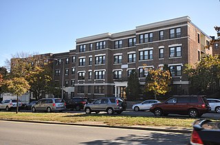
The Columbia Road–Strathcona Road Historic District encompasses a collection of brick residential apartment houses on Columbia and Strathcona Roads in the Roxbury neighborhood of Boston, Massachusetts. Arrayed on the southeast side of Columbia Road between Washington and Brinsley Streets are several multistory buildings with well-preserved Colonial Revival features. They were constructed in the first two decades of the 20th century, when the area was developed as a streetcar suburb. These were built mainly by Jewish developers Saul E. Moffie and Samuel Levy to serve a growing Jewish population in the area.

The Benjamin Silverman Apartments are a historic multifamily residential building at 50-52 Lorne Street and 4 Wilson Street in the Dorchester neighborhood of Boston, Massachusetts. Built in 1915, it is a good example of period Colonial Revival architecture, built during a major period of Jewish migration to the neighborhood. The building was listed on the National Register of Historic Places in 2018.
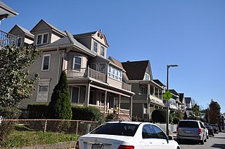
The Esmond Street Historic District is a historic district encompassing a small residential area in the Dorchester neighborhood of Boston, Massachusetts. Centered on a stretch of Esmond Street, the area was developed between 1884 and 1928, and includes a fine sample of Colonial Revival and Queen Anne architecture. The district was listed on the National Register of Historic Places in 2018.

The Samuel Edelman Apartments are a historic multifamily residential building at 97-103 Street in the Dorchester neighborhood of Boston, Massachusetts. It was built about 1908, during a period of major residential development of the area, and is a good example of Colonial Revival architecture in brick and stone. The building was listed on the National Register of Historic Places in 2013.
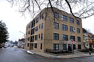
The Nathan Warnick Apartments are a historic multifamily residential building at 57 Street in the Dorchester neighborhood of Boston, Massachusetts. It was built about 1929, during an influx of Jewish immigrants to the area, and is a good example of Colonial Revival architecture in brick and stone. The building was listed on the National Register of Historic Places in 2019.
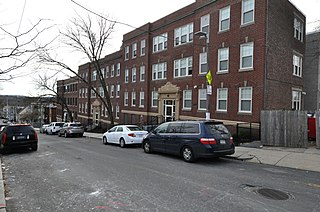
The Cartoof & Sherman Apartments are a group of three historic apartment houses at 31-35 Wales Street in the Dorchester neighborhood of Boston, Massachusetts. Built in 1925, they are well-preserved examples of Colonial Revival architecture, built during a period of growth fueled by the city's expanding streetcar network. The apartments were listed on the National Register of Historic Places in 2020.

The Intervale Street-Blue Hill Avenue Historic District is a historic district encompassing a densely built residential area in the Dorchester neighborhood of Boston, Massachusetts. Centered on a stretch of Intervale Street near Blue Hill Avenue, the area was developed in the late 19th and early 20th centuries during a major Jewish migration, and includes a fine sample of Colonial Revival architecture. The district was listed on the National Register of Historic Places in 2020.

The Thane Street Historic District is a historic district encompassing a group of apartment houses in the Dorchester neighborhood of Boston, Massachusetts. Extending along Thane Street from Harvard Street, the area was developed in 1910, during a major Jewish migration, and includes a fine sample of Colonial Revival architecture. The district was listed on the National Register of Historic Places in 2020.

The Elm Hill Park Historic District is a historic district encompassing a small residential area in the Roxbury neighborhood of Boston, Massachusetts. It encompasses a residential development created in the early 20th century, including fine examples of Colonial Revival and Queen Anne wood-frame construction, as well as a series of brick Romanesque apartment houses. The district was listed on the National Register of Historic Places in 2021.

The Lawrence Avenue Historic District is a historic district encompassing a small residential area in the Dorchester neighborhood of Boston, Massachusetts. Centered on Lawrence Avenue, the area was developed in the late 19th and early 20th century during a major Jewish migration, and includes a fine sample of Colonial Revival and Queen Anne architecture. The district was listed on the National Register of Historic Places in 2021.

The Humboldt Avenue Historic District is a historic district encompassing a cluster of multifamily brick buildings in the Dorchester neighborhood of Boston, Massachusetts. Centered on the junction of Humboldt Avenue and Hutchings Street, the area was developed in 1915-16 during a major Jewish migration, and includes a fine sample of Colonial Revival architecture. The district was listed on the National Register of Historic Places in 2021.

The Walnut Park Historic District is a historic district encompassing a cluster of multifamily brick buildings in the Roxbury neighborhood of Boston, Massachusetts. Roughly centered on the junction of Walnut Park and Waldren Road, the area was developed in the early 20th century during a major Jewish migration, and includes a fine sample of Colonial Revival architecture. The district was listed on the National Register of Historic Places in 2022.

The Charlotte Street-Esmond Street Historic District is a historic district encompassing a residential subdivision in the Dorchester neighborhood of Boston, Massachusetts. Centered on Charlotte and Esmond Streets, the area was developed in the early 20th century following the arrival of electrified street cars on nearby Blue Hill Avenue. The district was listed on the National Register of Historic Places in 2022.

The Dudley Terrace–Dudley Street Historic District is a historic district encompassing a cluster of four multifamily brick buildings in the Dorchester neighborhood of Boston, Massachusetts. Centered on the junction of Dudley Street and Virginia Avenue, the area was developed in the mid-1890s, and includes good examples of Queen Anne and Renaissance Revival architecture. The district was listed on the National Register of Historic Places in 2022.
