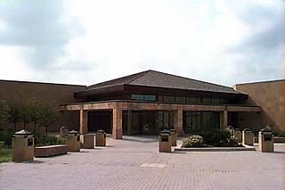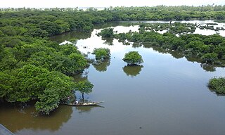
The Shiawassee National Wildlife Refuge is a 9,870.35 acres (39.9439 km2) National Wildlife Refuge in Saginaw County managed by the United States Fish and Wildlife Service. It is located in the central portion of the lower peninsula of the U.S. state of Michigan, approximately 25 miles (40 km) south of the Saginaw Bay in Lake Huron and five miles (8 km) south of the city of Saginaw in the county's Spaulding and James townships. It was established in 1953 to provide habitat for migratory waterfowl.

Sand Lake National Wildlife Refuge is located in the northeastern part of the U.S. state of South Dakota and is administered by the U.S. Fish and Wildlife Service. Created in 1935, it is a wetlands of international importance and a Globally Important Bird Area. Over 260 bird species are found in the refuge, including many migratory bird species and the world's largest breeding colony of Franklin's gulls.

Sand Lake Wetland Management District is located in the U.S. state of South Dakota and is administered by the U.S. Fish and Wildlife Service. This is the largest Wetland Management District in the U.S., with 45,000 acres (182 km2) of area directly under federal protection and another 550,000 acres (2,225 km2) managed in partnership with private landowners as conservation easements. A total of 162 Waterfowl Production areas are located on the federally owned lands and the conservation easements are generally adjacent to these areas and act as buffer zones to increase habitat protection.

Audubon Wetland Management District is located in the U.S. state of North Dakota and consists of 123 Waterfowl Production Areas (WPAs), 8 National Wildlife Refuges (NWRs), and numerous wetland and grassland easements and over 100 separate wetland areas set aside to preserve habitat for bird, plant and mammal species. These lands contain valuable wetland and grassland habitat for waterfowl and other migratory birds, and many other species of wildlife. Scattered throughout west central and southwestern North Dakota in McLean, Ward, and Sheridan Counties, the district is managed by the U.S. Fish and Wildlife Service and from Audubon National Wildlife Refuge. Hundreds of lakes and marshlands in this region provide critical habitat for migratory and nesting bird species.

The Lostwood Wetland Management District is located in the U.S. state of North Dakota and extends from the Canada–United States border to the neighboring state of Montana. The district consists almost exclusively of privately owned property, and landowners work cooperatively with the U.S. Fish and Wildlife Service to manage the land to maximize natural and agricultural needs. Hundreds of small bodies of water, wetlands and uplands are set aside to increase bird productivity and provide habitat for native animals and plants. The district comprises various areas spread throughout northwestern North Dakota which include waterfowl production areas, wetland easements, grassland easements, and easement refuges. The properties are located in Mountrail and part of Ward County, North Dakota.
The San Luis National Wildlife Refuge Complex is located in the northern San Joaquin Valley, within Merced County and Stanislaus County of California. The complex, with four federal National Wildlife Refuges, is managed by the U.S Fish & Wildlife Service.

Carlton Pond Waterfowl Production Area is a 1,055-acre (4.27 km2) artificial pond and wetland located in the town of Troy in Waldo County, Maine. The pond is formed by an earthen dam which backs up Carlton Brook. The area was acquired by the United States Fish and Wildlife Service in 1966 to protect the waterfowl and other wildlife associated with this area in Central Maine.

Established in 1936 by executive order of President Franklin D. Roosevelt, the Patuxent Research Refuge is the only National Wildlife Refuge in the United States established to support wildlife research. With land surrounding the Patuxent and Little Patuxent Rivers between Washington, D.C. and Baltimore, Maryland, the Refuge has grown from the original 2,670 acres (10.8 km2) to its present size of over 12,800 acres (52 km2) and encompasses land formerly managed by the Departments of Agriculture and Defense. Throughout decades of change, Patuxent's mission of conserving and protecting the nation's wildlife and habitat through research and wildlife management techniques has remained virtually unchanged.

The Michigan Wetland Management District consists of a 14-county area and includes three waterfowl production areas (WPAs): the 160-acre (0.65 km2) Schlee WPA and the 138-acre (0.56 km2) Mahan WPA in Jackson County and the 77-acre (310,000 m2) Kinney WPA in Van Buren County. The Michigan Department of Natural Resources, Wildlife Division, oversees day-to-day management of these three areas through a partnership with the U.S. Fish and Wildlife Service.
Waubay Wetland Management District is located in the "Coteau des Prairies", or prairie hills region of South Dakota. It includes more than 300 waterfowl production areas (WPAs) in six counties of northeastern South Dakota: Clark, Codington, Day, Grant, Marshall, and Roberts. The WPAs range from 40 acres (16 ha) to more than 1,600 acres (650 ha) in size, comprising a total of 40,000 acres (160 km2). WPAs provide vital wildlife habitat in a landscape of cropland and pasture.
Maple River National Wildlife Refuge is a National Wildlife Refuge in North Dakota. It is managed under Kulm Wetland Management District.

Butte Sink Wildlife Management Area is located in Colusa, Butte, and Sutter Counties. It is wetlands managed as part of the Sacramento National Wildlife Refuge Complex and is not open to the public.
The purpose of Big Stone Wetland Management District is to acquire and manage Waterfowl Production Areas in Lincoln and Lyon Counties. District staff also serve private land resource interests by providing technical assistance for United States Department of Agriculture programs and restoring wetlands on private lands.
Detroit Lakes Wetland Management District is located in northwest Minnesota and includes the counties of Becker, Clay, Mahnomen, Norman, and Polk - an area of approximately 6,000 square miles (16,000 km2). The district is divided into three general landscape areas, roughly equal in size. From west to east, these are: the Red River Valley floodplain, the glacial moraine/prairie pothole region, and the hardwood/coniferous forest. The district currently manages over 42,000 acres (170 km2) of public land in 165 waterfowl production areas (WPAs). Additionally, district staff are responsible for more than 300 wetland and upland easements on private property, totaling more than 11,000 acres (45 km2).
The Fergus Falls Wetland Management District was established in 1962 with the initiation of the Accelerated Small Wetlands Acquisition Program. It is located in west central Minnesota and includes the counties of Douglas, Grant, Otter Tail, Wadena and Wilkin.
The Minnesota Valley Wetland Management District is a fourteen-county district located in east central Minnesota. It includes portions of the Minnesota, Cannon, and Mississippi River watersheds.

The Windom Wetland Management District acquires and manages Waterfowl Production Areas, enforces wetland easements, and provides conservation assistance to landowners in 12 southwestern Minnesota counties. The landscape is dominated by intense, row-crop agriculture, which has led to the drainage of most wetlands and widespread water quality problems. Deteriorating drainage tile systems and the abundance of historic wetland basins provide unlimited opportunities for wetland restorations.
The Leopold Wetland Management District is named after Aldo Leopold, who is widely acknowledged as the father of wildlife conservation in America. Leopold is perhaps best known as the author of A Sand County Almanac, a book compiled of essays written on his farm in central Wisconsin. In tribute to his philosophy, the Leopold Wetland Management District is dedicated to preserving, restoring, and enhancing wildlife habitat in Wisconsin for the benefit of present and future generations.
Lying along the eastern edge of the tallgrass prairie in west-central Wisconsin, the St. Croix Wetland Management District encompasses a diversity of habitats. Within the eight-county district, one can travel north through the high river bluffs of Pepin County, to the prairie potholes of St. Croix County, and then to the pine barrens of Burnett County.

The Summer Lake Wildlife Area is a 29.6-square-mile (77 km2) wildlife refuge located on the northwestern edge of the Great Basin drainage in south-central Oregon. It is administered by the Oregon Department of Fish and Wildlife. The refuge is an important stop for waterfowl traveling along the Pacific Flyway during their spring and fall migrations. The Summer Lake Wildlife Area also provides habitat for shorebirds and other bird species as well as wide variety of mammals and several fish species. The Ana River supplies the water for the refuge wetlands.


