
Des Moines is the capital and most populous city in the U.S. state of Iowa. It is the county seat of Polk County with parts extending into Warren County. It was incorporated on September 22, 1851, as Fort Des Moines, which was shortened to "Des Moines" in 1857. It is located on, and named after, the Des Moines River, which likely was adapted from the early French name, Rivière des Moines, meaning "River of the Monks". The city's population was 214,133 as of the 2020 census. The six-county metropolitan area is ranked 81st in terms of population in the United States, with 709,466 residents according to the 2020 census by the United States Census Bureau, and is the largest metropolitan area fully located within the state.
George Peter Anthan was an American journalist. He was the Washington Bureau Chief for the Des Moines Register.

The Des Moines River is a tributary of the Mississippi River in the upper Midwestern United States that is approximately 525 miles (845 km) long from its farther headwaters. The largest river flowing across the state of Iowa, it rises in southern Minnesota and flows across Iowa from northwest to southeast, passing from the glaciated plains into the unglaciated hills near the capital city of Des Moines, named after the river, in the center of the state. The river continues to flow in a southeastern direction away from Des Moines, later flowing directly into the Mississippi River.

RAGBRAI, short for Register's Annual Great Bicycle Ride Across Iowa, is a non-competitive bicycle tour across the U.S. state of Iowa from the western to eastern border. First held in 1973, RAGBRAI is the largest bike-touring event in the world.

Lake Shetek State Park is a state park of Minnesota, United States, on Lake Shetek, which is the largest lake in southwestern Minnesota and the headwaters of the Des Moines River. It is most popular for water recreation and camping. However the park also contains historical resources related to the Dakota War of 1862, including an original log cabin and a monument to 15 white settlers killed there and at nearby Slaughter Slough on August 20, 1862.

Clear Lake is the name of a natural spring fed body of water located in Cerro Gordo County, Iowa near Clear Lake, Iowa. It is approximately 3,684 acres (15 km2) in size. It is a popular fishing destination, with walleye, yellow bass and channel catfish. People from Des Moines and Minneapolis–Saint Paul have had homes on the shores of the lake since the 1870s. The average depth is 10 feet (3 m) and the maximum depth is 30 feet (9 m), in the dredged area of the west end. The lake has 13.6 mi (22 km) of shoreline. As of 2004, the lake has seen major efforts undergone to restore its natural clarity, including filtration systems, dredging, and education of local farmers to reduce toxic pesticides from entering the lake. Clear Lake has been named the "Best Iowa Lake Town" by The Des Moines Register and "A Top Vacation Spot" by Midwest Living magazine.

Lake Keomah State Park is a state park in Mahaska County, Iowa, United States. To the park's immediate east is Keomah Village and the park is approximately 4 miles (6.4 km) east of Oskaloosa.

Interstate 35 (I-35) is a north–south Interstate Highway in the United States that runs from Laredo, Texas, to Duluth, Minnesota. In Iowa, the highway runs from south to north through the center of the state, roughly parallel to U.S. Highway 69 (US 69) and US 65. It enters the state near Lamoni from Missouri and continues north through the southern Iowa drift plain. In the Des Moines area, I-35 runs concurrently with I-80, and the two highways bypass Des Moines to the west and north. I-235, the only auxiliary route of I-35, serves the suburbs and downtown Des Moines; it begins and ends at the two interchanges where I-35 and I-80 meet. Near Mason City and Clear Lake, US 18 and Iowa Highway 27 (Iowa 27) overlap with I-35. Shortly after, US 18 splits off to the west in Clear Lake, while Iowa 27 runs with I-35 until they reach the Minnesota state line.
Pine Lake State Park is a state park in Hardin County, Iowa, United States. The park comprises 585 acres (237 ha) encompassing two lakes: 50-acre (20 ha) Lower Pine Lake and 69-acre (28 ha) Upper Pine Lake. The park is located near Eldora and Steamboat Rock.
Brushy Creek State Recreation Area is a state park in Webster County, Iowa in the United States. With an area encompassing over 6,000 acres (24 km2), the facility is one of Iowa's largest public outdoor recreation areas.

The geography of Iowa includes the study of bedrock, landforms, rivers, geology, paleontology and urbanisation of the U.S. state of Iowa. The state covers an area of 56,272.81 sq mi (145,746 km2).

Principal Riverwalk is a recreational park district along the banks of the Des Moines River in downtown Des Moines, Iowa. After eight years of work, it was completed in January 2013.

Iowa Highway 415 is a short state highway that runs mostly north-to-south in central Iowa. Iowa 415 begins at U.S. Highway 6 in Des Moines and ends at Iowa Highway 141 east of Granger. Prior to 2003, Iowa 415 extended north from Polk City and ended at Iowa Highway 17 south of Madrid. Now, Iowa 415 turns west at Polk City and crosses the Des Moines River at Saylorville Lake prior to ending at Iowa 141. Since the rerouting in 2003, the northern terminus for Iowa 415 is now farther south than its northernmost point in Polk City.

High Trestle Trail is a rail trail running from Ankeny to Woodward in central Iowa. The recreation trail opened on April 30, 2011. It is a paved recreational trail that runs through the Polk, Story, Boone, and Dallas counties. The trail's name is derived from a former 1913 bridge that spanned the Des Moines River between the towns of Madrid and Woodward.
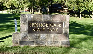
Springbrook State Park is a state park in Guthrie County, Iowa, United States, located approximately 5 miles (8.0 km) west of the city of Yale. The park contains a 17-acre (6.9 ha) spring-fed lake and timber-covered rolling hills along the Middle Raccoon River.

Lake Ahquabi State Park is a state park of Iowa, US, featuring a 115-acre (47 ha) reservoir. Ahquabi means "resting place" in the Fox language. The park is 6 miles (9.7 km) south of Indianola and 22 miles (35 km) south of Des Moines. Three sections of the park were listed on the National Register of Historic Places in 1991.
The Central Design Office, Ames was a design office at Iowa State, in Ames, Iowa that designed public works, many built under the Civilian Conservation Corps program. It designed many that are listed on the U.S. National Register of Historic Places.
Water Works Park is a 1,500 acre park southwest of downtown Des Moines, Iowa and contains the Des Moines Water Works (DMWW) which is a publicly owned municipal water utility that supplies the greater Des Moines metropolitan area. It is one of the largest urban parks in the United States. Located along the Raccoon River west of Fleur Drive, the park offers trails, picnic areas, grills, and fields.

Lacey-Keosauqua State Park is located southwest of Keosauqua, Iowa, United States. The park is located along the Des Moines River in Van Buren County. First dedicated in 1921, it is the largest state park in size in Iowa. In 1990, three areas were named nationally recognized historic districts and listed on the National Register of Historic Places.
Twin Lakes State Park is a 15-acre (6.1 ha) state park in Calhoun County, Iowa, United States, located near the city of Rockwell City. The park is composed of two areas on the eastern and western shores of the 453-acre (183 ha) North Twin Lake. It includes two beaches and fishing sites on the lake; while there are no boating facilities in the park itself, two public boat ramps can be found on the lake's south shore. The lake is home to bluegill, crappie, and walleye. The park also includes a picnic shelter built by the Civilian Conservation Corps in its eastern unit and a playground in its western unit. The eastern unit connects to a 7-mile (11 km) bike trail around the lake.


