| Pikes Point State Park | |
|---|---|
 Pikes Point State Park Location in Iowa  Pikes Point State Park Location in United States | |
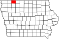
| Location | Dickinson County, Iowa, United States |
| Nearest city | McGregor, Iowa |
| Coordinates | 43°24′55″N95°09′47″W / 43.41528°N 95.16306°W |
| Area | 15 acres (6.1 ha) [1] |
| Elevation | 1,444 ft (440 m) |
| Established | 1931 |
| Administered by | Iowa Department of Natural Resources |
| Website | Official website |
Pikes Point State Park Shelter and Steps | |
| Area | less than one acre |
| Built | 1933 |
| Architect | Central Design Office, Ames |
| Architectural style | Rustic |
| MPS | CCC Properties in Iowa State Parks MPS |
| NRHP reference No. | 90001675 |
| Added to NRHP | November 15, 1990 |
Pikes Point State Park is located southwest of Spirit Lake, Iowa, United States. It is a small park on a point of land that projects into West Okoboji Lake. It provides space for picnicking, including a shelter listed on the National Register of Historic Places, a playground, a swimming beach, boating and fishing on the lake. [2]