Related Research Articles

Lizard Mound State Park is a state park in the Town of Farmington, Washington County, Wisconsin near the city of West Bend. The park contains a significant well-preserved effigy mound group, representing one of the largest and best-preserved collections of such mounds in the state. Mounds in the park are the subject of at least two different listings on the National Register of Historic Places, one encompassing the park as a whole, and another which includes a larger set of regional mounds. Established in 1950, the park was acquired by Washington County from the state of Wisconsin in 1986, and was returned to the state in 2021. It is now managed by the Wisconsin Department of Natural Resources.

Fish Farm Mounds State Preserve is a 3-acre (12,000 m2) archaeological mound group containing Native American burials in the U.S. state of Iowa. It is located within the larger Fish Farms Mounds Wildlife area, a state owned hunting area a few miles south of New Albin, just inland from the Upper Mississippi River in Allamakee County.

The Sunken Village Archeological Site, designated by the Smithsonian trinomial 35MU4, is an archaeological site on Sauvie Island in Multnomah County, Oregon, United States. The site consists of a remarkably well-preserved Chinookan village, dating back more than 700 years. It is a major example of a wet archaeological site, in which cultural materials were preserved in an anaerobic freshwater environment. Finds at the site include well-preserved basketry. The site was declared a National Historic Landmark in 1989.

The archaeology of Iowa is the study of the buried remains of human culture within the U.S. state of Iowa from the earliest prehistoric through the late historic periods. When the American Indians first arrived in what is now Iowa more than 13,000 years ago, they were hunters and gatherers living in a Pleistocene glacial landscape. By the time European explorers visited Iowa, American Indians were largely settled farmers with complex economic, social, and political systems. This transformation happened gradually. During the Archaic period American Indians adapted to local environments and ecosystems, slowly becoming more sedentary as populations increased. More than 3,000 years ago, during the Late Archaic period, American Indians in Iowa began utilizing domesticated plants. The subsequent Woodland period saw an increase on the reliance on agriculture and social complexity, with increased use of mounds, ceramics, and specialized subsistence. During the Late Prehistoric period increased use of maize and social changes led to social flourishing and nucleated settlements. The arrival of European trade goods and diseases in the Protohistoric period led to dramatic population shifts and economic and social upheaval, with the arrival of new tribes and early European explorers and traders. During the Historical period European traders and American Indians in Iowa gave way to American settlers and Iowa was transformed into an agricultural state.
Landergin Mesa, near Vega, Texas, is an archeological site, preserving some of the most significant Texas Panhandle culture ruins. Landergin Mesa is a large site with many isolated structures, it is important because of the unique artifacts dating to the Antelope Creek Phase. There are well preserved examples of Borger Cordmarked ceramic vessels from the period. The site also exhibits unique architecture indicative of the Antelope Creek Phase.

The Mines of Spain State Recreation Area and E. B. Lyons Nature Center is a state park in Dubuque County, Iowa, United States. It is near Dubuque, the eleventh-largest city in the state. The park features picnic areas, 15 miles (24 km) of walking/hiking trails, 4 miles (6.4 km) of ski trails, and the Betty Hauptli Bird and Butterfly Garden. It also includes archaeological sites of national importance as an early lead mining and smelting venture led by French explorer Julien Dubuque, as well as Dubuque's gravesite. These sites were collectively designated a National Historic Landmark District as Julien Dubuque's Mines.

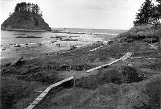
The Ozette Native American Village Archeological Site is the site of an archaeological excavation on the Olympic Peninsula near Neah Bay, Washington, United States. The site was a village occupied by the Ozette Makah people until a mudslide inundated the site around the year 1750. It is located in the now unpopulated Ozette Indian Reservation.

This is a list of the National Register of Historic Places listings in Iowa County, Iowa.

Cranberry Creek Archeological District, also known as Cranberry Creek Mound Group, is an ancient American Indian burial mound site from circa AD 100–800 near New Miner, Wisconsin, United States. It is three miles east of Necedah National Wildlife Refuge in Juneau County. It is part of the "effigy mound culture" of native peoples in Wisconsin, who practiced the "respectful burial of their dead".

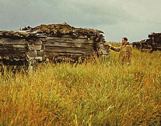
The Old Savonoski Site is the former site of a native village in Lake and Peninsula Borough, Alaska, that was buried by ash in the June 1912 eruption of the Novarupta Volcano. The site is located near the confluence of the Savonoski and Ukak Rivers, and is within the bounds of the Katmai National Park and Preserve. The site was visited by archaeologists in 1953, who identified a number of surviving elements, including fifteen barabaras, or semi-subterranean dwellings.
The Savonoski River Archeological District encompasses a complex of prehistoric and historic archaeological sites on the Savonoski River near the mouth of the Grosvenor River in Katmai National Park and Preserve, located on the Alaska Peninsula of southwestern Alaska. At least two sites, designated 49-MK-3 and 49-MK-4 by state archaeologists, were identified when the site was listed in 1978. In 2003, the district was enlarge to include a third site, XMK-53. This area is believed to be the site of one of a group of Native Alaskan settlements referred to in Russian records as "Severnovsk". Excavations of a known prehistoric site in 1964 uncovered additional evidence of a post-contact settlement.
Big Sioux Prehistoric Prairie Procurement System Archaeological District is a discontiguous historic district of 30 sites located along 15 miles (24 km) of river terraces and blufftops in Lyon County, Iowa. The sites are both large and small in size and they "contain a representative sample of the best preserved elements of a hunting and gathering system" of the native peoples who inhabited the northwest Iowa plains from 10,000 to 200 years ago. They include late base camps, deeply-buried early Archaic camps, and procurement sites from all time periods in the Pre-Columbian era. The district was listed on the National Register of Historic Places in 1989.

Kimball Village is an archaeological site located in the vicinity of Westfield, Iowa, United States. It is one of six known Big Sioux phase villages from the Middle Missouri tradition that existed between 1100-1250 C.E. The site, located on a terrace overlooking the Big Sioux River, has well-preserved features, including earth lodge and storage pits, and evidence of fortifaction. The site was listed on the National Register of Historic Places in 2010, and as a National Historic Landmark in 2016.
The Winooski Archeological Site, designated VT-CH-46 by state archaeologists, is a prehistoric Native American site in the city of Winooski, Vermont. First identified in 1972, it is one of the largest Native encampment sites of the Middle Woodland period in the northeastern United States. It was listed on the National Register of Historic Places in 1978, at which time it was recognized as one of just two stratified Woodland period sites in the state.
The Four Mounds site is a historic site located in Dubuque, Iowa, United States. It is made up of a row of four conical burial mounds on a blufftop that overlooks the Mississippi River. They are prehistoric in their origin. The site was individually listed on the National Register of Historic Places in 2000. It was included as a contributing property in the Four Mounds Estate Historic District in 2002.
The King Coulee Site is a prehistoric Native American archaeological site in Pepin Township, Minnesota, United States. It was listed on the National Register of Historic Places in 1994 for having state-level significance in the theme of archaeology. It was nominated for being a largely undisturbed occupation site with intact stratigraphy and numerous biofacts stretching from the late Archaic period to the Oneota period. This timeframe spans roughly from 3,500 to 500 years ago. The site yielded the oldest known evidence of domesticated plants in Minnesota: seeds dated to 2,500 years ago from the squash Cucurbita pepo.
Pagoda Creek is an archeological site which was listed on the National Register of Historic Places in 2017.
The Benson Archeological Site, designated 13WD50 in the state archaeological inventory, is a historic site located near Smithland, Iowa, United States. Pottery fragments found at the site include Black Sand and Crawford ware from the early Woodland period and Valley ware from the Middle Woodland period. The site was listed on the National Register of Historic Places in 1984.
The Osprey Site is an archeological site located near Bandon, Oregon, United States. Associated with the Coquille people, it is the largest known complex of fishing weirs on the Oregon coast, encompassing over 3000 identified wooden weir stakes organized into 25 discrete weir features. Radiocarbon dating suggests the site was in use possibly as early as 560 to 670 CE, and historic accounts indicate it continued in use into the 1850s. The site has also yielded more split wood lattice panels than any other weir location along the Northwest coast. It is a site of outstanding cultural importance to the Coquille people, and great research importance for understanding variation in weir technology during the precontact and postcontact periods.
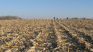
Wickiup Hill is a Native American archeological region near Toddville, in Linn County, Iowa. The area has the Wickiup Hill Outdoor Learning Center which was built where a Meskwaki village once stood. Wickiup Hill has been excavated by archeologists.
References
- ↑ Federal and state laws and practices restrict general public access to information regarding the specific location of this resource. In some cases, this is to protect archeological sites from vandalism, while in other cases it is restricted at the request of the owner. See: Knoerl, John; Miller, Diane; Shrimpton, Rebecca H. (1990), Guidelines for Restricting Information about Historic and Prehistoric Resources, National Register Bulletin, National Park Service, U.S. Department of the Interior, OCLC 20706997 .
- 1 2 "National Register Information System". National Register of Historic Places . National Park Service. July 9, 2010.
- ↑ "The Amana Nature Trail". University of Iowa. Retrieved 2016-02-05.
- ↑ "Indian Fish Trap State Preserve (Click on the link "State Preserves Guide (Listing of all 95 preserves)" in the text.)". Iowa Department of Natural Resources . Retrieved 2016-06-01.
- ↑ Herzberg, Ruth; Pearson, John A.; Resources, Iowa Department of Natural (2001). The Guide to Iowa's State Preserves. University of Iowa Press. ISBN 978-0-87745-774-9.
- ↑ Whittaker, William (2013). "The Disappearance of the Amana Indian Fish Weir (13IW100)". Newsletter of the Iowa Archeological Society. 63 (1): 1–5.