Jersey Shore Historic District

Last updated
Jersey Shore Historic District
Jersey Shore old houses.JPG
Jersey Shore Historic District, June 2009
USA Pennsylvania location map.svg
Red pog.svg
Location in Pennsylvania
Usa edcp location map.svg
Red pog.svg
Location in United States
LocationIrregular shape roughly bounded by Lawshe Run, W. Branch Susquehanna River, S borough boundaries, and Tomb Ave., Jersey Shore, Pennsylvania
Coordinates 41°12′4″N77°15′18″W / 41.20111°N 77.25500°W / 41.20111; -77.25500 Coordinates: 41°12′4″N77°15′18″W / 41.20111°N 77.25500°W / 41.20111; -77.25500
Area150 acres (61 ha)
Built byAlexander Smith (Humes building)
Architectural style Late Victorian, Greek Revival, Federal
NRHP reference No. 75001653 [1]
Added to NRHPMarch 31, 1975

The Jersey Shore Historic District is a national historic district located in Jersey Shore, Lycoming County, Pennsylvania. [2] The district encompasses 286 contributing buildings in the central business district and surrounding residential area of Jersey Shore. Most were built during the period 1830 to 1860, and are representative of Victorian, Greek Revival, and Federal style architecture.

Contents

It was added to the National Register of Historic Places in 1975. [1] [3]

History

The Borough of Jersey Shore had its beginnings in pre-Revolutionary War days, according to newspaper accounts of the town's history. [4]

Dean R. Wagner, who prepared the form which helped secure the Jersey Shore Historic District's placement on the National Register of Historic Places, the present day Borough of Jersey Shore, Pennsylvania confirmed in 1975 that the town is located on lands which were part of initial land grants made to 17th and 18th-century settlers along the western branch of the Susquehanna River, roughly 15 miles south of what is, today, the city of Williamsport in Lycoming County. Those land grants, from north to south, were: Forrest Situate, Richmond Situate, Richland Situate, and Forge Hammer. A portion of Forrest Situate was then subsequently purchased by Jeremiah and Reuben Manning who, sometime around the year 1800, had left the shore of New Jersey where they were residing to relocate to Pennsylvania. After purchasing their land, they then laid out a town north of what is, today, Allegheny Street, and initially named their new town Waynesburg. That year, there were just four houses inside the town's boundaries, but the town was ripe for expansion because there were multiple businesses located outside of town, including lumber and flour mills. [5]

Twelve years later, William B. Smith purchased land south of what is now Allegheny Street, and laid out a new section of town there in 1813. Initially reachable by wagon and stagecoach, the town became even more accessible when it became a stop on the West Branch Canal in 1834. Further growth was impeded during the mid-1800s, however, when planners chose to build the incoming railroad on the other side of the river, rather than closer to or through the town. [5]

The name of the town was officially changed to Jersey Shore in 1826. [6]

This historic district was added to the National Register of Historic Places in 1975. [1] [7]

Notable architecture

Notable buildings include:

Related Research Articles

<span class="mw-page-title-main">Sullivan County, Pennsylvania</span> County in Pennsylvania, United States

Sullivan County is a county in the Commonwealth of Pennsylvania. It is part of Northeastern Pennsylvania. As of the 2020 census, the population was 5,840, making it the second-least populous county in Pennsylvania. Its county seat is Laporte. The county was created on March 15, 1847, from part of Lycoming County and named for Major General John Sullivan.
<span class="mw-page-title-main">Lycoming County, Pennsylvania</span> County in Pennsylvania, United States

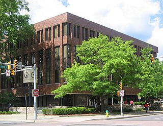
Lycoming County is a county in the Commonwealth of Pennsylvania. As of the 2020 census, the population was 114,188. Its county seat is Williamsport.

<span class="mw-page-title-main">Brown Township, Lycoming County, Pennsylvania</span> Township in Pennsylvania, United States

Brown Township is a township in Lycoming County, Pennsylvania, United States. The population was 92 at the 2020 census. It is part of the Williamsport, Pennsylvania Metropolitan Statistical Area.

<span class="mw-page-title-main">Jackson Township, Lycoming County, Pennsylvania</span> Township in Pennsylvania, United States

Jackson Township is a township in Lycoming County, Pennsylvania, United States. The population was 394 at the 2020 census. It is part of the Williamsport Metropolitan Statistical Area.

<span class="mw-page-title-main">Jersey Shore, Pennsylvania</span> Borough in Pennsylvania, United States

Jersey Shore is a borough in Lycoming County, Pennsylvania, United States. It is on the West Branch Susquehanna River, 15 miles (24 km) west by south of Williamsport. It is part of the Williamsport, Pennsylvania Metropolitan Statistical Area. In the past, Jersey Shore held farms, railroad shops, cigar factories, a foundry, and a large silk mill. The population was 4,158 at the 2020 census.

<span class="mw-page-title-main">Lewis Township, Lycoming County, Pennsylvania</span> Township in Pennsylvania, United States

Lewis Township is a township in Lycoming County, Pennsylvania, United States. The population was 987 at the 2010 census, down from 1,139 in 2000. It is part of the Williamsport Metropolitan Statistical Area.
<span class="mw-page-title-main">Muncy Township, Lycoming County, Pennsylvania</span> Township in Pennsylvania, United States

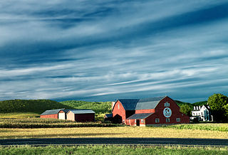
Muncy Township is a township in Lycoming County, Pennsylvania, United States. The population was 1,177 at the 2020 census. It is part of the Williamsport Metropolitan Statistical Area.

<span class="mw-page-title-main">Nippenose Township, Lycoming County, Pennsylvania</span> Township in Pennsylvania, United States

Nippenose Township is a township in Lycoming County, Pennsylvania, United States. The population was 662 at the 2020 census. It is part of the Williamsport, Pennsylvania Metropolitan Statistical Area.

<span class="mw-page-title-main">Porter Township, Lycoming County, Pennsylvania</span> Township in Pennsylvania, United States

Porter Township is a township in Lycoming County, Pennsylvania, United States. The population was 1,535 at the 2020 census. It is part of the Williamsport Metropolitan Statistical Area.

<span class="mw-page-title-main">Watson Township, Lycoming County, Pennsylvania</span> Township in Pennsylvania, United States

Watson Township is a township in Lycoming County, Pennsylvania, United States. The population was 534 at the 2020 census. It is part of the Williamsport Metropolitan Statistical Area.

<span class="mw-page-title-main">Woodward Township, Lycoming County, Pennsylvania</span> Township in Pennsylvania, United States

Woodward Township is a township in Lycoming County, Pennsylvania, United States. The population was 2,043 at the 2020 census, down from 2,200 in 2010. It is part of the Williamsport Metropolitan Statistical Area.

<span class="mw-page-title-main">West Branch Susquehanna River</span> River in Pennsylvania, United States

The West Branch Susquehanna River is one of the two principal branches, along with the North Branch, of the Susquehanna River in the Northeastern United States. The North Branch, which rises in upstate New York, is generally regarded as the extension of the main branch, with the shorter West Branch being its principal tributary.

<span class="mw-page-title-main">Larrys Creek</span> Tributary of the West Branch Susquehanna River

Larrys Creek is a 22.9-mile-long (36.9 km) tributary of the West Branch Susquehanna River in Lycoming County in the U.S. state of Pennsylvania. A part of the Chesapeake Bay drainage basin, its watershed drains 89.1 square miles (231 km2) in six townships and a borough. The creek flows south from the dissected Allegheny Plateau to the Ridge-and-valley Appalachians through sandstone, limestone, and shale from the Devonian, Mississippian, and Pennsylvanian periods.
<span class="mw-page-title-main">Pine Creek (Pennsylvania)</span> Creek in Pennsylvania, United States

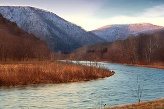
Pine Creek is a tributary of the West Branch Susquehanna River in Potter, Tioga, Lycoming, and Clinton counties in Pennsylvania. The creek is 87.2 miles (140.3 km) long. Within Tioga County, 23.25 miles (37.42 km) of Pine Creek are designated as a Pennsylvania Scenic River.

<span class="mw-page-title-main">West Branch Susquehanna Valley</span>

The West Branch Susquehanna Valley of central Pennsylvania, United States, in the Ridge-and-valley Appalachians, is the low-lying area draining into the West Branch Susquehanna River southeast of the Allegheny Front, northeast of the Bald Eagle Valley, southwest of the Wyoming Valley and north of the water gap formed between Shamokin Mountain and Montour Ridge.

<span class="mw-page-title-main">History of Lycoming County, Pennsylvania</span>

This article details a history of Lycoming County, Pennsylvania.

<span class="mw-page-title-main">Plunketts Creek (Loyalsock Creek tributary)</span> River in the US state of Pennsylvania

Plunketts Creek is an approximately 6.2-mile-long (10 km) tributary of Loyalsock Creek in Lycoming and Sullivan counties in the U.S. state of Pennsylvania. Two unincorporated villages and a hamlet are on the creek, and its watershed drains 23.6 square miles (61 km2) in parts of five townships. The creek is a part of the Chesapeake Bay drainage basin via Loyalsock Creek and the West Branch Susquehanna and Susquehanna Rivers.

<span class="mw-page-title-main">Coudersport station</span> United States historic place

The Coudersport and Port Allegany Railroad Station is a railroad station in Coudersport, Pennsylvania in the United States. It was built by the Coudersport and Port Allegany Railroad in 1899 and opened in January 1900 during the lumber industry boom in Potter County. When the lumber ran out, the railroad's business decreased and in 1964 the line and station were purchased by the Wellsville, Addison and Galeton Railroad. The station was abandoned in 1970 and was unoccupied until 1975, when the borough of Coudersport purchased it. The borough restored it and put a new roof on, then used the building for office space. The station was listed on the National Register of Historic Places on November 21, 1976.

<span class="mw-page-title-main">Coudersport and Port Allegany Railroad</span> Former railroad in Pennsylvania, United States

The Coudersport and Port Allegany Railroad was a shortline railroad that operated in Potter and McKean Counties in Pennsylvania in the United States between 1882 and 1964. The original line ran 17 miles (27 km) along the Allegheny River between the boroughs of Coudersport, the county seat of Potter County, and Port Allegany in McKean County. The line was originally a 3 ft narrow gauge and converted to 4 ft 8+12 instandard gauge in 1889. It was prosperous during a lumber boom in the region and expanded east to Ulysses. The lumber boom ended in the early 20th century and the line slowly declined until 1964, when it was purchased by the Wellsville, Addison and Galeton Railroad. The line was finally abandoned in 1970. Today the only surviving building from the railroad is the Coudersport and Port Allegany Railroad Station, which was listed on the National Register of Historic Places in 1976 and serves as the town hall for Coudersport today. As of 2009, much of the C&PA railroad grading can still be found. Railroad bridge abutments exist at Lillibridge Creek in Port Allegany and along the Allegheny River at Coleman Mills, east of Roulette, and east and west of Coudersport.

References

  1. 1 2 3 "National Register Information System". National Register of Historic Places . National Park Service. July 9, 2010.
  2. "Jersey Shore Historic District," in "PENNSYLVANIA: Lycoming County." Washington, D.C.: National Register of Historic Places, retrieved online September 18, 2019.
  3. "The Comprehensive Plan Background Studies for the US 220/Future I-99 Planning Area" (final draft), p. 108. Lycoming County, Pennsylvania: Jersey Shore Borough, Piatt Township, Porter Township, Woodward Township, February 2003.
  4. Barnes, Tom. "Jersey Shore, Pennsylvania has plenty to offer except sand and surf." Pittsburgh, Pennsylvania: Pittsburgh Post Gazette, October 7, 2012.
  5. 1 2 3 "National Historic Landmarks & National Register of Historic Places in Pennsylvania". CRGIS: Cultural Resources Geographic Information System. Archived from the original (Searchable database) on 2007-07-21. Retrieved 2011-11-19.Note: This includes Dean R. Wagner (May 1974). "National Register of Historic Places Inventory Nomination Form: Jersey Shore Historic District" (PDF). Retrieved 2011-11-19.
  6. Grundhauser, Eric. "Why There's a Jersey Shore in the Middle of Pennsylvania." Atlas Obscura, August 15, 2017.
  7. "The Comprehensive Plan Background Studies for the US 220/Future I-99 Planning Area," p. 108, Jersey Shore Borough, et al.
  8. Meginness, John Franklin, ed. History of Lycoming County , Pennsylvania, p. 486. Chicago, Illinois: Brown, Runk & Co., Publishers, 1892.
  9. Megenness, History of Lycoming County, p. 685.
  10. Meginness, History of Lycoming County, p. 1044.