
Narragansett is a town in Washington County, Rhode Island, United States. The population was 14,532 at the 2020 census. However, during the summer months the town's population more than doubles to near 34,000. The town of Narragansett occupies a narrow strip of land running along the eastern bank of the Pettaquamscutt River to the shore of Narragansett Bay on the Atlantic Ocean. It was separated from South Kingstown in 1888 and incorporated as a town in 1901. With several ocean beaches and a walkable strip along the ocean front, Narragansett is a resort area in the summer season as well as a popular East Coast surfing spot due to frequent southerly swells from Atlantic Ocean.

North Kingstown is a town in Washington County, Rhode Island, United States, and is part of the Providence metropolitan area. The population was 27,732 in the 2020 census. North Kingstown is home to the birthplace of American portraitist Gilbert Stuart, who was born in the village of Saunderstown. Within the town is Quonset Point, location of the former Naval Air Station Quonset Point, known for the invention of the Quonset hut, as well as the historic village of Wickford.

South Kingstown is a town in, and the county seat of, Washington County, Rhode Island, United States. The population was 31,931 at the 2020 census. South Kingstown is the second largest town in Rhode Island by total geographic area, behind New Shoreham, and the third largest town in Rhode Island by geographic land area, behind Exeter and Coventry.
Potowomut is an isolated neighborhood and a peninsula in Warwick, Rhode Island. It is bordered by the Town of East Greenwich to the northwest, and by North Kingstown to the southeast. Greenwich Bay surrounds all other sides.

Point Judith is a village and a small cape, on the coast of Narragansett, Rhode Island, United States, on the western side of Narragansett Bay where it opens out onto Rhode Island Sound. It is the location for the year-round ferry service that connects Block Island to the mainland and contains the fishing hamlet of Galilee.
Conanicut Island is an island in Narragansett Bay in the American state of Rhode Island. The second-largest in the Bay, it is connected on the east to Newport on Aquidneck Island by the Claiborne Pell Bridge, commonly known as the Newport Bridge, and on the west to North Kingstown on the mainland via the Jamestown-Verrazano Bridge. The town of Jamestown comprises the entire island. The U.S. Census Bureau reported a land area of 24.46 km2 (9.44 sq mi) and a population of 5,622 in 2000. A tombolo connects the southern part of Conanicut to an extension of the island to the southwest.

The Pawcatuck River is a river in the US states of Rhode Island and Connecticut flowing approximately 34 miles (55 km). There are eight dams along the river's length. USS Pawcatuck was named after the river.

Kingston is a village and a census-designated place within the town of South Kingstown in Washington County, Rhode Island, United States, and the site of the main campus of the University of Rhode Island. The population was 6,974 at the 2010 census. Much of the village center is listed on the National Register of Historic Places as Kingston Village Historic District. It was originally known as Little Rest.
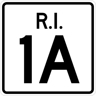
Route 1A, largely signed as Scenic 1A, is a 33.3-mile (53.6 km) long numbered state highway located in Washington County, Rhode Island, United States. The route, which parallels U.S. Route 1 for its entire length, has four distinct sections connected by US 1, two of which require median u-turn ramps to cross US 1. It travels through five towns in Washington County: Westerly, Charlestown, South Kingstown, Narragansett, and North Kingstown.
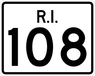
Route 108 is a 8.6-mile-long (13.8 km) state highway in Washington County, Rhode Island. The route begins at an intersection with Ocean Road in the village of Narragansett Pier, just north of Point Judith Light. The route's northern terminus is at an intersection with Route 138 in the town of South Kingstown, just east of the University of Rhode Island. In between, Route 108 connects to the Block Island Sound community of Galilee and passes through the villages of Wakefield and Peace Dale.

Saunderstown is a small village and historic district in the towns of Narragansett and North Kingstown in Washington County, Rhode Island, United States. It was named in honor of John Aldrich Saunders, a member of the Saunders family. Saunderstown has its own post office with the ZIP Code of 02874, which also includes a small part of South Kingstown. Its population is 6,245.

Fox Island is an island in Narragansett Bay, Rhode Island, in the United States of America. It lies between Conanicut Island and North Kingstown just south of the village of Wickford, Rhode Island. The island is a part of the town of North Kingstown. The Native Americans called the island "Nanaquonset" The island was purchased from Native Americans by Randall Holden and Samuel Gorton in 1659. In the 1860s a Christian preacher named Captain Jimmie Hammond became the first full-time resident of the island where he lived with his chickens and cat. In 1880, Rev. William Pendleton Chapman, a pastor at the nearby Quidnessett Church, featured the island in his adventure book titled “Budd Boyd’s Triumph: The Boy Firm of Fox Island.” Various other private owners have owned the island since its first habitation. Since 2000 it has been privately owned by a corporation which uses a large wind generator on the east side of the island.
The Saugatucket River is a river in the U.S. state of Rhode Island. It flows approximately 13 km (8 mi). There are three dams along the river's length.
The Potowomut River is a tidal extension of the Hunt River in the U.S. state of Rhode Island. It runs approximately 2.5 miles (4.0 km).
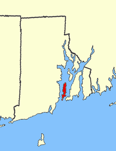
Point Judith Pond is a shallow, four-mile (6 km)-long salt body of water lying behind the barrier beaches and sand dunes that form Point Judith Harbor, which lies immediately west of Point Judith in Narragansett, Rhode Island at the southwestern tip of Narragansett Bay. Located about 14 miles (23 km) southwest of Newport Harbor, Point Judith Pond forms a partial border between the communities of Narragansett and South Kingstown, and is connected to Point Judith Harbor by a narrow waterway that cuts through the beaches and sandy shoreline. This waterway is used by a large fishing fleet and local and transient recreational craft. The harbor handles a large amount of passenger traffic, primarily during the summer. Year-round ferry service is available between Point Judith and Block Island.

U.S. Route 1 (US 1) is a major north–south U.S. Route through the U.S. state of Rhode Island, specifically within the Providence metropolitan area. Staying close to the Atlantic Ocean and Narragansett Bay, it is a longer route than Interstate 95 (I-95), and many portions are a four-lane divided highway.
Matunuck is a village in South Kingstown, Rhode Island, United States, located near Charlestown. It is located on a point along the southern Atlantic coast of Rhode Island off U.S. Route 1. The village takes its name from an Indian word meaning "lookout". The Narragansett tribe made a summer encampment at this location before the land was sold to colonists as part of the Pettaquamscutt purchase.

Washington County, known locally as South County, is a county located in the U.S. state of Rhode Island. As of the 2020 census, the population was 129,839. Rhode Island counties have no governmental functions other than as court administrative boundaries, which are part of the state government.

Galilee is a fishing village on Point Judith within the town of Narragansett, Rhode Island, United States, and is notable for being home to the largest fishing fleet in Rhode Island and for being the site of the Block Island Ferry. The village is directly across the harbor from Jerusalem, Rhode Island. Galilee, Rhode Island is named after the Biblical Galilee, which was the original home region of Jesus Christ, who grew up in Nazareth, a village in the Galilee region of Israel on the Sea of Galilee. Four of Jesus' disciples, Andrew, Peter, James and John, were fishermen from Galilee.

East Matunuck State Beach is a public recreation area encompassing 144 acres (58 ha) on the shore of Block Island Sound in the town of South Kingstown, Rhode Island. The state beach offers picnicking, ocean swimming, and beach activities. It is open seasonally.

