Wakefield, Rhode Island

Last updated

Wakefield
Village
Bell Block.JPG
Bell Block
USA Rhode Island location map.svg
Red pog.svg
Wakefield
Usa edcp location map.svg
Red pog.svg
Wakefield
Coordinates: 41°26′14″N71°30′05″W / 41.43722°N 71.50139°W / 41.43722; -71.50139
Country United States
State Rhode Island
County Washington
Elevation
7 ft (2 m)
Time zone UTC-5 (Eastern (EST))
  Summer (DST) UTC-4 (EDT)
ZIP code
02880 [1]
GNIS feature ID1219863 [2]
Wakefield Baptist Church Wakefield Baptist Church.jpg
Wakefield Baptist Church

Wakefield is a village in the town of South Kingstown, Rhode Island, United States, and the commercial center of South Kingstown. Together with the village of Peace Dale, it is treated by the U.S. Census as a component of the census-designated place identified as Wakefield-Peacedale, Rhode Island. West Kingston, another South Kingstown village, was the traditional county seat of Washington County. Since 1991, the Washington County Courthouse has been in Wakefield. The Sheriff's Office which handles corrections is also in Wakefield.

Contents

The Wakefield village center along Main Street (old Boston Post Road) between Belmont Avenue and Columbia Street was listed on the National Register of Historic Places in 1996 as Wakefield Historic District, with boundary increases in 2019 and 2022. The district is significant for being an early commercial and industrial center. The district includes 53 properties over an area of 400 acres (160 ha).

History

Wakefield was a focus for settlement due to its location on the Saugatucket River and the old Post Road, which was laid out early in the 18th century. Settlement began in the early 18th century with establishment of a small mill on the Saugatucket River. A tavern and stagecoach stop were established in 1745 and a snuff mill was built around 1765. The textile industry began to become an important source of economic activity in 1807 when a carding mill was established on the Saugatucket River. By 1822, the village had about 60 residents and consisted of nine houses, a store, the carding mill, a grist mill, a saw mill, and a blacksmith shop. A Baptist church was built in 1830 and an Episcopal church followed in 1840. [3]

The local textile mill continued to operate and expand through the 19th century, but in the mid-century, as nearby Peace Dale grew as a manufacturing center and factories were established in other water power sites in the area, Wakefield became the commercial center of South Kingstown. It underwent considerable growth in the 1840s, including the development of some major retail stores. A Roman Catholic priest was assigned to Wakefield in 1852 and the first Catholic church was built two years later. Kenyon's Department Store was founded in 1856. A carriage manufacturing operation was established in 1874, and in 1876 the Narragansett Pier Railroad started operation, with a station in Wakefield. It is now a bike trail called the William C. O'Neill Bike Path. In 1877, the South Kingstown Town Hall was built in the village. A bank and several other major businesses arrived in the 1880s. By 1895, Wakefield had a population of 1,543, and had begun to coalesce with the villages of Peace Dale and Rocky Brook, forming a roughly contiguous settlement with a total population of 3,285. [3]

The Wakefield Mill underwent several ownership changes and expansions in the 20th century. In 1903, it was sold to the Wakefield Woolen Company, which installed new looms and carding equipment for producing high-grade woolen fabrics. It sold again in 1922 and four more times between World War II and 1984. Beginning in the 1950s, parts of the mill complex began to be converted to other uses, but as of 1984, much of the complex was still used for textile manufacturing. [3]

Wakefield's first hospital was started in a house in 1919, and a new South County Hospital building was built in 1925 on a 6-acre (2.4 ha) tract that formerly had been the town farm. [3]

Beginning in the late 1950s, commercial activity in Wakefield migrated away from the central business district to new commercial areas on the periphery of the community. As of 1984, the village was considered the largest shopping area in South County. [3]

Economy

Much of Wakefield's economy is driven by seasonal tourism, as the main central business district of South Kingstown runs from the Saugutucket River up to Old Tower Hill.

Arts and culture

Buildings in Wakefield listed on the National Register of Historic Places listings in Washington County, Rhode Island include Wakefield Baptist Church, Nathaniel C. Armstrong House, John H. Armstrong House, Hera Gallery, [4] and Bell Block. [5]

Education

Wakefield is part of the South Kingstown School District. Schools in Wakefield include South Kingstown High School, Broad Rock Middle School, Curtis Corner Middle School, and Wakefield Elementary School. [6]

Media

The Narragansett Times , a twice-weekly paper serving Narragansett and South Kingstown, is published in Wakefield.[ citation needed ]

Notable people

Related Research Articles

<span class="mw-page-title-main">North Kingstown, Rhode Island</span> Town in Rhode Island, United States

North Kingstown is a town in Washington County, Rhode Island, United States, and is part of the Providence metropolitan area. The population was 27,732 in the 2020 census. North Kingstown is home to the birthplace of American portraitist Gilbert Stuart, who was born in the village of Saunderstown. Within the town is Quonset Point, location of the former Naval Air Station Quonset Point, known for the invention of the Quonset hut, as well as the historic village of Wickford.

<span class="mw-page-title-main">South Kingstown, Rhode Island</span> Town in Rhode Island, United States

South Kingstown is a town in, and the county seat of, Washington County, Rhode Island, United States. The population was 31,931 at the 2020 census. South Kingstown is the second largest town in Rhode Island by total geographic area, behind New Shoreham, and the third largest town in Rhode Island by geographic land area, behind Exeter and Coventry.

<span class="mw-page-title-main">Peace Dale, Rhode Island</span> United States historic place

Peace Dale is a village in the town of South Kingstown, Rhode Island. Together with the village of Wakefield, it is treated by the U.S. Census as a component of the census-designated place identified as Wakefield-Peacedale, Rhode Island.

<span class="mw-page-title-main">Kingston, Rhode Island</span> Census-designated place in Rhode Island, United States

Kingston is a village and a census-designated place within the town of South Kingstown in Washington County, Rhode Island, United States, and the site of the main campus of the University of Rhode Island. The population was 6,974 at the 2010 census. Much of the village center is listed on the National Register of Historic Places as Kingston Village Historic District. It was originally known as Little Rest.

<span class="mw-page-title-main">Rhode Island Route 1A</span> State highway in Washington County, Rhode Island, US

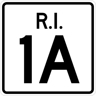
Route 1A, largely signed as Scenic 1A, is a 33.3-mile (53.6 km) long numbered state highway located in Washington County, Rhode Island, United States. The route, which parallels U.S. Route 1 for its entire length, has four distinct sections connected by US 1, two of which require median u-turn ramps to cross US 1. It travels through five towns in Washington County: Westerly, Charlestown, South Kingstown, Narragansett, and North Kingstown.

<span class="mw-page-title-main">Rhode Island Route 108</span> State highway in Rhode Island, US

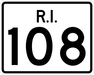
Route 108 is a 8.6-mile-long (13.8 km) state highway in Washington County, Rhode Island. The route begins at an intersection with Ocean Road in the village of Narragansett Pier, just north of Point Judith Light. The route's northern terminus is at an intersection with Route 138 in the town of South Kingstown, just east of the University of Rhode Island. In between, Route 108 connects to the Block Island Sound community of Galilee and passes through the villages of Wakefield and Peace Dale.

<span class="mw-page-title-main">Wickford, Rhode Island</span> Village in North Kingstown, Rhode Island, US

Wickford is a small village in the town of North Kingstown, Rhode Island, United States, which is named after Wickford in Essex, England. Wickford is located on the west side of Narragansett Bay, just about a 20-minute drive across two bridges from Newport, Rhode Island. The village is built around one of the most well-protected natural harbors on the eastern seaboard, and features one of the largest collections of 18th century dwellings to be found anywhere in the Northeast. Today the majority of the village's historic homes and buildings remain largely intact upon their original foundations.

<span class="mw-page-title-main">Saunderstown, Rhode Island</span> United States historic place

Saunderstown is a small village and historic district in the towns of Narragansett and North Kingstown in Washington County, Rhode Island, United States. Saunderstown has its own post office with the ZIP Code of 02874, which also includes a small part of South Kingstown. Its population is 6,245.

<span class="mw-page-title-main">Carolina, Rhode Island</span> United States historic place

Carolina is a village that straddles the border of the towns of Charlestown and Richmond on the Pawcatuck River in Washington County, Rhode Island. Rhode Island Route 112 passes through the village. Carolina is identified as a census-designated place, with a population of 970 at the 2010 census.

<span class="mw-page-title-main">Saylesville, Rhode Island</span> United States historic district

Saylesville is a village and historic district in Lincoln, Rhode Island.

<span class="mw-page-title-main">Hillsdale Historic and Archeological District</span> Historic district in Rhode Island, United States

Hillsdale Historic and Archeological District is a historic district in Richmond, Rhode Island. The district was added to the National Register of Historic Places in 1980. It represents the site of the former textile mill village of Hillsdale.

<span class="mw-page-title-main">Hope Village Historic District</span> Historic district in Rhode Island, United States

The Hope Village Historic District is a historic rural mill settlement within Hope Village in Scituate, Rhode Island. Hope Village is located on a bend in the North Pawtuxet River in the southeastern corner of Scituate. Industrial activity has occurred in Hope Village since the mid-eighteenth century. Surviving industrial and residential buildings in the Historic District date back to the early 19th century. The village center sits at junction of Main Street and North Road. Hope Village radiates out from the center with houses on several smaller side streets in a compact configuration. Currently there is little commercial or industrial activity in Hope Village and none in the Historic District. The present stone mill building on the south side of Hope Village was built in 1844 by Brown & Ives of Providence, expanded in 1871 and modified in 1910. Approximately one quarter of the village's current housing stock was built as mill worker housing by various owners of Hope Mill.

<span class="mw-page-title-main">Old Narragansett Cemetery</span> Historic cemetery in Washington County, Rhode Island, US

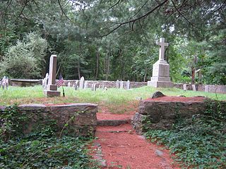
The Old Narragansett Cemetery is an historic cemetery on Shermantown Road in North Kingstown, Rhode Island. Variant names for the cemetery include Narragansett Cemetery, Platform Cemetery, and The Platform Cemetery. The cemetery occupies a 1.2 acres (0.49 ha) plot about 300 feet (91 m) south of Shermantown Road, roughly midway between its two junctions with Mourning Dove Drive. It was established early in the 18th century, and is one of North Kingstown's oldest and longest-used cemeteries. It has 110 marked graves, and was used from its establishment c. 1705 to the 1880s. The most prominent memorials are to James MacSparran and Samuel Fayerweather, two long-serving ministers at the Old Narragansett Church, which stood nearby when it was built in 1706.

<span class="mw-page-title-main">Central Village Historic District</span> Historic district in Connecticut, United States

The Central Village Historic District is a historic district in the Central Village area of Plainfield, Connecticut that was listed on the National Register of Historic Places (NRHP) in 1991. It encompasses a late 19th-century historic mill village, including a small commercial center where Connecticut Route 12 and 14 meet, a cluster of architecturally distinguished buildings built by mill owners and managers, and a collection of mill worker housing units. It includes the Plainfield Woolen Company Mill, which is separately listed, as well as archaeological remnants of other mill infrastructure. It also includes Plainfield's old town hall and high school. Other architecturally prominent buildings include the c. 1855 Italianate mansion of mill owner Arthur Fenner, and the 1845 Greek Revival Congregational Church.

<span class="mw-page-title-main">Narragansett Pier Railroad</span> Defunct railroad in Rhode Island

The Narragansett Pier Railroad was a railroad in southern Rhode Island, running 8 miles (13 km) from West Kingston to Narragansett Pier. It was built by the Hazard Family of Rhode Island to connect their textile mills in Peace Dale and Wakefield to the New York, Providence and Boston Railroad at Kingston Station as well as to ocean-going steamboats at Narragansett Pier. Passenger service ran on the line from 1876 to 1952; the line continued freight operation as a Class III railroad until 1981. Most of the right-of-way has been converted to the William C. O'Neill Bike Path.

<span class="mw-page-title-main">Rowland G. Hazard</span> American industrialist and businessman

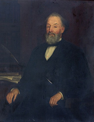
Rowland Gibson Hazard was an American industrialist, politician, and social reformer.

<span class="mw-page-title-main">Hallville Mill Historic District</span> Historic district in Connecticut, United States

Hallville Mill Historic District is a historic district in the town of Preston, Connecticut, that was listed on the National Register of Historic Places in 1996. Contributing properties in the district are 23 buildings, two other contributing structures, and one other contributing site over a 50-acre (20 ha) area. The district includes the dam that forms Hallville Pond, historic manufacturing buildings and worker housing, and the Hallville Mill Bridge, a lenticular pony truss bridge built circa 1890 by the Berlin Iron Bridge Company.

The Stillwater Mill was a former textile factory located in Smithfield, Rhode Island.

<span class="mw-page-title-main">Jericho Village Historic District</span> Historic district in Vermont, United States

The Jericho Village Historic District encompasses the historic industrial and commercial center of the village of Jericho, Vermont. Stretched along Vermont Route 15 south of Browns River, which powered the village's industries for many years, the village center includes a well-preserved array of 19th and early 20th-century buildings. The district was listed on the National Register of Historic Places in 1992.

<span class="mw-page-title-main">Frederick C. Olney</span> African-American lawyer

Frederick Clayton Olney was an American lawyer and entrepreneur. An African-American resident of Wakefield, Rhode Island, with Native American ancestry, he was one of the first African-American lawyers admitted to the bar in the state, and one of the founders of the Gladstone Springs Water Company.

References

  1. "Wakefield ZIP Code". zipdatamaps.com. 2022. Retrieved November 11, 2022.
  2. U.S. Geological Survey Geographic Names Information System: Wakefield
  3. 1 2 3 4 5 Historic and Architectural Resources of South Kingstown, Rhode Island: A Preliminary Report, Rhode Island Historical Preservation Commission, 1984
  4. "State of Rhode Island Historic Property Search". National Register of Historic Places. State of Rhode Island, Historical Preservation & Heritage Commission. September 30, 2012.
  5. "State of Rhode Island Historic Property Search Bell Block". National Register of Historic Places. State of Rhode Island, Historical Preservation & Heritage Commission. September 30, 2012.
  6. "Our Schools". South Kingstown School District. Retrieved March 22, 2020.

Commons-logo.svg Media related to Wakefield, Rhode Island at Wikimedia Commons