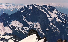
Monte Cristo Peak is a mountain peak in the Henry M. Jackson Wilderness in Washington state. Together with Columbia Peak and Kyes Peak it forms a basin that contains Columbia Glacier and Blanca Lake. The 1918 edition of The Mountaineer called the mountain "a huge pile of red rock."
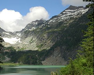
Kyes Peak, which is also known as "Goblin Peak", is a mountain peak located in the Henry M. Jackson Wilderness in Washington, United States. Kyes Peak rises to over 7,280 feet (2,220 m). Together with Columbia Peak and Monte Cristo Peak it forms a basin that contains Columbia Glacier and Blanca Lake. It is the highest summit in the Monte Cristo group of peaks.
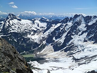
Luna Peak is the highest mountain in the Picket Range, an extremely rugged subrange of the North Cascades in the American state of Washington. It is located within North Cascades National Park. It is notable for its large local relief and isolated position on a far-flung eastern ridge of the Pickets. For example, it rises over 6,560 ft (2,000 m) in 1.8 mi (2.9 km) above McMillan Creek to the south.

Davis Peak is a mountain just north of Gorge Lake in North Cascades National Park, in the US state of Washington. It is located just south of the Picket Range. While not of particularly high elevation, even for the North Cascades, it is notable for its large, steep local relief, and in particular for its huge Northeast Face, which drops 5,250 ft (1,600 m) in one horizontal mile (1.6 km). This is one of the two largest vertical drops in one horizontal mile in the contiguous United States, the other being the North Face of Kinnerly Peak.
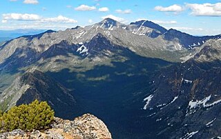
North Gardner Mountain is a mountain in the North Cascades of Washington state. The mountain is located in the Okanogan–Wenatchee National Forest and is the highest point in Okanogan County, Washington, and the 23rd highest mountain in the state.

Sahale Mountain is a jagged, glaciated mountain, in North Cascades National Park, in northern Washington state. The summit of Sahale Mountain is referred to as Sahale Peak. It is 0.3 miles (0.48 km) south of its higher neighbor, Boston Peak, and the saddle between the two is 80 feet (24 m) lower than Sahale's summit. Quien Sabe Glacier is to the west of the ridge between the two peaks while Davenport Glacier is in a cirque east of this ridge and above Horseshoe Basin. Sahale Glacier is south of the summit and east of Sahale Arm, a ridge that extends southwest from Sahale to Cascade Pass. The name Sahale may originate from a Northwest Native American word meaning "high place," "falcon," or "sacred."

Buckner Mountain is a tall peak in the North Cascades of Washington state and in the Stephen Mather Wilderness of North Cascades National Park. At 9,114 feet (2,778 m) in elevation it is the highest in Skagit County and one of about ten of Washington's non-volcanic peaks above 9,000 feet high. It is ranked as the 14th highest peak in the state, and the third highest peak in North Cascades National Park.

Mount Redoubt is a mountain in the North Cascades range in Whatcom County, Washington state. The peak is located 3.0 miles (5 km) from the Canada–US border, 16.3 miles (26 km) east-northeast of Mount Shuksan. It is the 21st highest peak in the state, with a height of 8,956 feet (2,730 m) and a prominence of 1,649 feet (503 m). Redoubt is in the Skagit Range, a sub-range of the North Cascades, in the Custer-Chilliwack Group which includes Mount Spickard, Mount Redoubt, Mount Custer and Mox Peaks, among others. Redoubt, Bear, and Depot creeks drain off the mountain, which is composed of Skagit gneiss. Mount Redoubt is listed as one of the "Classic Eight Peaks" in the North Cascades.

Bacon Peak is a mountain located in North Cascades National Park, in the Cascade Range in the U.S. state of Washington. Its glaciers cover 1.2 square miles (3.2 km2); the three main glaciers are Diobsud Creek Glacier, Green Lake Glacier and Noisy Creek Glacier.
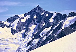
Forbidden Peak is an 8,815 feet (2,687 m) glacial horn located in North Cascades National Park, in Skagit County of Washington state. It is part of the North Cascades and is located near Cascade Pass. Forbidden Peak features a rock climbing route named West Ridge route which is featured in Fifty Classic Climbs of North America. The peak was first climbed by a party consisting of Fred Beckey, his brother Helmy Beckey, Jim Crooks, Lloyd Anderson and Dave Lind in 1940.

Sinister Peak is in Mount Baker-Snoqualmie and Wenatchee National Forests in the U.S. state of Washington. It is situated in Glacier Peak Wilderness and the North Cascades. Not quite 1 mi (1.6 km) east of Dome Peak, Sinister Peak is along a high ridge connecting the two peaks. The Chickamin Glacier is on the north slopes of Sinister Peak while the Garden Glacier is just southeast. Though some of the routes to the summit are technical, it can be reached by a moderate scramble.

Nooksack Tower is in North Cascades National Park in the U.S. state of Washington. Nooksack Tower is part of the Mount Shuksan Massif and is .75 mi (1.21 km) northeast of the main summit of Shuksan. Nooksack Tower looms to the west over Nooksack Cirque. The East Nooksack Glacier lies to the southeast, West Nooksack Glacier to the east and Price Glacier is on the north flanks of the tower. Nooksack Tower is one of the most difficult mountains to climb in the Cascade Range, with loose rock, 50-degree or greater slopes and ice ridges as well as accessibility issues and exposure, all weighing into the climbing equation. The descent may require ten or more rappels.
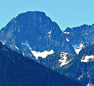
Mesahchie Peak is in North Cascades National Park in the U.S. state of Washington. Mesahchie Peak is named after the Chinook word for wicked. Mesahchie Peak is the highest summit along a ridge known as Ragged Ridge and is only .25 mi (0.40 km) east of Katsuk Peak. Both the Katsuk and Mesahchie Glaciers descended down the northwest and northeast flanks of the peak respectively.

Holliway Mountain is an 8000+ ft granite summit located in Okanogan County in Washington state. It is part of the Okanogan Range which is a sub-range of the North Cascades Range. Holliway Mountain is situated near the headwaters of the Methow River on land administered by the Okanogan–Wenatchee National Forest. The nearest higher peak is Golden Horn, 0.91 miles (1.46 km) to the south. Azurite Peak is located three miles to the north-northwest.
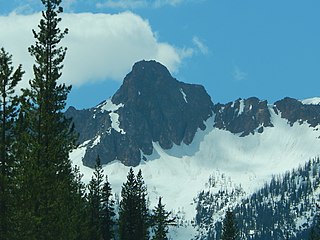
Molar Tooth is a 7,547-foot-elevation (2,300-meter) granite summit located on the shared border of Okanogan County and Skagit County, in Washington state. The mountain is part of the Okanagan Range which is a subrange of the Cascade Range. Set in the Okanogan–Wenatchee National Forest, Molar Tooth is situated south of Cutthroat Pass, and 0.57 miles (0.92 km) north of Cutthroat Peak, which is also the nearest higher peak. The easiest climbing route is class 4 scrambling, but solid rock provides class 5 technical routes as well. Precipitation runoff from the east side of Molar Tooth drains into tributaries of the Methow River, whereas runoff from the west side drains into tributaries of the Skagit River.

Cascade Peak is a 7,428-foot (2,264-metre) mountain summit located in Skagit County of Washington state. It is in the North Cascades, which is a subrange of the Cascade Range. The peak is situated above Cascade Pass, on the shared border of North Cascades National Park and Glacier Peak Wilderness. The nearest higher peak is Johannesburg Mountain, 0.53 miles (0.85 km) to the west-southwest, and The Triplets stand guard 0.35 miles (0.56 km) to the east-southeast. Surface runoff from the mountain drains into the Cascade River.
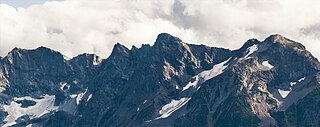
Elija Ridge is a prominent 7,739 ft (2,360 m) ridge located in North Cascades National Park, in Whatcom County of Washington state. It is part of the North Cascades which is a subset of the Cascade Range. The highest point is called Elija Peak, and another peak on this ridge with sufficient prominence to qualify as a separate summit is called Ezekiel,. The nearest higher neighbor is Gabriel Peak, 1.9 miles (3.1 km) to the southeast, Beebe Mountain is set 1.86 miles (2.99 km) to the northeast, and Ruby Mountain is 4.86 miles (7.82 km) to the northwest. Precipitation runoff from this ridge drains to Ross Lake via Panther Creek. This geographical feature is named after the prophet Elija, which is a reference to Tommy Rowland who settled in the Skagit River area in 1895 and later pronounced himself the "Prophet Elisha." Gabriel Peak, Genesis Peak, and Mount Prophet are also named in association with Rowland.
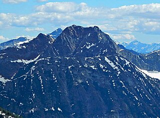
Mother Lode is a 7,905-foot-elevation (2,409-meter) mountain summit located in the North Cascades, in Okanogan County, Washington. It is situated in the Lake Chelan-Sawtooth Wilderness, on land managed by Okanogan–Wenatchee National Forest. The mountain is part of the Methow Mountains, which are a subset of the Cascade Range, and the peak is approximately two miles east of the crest of the range. Mother Lode is set approximately six miles south of Washington Pass, and the nearest higher neighbor is Gilbert Mountain, three miles to the northeast. Topographic relief is significant as the north aspect rises 3,500 feet above the South Fork Twisp River in one mile. The peak was climbed in 1983 by Rick La Belle and Glen Sterr via the north ridge, and the northeast ridge was climbed in 1985 by Carl and Gordon Skoog. Precipitation runoff from the peak drains into tributaries of Twisp River, which in turn is a tributary of the Methow River.

Edward Peak, also known as The Mole, is a 7,280-foot (2,219-metre) granite summit located in Chelan County of Washington state. It is set within the Alpine Lakes Wilderness, on land managed by Okanogan-Wenatchee National Forest. Edward Peak belongs to the Stuart Range which is a subset of the Cascade Range. It is situated 1.9 miles (3.1 km) north of The Temple, and the nearest town is Leavenworth, 7 miles (11 km) to the northeast. Precipitation runoff from the mountain drains north into Icicle Creek via Rat Creek.

Wedge Mountain is a 5,860-foot-elevation (1,786-meter) summit located in Chelan County of Washington state. It is set on the boundary line of the Alpine Lakes Wilderness, on land managed by Okanogan-Wenatchee National Forest. Wedge Mountain is the northeastern terminus of the Stuart Range, which is a subset of the Cascade Range. It is situated 3.5 miles (5.6 km) northeast of The Temple, and the nearest town is Leavenworth, 5 miles (8.0 km) to the north-northeast. Precipitation runoff from the mountain drains into tributaries of the Wenatchee River. Topographic relief is significant as the summit rises over 2,800 feet above Snow Creek in one-half mile. Backpackers hiking en route to The Enchantments via the Snow Creek Trail traverse the western foot of this mountain. Wedge Mountain is the toponym officially adopted by the U.S. Board on Geographic Names for the 5,860-foot summit.
