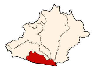
Julcán District, Jauja

Last updated
Julcán District
District
Country Flag of Peru.svg  Peru
Region Junín
Province Jauja
Founded January 21, 1925
Capital Julcán
Government
   Mayor Felix Mabi Ildefonso Quispe
Area
  Total 24.78 km2 (9.57 sq mi)
Elevation 3,460 m (11,350 ft)
Population (2005 census)
  Total 814
  Density 33/km2 (85/sq mi)
Time zone PET (UTC-5)
UBIGEO 120412

Julcán District is one of thirty-four districts of the province Jauja in Peru. [1]

Districts of Peru third level administrative subdivision of Peru

The districts of Peru are the third-level country subdivisions of Peru. They are subdivisions of the provinces, which in turn are subdivisions of the larger regions or departments. There are 1,838 districts in total.

Jauja Province Province in Junín, Peru

Jauja Province is a Peruvian province. It is one of the nine provinces of the Junín Region. To the north it borders with the Yauli, Tarma and Chanchamayo Provinces. To the east with the Satipo Province, to the south with the Concepción Province and to the west with the Lima Region. The capital of the Jauja Province is the city of Jauja. The city was founded by Francisco Pizarro as the first capital of Peru.

Peru republic in South America

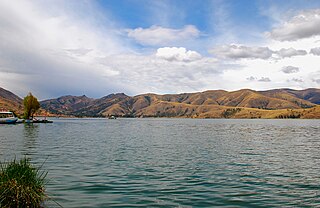
Peru, officially the Republic of Peru, is a country in western South America. It is bordered in the north by Ecuador and Colombia, in the east by Brazil, in the southeast by Bolivia, in the south by Chile, and in the west by the Pacific Ocean. Peru is a megadiverse country with habitats ranging from the arid plains of the Pacific coastal region in the west to the peaks of the Andes mountains vertically extending from the north to the southeast of the country to the tropical Amazon Basin rainforest in the east with the Amazon river.

Related Research Articles

North Houston is an Unincorporated community in Harris County, Texas, United States that used to be a distinct community.

San Ramón District, Chanchamayo District in Junín, Peru

San Ramón District is one of six districts of the province Chanchamayo in Peru.

Vitoc District District in Junín, Peru

Vitoc District is one of six districts of the province Chanchamayo in Peru.

Hualhuas District is one of twenty-eight districts of the province Huancayo in Peru.

Ingenio District is one of twenty-eight districts of the province Huancayo in Peru.

Quilcas District is one of twenty-eight districts of the province Huancayo in Peru.

San Agustín District is one of twenty-eight districts of the province Huancayo in Peru.

San Jerónimo de Tunán District is one of twenty-eight districts of the province Huancayo in Peru.

Acolla District is one of thirty-four districts of the province Jauja in Peru.

Huamalí District is one of thirty-four districts of the province Jauja in Peru.

Leonor Ordóñez District is one of thirty-four districts of the province Jauja in Peru.

Marco District is one of thirty-four districts of the province Jauja in Peru.

Monobamba District is one of thirty-four districts of the province Jauja in Peru.

Paca District District in Junín, Peru

Paca District is one of thirty-four districts of the province Jauja in Peru.

Pancán District is one of thirty-four districts of the province Jauja in Peru.

San Lorenzo District is one of thirty-four districts of the province Jauja in Peru.

San Pedro de Chunan District is one of thirty-four districts of the province Jauja in Peru.

Sausa District is one of thirty-four districts of the province Jauja in Peru.

Tupe District is one of thirty-three districts of the province of Yauyos in Peru. It is home to the Jaqaru ethnolinguistic minority.

Phoenix College is a special school in Reading, Berkshire. The school has fifty places and caters for boys aged 11–18. All pupils have statements of special educational needs relating to behavioural, social and emotional needs. The school was last inspected in 2014 and judged Good.

References

Coordinates: 11°45′41″S75°26′36″W / 11.7614°S 75.4432°W / -11.7614; -75.4432

Geographic coordinate system Coordinate system

A geographic coordinate system is a coordinate system that enables every location on Earth to be specified by a set of numbers, letters or symbols. The coordinates are often chosen such that one of the numbers represents a vertical position and two or three of the numbers represent a horizontal position; alternatively, a geographic position may be expressed in a combined three-dimensional Cartesian vector. A common choice of coordinates is latitude, longitude and elevation. To specify a location on a plane requires a map projection.