Kagaznagar, Telengana

Last updated

Sirpur-Kaghaznagar
India Telangana location map.svg
Red pog.svg
Sirpur-Kaghaznagar
Location in Telangana State, India
India location map.svg
Red pog.svg
Sirpur-Kaghaznagar
Sirpur-Kaghaznagar (India)
Coordinates: 19°20′00″N79°29′00″E / 19.3333°N 79.4833°E / 19.3333; 79.4833
CountryFlag of India.svg  India
State Telangana
District Komaram Bheem
Government
  TypeChairman-Council
  BodyKagaznagar Municipal Council
Area
[1]
  Total8.31 km2 (3.21 sq mi)
Elevation
174 m (571 ft)
Population
 (2011) [2]
  Total57,583
  Density6,900/km2 (18,000/sq mi)
Languages
  Official Telugu, Hindi, Urdu ,Gondi
Time zone UTC+5:30 (IST)
PIN
504296 [3]
Area code +91-8738
Vehicle registration TS 20
Website kagaznagarmunicipality.telangana.gov.in

Sirpur-Kaghaznagar is a town and a municipality in Komaram Bheem Asifabad district in the state of Telangana in India. [4] [5] It is located about 297 kilometres from the state capital, Hyderabad, 140 kilometres from Karimnagar, 90 kms from Chandrapur and 250 kilometres from Nagpur.

Contents

History

Sirpur, formerly known as Suryapuram, was ruled by the Gond King, Ballala. The Gond King, Bhim Ballal Sing built Sirpur Fort in 9th century AD. The town derives its name from the paper factory established during the times of Nizams rule.

The area was initially a sub-district called Sirpur-Tandur carved out in 1872 and comprised Edlabad (Adilabad), Rajura (now in Maharashtra) and Sirpur taluks. Sirpur-Tandur was originally a district in Maratwada region. Later it was merged with Adilabad district of Telangana. In 2016, Komaram Bheem district was carved out of Adilabad district, and consequently, Sirpur Kaghaznagar now is in Komaram Bheem district.

Geography

Kagaznagar is located at 19°20′00″N79°29′00″E / 19.3333°N 79.4833°E / 19.3333; 79.4833 . [6] It has an average elevation of 174 meters (574 feet).

Topography

Kaghaznagar is surrounded by Major rivers like Wardha river on northern side , Pranhita in eastern side and pedda vagu river which runs through the town.

There is scope to make this forest Wild Life Sanctuary which will can generate tourism via Safari , Waterfall Trekking and Bird watching.

Demographics

As of 2011 India census, the town of Kagaznagar had a population of 66,293, with 33,124 males, and 33,169 females. There were a total of 5,576 children between the ages of 0 and 6 and 15,712 inhabitants were classified as illiterate. The town has a unique blend of people settled from different parts of India. Apart from Telugu ,Hindi ,Urdu and Gondi, Marathi is also widely understood due to the town's proximity to Maharashtra. Bengali language is widely spoken in Easgaon village owing to settlement of Bengali refugees. The literacy rate stood at 73.07 percent. [2]

The majority of people in the area practice Hinduism, followed by Islam and Christianity. Telugu is the most widely spoken language.

Economy

The local economy was almost completely dependent on manufacturing at Sirpur Paper Mills which has been acquired by J. K. Organisation and has been restarted in August 2018 with production likely to begin from April 2019. Sirsilk Textile Factory is closed, but Koneru Konappa, the previous MLA of the area claimed that he will reopen it. Presently the entire economy is run by agriculture allied activities and also the Real Estate is growing very fast. [7]

Education

This is a list of educational institutions in Kaghaznagar.


Important places


Culture

Festivals

Dasra (Vijayadashami)

Every year on vijayadashmi ravan dahan happens on Trishul Pahad.

Bathukamma it is celebrated around the period of Dasra. This is a nine-day festival. The women participate in the bathukamma, and it is decorated with the flowers of thangadi, gunuka, thamara, chamanthi, etc. The nine days of Bathukamma are

Shivaratri Jatra (Easgoan Temple)

Every year Shivaratri is celebrated at ancient Shiva Mallanna Temple located in Easgoan with 3 days long Jatra.

Pranhita Pushkaralu

Pranahita Pushkaralu is a festival of River Pranahita normally occurs once in 12 years. The Pushkaram is observed for a period of 12 days from the time of entry of Jupiter into Pisces (Meena rasi).[2]

As per Telugu culture, there are 12 sacred rivers across the country that go for a cycle what is called as “Pushakaram”. Each among those 12 rivers goes for the Pushkaram, in the order of one at a year. They are Ganga, Yamuna, Saraswati, Godavari, Sindhu, Narmada, Kaveri, Krishna, Tapti, Tungabhadra, Bheema and Pranahita.

List of Major Ghats Tummidi Hatti , Arjunigutta , Vemanpalli

Sri Rama Navami

As per Telugu culture Sri Rama Kalyanam is performed at all sri rama temples in the town.Railway colony is the famous for Kalyanam.

Chhath pooja

Chhath pooja is celebrated by the communities from UP and Bihar working in paper mills at SPM Garden every year.

Transport

The Town is connected to many cities in Telangana by the Telangana State Road Transport Corporation bus service. It is well connected to

Kaghaznagar is flanked on one side by National Highway 363 part of Nagpur-Vijayawada Express way and Raipur–Hyderabad Expressway which will pass near town is sanctioned.

National Highway 130D (India) which is under construction once completed this will provide Sirpur-Kaghaznagar region connectivity to Chhattisgarh (Kondagoan/Narayanpur) and further to Odisha and Araku valley (Vizag) AP.

Connected to Maharashtra Gondpipari/Gadchiroli via Venkatraopet-Polsa Interstate Bridge over Penganga river near Tonkini

Connected to Maharastra Aheri/Allapalli via Gudem-Aheri Interstate Bridge over Pranhita river

Nearby National Highways National Highway 353B (India) Ashti - Rajura - Adilabad Highway National Highway 63 (India) Jagdalpur - Mancherial - Nizamabad

Rail

The town is served by Sirpur Kaghaznagar railway station which lies on New Delhi–Chennai main line. It is administered by South Central Railway zone. It is well connected to all over India. It is an NSG4 category railway station in Secunderabad division of SCR railway with Potential stoppage of trains.

Air

The nearest airport is Nagpur Airport (257 km away) and Hyderabad Airport (307 km away).

There is Proposal to build Chadrapur Airport. Similarly, the existing airport in Adilabad district is being revived. under UDAAN Scheme.

Sirpur Assembly constituency

Sirpur Assembly constituency is an assembly constituency in Telangana.

Civic administration

Kagaznagar Municipality was constituted in 1956 and is classified as a third grade municipality with 30 election wards. [8] The jurisdiction of the civic body is spread over an area of 8.31 km2 (3.21 sq mi). [1]


Notable Persons

  1. Rajesh Kumar Nalla: Young Entrepreneur and businessman [9]

Related Research Articles

<span class="mw-page-title-main">Gadchiroli district</span> District of Maharashtra in India

Gadchiroli district is an administrative district in Maharashtra, India. The city of Gadchiroli is the administrative headquarters of the district.

Adilabad is a city which serves as the headquarters of Adilabad district, in the Indian state of Telangana. Telugu, Urdu, Marathi, and Lambadi, gondi are the most spoken languages of Adilabad. Adilabad is famous for its rich cultivation of cotton. Hence, Adilabad is also referred as "White Gold City". It is located about 304 kilometres (189 mi) north of the state capital, Hyderabad, 150 kilometres (93 mi) from Nizamabad and 196 kilometres (122 mi) from Nagpur.

Kerameri or Kerimeri is a mandal in Komaram Bheem Asifabad district in the state of Telangana in India. It is also home to the Kumuram Bheem Tribal Museum.

Sirpur (U) is a village and a mandal in Komaram Bheem district in the state of Telangana in India.

<span class="mw-page-title-main">Sirpur (T)</span> Town in Telangana, India

Sirpur (T) is a town and a mandal in Komaram Bheem district of the Indian state of Telangana.

<span class="mw-page-title-main">Pranahita River</span> River in India

The Pranahita River is the largest tributary of Godavari River covering about 34% of its drainage basin conveying the combined waters of the Penganga River, the Wardha River, and the Wainganga River. By virtue of its extensive network of tributaries, the river drains a large part of Vidarbha region in Maharashtra, as well as the southern slopes of the Satpura Range in southeast Madhya Pradesh. It flows along the border of Gadchiroli district in Maharashtra and Komaram Bheem Asifabad district in Telangana. The Pranahita sub-basin is the seventh largest in India, measuring about 109,078 km2, making it larger than the individual basins of significant rivers such as the Narmada River and Kaveri.

<span class="mw-page-title-main">Komaram Bheem</span> Indian tribal leader (1900–1940)

Komaram Bheem (1901–1940), alternatively Kumram Bheem, was a revolutionary leader in Hyderabad State of British India from the Gond tribes. Bheem, in association with other Gond leaders, led a protracted low intensity rebellion against the feudal Nizams of Hyderabad in the eastern part of the princely state during the 1930s, which contributed in the culmination of the Telangana Rebellion of 1946.

Sirpur Assembly constituency is a constituency in Komaram Bheem Asifabad district of Telangana that elects representatives to the Telangana Legislative Assembly in India. It is one of the seven assembly segments of the Adilabad Lok Sabha constituency.

Asifabad is a constituency of Telangana Legislative Assembly, India. It is one of two constituencies in Komaram Bheem district. It comes under Adilabad Lok Sabha constituency along with 6 other Assembly constituencies.

<span class="mw-page-title-main">Adilabad district</span> District of Telangana in India

Adilabad district is a district in the northern state of Telangana, India. It is known as the gateway district to South and Central India. The district's headquarters is the town of Adilabad.

Sirpur may refer to the following communities:

<span class="mw-page-title-main">Sirpur Paper Mills</span> Pulp and paper company in Telangana, India

Sirpur Paper Mills Limited (SPM) is an integrated pulp and paper mill situated at Kagaznagar in Komaram Bheem district, Telangana. JK Paper Ltd acquired Sirpur Paper Mills in August 2018.

Gunjala is a village in the Adilabad district of Telangana, India.

<span class="mw-page-title-main">Sri Komaram Bheem Project</span> Dam in Telangana, India

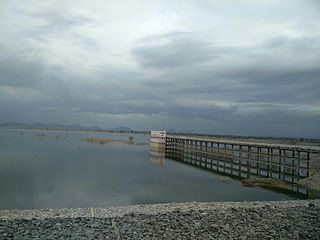
The Sri Komaram Bheem Project is a Medium Reservoir has been built across Peddavagu River, a tributary of the Pranahita River. It is located at Ada village, Asifabad Mandal, Komaram Bheem district, Telangana.

<span class="mw-page-title-main">Asifabad, Telangana</span> Census town in Telangana, India

Asifabad is a census town and the district headquarters of Kumuram Bheem district in the Indian state of Telangana. It is located in Asifabad mandal of Asifabad revenue division. It is situated on the banks of Peddavagu river. It is about 309 kilometres (192 mi) north of the state capital Hyderabad,86 kilometres (53 mi) from Ramagundam, 118 kilometres (73 mi) from Adilabad and 148 kilometres (92 mi) from Karimnagar.

<span class="mw-page-title-main">Mancherial district</span> District in Telangana, India

Mancherial district is a district located in the northern region of the Indian state of Telangana. The district comprises 18 mandals and two revenue divisions – Mancherial and Bellampalli. The district headquarters is located at Mancherial town. It is surrounded by Komaram Bheem, Nirmal, Jagtial, Peddapalli and Bhupalpally districts of Telangana and with Maharashtra state.

<span class="mw-page-title-main">Nirmal district</span> District of Telangana in India

Nirmal district is a district located in the northern region of the Indian state of Telangana. The district headquarters is located in the town of Nirmal. It borders the Telangana districts of Adilabad, Nizamabad, Mancherial, Asifabad, Jagtial districts as well as Nanded district of the state Maharashtra.

<span class="mw-page-title-main">Komaram Bheem Asifabad district</span> District of Telangana in India

Kumuram Bheem Asifabad district is a district in the Indian state of Telangana. The town of Asifabad is its district headquarters and kagaznagar as its largest town. It is named after Gond tribal leader Kumuram Bheem. It was earlier part of Adilabad district and it became a new district in 2016. The district share boundaries with Adilabad, Nirmal, Mancherial districts and with the state boundary of Maharashtra. It is the second most backward district in India, according to the 2018 NITI Aayog ranking.

The Parvati Barrage, also known as the Sundilla Barrage is an irrigation project located at Kasipeta Village, Manthani Mandal, Peddapalli district in Telangana State, India.

<span class="mw-page-title-main">Sirpur Kaghaznagar railway station</span>

Sirpur Kaghaznagar railway station is a major station on New Delhi–Chennai main line in Secunderabad division of South Central Railway in Indian Railways. It serves the Kagaznagar town in Komaram Bheem district in Telangana. The elevation of the railway station is 184 m above sea level.

References

  1. 1 2 "Urban Local Body Information" (PDF). Directorate of Town and Country Planning. Government of Telangana. Archived from the original (PDF) on 15 June 2016. Retrieved 28 June 2016.
  2. 1 2 "Census 2011". The Registrar General & Census Commissioner, India. Retrieved 26 July 2014.
  3. "Sirpur Khagaznagar Pin code". pin-code.net. Retrieved 9 July 2021.
  4. "Mandals in Adilabad district". Panchayat Informatics Division. Retrieved 27 March 2018.
  5. "Home". kagaznagarmunicipality.telangana.gov.in.
  6. Falling Rain Genomics. Kagaznagar
  7. Singh, S. Harpal (5 February 2015). "Memories of Sirsilk haunt Kagaznagar". The Hindu. ISSN   0971-751X.
  8. Members of Kagaznagar Municipal Council
  9. "He used lockdown as a catalyst". The New Indian Express. Retrieved 4 April 2023.