
Sierra Vista is a city in Cochise County, Arizona, United States. According to the 2020 Census, the population of the city is 45,308, and is the 27th most populous city in Arizona. The city is part of the Sierra Vista-Douglas Metropolitan Area, with a 2010 population of 131,346. Fort Huachuca, a U.S. Army post, has been incorporated and is located in the northwest part of the city. Sierra Vista is bordered by the cities of Huachuca City and Whetstone to the north and Sierra Vista Southeast to the South.
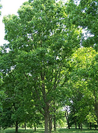
The pecan is a species of hickory native to the southern United States and northern Mexico in the region of the Mississippi River.

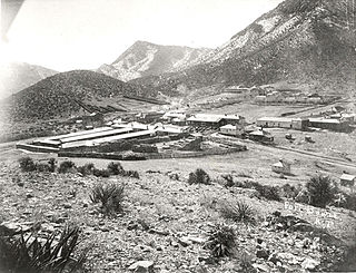
Lowell is a populated place situated in Cochise County, Arizona, United States. It was incorporated into Bisbee in the early 1900s.

The Wupatki National Monument is a United States National Monument located in north-central Arizona, near Flagstaff. Rich in Native American archaeological sites, the monument is administered by the National Park Service in close conjunction with the nearby Sunset Crater Volcano National Monument. Wupatki was established as a national monument in 1924 and was listed on the National Register of Historic Places on October 15, 1966. The listing included three contributing buildings and 29 contributing structures on 35,422 acres (14,335 ha).
Fort Bowie was a 19th-century outpost of the United States Army located in southeastern Arizona near the present day town of Willcox, Arizona. The remaining buildings and site are now protected as Fort Bowie National Historic Site.
Hereford is a populated place in Cochise County along the San Pedro Riparian National Conservation Area in the southern part of the U.S. state of Arizona. It is southeast of Sierra Vista and is a part of the Sierra Vista-Douglas micropolitan area. The elevation is 4,193 feet at the location of the original townsite at the far eastern end of the unincorporated area; the residential area runs for another 8 miles west from this location, blending into the unincorporated area of Nicksville at an elevation of approximately 4800 feet. Hereford Station Post Office is located at the far western end of Nicksville, at the foot of the Huachuca Mountains.

Maricopa Wells is a former place (locale) situated in Pinal County, Arizona. It has an estimated elevation of 1,093 feet (333 m) above sea level. Historically, it was an oasis around a series of watering holes in the Sierra Estrella, eight miles north of present-day Maricopa, Arizona, and about a mile west of Pima Butte. It developed as a trading center and stopping place for travelers in the mid to late 19th century.

Apache is a ghost town in Cochise County, Arizona, United States. It has an estimated elevation of 4,383 feet (1,336 m) above sea level.
Bakerville is a populated place situated within the city of Bisbee in Cochise County, Arizona, United States.

Beardsley is a populated place situated within the Sun City West CDP in Maricopa County, Arizona, United States. It has an estimated elevation of 1,263 feet (385 m) above sea level, and was named for William H. Beardsley, an irrigation pioneer who began an irrigation project at this location in 1888.
Black Diamond is a populated place situated in Cochise County, Arizona, United States.
Double Adobe is a populated place situated in Cochise County, Arizona, United States.
Forrest was a populated place situated in Cochise County, Arizona, United States.
Galeyville is a populated place situated in Cochise County, Arizona, United States. Founded in 1881, it is now a ghost town. It has an estimated elevation of 5,732 feet (1,747 m) above sea level.
Johnson is a populated place situated in Cochise County, Arizona, United States, on the east side of the Little Dragoon Mountains.
Lewis Springs, also called San Pedro Springs after the nearby San Pedro River, is a populated place situated in Cochise County, Arizona, United States.
Nicksville is a populated place in Cochise County, Arizona, just north of the international border between the United States and Mexico.
South Bisbee is a populated place situated in Cochise County, Arizona, United States, just north of the international border with Mexico.
Sunnyside is a populated place situated in the far west of Cochise County, Arizona, United States, located just north of the international border with Mexico. It has an estimated elevation of 5,814 feet (1,772 m) above sea level.

Agriculture in Arizona is a notable sector in the state's economy, contributing more than $23.3 billion in 2018. Arizona's diverse climate allows it to export all sorts of commodities such as nuts, wheat, cotton, eggs, meat, and dairy to the United States and 70 other countries. In 2018, the state produced 455.7 million pounds (206.7 kt) of red meat and ranked 3rd in producing vegetables in the United States, occupying 26 million acres of land for farms and ranches combined.


