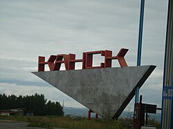
Founded in 1628 as a Russian fort, it was transferred to its current location in 1636 and granted town status in 1782.[citation needed] The town is a center of the Kansk-Achinsk lignite basin, which in the early 1980s was developed into one of the largest coal areas of the Soviet Union. It also has cotton, timber, hydrolysis, and food industries.[citation needed]
Законодательное собрание Красноярского края.Закон№10-4765от10 июня 2010 г. «О перечне административно-территориальных единиц и территориальных единиц Красноярского края», в ред. Закона №7-3007 от16 декабря 2014 г.«Об изменении административно-территориального устройства Большеулуйского района и о внесении изменений в Закон края "О перечне административно-территориальных единиц и территориальных единиц Красноярского края"». Вступил в силу1июля 2010г. Опубликован: "Ведомости высших органов государственной власти Красноярского края", №33(404), 5 июля 2010 г. (Legislative Assembly of Krasnoyarsk Krai.Law#10-4765ofJune10, 2010 On the Registry of the Administrative-Territorial Units and the Territorial Units of Krasnoyarsk Krai, as amended by the Law#7-3007 ofDecember16, 2014 On Changing the Administrative-Territorial Structure of Bolsheuluysky District and on Amending the Krai Law "On the Registry of the Administrative-Territorial Units and the Territorial Units of Krasnoyarsk Krai". Effective as ofJuly1, 2010.).
Законодательное собрание Красноярского края.Закон№12-2372от22 октября 2004 г. «О наделении муниципального образования город Канск статусом городского округа». Вступил в силучерез десять дней после официального опубликования. Опубликован: "Ведомости высших органов государственной власти Красноярского края", №30, 14 ноября 2004 г. (Legislative Assembly of Krasnoyarsk Krai.Law#12-2372ofOctober22, 2004 On Granting Urban Okrug Status to the Municipal Formation of the Town of Kansk. Effective as ofthe day ten days after the official publication.).
Законодательное собрание Красноярского края.Закон№13-3015от18 февраля 2005 г. «Об установлении границ и наделении соответствующим статусом муниципального образования Канский район и находящихся в его границах иных муниципальных образований», в ред. Закона №8-3158 от23 апреля 2009 г.«О внесении изменений в Закон края «Об установлении границ и наделении соответствующим статусом муниципального образования Канский район и находящихся в его границах иных муниципальных образований»». Вступил в силучерез десять дней после официального опубликования. Опубликован: "Ведомости высших органов государственной власти Красноярского края", №9, 4 марта 2005 г. (Legislative Assembly of Krasnoyarsk Krai.Law#13-3015ofFebruary18, 2005 On Establishing the Borders and Granting an Appropriate Status to the Municipal Formation of Kansky District and to Other Municipal Formations Within Its Borders, as amended by the Law#8-3158 ofApril23, 2009 On Amending the Krai Law "On Establishing the Borders and Granting an Appropriate Status to the Municipal Formation of Kansky District and to Other Municipal Formations Within Its Borders". Effective as often days after the official publication.).
This page is based on this Wikipedia article Text is available under the CC BY-SA 4.0 license; additional terms may apply. Images, videos and audio are available under their respective licenses.