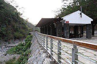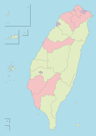
Kaohsiung,officially Kaohsiung City,is a special municipality located in southern Taiwan. It ranges from the coastal urban center to the rural Yushan Range with an area of 2,952 km2 (1,140 sq mi). Kaohsiung City has a population of approximately 2.73 million people as of October 2023 and is Taiwan's third most populous city and largest city in southern Taiwan.

Hualien County is a county on the east coast of Taiwan. It is Taiwan's largest county by area,yet due to its mountainous terrain,has one of the lowest populations in the country. The county seat and largest city is Hualien City. Hualien County is located in the eastern part of Taiwan;the Pacific Ocean is to its east and the Central Mountain Range is to its west. Hualien is the largest county in Taiwan in terms of area,with a long,narrow and mountainous terrain.

Tainan County was a county in southern Taiwan between 1945 and 2010. The county seat was in Sinying City.

Pingtung County is a county located in southern Taiwan. It has a warm tropical monsoon climate and is known for its agriculture and tourism. Kenting National Park,Taiwan's oldest national park,is located in the county. The county seat is Pingtung City.

Taichung County was a county in central Taiwan between 1945 and 2010. The county seat was in Yuanlin Township before 1950 and Fongyuan City after 1950.

Fongshan District is a district located in southern Kaohsiung,Taiwan. Fongshan is one of the administrative centers of Kaohsiung and is home to the Republic of China Military Academy. There are three military units currently located in Fongshan. Both the Republic of China Military Academy and R.O.C. Army Infantry School came to Taiwan from mainland China and were re-established here in 1950. Chung Cheng Armed Forces Preparatory School was established in 1976. These three units used to be the main economic driving force,but their importance diminished gradually as Fongshan has established itself as a conjunction between Pingtung City and Kaohsiung.

Cishan District is a suburban district in northeastern Kaohsiung,Taiwan. It has an area of 94.61 square kilometers,or 36.53 square miles. The population of Cishan is 34,372 as of October 2023. It is the 19th most populous district in Kaohsiung.

Namasia District (Kanakanavu language,Bunun language:Namasia;Chinese:那瑪夏區;Hanyu Pinyin:NàmǎxiàQū;Tongyong Pinyin:NàmǎsiàCyu;Wade–Giles:Na4-ma3-hsia4 Ch'ü1),formerly Sanmin Township (三民鄉;Sānmín Xiāng),is a mountain indigenous district located in the northeastern part of Kaohsiung,Taiwan. It is the second largest district in Kaohsiung after Taoyuan District.

Takao Prefecture was one of the administrative divisions of Taiwan during the Japanese rule. The prefecture consisted of modern-day Kaohsiung City and Pingtung County.

Alian District (Chinese:阿蓮區;pinyin:Ālián Qū;Wade–Giles:A1-lien2 Ch'ü1;Pe̍h-ōe-jī:A-lian-khu) is a rural district in Kaohsiung,Taiwan.

Ciaotou District is a rural district in Kaohsiung City,Taiwan.

Liouguei District is a rural district of Kaohsiung City,Taiwan. It is the third largest district in Kaohsiung City after Tauyuan District and Namasia District. The place-name is derived from the name of a Taivoan community Lakuri or Lakkuli,which emigrated from Vogavon in Tainan,driven to Kaohsiung by the invasion of Han immigrants and Siraya in the late 17th century.

Taoyuan District is a mountain indigenous district of Kaohsiung City,Taiwan. It is the largest district in Kaohsiung City by area and the least densely populated district in Taiwan.

Majia Township is a mountain indigenous township in Pingtung County,Taiwan. The area is known as Makazayazaya (瑪家雑牙雑牙社) in the Paiwan language,and the Taiwanese mountain pitviper is named after it. The main population is the indigenous Paiwan people.

Sandimen Township is a mountain indigenous township in Pingtung County,Taiwan Province,Republic of China. The population of the township consists mainly of the Paiwan people with a substantial Rukai minority.

Lioujiao Township is a rural township in Chiayi County,Taiwan.

Wutai Township is a mountain indigenous township in Pingtung County,Taiwan. It has a population total of 3,266 and an area of 278.80 square kilometres (107.65 sq mi).
Districts are administrative subdivisions of the Republic of China (Taiwan)'s special municipalities of the second level and provincial cities of the third level formerly under its provinces. There are two types of district in the administrative scheme.

A county,constitutionally known as a hsien,is a de jure second-level administrative division unit in the Republic of China (Taiwan). Under the administrative structure of Taiwan,it is with the same level of a provincial city.

Special municipality,historically known as Yuan-controlled municipality,is a first-level administrative division unit in Taiwan. It is the highest level of the country's administrative structure and is equivalent to a province. After the suspension of the provincial governments of 2018,the special municipalities along with provincial cities and counties have all governed directly under the central government.


