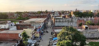
Zamania is a town in the Indian state of Uttar Pradesh. Its municipal council is subordinate to the Ghazipur District. It is also the administrative head of Zamania tehsil,. It is also a very historical town, it derives its name from Ali Quli Khan Zaman, who was also known as Khan Zaman or Zaman Khan, he was a governor of Jaunpur, and Ghazipur during the time of Akbar.
Dildarnagar Kamsar is a pargana (region) and a mashra comprising 34 settlements located around the Karamnasa River in the Ghazipur district of Uttar Pradesh and the Kaimur district of Bihar, India. Of these, 18 mouzas are the primary settlements. It is a prominent settlement of Khanzadas, also known as Kamsari Pathans, as well as Afghan Pathans, primarily of the Niazi and Yusufzai clans. The original name of the region was Kamsar, but due to close and historical ties with the family of Bara Pathans, the region is often referred to as Kamsar-O-Bar. It was established in 1542 by Raja Narhar Khan.
Usia is a village in Kamsaar, Uttar Pradesh, India. It is located southeast of Ghazipur and east of Dildarnagar, near the Bihar State border. The village has a population of 24,786 residents living in 3,471 households. Usia is approximately 7 km from Dildarnagar. Around 8500 Kamsar Pathans lived here as of 2011.
Amir Chak is a village in Kamsaar in the Indian state of Uttar Pradesh.
Rakasaha is a village in Kamsaar in the Indian state of Uttar Pradesh. Almost 6500 Kamsaar Pathans(NAWABS) lived in the village as of 2011.

Kurrah or Tajpur Kurrah is a village in Dildarnagar Kamsar region of Zamania tehsil in Ghazipur district. It is avillage of pathan Kamsaari pathans in the Indian state of Uttar Pradesh. Almost 3900 Kamsaar Pathans lived in the village as of 2011.

Gorasara is a village located in Dildarnagar Kamsar, Uttar Pradesh, India. Goarasara village was established by Bhikham Khan, son of Fateh Bahadur Khan, and great great grand son of Narhar Khan.

Saraila is a village in Kamsaar in the Indian state of Uttar Pradesh.Saraila is a village in Seorai Tehsil in Ghazipur District of Uttar Pradesh, India. It belongs to Varanasi Division. It is located 30 km to the south of District headquarters Ghazipur. 11 km from Seorai. 372 km from State capital Lucknow. The village was also a part of Daudpur Estate which had its capital at Dewaitha during Mughal and early British era.
Bahuara is a village in Kamsaar in the Indian state of Uttar Pradesh. Bahuara is a village with a population of almost 5000. It is surrounded by others Kamsar villages. Bahuara is well connected with the town of Dildarnagar which is hardly 2-3 kilometres away from the village. People of Bahuara are scattered throughout the world. Ancestrally, the people of bahuara have been a land-owning (Zamindar) community divided into two colonies Westside & Eastside. Neighbouring villages are Rakhsaha, Dildarnagar, and others.

Bara is a village of Dildarnagar Kamsar in Ghazipur district in the Indian state of Uttar Pradesh. It is situated on the banks of the holy river Ganges.
Mania is a village in Kamsaar in the Indian state of Uttar Pradesh. It is located in Seorai Tehsil in the Ghazipur district. It is situated 22 km (14 mi) from the sub-district headquarters Seorai and from the district headquarters Ghazipur. Its total area is 428.68 hectares and a total population of 5736. Mania village was established in the early 1590 a.d. by Khizir Khan, who was a grandson of Narhar Khan.
Chitarkoni is a village in Kamsaar in the Indian state of Uttar Pradesh.

Jaburna is a village in Kamsaar in the Indian state of Uttar Pradesh.
Fufuao or Rampur Phuphuaon is a village in Dildarnagar Kamsar in the Indian state of Uttar Pradesh.
Khizirpur-Alinagar is a village in Dildarnagar kamsar founded by Zamindaar Imran Khan & Zamindaar Numan Khan who came from [[Usia, Dildarnagar village of kamsar-o-bar Dildarnagar in the Indian state of Uttar Pradesh.
Dumri is a village in Dildarnagar kamsar located in Durgawati tehsil of the Indian state of Bihar. Dumri is large village and have svetalaana small villages or hamlets which are relative villages of Dumri which makes it the largest Gram Panchayat of Durgawati tehsil.
Kamsar is a village in Gasht Rural District, in the Central District of Fuman County, Gilan Province, Iran. At the 2006 census, its population was 232, in 67 families.
Baksara or Baksarah is a village of Ghazipur, Uttar Pradesh, India. Baksara village was established by Kamsar Pathans but later most of them migrated from Baksara to Gorasara and Mania village.
Palia is a village of Dildarnagar Kamsar located in Ghazipur District of Uttar Pradesh, India.
Dewaitha is a village of Dildarnagar Kamsar,in Zamania tehsil of Ghazipur, India, located on the banks of the Karmanasa River and it's tributary Eknaiya, The village had a population of 7,104 as of the 2011 Census of India. The place is inhabited by Kamsar Pathans..
