The Masjid-i-Jehan-Numa, commonly known as the Jama Masjid of Delhi, is one of the largest Sunni mosques in India.

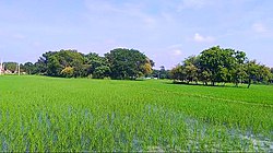
Dildarnagar Fatehpur Bazar is a neighbourhood of Dildarnagar, located in the Ghazipur district of the Indian state of Uttar Pradesh. It is situated on the banks of the River Ganges and is approximately 35 kilometers from the city of Ghazipur. The town is known for its historical and cultural significance, and it has several temples, mosques, and other landmarks that attract visitors from different parts of India. Dildarnagar is also an important commercial center and has a bustling market where locals and visitors can purchase a variety of goods and products. As of 2011 estimate the Population of Dildarnagar is 12855 and have an area of 1000 hectares.

The Jama Mosque (Masjid) is a disputed 17th-century congregational mosque in Mathura, Uttar Pradesh, India. It was built by Abd-al-Nabi Khan, governor of Mathura during the reign of Mughal Emperor Aurangzeb.
Usia is a village in Kamsaar, Uttar Pradesh, India. It is located southeast of Ghazipur and east of Dildarnagar, near the Bihar State border. The village has a population of 24,786 residents living in 3,471 households. Usia is approximately 7 km from Dildarnagar. Around 8500 Kamsar Pathans lived here as of 2011.
Rakasaha is a village in Kamsaar in the Indian state of Uttar Pradesh. Almost 6500 Kamsaar Pathans(NAWABS) lived in the village as of 2011.

Kurrah or Tajpur Kurrah is a village in Dildarnagar Kamsar region of Zamania tehsil in Ghazipur district. It is avillage of pathan Kamsaari pathans in the Indian state of Uttar Pradesh. Almost 3900 Kamsaar Pathans lived in the village as of 2011.
Kusi is a village of Kamsaar in Ghazipur district in the Indian state of Uttar Pradesh. The village has also Jama masjid Kusi. The nearest railway station is Dildar nagar. As of 2011 census the main population of the village lived in an area of 62 acres and had 796 households. The family of Kusi were one of the largest zamindars of Ghazipur and their zamindari was known as Kusi Kusi zamindari it became a Zamindari chieftaincy in year 1858 which was ruled by the family of Kusi and Bhaksi, it had 15 villages with an area of 94 km² in year 1901.

Gorasara is a village located in Dildarnagar Kamsar, Uttar Pradesh, India. Goarasara village was established by Bhikham Khan, son of Fateh Bahadur Khan, and great great grand son of Narhar Khan.

Saraila is a village in Kamsaar in the Indian state of Uttar Pradesh.Saraila is a village in Seorai Tehsil in Ghazipur District of Uttar Pradesh, India. It belongs to Varanasi Division. It is located 30 km to the south of District headquarters Ghazipur. 11 km from Seorai. 372 km from State capital Lucknow. The village was also a part of Daudpur Estate which had its capital at Dewaitha during Mughal and early British era.
Bahuara is a village in Kamsaar in the Indian state of Uttar Pradesh. Bahuara is a village with a population of almost 5000. It is surrounded by others Kamsar villages. Bahuara is well connected with the town of Dildarnagar which is hardly 2-3 kilometres away from the village. People of Bahuara are scattered throughout the world. Ancestrally, the people of bahuara have been a land-owning (Zamindar) community divided into two colonies Westside & Eastside. Neighbouring villages are Rakhsaha, Dildarnagar, and others.
Mania is a village in Kamsaar in the Indian state of Uttar Pradesh. It is located in Seorai Tehsil in the Ghazipur district. It is situated 22 km (14 mi) from the sub-district headquarters Seorai and from the district headquarters Ghazipur. Its total area is 428.68 hectares and a total population of 5736. Mania village was established in the early 1590 a.d. by Khizir Khan, who was a grandson of Narhar Khan.

Khajuri Kamsar is a village in Dildarnagar Kamsar in the Indian state of Uttar Pradesh. Its situated on the bank of Karamsaha. As of 2011 census the main population of the village lived in an area of 44 acres with 531 households.

Jaburna is a village in Kamsaar in the Indian state of Uttar Pradesh.
Fufuao or Rampur Phuphuaon is a village in Dildarnagar Kamsar in the Indian state of Uttar Pradesh.
Shangus is an assembly constituency and a tehsil in Anantnag district of the Indian union territory of Jammu and Kashmir. It is Home Town of current MLA Shangus-Anantnag East Reyaz Ahmad Khan. Shangus is the biggest village in Anantnag District in terms of Population and area. Jamia Masjid Shangus popular as Masjid e Mukaram is the 2nd largest Masjid in J&K after Jamia Masjid, Srinagar.The old Jama Masjid shangus was the third-largest mosque in Kashmir,after Srinagar and shopian built on the pattern of Srinagar and Shopian Jamia Masjids. It was heavily influenced by Persian architecture and has a square garden in the middle. The construction of the mosque started on 9 November 1949, and was completed in 1955, taking around 6 years at that time. According to ancestors, when the fundraising began, it was around 300 rupee first time & then money for the construction of the mosque was collected from the whole area, totaling 18,000 rupees at that time during the inaugural construction. Later, it was upgraded and decorated over time to time In 2020, it was decided that reconstruction should take place by the local body of auqaf but it took some time because of COVID that time .The reconstruction started with a stone-laying ceremony on 13 August 2021, and is continuing to this date. Its area was increased from two sides, making it the second-largest mosque in all of Kashmir after Historic Srinagar jamia masjid & taking over shopian mosque. If you want to visit, you can simply reach Shangus via Achabal or, which is just 6-7 km away or through mattan side u can also reach shangus.It is located on the road leading to Anantnag East (Islamabad) areas like Wangam, Isso, Ranipora,brah telwani etc.The auqaf building is just adjacent to jamia masjid.{Note:Whoever has edited before please provide the correct info-SIA}
Seorai is a village of Dildarnagar Kamsar, and also serve as the headquarters of SeoraiTahsil in region of Ghazipur District of Uttar Pradesh, India. The Seorai tehsil was made a tehsil of the Ghazipur District in year 2016. It consists of 142 villages and one town. Seorai main village has a total area of 878.02 hectares and a population of 20000 but its total area is 1,082.83 hectares and a population of 20,530 which also includes Bhadaura. Seorai tehsil has the total area of 366.62 km2 (141.55 sq mi). Seorai also served as the capital of Kamsaar estate from late 1500s to mid 1600s.
Nawali is a village in Seorai tehsil of Ghazipur District, Uttar Pradesh, India.

Purani Mosque of Dewaitha was built by Sarkar Dewan Raja Daud Khan Zamindar in 1606 at Dewaitha village. Jama Masjid of Dewaitha is one of the oldest historic monuments in Ghazipur district.
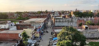
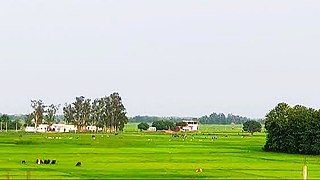
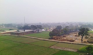
Dildarnagar is a municipality in Kamsaar of Ghazipur District, Uttar Pradesh, India. Dildarnagar is a fast-developing town. It is located 34 km from Ghazipur. It is also known as the heart of the Kamsaar-o-Bar region. The total area of Dildarnagar includes Fatehpur Bazar, Dildarnagar Gao, Tajpur, and Nirahukapura. These four neighbourhoods form the town of Dildarnagar. As of the 2011 census, the population of Dildarnagar was 28,913 and the town had an area of 1,995.95 hectares. Dildarnagar is on the road from Varanasi to Buxar. It was also the capital of Dildarnagar Estate.
Dewaitha is a village of Dildarnagar Kamsar,in Zamania tehsil of Ghazipur, India, located on the banks of the Karmanasa River and it's tributary Eknaiya, The village had a population of 7,104 as of the 2011 Census of India. The place is inhabited by Kamsar Pathans..