
Deoghar is a major city in Jharkhand, India. It is a holy sacred place of Hinduism. It is one of the 12 Jyotirlingas sites of Hinduism. The sacred temples of the city make this a place for pilgrimage and tourists. The city is administrative headquarter of Deoghar District at Santhal Parganas division of Jharkhand.
Garhwa is a town and a municipality in, and headquarters of, Garhwa district in the state of Jharkhand, India. Uttar Pradesh, Chhattisgarh and Bihar are nearby states. Garhwa Road (Rehla) is a major Railway Junction where thousands of passengers find this station most convenient to catch their train for Delhi and Kolkata. You can find bus services for Ranchi, Ambikapur, Gaya etc.
Jamui is a district among 38 districts of Bihar state, India. The district was formed on 21 February 1991, when it was separated from Munger district. It is located at a longitude of 86° 13'E and the latitude is 24° 55'N.

Devprayag is a town and a nagar panchayat (municipality) in Tehri Garhwal District in the state of Uttarakhand, India, and is the final one of the Panch Prayag of Alaknanda River where Alaknanda meets the Bhagirathi river and both rivers thereafter flow on as the Ganges river or Ganga.

Sonpur is a city and sub-division in the Indian state of Bihar, situated on the banks of the River Gandak and Ganges River in the Saran District. Sonpur once famous for its longest Railway Platform, it also hosts Asia's largest Cattle Fair which starts on Kartik Poornima.
Bairgania is a town and notified area in the Sitamarhi district in the state of Bihar, India. Bairgania is one of the blocks of Sitamarhi districts and is a border of India that links Nepal via Rautahat District through a custom checkpoint. Bairgania is the first town of India that is located on the bank of the Bagmati River.It has a good government medical hospital and experience doctors such as alumni from PMCH.
Kahalgaon is a town and a municipality in Bhagalpur district in the state of Bihar, India. It is located close to the Vikramashila, that was once a famous centre of Buddhist learning across the world, along with Nalanda during the Pala dynasty. The Kahalgaon Super Thermal Power Plant (KhSTPP) is located near the town(3 km).

Mainaguri is a town and a municipality in the Jalpaiguri Sadar subdivision of the Jalpaiguri district in the state of West Bengal, India. It is known as the "Gateway of the Dooars" and is a regionally significant tourist destination for "Jalpesh Temple" of Lord Shiva and nearby Gorumara National Park.
Makhdumpur is a town and notified area in the Bihar state of India.It is the 2nd biggest town of Jehanabad District and 3rd biggest town/city of Patna-Gaya Corridor after Jehanabad and Masaurhi.Famous Barabar Hills/Barabar Caves tourist place is situated towards 11KM South-East of Makhdumpur Urban Area.

Tarakeswar is a famous sacred city and a municipality in Hooghly district in the Indian state of West Bengal. Tarakeswar is called "Babar Dham" or "The city of Shiva". It is one of the major tourist and holy place of West Bengal as well as India. Tarakeswar is a place of pilgrimage of Lord Shiva sect in West Bengal 58 kilometres (36 mi) away from State Capital Kolkata and about 1520 kilometres away from National Capital New Delhi. Tarakeswar can be reached conveniently by Train and Bus from various places of West Bengal. Tarakeswar Station is well connected by Howrah Station. This city is also famous for agriculture, Tarakeswar's potato is also famous in all over India.
Fatuha also spelled Fatwah or Fatwa, is a Satellite town in proposed Patna Metropolitan Region, in the Patna district in the Indian state of Bihar. Fatuha lies 24 km east of Patna the capital of Bihar. Fatuha is an important industrial centre known for small industries and its handloom industries. The city's name is said to come from its status as a center of textile manufacturing.
Haveli Kharagpur is a town and One of the three subdivision in Munger district in the indian state of Bihar. Historically it was the centre of the medieval Kharagpur Raj chieftaincy.

Tilothu, also spelled Tilauthu or Tilothu, is a village and corresponding community development block in Rohtas district, Bihar, India. It is located 15 km from Dehri-on-Sone on the west bank of the Son River. As of 2011, the population of Tilouthu was 16,402, in 2,745 families, while the corresponding block population was 109,249.

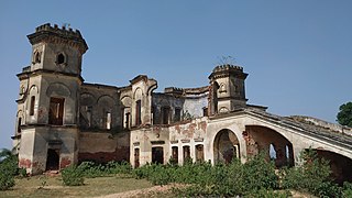
Gidhaur is a small town in the Jamui District of Bihar. In the early-modern period, it was the centre of the Gidhaur chieftaincy.
Raghopur is a community development block in Vaishali district of Bihar. Situated between two streams of the Ganges river, it is a river island. It is connected to Patna by Pipa pul. Ancient name of Raghopur is Kotigram.
Sarmera is a town and a block in Nalanda district in the Indian state of Bihar. It is located 110 km east of Patna and is on the National Highway NH33 and State Highway SH78 connecting it to major cities in Bihar. Sarmera is a block in Nalanda district of Bihar, India and has nine panchayats namely Malawan, Kenar, Dhanuki, Mirnagar, Husaina, Sarmera, Chero, Narshinghpur, Sasaur and Isua. Major inhabited villages in Sarmera are Gopalbad, Brindawan, Pojh, Chero, Parnawa, Isua, Bari Malawan, Choti Malawan, Kenar, Mirnagar, Narshinghpur, Rupaspur, Sasaur, Husiana dHARAMPUR and until 1943 it was ruled by royal family of Nalanda.
Shree Banshidhar Nagar, also known as Nagar Unntari, is one of the administrative block in Garhwa district, Jharkhand state, India. It is located 40 km towards west from District headquarters Garhwa in Bhawanathpur Bidhansabha. Shree Banshidhar Nagar is surrounded by states Uttar Pradesh, Chhattisgarh and Bihar.
Naromurar is a Village in Warisaliganj Tehsil, located 10 km far from National Highway 31 and 8 km from State Highway 59, making it the only village of the area well connected to both Nawada and Nalanda districts of Bihar.
Literally the word Nar means water and Murar means Lord Krishna who appeared as the 8th avatara of Lord Vishnu in Dvapara Yuga as mentioned in Garuda Purana, that is the word Naromurar means the house of lord Vishnu -Kshirsagar.
Naromurar is a village of great traditions. It is one of the ancient villages of India having a four hundred year older Thakur Wadi dedicated to Maryada Purushottam Ram and Lord Shiva.
Along with the Rajkiyakrit Madhya Vidyalay having established in 1920 AD, 27 years before the freedom of India, a Janta Pustakalay the Public Library is also started in the year of 1956 AD which was inaugurated by the Education Minister of Bihar during the time of Krishna Singh.
Dumari is a village in Taraiya Block of Saran district in Bihar, India. Located in a rural area of Saran district, it is one of the 79 villages of Taraiya Block. The village has 321 homes.
Kusheshwar Asthan is a town and a notified area of the Darbhanga in the Indian state of Bihar. Kusheshwar Asthan also known as mithilanchal dev ghar.
