Kirribilli, New South Wales

Last updated

Kirribilli
Sydney,  New South Wales
House in Willoughby Street, Kirribilli, New South Wales 07.jpg
Kirribilli Wharf
Kirribilli, New South Wales
Kirribilli
Population3,820 (2016 census) [1]
 • Density7,600/km2 (19,800/sq mi)
Postcode(s) 2061
Area0.5 km2 (0.2 sq mi)
Location3 km (2 mi) north of Sydney CBD
LGA(s) North Sydney Council
State electorate(s) North Shore
Federal division(s) North Sydney
Suburbs around Kirribilli:
Milsons Point North Sydney Neutral Bay
Milsons Point Kirribilli
The Rocks Sydney CBD
Kirribilli House Kirribilli House (2019).jpg
Kirribilli House

Kirribilli is a suburb of Sydney, New South Wales, Australia. One of the city's most established and affluent neighbourhoods, [2] it is located three kilometres north of the Sydney central business district, in the local government area administered by North Sydney Council. Kirribilli is a harbourside suburb, sitting on the Lower North Shore of Sydney Harbour. [3] Kirribilli House is one of the two official residences of the Prime Minister of Australia.

Contents

History

The Sydney city centre behind Kirribilli in 1937. The two regions were linked by the opening Harbour Bridge. Kirribilli, Harbour Bridge and City - 15 June 1937 (29916158671).jpg
The Sydney city centre behind Kirribilli in 1937. The two regions were linked by the opening Harbour Bridge.

The name Kirribilli is derived from an Aboriginal word Kiarabilli, which means 'good fishing spot'. Another theory suggests that Kirribilli is an adaptation of 'Carabella', the name given by early colonist James Milson to his first house. [4]

The suburb initially formed in the vicinity of Jeffrey Street and was subsequently part of a grant to James Milson, after whom Milsons Point was named. The area was largely covered in native bush. As the decades passed, the land was cleared bit by bit and sub-divided, first for the construction of large family residences during the 1840s, secondly for the erection of Victorian terrace houses from the 1860s onwards, and finally for 20th-Century flats.[ citation needed ]

Prominent early landowners in Kirribilli included members of the Campbell, Jeffrey and Gibbes families. Colonel John George Nathaniel Gibbes (1787-1873), the Collector of Customs for New South Wales, built 'Wotonga' - the forerunner of Admiralty House - in 1842–43 on a 5-acre (20,000 m2) site which he leased, and then purchased, from the Campbells. Gibbes' son, William John Gibbes, lived nearby in Beulah House during the 1840s. Beulah was later lived in by the Riley and Lasseter families. Eventually, the house was demolished and its grounds subdivided into numerous residential blocks which were put up for public auction in 1905. [5]

Although Kirribilli is a predominantly residential area today, from 1890 to 1921, the Pastoral Finance Association had a large wool warehouse, meat cold store and wharf, on the foreshore adjacent to Admiralty House.The seven-storey building was destroyed by fire in December 1921, along with 30,000 bales of wool. Its engine room, which survived the fire, supplied electricity to customers on the north side of the harbour, until around 1922.The land was sold off in 19 allotments, in 1925, and later redeveloped as blocks of apartments. [6] [7] [8] [9] [10] [11]

The Kirribilli area opened up further for development with the completion of the Sydney Harbour Bridge in 1932, which linked the municipality of North Sydney directly by road and rail with the CBD of the City of Sydney.

Population

In the 2016 Census, there were 3,820 people in Kirribilli. 52.0% of people were born in Australia. The most common other countries of birth were England 7.9% and New Zealand 3.5%. 72.0% of people only spoke English at home. The most common responses for religion were No Religion 37.4% and Catholic 21.4%.

Landmarks

Admiralty House (1) Admiralty House2.jpg
Admiralty House

Kirribilli is one of Australia's older suburbs, with the first land grants in the area being granted by the colonial government during the 1790s. A scattering of Georgian and Gothic-revival houses and mansions were built in the 1830s, '40s and '50s. Most of these have since been razed. Originally, Kirribilli formed part of the Parish of St Leonard's and was served by a private ferry service. In a process which began in the 1860s, the area's old estates were subdivided. New residential streets were laid out and terrace houses, Victorian villas and, later, blocks of apartments erected. During the early decades of the 20th century, Kirribilli's shoreline was dominated by a large, multi-storey brick warehouse which was eventually torn down to make way for housing.

The suburb contains Kirribilli House (the official Sydney residence of the Prime Minister of Australia), Admiralty House (the official Sydney residence of the Governor-General of Australia), and the headquarters and marina of the Royal Sydney Yacht Squadron located on the former Carabella mansion. The Sydney headquarters of ASIO was formerly at 31 Carabella Street. [12] The Sydney Flying Squadron is located adjoining Milson Park, formerly Kirribilli Park.

Admiralty House, originally a private dwelling belonging to Colonel John George Nathaniel Gibbes, is Kirribilli's oldest extant building, the earliest portions of which date to 1842. Kirribilli House was built next door by Adolphus Frederick Feez, a wealthy merchant, in 1854–55.

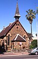
The following buildings are on the Register of the National Estate: [13]

Transport

Kirribilli, New South Wales 1KIRRAbill.jpg
Kirribilli, New South Wales
Yacht racing off Kirribilli Point, circa 1900 Yachting off Kirribilli Point, Sydney.jpg
Yacht racing off Kirribilli Point, circa 1900

Kirribilli supports the northern end of the Sydney Harbour Bridge. The Warringah Freeway provides a link south to the Sydney CBD and north to Chatswood. Kirribilli is serviced by rail, bus and ferry services.

Milsons Point railway station is the closest railway station on the North Shore railway line of the Sydney Trains network. It is located next to the main shopping streets, and has frequent services to the Sydney CBD and the North Shore.

Busways operate regular services from Kirribilli to many parts of northern Sydney. The 269 bus service runs a loop within the Kirribilli - Milsons Point - McMahons Point - North Sydney railway station area on weekdays.

There are four operating ferry wharves near Kirribilli, serviced by both public and private ferries. They are:

Commercial area

A commercial strip in Kirribilli Kirribilli NSW 2061, Australia - panoramio.jpg
A commercial strip in Kirribilli

Kirribilli has a small shopping strip opposite Milsons Point railway station. The 'Kirribilli Markets' are held on the fourth Saturday of each month, on the lawns of the former Kirribilli Bowling Club. The markets contain a mixture of new and second-hand clothing, bric-a-brac, jewellery, and food-and-drink stands.

Schools

The two main schools in the suburb are St Aloysius' College and Loreto Kirribilli.

Churches

Culture

Kirribilli is the home of Australia's oldest continuously operating professional theatre company, The Ensemble Theatre. Located in a converted boatshed, it shows productions of contemporary works by both Australian and International playwrights.

People

See also

Streets

Landmark buildings, structures and heritage

Tourism, theatres and sport

Other

Related Research Articles

<span class="mw-page-title-main">Admiralty House, Sydney</span> Official residence of the Governor-General of Australia in Kirribilli, Sydney

Admiralty House is the Sydney official residence of the governor-general of Australia. It is located in the suburb of Kirribilli, on the northern foreshore of Sydney Harbour. This large Victorian Regency and Italianate sandstone manor, completed in stages based on designs by James Barnet and Walter Liberty Vernon, occupies the tip of Kirribilli Point. Once known as "Wotonga", it has commanding views across Sydney Harbour to the Sydney Harbour Bridge and the Sydney Opera House.

<span class="mw-page-title-main">Circular Quay</span> Locality in Sydney, New South Wales, Australia

Circular Quay is a harbour, former working port and now international passenger shipping port, public piazza and tourism precinct, heritage area, and transport node located in Sydney, New South Wales, Australia on the northern edge of the Sydney central business district on Sydney Cove, between Bennelong Point and The Rocks. It is part of the local government area of the City of Sydney.

<span class="mw-page-title-main">North Shore (Sydney)</span> Region in New South Wales, Australia

The North Shore is a region within Northern Sydney, in the state of New South Wales, Australia, generally referring to suburbs located on the northern side of Sydney Harbour up to Wahroonga, and suburbs between Middle Harbour and the Lane Cove River.

<span class="mw-page-title-main">North Sydney, New South Wales</span> Suburb of Sydney, New South Wales, Australia

North Sydney is a suburb and major commercial district on the Lower North Shore of Sydney, New South Wales, Australia. North Sydney is located three kilometres north of the Sydney central business district and is the administrative centre for the local government area of North Sydney Council.

<span class="mw-page-title-main">Milsons Point railway station</span> Railway station in Sydney, New South Wales, Australia

Milsons Point railway station is a heritage-listed railway station located on the North Shore line, serving the Sydney suburb of Milsons Point in New South Wales, Australia. It is served by Sydney Trains T1 North Shore line services. The station is located above ground, accessible via stairs and a lift, in Milsons Point, in the North Sydney Council local government area of New South Wales, Australia. It was designed and built by the Sydney Harbour Bridge Branch of the NSW Department of Public Works. The property was added to the New South Wales State Heritage Register on 2 April 1999.

<span class="mw-page-title-main">Milsons Point</span> Suburb of Sydney, New South Wales, Australia

Milsons Point is a suburb on the lower North Shore of Sydney, in the state of New South Wales, Australia. The suburb is located 3 kilometres north of the Sydney central business district in the local government area of North Sydney Council.

<span class="mw-page-title-main">Lavender Bay, New South Wales</span> Suburb of Sydney, New South Wales, Australia

Lavender Bay is a harbourside suburb on the lower North Shore of Sydney, New South Wales, Australia. Lavender Bay is located 3 kilometres north of the Sydney central business district, in the local government area of North Sydney Council.

<span class="mw-page-title-main">McMahons Point</span> Suburb of Sydney, New South Wales, Australia

McMahons Point is a harbourside suburb on the lower North Shore of Sydney, New South Wales, Australia. McMahons Point is located 3 kilometres north of the Sydney central business district, in the local government area of North Sydney Council. McMahons Point sits on the peninsula flanked by Berrys Bay to the west and Lavender Bay to the east. The lower tip of the peninsula is known as Blues Point, which offers expansive views of Port Jackson. The postcode is 2060.

<span class="mw-page-title-main">Loreto Kirribilli</span> Private girls school in Sydney, Australia

Loreto Kirribilli is an independent Roman Catholic comprehensive single-sex primary and secondary day school for girls, located in Kirribilli, a Lower North Shore suburb of Sydney, New South Wales, Australia.

<span class="mw-page-title-main">Milsons Point ferry wharf</span>

Milsons Point ferry wharf is located on the northern side of Sydney Harbour serving the Sydney suburb of Milsons Point. It is next to Luna Park and the Sydney Harbour Bridge. It is served by Sydney Ferries Parramatta River and Pyrmont Bay services operated by First Fleet and RiverCat class ferries.

Inner Harbour ferry services was a name used for ferry services connecting suburbs on the foreshore of the inner Sydney Harbour with Circular Quay by commuter ferry. Since 2017 this name is no longer used and all services have reverted to individual names

<span class="mw-page-title-main">Northern Sydney</span> Region of Sydney in New South Wales, Australia

Northern Sydney is a large metropolitan area in Greater Sydney, New South Wales, Australia on the north shore of Sydney Harbour and Parramatta River. The region embraces suburbs in Sydney's north-east, north and inner north west. Northern Sydney is divided into distinctive regions such as the North Shore, Northern Beaches and Forest District.

<span class="mw-page-title-main">Jeffrey Street</span> Street in Sydney, Australia

Jeffrey Street or Jeffreys Street is a street located in Kirribilli, famous for being one of the most popular vantage points for views of the city skyline of Sydney, the Sydney Harbour Bridge and the Sydney Opera House. The street is located on the Lower North Shore of Sydney Harbour, directly across the harbour from Circular Quay and is a popular destination for tourists, particularly on Australia Day and New Year's Eve. The street leads uphill from the harbour in a northerly direction to the small shopping village of Kirribilli. For many years the area was called the North Shore and the original land grant changed hands a number of times. Over the past 200 years the area has also been called Huntershill, St Leonards, North Sydney, "Kiarabilli", Milsons Point and "Kirribilli Point". The modern spelling Kirribilli was first used in 1853 and the use of Kirribilli as a locality is more recent.

<span class="mw-page-title-main">John George Nathaniel Gibbes</span> British Army officer

Colonel John George Nathaniel Gibbes was a British army officer who emigrated to Australia in 1834 on his appointment as Collector of Customs for the Colony of New South Wales, an appointment which gave him a seat on the New South Wales Legislative Council and which he held for 25 years.

<span class="mw-page-title-main">Kirribilli Neighbourhood Centre</span>

The Kirribilli Neighbourhood Centre occupies two restored old stone houses, known as 16 and 18 Fitzroy Street at the northern end of Jeffrey Street, Kirribilli. The houses were built by Henry Hocken Bligh in 1875-1876. Bligh was born on 19 October 1826 in Bodmin, Cornwall England and died at his home on 30 July 1904. The houses were acquired by North Sydney Council in 1974 and the modern day Kirribilli Neighbourhood Centre opened in 1976.

Sydney Ferries Limited operated ferry services on Sydney Harbour from 1900 until June 1951.

<span class="mw-page-title-main">Neutral Bay ferry services</span> Ferry route in Sydney, Australia

Neutral Bay ferry services is a commuter ferry route in Sydney, New South Wales, Australia. Part of the Sydney Ferries network, it serves several Lower North Shore suburbs around Neutral Bay.

The Mosman Bay ferry service is a commuter ferry route in Sydney, New South Wales, Australia. Part of the Sydney Ferries network, it serves several Lower North Shore suburbs around Mosman Bay.

<i>Koree</i>

Koree was a "K-class" ferry on Sydney Harbour. Launched in 1902, the timber-hulled steamer was built for Sydney Ferries Limited during the boom in cross-harbour ferry travel prior to the opening of the Sydney Harbour Bridge.

<i>Kurraba</i> and <i>Kirribilli</i> Steamers for SYDNEY HARBOUR

Kurraba and Kirribilli were two similar "K-class" ferries on Sydney Harbour. Launched in 1899 and 1900 respectively, the two timber-hulled steamers were built for Sydney Ferries Limited during the boom in cross-harbour ferry travel prior to the opening of the Sydney Harbour Bridge.

References

  1. Australian Bureau of Statistics (27 June 2017). "Kirribilli (State Suburb)". 2016 Census QuickStats. Retrieved 6 November 2017. OOjs UI icon edit-ltr-progressive.svg
  2. "Richardson & Wrench North Sydney".
  3. Gregorys Sydney Street Directory, Gregorys Publishing Company, 2007
  4. "Kirribilli | the Dictionary of Sydney".
  5. The Book of Sydney Suburbs, Frances Pollon, Angus and Robertson, 1990
  6. "THE Leading Wool Selling Houses of Sydney". Sydney Wool and Stock Journal (NSW : 1899 - 1917). 9 May 1902. p. 9. Retrieved 23 June 2021.
  7. "KIRRIBILLI'S GREAT FIRE". Sydney Morning Herald (NSW : 1842 - 1954). 17 May 1954. p. 7. Retrieved 23 June 2021.
  8. "THE GREAT SYDNEY FIRE: DESTRUCTION OF THE P. F. A. STORES". Sydney Mail (NSW : 1912 - 1938). 21 December 1921. p. 5. Retrieved 23 June 2021.
  9. "PLANT WHICH COST £200,000 TO INSTAL". Daily Telegraph (Sydney, NSW : 1883 - 1930). 4 September 1922. p. 3. Retrieved 23 June 2021.
  10. "KIRRIBILLI FIRE". Sun (Sydney, NSW : 1910 - 1954). 17 December 1921. p. 6. Retrieved 23 June 2021.
  11. "NEW SOUTH WALES". Barrier Miner (Broken Hill, NSW : 1888 - 1954). 23 March 1925. p. 1. Retrieved 23 June 2021.
  12. Dunn, Ross Spies Win Battle of the Trees' Sydney Morning Herald 19 June 1985
  13. The Heritage of Australia, Macmillan Company, 1981
  14. "'Sunnyside,' the mirror image of Kirribilli House, sets new suburb record". www.news.com.au. Archived from the original on 20 December 2014.


33°51′02″S151°12′53″E / 33.85045°S 151.21477°E / -33.85045; 151.21477