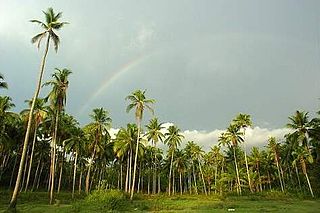
Mundakayam, is a town in Kanjirappally Taluk in the Kottayam District of Kerala. It is the doorway to the high ranges of southern Kerala, and is at the border of Kottayam and Idukki districts. The next nearest town, Kanjirappally, is 14 km (8.7 mi) & Erumely is 12 km from Mundakayam. Mundakayam has rubber plantations, and greenery. The Manimala River runs through Mundakayam. It is located 48 km east of the district headquarters at Kottayam and 148 km from the state capital, Thiruvananthapuram. The name Mundakayam is said to be derived from the Mundi cranes that used to be seen along the Manimala River banks.

Perumbavoor is a place located at the bank of Periyar in Ernakulam District in the Indian state of Kerala. It is a part of the Kochi metropolitan area. It lies in the northeastern tip of the Greater Cochin area and is also the headquarters of Kunnathunad Taluk. Perumbavoor is famed in the state for wood industries and small-scale industries. Ernakulam lies 30 km southwest of Perumbavoor. The town lies between Angamaly and Muvattupuzha on the Main Central Road (MC), which connects Thiruvananthapuram to Angamaly through the old Travancore part of Kerala.
Pazhuvil is a small village in Trissur district of Kerala state, south India. It is 17 km from Thrissur town, on the Cherpu - Triprayar road.

Cherpu is a suburb of Thrissur city in the Kerala State of South India. It is 12 kilometres south of Thrissur town and is on the Thriprayar road. It is dotted by a number of temples and has quite a few rivers flowing by its vicinity.
Eloor is a municipality in the Ernakulam district of Kerala, India. It is an industrial area situated around 13 kilometres north of the Kochi city centre, and is a part of the Kochi metropolitan area. It is an island of 14.21 km2 formed between two distributaries of river Periyar and is the largest industrial belt in Kerala. The neighbouring places of Eloor are Kalamassery industrial hub, Aluva, Cheranalloor and Paravur.
Ashtamichira is a village in Thrissur district in the Indian state of Kerala.
Kottuvally is a census town in Paravoor.It is also a village in Paravur Taluk, Ernakulam district in the Indian state of Kerala. The village is situated in the south of the taluk. The nearest town is North Paravur, 4 km away. The Kottuvally panchayath is spread out on both sides of NH-66 road.

Varandarappilly is a panchayat near Pudukkkad town in Thrissur district, Kerala, India. It is located 22 km from Thrissur City and 65 km from Kochi city. The Panchayath area is 102 km² and it has a population 27,343. Nandipulam, Mupliyam, Velupadam, Palappilly, and Kallayi are nearby villages. Alagappa Nagar, Mattathur and Puthukkad are the neighbouring Panchayaths. It is the hometown for Chemmannur group in the field of gold jewellery manufacturing.

Kangazha is a panchayath and village in the Changanacherry Taluk of the Kottayam District of Kerala State in India. It is located 21 kilometers east of Kottayam and 10 kilometers north of Karukachal. It lies midway between the backwaters of Western Kerala and the misty mountains of the Western Ghats.
Ezhikkara is a panchayat in Paravur Taluk of Ernakulam District, Kerala. The North Paravur, Chathanad road (9 km) passes through this village. Ezhikkara is situated close to Ernakulam. Ezhikkara is famous for its pokkali fields and prawn farms.
Paravur Taluk, IPA:[pɐrɐʋuːr], is a taluk of Ernakulam District in the Indian State of Kerala. North Paravur is the capital of the taluk. Paravur Taluk lies in the north western part of Ernakulam district bordering Thrissur district. The surrounding taluks are Kochi to the west consisting of Vypin Island, Kodungallur to the north, Chalakudy to the north consisting of Mala, Aluva to the east consisting of Angamaly, Nedumbassery and Aluva, Kanayanur to the south consisting of Cochin City. Paravur is a part of Kochi urban agglomeration area. The western parts of taluk are coastal areas with cultivations like prawn and pokkali rice. The eastern parts are fertile lands. The heavy industries of Kochi is located in Udyogmandal area of the taluk.
Kunnukara is a census town and panchayat in Paravur Taluk of Ernakulam district, Kerala, India. The village is situated on the airport road connecting North Paravur (NH66) and Nedumbassery (NH544). North Paravur is the nearest town, 7 km from this village. Aluva (10 km) and Angamaly (12 km) are also near to Kunnukara. Its administrative headquarters is in Kunnukara Town itself. The Mini Civil Station has four hospitals, all the Govt. offices, a Khadi Unit Supermarkets etc.
Pullazhi or Pullazhy, is a suburban area of Thrissur City in Kerala state, south India. It is almost 6 km away from Swaraj Round. Pullazhy is surrounded by paddy fields called "Kolpadavu", supervised and controlled by Pullazhi Kolpadavu Sahakarana Sangham. Many of the native families have an agrarian background. The village also contains a library called "Yuvajana Sangham Vayanasala".

Wadakkancherry is a major town in Thrissur, Kerala. Up until 1860, this area was part of Chelakkara Taluk. Now, it is the headquarters of Talappilly Taluk. Wadakkanchery obtained municipality status from the government by merging with the Mundathikode panchayath and it is the only town in Thrissur District to be raised as municipality recently. There are two places with similarly pronounced names: Wadakanchery and Vadakkenchery.
Mannancherry is a village in Alappuzha district in Kerala, India. It is situated about 10 km north of Alappuzha town. Vembanad Lake forms the eastern boundary of the village. In governance, Mannancherry is a Panchayat. In parliamentary representation, it is part of the Alappuzha Assembly constituency, as well as the Alappuzha LokSabha constituency. The primary occupation of the village's inhabitants has been coir-making for the past several decades.
Edathirinji is a village in Thrissur district in the state of Kerala, India.
Kannankulangara/Kannamkulangara is a desam [area] in the Southern part of Thrissur which is a part of OR intersected with Koorkenchery; in Kerala state, South India.
Perumbavoor has many Hindu temples, Muslim mosques and Christian churches. As the area is dominated by expatriate north Indian workers, some places of worship cater to the taste of North Indian devotees.

