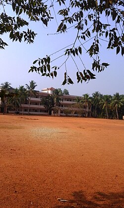
Thiruvambady is a major hill town and a suburb in southeastern Kozhikode district in Kerala, India. Thiruvambady is a Panchayat headquarters, and a legislative assembly constituency, situated 35 kilometres (22 mi) from the district headquarters of Kozhikode.

Kozhikode, or Calicut district, is one of the 14 districts in the Indian state of Kerala, along its southwestern Malabar Coast. The city of Kozhikode, also known as Calicut, is the district headquarters. The district is 67.15% urbanised. Kozhikode city is the fashion capital of Kerala.

Mavoor is a town situated in Kozhikode district in Kerala, India. It is 19 km away from Kozhikode city.
Cheruvadi is a village in the Kozhikode district of Kerala. It is located 24 kilometres east of Kozhikode.
Chathamangalam is a village in Kozhikode district of Kerala state, India.

Kodiyathur is a gram panchayat in Kozhikode district in the state of Kerala, India.

Kuttikkattoor and Velliparamba are two adjacent suburbs of Kozhikode city separated by three kilometres on the road to Mavoor. These villages are also connected to Palazhi and Pantheeramkavu areas.

Koduvally is a major municipal town in Kozhikode district in the Indian state of Kerala. It is located on the National Highway 766 and is about 21 km northeast of Kozhikode (Calicut) city. koduvally is known as the city of gold for its gold trade legacy since 18s and 19s. Koduvally is one of the 140 assembly constituencies in Kerala and One of the 12 block panchayats in kozhikode.The nearest local bodies are Kizhakkoth, Madavoor, kunnamangalam, Omassery, Mukkam, and Thamarassery. Koduvally also gives its name to the Koduvally River which flows west into the sea.

Kunnamangalam is a growing census town located about 14 km east of Kozhikode (Calicut) city on National highway 766. Nearby places are Koduvally, Mukkam, Chathamangalam, and Kattangal. India's premier educational institutions like Indian Institute of Management, Kozhikode (IIMK), National Institute of Technology Calicut, National Institute of Electronics & Information Technology, Indian Institute of Spices Research, and Kerala School of Mathematics, Kozhikode are located here. Kunnamangalam is developing as a suburb of Kozhikode, Kunnamangalam is the east side entry of Calicut city.

Mukkam is a major municipality town in Kozhikode, state of Kerala, India. Mukkam is one of the major regional suburb of the Kozhikode district. Mukkam is located about 27 km east of Calicut city on the bank of river Iruvanjippuzha, one of the major tributaries of river Chaliyar. Mukkam is also well knows for its secularistic features. The urban region of Mukkam is spread across Mukkam Municipality and the North Karassery region of Karassery Grama Panchayath. The town begins from North Karassery junction region and runs till Agasthianmuzhi Junction region.
Kattangal is a sub-urban town situated near the National Institute of Technology Calicut, located in Kerala, India. It is about 22 km distant from the city of Kozhikode. Chathamangalam Gramapanchayath is the village administration and this village is a major educational hub in Kerala. Mavoor–Koduvally Road and Kozhikode–Mukkam Highways are crossing at Kattangal town.one can see a miniature form of india and of course kerala when you just walk through kattangal. This is due to manual workers from bengal and north Indianstates and major educational institutions.
Kalanthode is a fast-growing rural area near to the National Institute of Technology Calicut, in the Kozhikode district of the Indian state of Kerala.

Kottooly and Pottammal are two nearby junctions on the eastern side of Kozhikode city in India. They are at a distance of 650 meters. The Mavoor Road originates from Mananchira area in downtown Calicut and proceeds to Arayidathu-palam junction through the KSRTC bus station and the new bus station areas.
Kovoor Town is a suburb of Kozhikode city on the eastern side.

Mavoor Road is the busiest High street of Kozhikode city in Kerala, India. This road connects the Mananchira pond area with the Kozhikode Medical College. After the medical college, the road is extended further to the little village of Mavoor but the term 'Mavoor Road' refers to the section between the city and the Medical college.
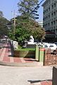
Arayidathupalam Junction is the busiest road intersection of Kozhikode city in India.
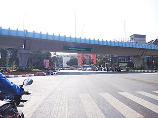
Thondayad Junction is an important intersection of Kozhikode city, India. This junction connects the city to the eastern town of Kozhikode District so the traffic is heavy. The junction also connects to the northern and southern cities of Kerala by National highway 66
Kozhikode district has an extensive network of road, rail and air travel services. Kozhikode city is the epicenter of the district. Vatakara and Thamarassery are other transport hubs.
T. Siddique is an Indian politician and as of 2021 was one of the three Working Presidents of Kerala Pradesh Congress Committee and a member of the Indian National Congress.