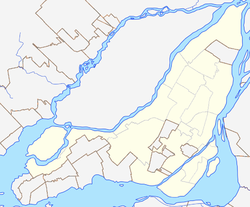
The Island of Montreal is a large island in southwestern Quebec, Canada, that is the site of a number of municipalities, including most of the city of Montreal, and is the most populous island in Canada. It is the main island of the Hochelaga Archipelago at the confluence of the Saint Lawrence and Ottawa rivers.

L'Île-Dorval is a city in southwestern Quebec, Canada. It is coterminous with Dorval Island, an island in Lake Saint-Louis off the Island of Montreal. It lies a short distance offshore from the city of Dorval and is connected with a seasonal ferry service.

Sainte-Anne-de-Bellevue is an on-island suburb located at the western tip of the Island of Montreal in southwestern Quebec, Canada. It is the second oldest community in Montreal's West Island, having been founded as a parish in 1703. The oldest, Dorval, was founded in 1667.

Île Bizard is an island near the Island of Montreal in the Hochelaga Archipelago region. It is one of the three populated islands within the city of Montreal, along with the Island of Montreal and Nuns' Island. The island is served by buses 207 and 407.
Pierrefonds—Dollard is a federal electoral district in Quebec, Canada, that has been represented in the House of Commons of Canada since 1988. Its population was 108,587 at the 2016 Canadian Census.

The urban agglomeration of Montreal is an urban agglomeration in Quebec, Canada. Coextensive with the administrative region of Montréal, it is a territory equivalent to a regional county municipality (TE) and a census division (CD), for both of which its geographical code is 66. Prior to the merger of the municipalities in Region 06 in 2002, the administrative region was co-extensive with the Montreal Urban Community.

Griffintown is a historic neighbourhood of Montreal, Quebec, southwest of downtown. The area existed as a functional neighbourhood from the 1820s until the 1960s and was mainly populated by Irish immigrants and their descendants. Mostly depopulated since then, the neighbourhood has been undergoing redevelopment since the early 2010s.

Nuns' Island is an island located in the Saint Lawrence River that forms a part of the city of Montreal, Quebec. It is part of the borough of Verdun.
Vaudreuil—Soulanges is a federal electoral district in Quebec, Canada, that has been represented in the House of Commons of Canada since 1867.
The Town of Île-Perrot is a town and municipality on Île Perrot in southwestern Quebec, Canada. The population as of the Canada 2016 Census was 10,756. The town is at the western end of Lake Saint-Louis, and borders the local island communities of Terrasse-Vaudreuil, Pincourt and Notre-Dame-de-l'Île-Perrot. It also includes Dowker Island and the small Claude and Bellevue Islands.

Ahuntsic-Cartierville is a borough (arrondissement) of the city of Montreal, Quebec, Canada. The borough was created following the 2002 municipal reorganization of Montreal. It comprises two main neighbourhoods, Ahuntsic, a former village annexed to Montreal in 1910 and Cartierville, a town annexed to Montreal in 1916.

Sainte-Geneviève was a municipality located on the Island of Montreal in southwestern Quebec, Canada. It is now part of the Borough of L'Île-Bizard–Sainte-Geneviève in the City of Montreal, created on January 1, 2002.
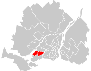
L'Île-Bizard–Sainte-Geneviève is a borough (arrondissement) of the city of Montreal.
Pincourt is a municipality on the island of Île Perrot, off the western tip of the island of Montreal, Quebec. The population as of the 2021 Canadian census was 14,751. The town shares the island with the three other municipalities of Notre-Dame-de-l'Île-Perrot, Terrasse Vaudreuil and L'Île-Perrot, bordering on each one. The south end of the Ottawa River flows between Vaudreuil-Dorion and Pincourt, defining the town's western boundary.
The Montreal Public Libraries Network is the public library system on the Island of Montreal in Quebec, Canada. It is the largest French language public library system in North America, and also has items in English and other languages. Its central branch closed in March 2005 and its collections incorporated into the collections of the Grande Bibliothèque.

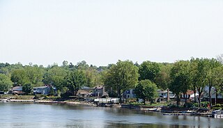
Notre-Dame-de-l'Île-Perrot is the largest of four municipalities located on Île Perrot, west of the island of Montreal, Quebec. The population as of the Canada 2016 Census was 10,654. It hosts the island's first church built in 1740 originally situated at Pointe-du-Moulin which was reconstituted as the Chapelle du Souvenir in 1953 beside the church of Sainte-Jeanne-de-Chantal across from the town hall.

Côte-Saint-Paul is a neighbourhood located in the Southwest Borough of Montreal, Quebec, Canada.

Cité du Havre is a neighbourhood in the borough of Ville-Marie of the city of Montreal, Quebec, Canada. It is located on a narrow man-made peninsula, the Mackay Pier, which was largely built to protect the Old Port of Montreal from the currents of the Saint Lawrence River and from ice banks and floodings in the springtime.
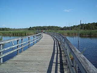
Bois-de-l'Île-Bizard Nature Park is a large nature park in the L'Île-Bizard–Sainte-Geneviève borough of Montreal, Quebec, Canada.