La Huerta | |
|---|---|
Municipality and town | |
 Coat of arms | |
 Location of the municipality in Jalisco | |
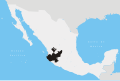
 La Huerta Location in Mexico | |
| Coordinates: 19°29′N104°39′W / 19.483°N 104.650°W | |
| Country | |
| State | Jalisco |
| Area | |
• Total | 2,011 km2 (776 sq mi) |
| • Town | 4.29 km2 (1.66 sq mi) |
| Population (2020 census) [1] | |
• Total | 23,258 |
| • Density | 12/km2 (30/sq mi) |
| • Town | 7,954 |
| • Town density | 1,900/km2 (4,800/sq mi) |
| Time zone | UTC-6 (Central Standard Time) |
| • Summer (DST) | UTC-5 (Central Daylight Time) |
La Huerta is a town and municipality in Jalisco in central-western Mexico. The municipality covers an area of 2,011 km2.
Contents
As of 2005, the municipality had a total population of 20,161. [2]
Its inhabitants, before the arrival of the Spaniards, were from Mazatlan. The first settlement of this town was on the hill west of what is now La Huerta, within a palm of coquito oil and next to an eye of water.[ citation needed ]