Geography
The municipality of Atoyac is located in the southern region of the state of Jalisco, between coordinates 19°52'20" to 20°07'35" North and 103°20'40" to 103°36'05" West, at a height of 1,350 meters above sea level.
It limits the north with the municipality of Zacoalco de Torres and Teocuitatlán de Corona, the south with Sayula and Gómez Farías; to the east with Teocuitatlán de Corona and Concepción de Buenos Aires and to the west with Amacueca and Techaluta de Montenegro.
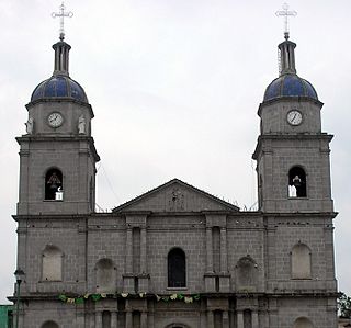
The municipal territory of Atoyac has a surface of 235.81 km². Festivities - Atoyac, as many towns in Mexico, is part of an annual festivity in which a saint (El Senor the de la Salud) is celebrated. According to an ancient myth, the town of Atoyac suffered a devastating epidemic that killed several residents. It was not until the saint was brought down from its post and paraded around the town that the epidemic allegedly stopped. In celebration of this miracle, the saint is parade every year following the same route it did the first time.

Ixtlahuacán del Rio is a town and municipality in the center of the Mexican state of Jalisco, a little less than 50 kilometres (31 mi) from state capital Guadalajara. It stands at 1,655 metres (5,430 ft) above sea level; the climate is semi-arid, with a mild winter and an average annual temperature of 19 °C (66 °F).
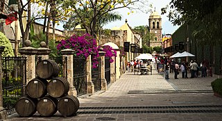
Santiago de Tequila is a Mexican town and municipality located in the state of Jalisco about 60 km from the city of Guadalajara. Tequila is best known as being the birthplace of the drink that bears its name, “tequila,” which is made from the blue agave plant, native to this area. The heart of the plant contains sugars and had been used by native peoples here to make a fermented drink. After the Spanish arrived, they took this fermented beverage and distilled it, producing the tequila known today. The popularity of the drink and the history behind it has made the town and the area surrounding it a World Heritage Site. It was also named a "Pueblo Mágico" in 2003 by the Mexican federal government.
Atemajac de Brizuela is a municipality and small town in the southeast sierra of Jalisco, Mexico, 64 km southwest of Guadalajara, between Highways 80 and 401. The municipality had a population of 6,367 in 2014.

Zapopan is a city and municipality located in the Mexican state of Jalisco. Part of the Guadalajara Metropolitan Area, the population of Zapopan city proper makes it the second largest city in the state, very close behind the population of Guadalajara proper. It is best known as being the home of the Virgin of Zapopan, an image of the Virgin Mary which was made in the 16th century. This image has been credited with a number of miracles and has been recognized by popes and even visited by Pope John Paul II. The municipality is also the home of the Centro Cultural Universitario, which contains one of the most important concert venues in Latin America and is the home of the new stadium for the C.D. Guadalajara.

The municipality and town of Totatiche is located in the northern extreme of the state of Jalisco, Mexico between 21°48’30” and 22°06’00” latitude north and 103°20’00” and 103°34’00” longitude east at a height of 1,751 meters (5,745 ft) above sea level. The municipality is bordered on the north and southeast by the state of Zacatecas. On the northeast, it shares its border with the municipality of Colotlán and on the west it is bordered by the municipalities of Villa Guerrero and Chimaltitán.

Ocotlán is a city and municipality in Jalisco, Mexico. Its industry includes furniture production. Is the seat of the Región Ciénega.

The municipality of Tepechitlán is located in the southwestern portion of the Mexican state of Zacatecas. It is located between 21º33'49" and 21º44'00" latitude north and 103º09'07" and 103º32'01" longitude west with an average altitude of approximately 1700 meters above sea level. The municipality covers an area of 584 square kilometers.
Benito Juárez Municipality is a Mexican municipality located in the southern extreme of the state of Zacatecas on the edge of the Canyon of Tlaltenango.

Chimaltitán Municipality is a municipality in the north of the state of Jalisco, Mexico.
Mezquitic Municipality is a municipality in the north of the state of Jalisco, Mexico.

Ajijic is a town about 5 kilometres (3.1 mi) west from the town of Chapala, part of the municipality, in the State of Jalisco, Mexico. It is situated on the north shore of Lake Chapala, surrounded by mountains. Ajijic enjoys a moderate climate year-round. The population of Ajijic was 11,439 as of the 2020 census.
Coalcomán de Vázquez Pallares is a municipality located in the Sierra Madre del Sur mountain range, in the southwest region of the state of Michoacán in central-western Mexico.
Chinicuila is a municipality located in the southwestern region of the Mexican state of Michoacán. The municipality has an area of 928.64 square kilometres and is bordered to the north by the state of Jalisco, to the east by Coalcomán, to the south by Aquila, and to the west by Coahuayana and the state of Colima. The municipality had a population of 5,343 inhabitants according to the 2005 census. Its municipal seat is the city of Villa Victoria.
Tuxpan is a town and municipality in the Mexican state of Jalisco. The name "Tuxpan" comes from the Nahuatl word tochpan, a word used to describe where rabbits live or possibly place of abundant rabbits. Some others translate it as a location above the river.

Acatlán de Juárez is a town and municipality, in Jalisco in central-western Mexico. The municipality covers an area of 166.68 km².
Ixhuatlán de Madero is a Municipality in Veracruz, Mexico. It is located in north zone of the State of Veracruz, about 376 km from state capital Xalapa, in the region called Huasteca Baja. It is one of 212 municipalities in Veracruz. It has an area of 598.81 km2. It is located at 20°41′N98°01′W.
Ipazoltic is a town in the municipality of San Martín de Hidalgo in the Mexican state of Jalisco. It is located 500 km West of the capital, Mexico City. There are about 533 inhabitants located in Ipazoltic.

Tulcingo (municipality) is a town and municipality in Puebla in south-eastern Mexico.
Atotonilco el Bajo is a town in the municipality of Villa Corona; in the Mexican state of Jalisco. According to the INEGI census of 2000: 2,255 people resided in the town.
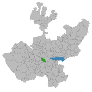
Laguna de Sayula is a lake located in the southern area of Jalisco, about 60 km from Guadalajara. It is located in the municipalities of Sayula, Zacoalco de Torres, Amacueca, Teocuitatlán de Corona, Atoyac and Techaluta de Montenegro.


