
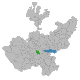
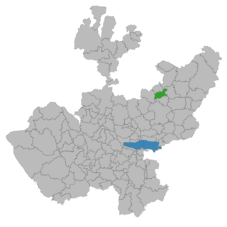
Jalisco is a state in Western Mexico that is divided into 125 municipalities. According to the 2020 Mexican Census, it is the third most populated state with 8,348,151 inhabitants and the seventh largest by land area spanning 78,595.9 square kilometres (30,346.0 sq mi). The largest municipality by population is Zapopan, with 1,476,491 residents, while the smallest is Santa María del Oro with 1,815 residents. The largest municipality by land area is Mezquitic which spans 3,363.60 km2 (1,298.69 sq mi), and the smallest is Techaluta with 79.20 km2 (30.58 sq mi). The newest is San Ignacio Cerro Gordo, established in 2007 out of Arandas.
Atemajac de Brizuela is a municipality and small town in the southeast sierra of Jalisco, Mexico, 64 km southwest of Guadalajara, between Highways 80 and 401. The municipality had a population of 6,367 in 2014.

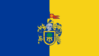
La Piedad is a municipality located at
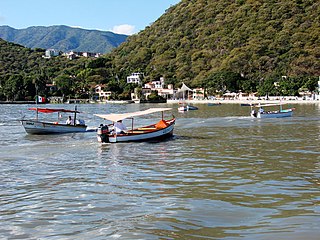
Lake Chapala is Mexico's largest freshwater lake. It lies in the municipalities of Ocotlán, Chapala, Jocotepec, Poncitlán, and Jamay, in Jalisco, and in Venustiano Carranza and Cojumatlán de Régules, in Michoacán.

Unión de San Antonio is a town and municipality located in the Mexican state of Jalisco. It is named after Saint Anthony of Padua since the first church built there was in his honor. As of 2005, the municipality had a population of 15,484. It is located about 32 km (20 mi) west of León, Guanajuato. The main local industry is agriculture, including maize, wheat, beans, and livestock.

Ocotlán is a city and municipality in Jalisco, Mexico. Its industry includes furniture production. Is the seat of the Región Ciénega.

Ojuelos de Jalisco is a colonial town and municipality in the state of Jalisco, Mexico. The town's 1990 population was 7,265, although by the year 2010 it had increased to 11,881.
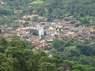
San Sebastián del Oeste is a town and municipality, located on the western part of Jalisco state, Mexico, between 20°39’45’’ - 21°02’30’’ N and 104°35’00’’ - 104°51’00’’ W, at a height of 1,480 metres (4,856 ft).

La Barca is a town and municipality in the Mexican state of Jalisco, and is locates about an hour and 20 minutes drive from the state capital Guadalajara.
Ocotlán de Morelos is a town and municipality in the state of Oaxaca, about 35 km south of the center of the city of Oaxaca along Highway 175. It is part of the Ocotlán District in the south of the Valles Centrales Region. The area was a significant population center at the time of the Spanish Conquest, and for that reason an important Dominican monastery was established here in the 16th century. The complex still exists, with the church still being used for worship and the cloister area used as a museum. While mostly quiet, the city is an important distribution and transportation center for the south of the Central Valleys region of Oaxaca, a function which is expected to be reinforced with the opening of new highway being built to connect the city of Oaxaca with the Pacific coast. The city is known for artist Rodolfo Morales, who painted aspects of his hometown in his works and sponsored projects to save and restore historic monuments here. For generations the municipality has been known for its crafts, with the ceramics making Aguilar family producing some of the best known craftsmen.
Jalisco, officially the Free and Sovereign State of Jalisco, is one of the 31 states which, along with Mexico City, comprise the 32 Federal Entities of Mexico. It is located in western Mexico and is bordered by six states, which are Nayarit, Zacatecas, Aguascalientes, Guanajuato, Michoacán, and Colima. Jalisco is divided into 125 municipalities, and its capital and largest city is Guadalajara.
Tuxpan is a town and municipality in the Mexican state of Jalisco. The name "Tuxpan" comes from the Nahuatl word tochpan, a word used to describe where rabbits live or possibly place of abundant rabbits. Some others translate it as a location above the river.

Ayotlán Municipality is a municipality, in Jalisco in central-western Mexico. The municipality covers an area of 518.57 km2.
Cañadas de Obregón is a town and municipality, in Jalisco in central-western Mexico. It is located in the Altos Sur Region. The municipality covers an area of 182.09 square miles (271.8 km2).

San Cristóbal de la Barranca is a town and municipality, in Jalisco in central-western Mexico. The municipality covers an area of 523 km².
Zapotlán del Rey is a town and municipality in Jalisco in west-central Mexico. The municipality covers an area of 400 km².
San Ignacio Cerro Gordo is a municipality in Jalisco, Mexico. It was established by the Congress of the State of Jalisco, on 1 January 2007 out of Arandas. Decree Number 20371 was published in the Periódico Oficial El Estado de Jalisco, on 30 December 2003, three years before the creation of this municipality, to allow its municipal authorities to be elected by the citizens in the election of municipal presidents on 2 July 2006.
Daniel Jiménez López is a Mexican footballer who plays as a midfielder for Pioneros de Cancún.
XHLB-FM is a radio station on 104.7 FM in Jamay, Jalisco. It is known as Candela La Barca and affiliated to Cadena RASA.

On 19 March 2015, a convoy of the National Gendarmerie, a subdivision of the Mexican Federal Police (PF), was ambushed by gunmen of the Jalisco New Generation Cartel (CJNG), a criminal group based in Jalisco, Mexico. The attack occurred in a residential neighborhood in Ocotlán, Jalisco. Five policemen, four CJNG gunmen, and two civilian bystanders were killed. According to police reports, as the PF convoy pulled up next to a parked vehicle, gunmen shot at them from the vehicle and from rooftops. The police attempted to shield themselves using their patrol cars, but reinforcements from the CJNG arrived at the scene and overwhelmed them. The shootout lasted between thirty minutes to two hours before the CJNG fled the scene.


