Quitupan | |
---|---|
Municipality and town | |
Coordinates: 19°39′N102°45′W / 19.650°N 102.750°W | |
Country | Mexico |
State | Jalisco |
Area | |
• Total | 674.3 km2 (260.3 sq mi) |
• Town | 1.23 km2 (0.47 sq mi) |
Population (2020 census) [1] | |
• Total | 7,734 |
• Density | 11/km2 (30/sq mi) |
• Town | 1,466 |
• Town density | 1,200/km2 (3,100/sq mi) |
Time zone | UTC-6 (Central Standard Time) |
• Summer (DST) | UTC-5 (Central Daylight Time) |
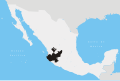
Quitupan is a town and municipality located in the southeastern region of the Mexican state of Jalisco. [2] The name Quitupan comes from the word "Quitoa" or "Quitla", which means "place where declarations or treaties come from" or "place that is located above".
The formal indigenous foundation of the town precisely coincides with the establishment of a peace treaty between tarascos (Purépechas) and aboriginals, [3] which occurred ten years before the arrival of the conqueror Hernán Cortés. A census taken in 1580 noted 30 integrated families.
The town was conquered by Alonso de Avalos, who nevertheless recognized the chieftainship of the original inhabitants. In 1522, Cortés dispatched one of his generals, Cristóbal de Olid to conquer Quitupan and surrounding areas. In 1530, Nuño Beltrán de Guzmán arrived to conduct a census of the native inhabitants and to impose a new order. The Evangelization of Quitupan was led by the Franciscans – in 1530, Friar Martin de Jesus began to preach, joined in 1532 by Friars Juan de Padilla and Miguel de Bologna. Viceroy Antonio de Mendoza then visited the area, under his appointment by King Charles I of Spain to pacify the various indigenous people of New Spain and to unify the territory, which was partially divided among competing conquistadors.
During the second half of the century, the region was beset by various armed confrontations between conservatives and liberals. Other historical landmarks include the Franciscan Intervention, the revolution of 1920 and the Guerra Cristera. On October 28, 1870 Quitupan was official recognized as a municipality of the state of Jalisco. Its first president was Francisco Lorenzo Gonzalez.
Quitupan is located in the southeast region of the state of Jalisco. The Northern latitudes measures 19° 39' 20" to 19°58’ 10”, the Western longitude measures 102° 45’ to 103° 01’. It is 1,593 meters above sea level.
More than half of its surface (55%) is composed of rugged mountainous terrain, with altitudes reaching to 2,100 meters above sea level. 25% the land forms part of the mountain range known as Mazamitla. Foothills cover another quarter of the surface (25%) with altitudes ranging from 1650 to 1800 meters. The rest of it surface (20%) are plains that measure in altitude of 1550 to 1650 meters.
The climate is semi-arid. Winters and springs are dry and semi warm with little temperature change. The annual average temperature is 19 °C with a maximum of 26.71 °C. The rainy season begins in June and lasts until August with average precipitation of 807.3 millimeters.
The Guadalupe lagoon is also known as El Quiringual because three quarters of the lagoon is in inhabited by the town Quiringual. Nonetheless, the town El Quiringual has approximately 50 people living in it.
La Paz is the capital city and the largest city of the Mexican state of Baja California Sur. The city had a 2020 census population of 250,141 inhabitants, making it the most populous city in the state. It is in La Paz Municipality, which is the fourth-largest municipality in Mexico in geographical size and reported a population of 292,241 inhabitants on a land area of 20,275 km2 (7,828 sq mi).
Zapopan is a city and municipality located in the Mexican state of Jalisco. Part of the Guadalajara Metropolitan Area, the population of Zapopan city proper makes it the second largest city in the state, very close behind the population of Guadalajara proper. It is best known as the home of the Virgin of Zapopan, an image of the Virgin Mary which was made in the 16th century. This image has been credited with a number of miracles and has been recognized by popes and even visited by Pope John Paul II. The municipality is also the home of the Centro Cultural Universitario, which contains one of the most important concert venues in Latin America and is the home of the new stadium for the C.D. Guadalajara.
Villa Guerrero is a municipality in the north of the state of Jalisco, México. It is located between 103°22′30″ and 103°50′00″ longitude west and 21°54′00″ and 22°10′00″ latitude north, at an altitude of 1,767 metres (5,797 ft) above sea level. The municipality covers an area of 673.3 square kilometres (260.0 sq mi).
Tonalá is a city and municipality within the Guadalajara Metropolitan Area in the state of Jalisco in Mexico. With a population of 442,440, it is the fourth largest city in the state, the other three being the other major population centres in the metro area: Guadalajara, Zapopan, and Tlaquepaque. It is best known as a major handcrafts center for Jalisco, especially pottery, as well as its very large Thursday and Sunday street market, dedicated to handcrafts.
Bolaños Municipality is located in the north of the Mexican state of Jalisco.
Tenamaxtlán is a municipio (municipality) and town in the Sierra de Amula Region in the state of Jalisco, Mexico.
Lagoa da Prata is a Brazilian municipality in the state of Minas Gerais. In 2020, its population was estimated to be 52,711. The city belongs to the mesoregion of Central Mineira and to the microregion of Bom Despacho.
El Salto is a city, and the surrounding municipality of the same name, in the central region of the Mexican state of Jalisco.
Jalisco, officially the Free and Sovereign State of Jalisco, is one of the 31 states which, along with Mexico City, comprise the 32 Federal Entities of Mexico. It is located in western Mexico and is bordered by six states, Nayarit, Zacatecas, Aguascalientes, Guanajuato, Michoacán, and Colima. Jalisco is divided into 125 municipalities, and its capital and largest city is Guadalajara.
Mazamitla is a town and municipality of the Mexican state of Jalisco. It is located 124 km south of Guadalajara in the Southeast Region and is a popular resort destination for travelers from Guadalajara and nearby urban centers. Its name comes from the Nahuatl and means "place where arrows are made to hunt deer"; its area is 288.9 km2. According to Count II Population and Housing, the municipality has 11671 inhabitants who are devoted mainly to the tertiary sector. For its natural environment is considered by the federal Secretariat of Tourism as a Pueblo Mágico.
Tuxpan is a town and municipality in the Mexican state of Jalisco. The name "Tuxpan" comes from the Nahuatl word tochpan, a word used to describe where rabbits live or possibly place of abundant rabbits. Some others translate it as a location above the river.
Juanacatlán is a town and municipio (municipality) in the central region of the Mexican state of Jalisco.
La Manzanilla de La Paz is a town and municipality, in Jalisco in central-western Mexico. The municipality covers an area of 134 km². As of 2020, the municipality had a total population of 4,099.
Tapalpa is a town and municipality in Jalisco, a state of central-western Mexico.
Tomatlán is a town and municipality, in Jalisco south of Cabo Corrientes in central-western Mexico. The municipality covers an area of 3,015 km2.
Santa María del Oro is a town and municipality, in the Southeastern Region of Jalisco, in central-western Mexico. The municipality covers an area of 776.4 km2.
Zapotlán del Rey is a town and municipality in Jalisco in west-central Mexico. The municipality covers an area of 400 km2.
El Tuito is a Mexican agricultural town situated South of the Pacific Ocean's Bahía de Banderas in the Region Costa-Sierra Occidental of the Mexican state of Jalisco. It is the administrative and municipal seat of the municipality of Cabo Corrientes.
The Alberca de Los Espinos or Alberca de Santa Teresa is a volcanic crater lake that is located in a state protected area that includes 142 hectares within the Mexican state of Michoacán.
San Gerónimo Tlamaco is a locality in Mexico belonging to the municipality of Atitalaquia in the state of Hidalgo.