Tala, Jalisco

Last updated
Tala
Municipality and town
Escudo Tala Jalisco.jpg
Tala (municipio de Jalisco).png
Location of the municipality in Jalisco
Mexico States blank map.svg
Red pog.svg
Tala
Location in Mexico
Coordinates: 20°40′N103°42′W / 20.667°N 103.700°W / 20.667; -103.700
CountryFlag of Mexico.svg  Mexico
State Jalisco
Area
  Municipality389.24 km2 (150.29 sq mi)
  Town7.51 km2 (2.90 sq mi)
Elevation
1,820 m (5,970 ft)
Population
 (2020 census) [1]
  Municipality87,690
  Density230/km2 (580/sq mi)
  Town
40,906
  Town density5,400/km2 (14,000/sq mi)
Area code 384
Climate Cwa
Website https://www.talajalisco.gob.mx/

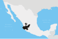
Tala is a town and a municipality in the state of Jalisco, Mexico. It is a small town that has grown over the years. Some major towns in the municipality are Tala (municipal seat), El Refugio, San Isidro Mazatepec, Cuisillos, and Ahuisculco. [2] [3] [4]

Contents

History

"Tlallan", "Tala" or "Land of labor". It was a manor ruled by Pythaloc who had under his jurisdiction Ahuitzculco, Ocotán, Nextipac and Xocotán. It is believed that its foundation dates back to 1126. Nuño Beltrán de Guzmán conquered it in 1530 and was evangelized in 1531 by Fray Antonio de Segovia, Fray Juan de Badillo and Fray Andrés de Córdova. The peninsular found the ruins of Cués or shrines scattered in the Tala Valley. The aborigines did not submit easily to the conquerors and had two battles with them. Tala was compromised in the jurisdiction of the Kingdom of Nueva Galicia as a corregimiento. Its first ruler was Francisco Socorro Nuño de Guzmán who was the most combative aborigine, and Pedro Patiño de Guzmán was left in his place. In 1579 it was entrusted to Diego de Colio. Its inhabitants had a forest that they loved very much, being forced to cut it down when the Spaniards arrived. Out of sarcasm or contemptuously they began calling the town Talatitlán, degenerating into its current name. Throughout the colonial era, Tala retained its category of corregimiento. Since 1825 it belonged to the first Canton of Guadalajara and the department or party of Zapopan; and on that date Tala already had a town hall. On April 3, 1844 the town hall is established. Since 1847 it belonged to the 1st Canton of Guadalajara and the Department or Zapopan Party. In 1887 it has category of town. In 1995 Tala is elevated to the category of city. By 1890 the town of Tala included in its jurisdiction the following towns and farms: El Refugio, Cuisillos, Huaxtla, San Isidro, Ahuisculco, Santa Ana Tepetitlán and Navajas. In 1920 they are annexed to the municipality Cuxpala and San Isidro. By decree number 10211, published on January 10, 1980, it was decided that the population of Tala would rise to the category of city, having achieved higher rates of progress in the political, economic, cultural, social, demographic aspects; for its infrastructure works and in merit to the greatness and dignity of its inhabitants that are characterized by their civic, moral and intellectual qualities.

Tourism

Historical Monuments

Temple of San Francisco de Asís, Chapel of the Rosary, Treasury of the Orendaín Refuge.

Archeological zones

In the Tala Valley there are scattered archeological vestiges of what in the pre-Hispanic era were shrines or cués. In the region they are known as Guachimonton.

Parties

The Caña Fair that takes place on the last days of April and the first of May. The Feasts of San Francisco de Asís that are celebrated from September 26 to October 4.

Music

Mariachi & Banda

Handicrafts

Handicrafts are made with obsidian and saddlery.

Traditional costumes

Main Church of Tala Templo de Tala 4622A17C-4C9A-4F56-8545-36C8A8406919.jpg
Main Church of Tala

The charro suit and the dress of poblana china.

Gastronomy

Well and birria; piloncillo, dulce de leche and fruits in syrup; cane juice, punch and coffee with liquor, cane mezcal.

Touristic centres

The municipality has natural forests located in "La Primavera" Ahuisculco, Cerro de Las Garzas, Cerro Monte Negro, Las Navajas Hill and spas such as Los Tejabanes and El Rincón.

Government

Municipal presidents

Municipal presidentTermPolitical partyNotes
Manuel I. Gómez [5] 1918-1919
Pedro Romo Vivar1921
Manuel I. Gómez1921-1922
Dionisio M. Gómez1923
Luis García Rodríguez1924
Benito Navarro Castillo1925
Luis García Rodríguez1926
Juan Calderón Martínez1927-1928
Benito Navarro Castillo1928
Luis García Rodríguez1929 PNR Logo Partido Nacional Revolucionario.svg
Antonio López1929PNR Logo Partido Nacional Revolucionario.svg
Francisco M. Gómez1929PNR Logo Partido Nacional Revolucionario.svg
Benito Navarro Castillo1930PNR Logo Partido Nacional Revolucionario.svg
Dionisio R. Mariscal1931PNR Logo Partido Nacional Revolucionario.svg
Dionisio M. Gómez1932-1933PNR Logo Partido Nacional Revolucionario.svg
J. Jesús Núñez Guzmán1934PNR Logo Partido Nacional Revolucionario.svg
Mateo Romero López1935PNR Logo Partido Nacional Revolucionario.svg
Pedro C. Castro1936PNR Logo Partido Nacional Revolucionario.svg
Pedro Ramírez Calderón1937PNR Logo Partido Nacional Revolucionario.svg
Blas Sepúlveda1938PNR Logo Partido Nacional Revolucionario.svg
Francisco Rodríguez Z.1938 PRM Logo Partido de la Revolucion Mexicana.svg
Eleno Vega Mariscal1939PRM Logo Partido de la Revolucion Mexicana.svg
Mateo Romero López1940PRM Logo Partido de la Revolucion Mexicana.svg
Marcial Sayavedra1941-1942PRM Logo Partido de la Revolucion Mexicana.svg
Pedro Ramírez Calderón1943PRM Logo Partido de la Revolucion Mexicana.svg
Juan Zavala Rosales1944PRM Logo Partido de la Revolucion Mexicana.svg
Eleno Vega Mariscal1945-1946PRM Logo Partido de la Revolucion Mexicana.svg
Francisco López Suárez1947-1949 PRI PRI Party (Mexico).svg
J. Jesús Cortés Martínez1950-1952PRI PRI Party (Mexico).svg
Francisco Checa Zavala1953-1955PRI PRI Party (Mexico).svg
Espiridión López García1956-1958PRI PRI Party (Mexico).svg
Adolfo Diéguez Palomera1959-1961PRI PRI Party (Mexico).svg
Ramiro González Gómez1962-1964PRI PRI Party (Mexico).svg
Carlos González Sánchez1965-1967PRI PRI Party (Mexico).svg
J. Jesús Zavala Calderón1968-1970PRI PRI Party (Mexico).svg
Carlos Rodríguez Rodríguez1971-1973PRI PRI Party (Mexico).svg
Luis Arias Gómez1974-1976PRI PRI Party (Mexico).svg
Antonio Murillo Rosales1977-1979PRI PRI Party (Mexico).svg
Luis Arias Gómez1980-1982PRI PRI Party (Mexico).svg
Javier Barragán Castro1983-1985PRI PRI Party (Mexico).svg
J. Jesús Hernández Lira1986-1988PRI PRI Party (Mexico).svg
J. Jesús Cortés Gómez1989-1992 PARM LOGOTIPO PARM.jpg
J. Rosario Zavala Quezada1992-1995PRI PRI Party (Mexico).svg
Teresa Núñez Casas1995-1997PRI PRI Party (Mexico).svg
Narciso Valdez Partida1997PRI PRI Party (Mexico).svg Acting municipal president
José de Jesús Morales Delgadillo1998-2000 PRD PRD logo without border (Mexico).svg
Narciso Valdez Partida2001-2003PRI PRI Party (Mexico).svg
María Elena Núñez Casas2004-2006PRI PRI Party (Mexico).svg
Cipriano Aguayo Durán2007-2009PRD PRD logo without border (Mexico).svg PT PT Party (Mexico).svg
Salvador Jorge Rivera Guerrero2010-2012PRD PRD logo without border (Mexico).svg
Antonio López Orozco2012-2015PRI PRI Party (Mexico).svg PVEM PVE logo (Mexico).png
Arturo Macías2015PRI PRI Party (Mexico).svg Acting municipal president
Aarón César Buenrostro Contreras2015-2018PRI PRI Party (Mexico).svg PVEM PVE logo (Mexico).png
Enrique Gabriel Buenrostro Ahued [6] 2018-2021 PAN PAN Party (Mexico).svg PRD PRD logo without border (Mexico).svg MC MC Party (Mexico).svg
José Luis López Cervantes2021PAN PAN Party (Mexico).svg PRD PRD logo without border (Mexico).svg MC MC Party (Mexico).svg Acting municipal president
Antonio Porfirio Casillas Díaz2021-PRI PRI Party (Mexico).svg

Related Research Articles

<span class="mw-page-title-main">Municipalities of Jalisco</span>

Jalisco is a state in Western Mexico that is divided into 125 municipalities. According to the 2020 Mexican census, it is the third most populated state with 8,348,151 inhabitants and the seventh largest by land area spanning 78,595.9 square kilometres (30,346.0 sq mi). The largest municipality by population is Zapopan, with 1,476,491 residents, while the smallest is Santa María del Oro with 1,815 residents. The largest municipality by land area is Mezquitic which spans 3,363.60 km2 (1,298.69 sq mi), and the smallest is Techaluta with 79.20 km2 (30.58 sq mi). The newest is San Ignacio Cerro Gordo, established in 2007 out of Arandas.

<span class="mw-page-title-main">Ixtlahuacán del Río</span> Municipality and town in Jalisco, Mexico

Ixtlahuacán del Rio is a town and municipality in the center of the Mexican state of Jalisco, a little less than 50 kilometres (31 mi) from state capital Guadalajara. It stands at 1,655 metres (5,430 ft) above sea level; the climate is semi-arid, with a mild winter and an average annual temperature of 19 °C (66 °F).

<span class="mw-page-title-main">Tlaquepaque</span> City in Jalisco, Mexico

Tlaquepaque, officially San Pedro Tlaquepaque, is a city and the surrounding municipality in the Mexican state of Jalisco.

<span class="mw-page-title-main">Tepatitlán</span> City in Jalisco, Mexico

Tepatitlán de Morelos is a city and municipality founded in 1530, in the central Mexican state of Jalisco. It is located in the area known as Los Altos de Jalisco, about 70 km east of state capital Guadalajara. It is part of the macroregion of the Bajío. Its surrounding municipality of the same name had an area of 1,400 km2. Its most distinctive feature is the Baroque-style parish church in the centre of the city dedicated to Saint Francis of Assisi. Other notable sites include the kiosk that sits on the Plaza de Armas in downtown, the Temple of San Antonio, and the city hall. The latter is one of the most distinctive features in the city, built in neoclassic-baroque style.

<span class="mw-page-title-main">Zapopan</span> City and municipality in Jalisco, Mexico

Zapopan is a city and municipality located in the Mexican state of Jalisco. Part of the Guadalajara Metropolitan Area, the population of Zapopan city proper makes it the largest city in the state, very close behind the population of Guadalajara proper. It is best known as the home of the Virgin of Zapopan, an image of the Virgin Mary which was made in the 16th century. This image has been credited with a number of miracles and has been recognized by popes and even visited by Pope John Paul II. The municipality is also the home of the Centro Cultural Universitario, which contains one of the most important concert venues in Latin America and is the home of the new stadium for the C.D. Guadalajara.

<span class="mw-page-title-main">Tonalá, Jalisco</span> City and municipality in Jalisco, Mexico

Tonalá is a city and municipality within the Guadalajara Metropolitan Area in the state of Jalisco in Mexico. With a population of 442,440, it is the fourth largest city in the state, the other three being the other major population centres in the metro area: Guadalajara, Zapopan, and Tlaquepaque. It is best known as a major handcrafts center for Jalisco, especially pottery, as well as its very large Thursday and Sunday street market, dedicated to handcrafts.

<span class="mw-page-title-main">Totatiche</span> Place in Jalisco, Mexico

The municipality and town of Totatiche is located in the northern extreme of the state of Jalisco, Mexico between 21°48’30” and 22°06’00” latitude north and 103°20’00” and 103°34’00” longitude east at a height of 1,751 meters (5,745 ft) above sea level. The municipality is bordered on the north and southeast by the state of Zacatecas. On the northeast, it shares its border with the municipality of Colotlán and on the west it is bordered by the municipalities of Villa Guerrero and Chimaltitán.

<span class="mw-page-title-main">Pihuamo</span> Municipality and town in Jalisco, Mexico

Pihuamo is a town and municipality located in the state of Jalisco in Mexico.

<span class="mw-page-title-main">Basilica of Our Lady of Zapopan</span>

The Basilica of Our Lady of Zapopan and the abbey of Our lady of zapopan of Zapopan are a 17th-century Franciscan sanctuary built in downtown Zapopan, in the state of Jalisco, México.

<span class="mw-page-title-main">Jalisco</span> State of Mexico

Jalisco, officially the Free and Sovereign State of Jalisco, is one of the 31 states which, along with Mexico City, comprise the 32 Federal Entities of Mexico. It is located in western Mexico and is bordered by six states, Nayarit, Zacatecas, Aguascalientes, Guanajuato, Michoacán, and Colima. Jalisco is divided into 125 municipalities, and its capital and largest city is Guadalajara.

<span class="mw-page-title-main">Zapotiltic</span> Municipality and town in Jalisco, Mexico

Zapotiltic is a town and municipality in the south region of the state of Jalisco, Mexico. It is located approximately 115 km south of Guadalajara. According to the "Conteo de Poblacion y Vivienda of 2015" the municipality had a population of 29,190.

<span class="mw-page-title-main">Juanacatlán</span> Municipality in Jalisco, Mexico

Juanacatlán is a town and municipio (municipality) in the central region of the Mexican state of Jalisco.

<span class="mw-page-title-main">Acatlán de Juárez</span> Municipality and town in Jalisco, Mexico

Acatlán de Juárez is a town and municipality, in Jalisco in central-western Mexico. The municipality covers an area of 154 km².

<span class="mw-page-title-main">El Arenal, Jalisco</span> Municipality and town in Jalisco, Mexico

El Arenal is a town and municipality in the state of Jalisco in central-western Mexico. El Arenal is known as the gateway to the so-called "blue agave" region in the Jaliscan Highlands. The municipality has an area of approximately 111.8 square kilometres (43.2 sq mi).

<span class="mw-page-title-main">San Cristóbal de la Barranca</span> Municipality and town in Jalisco, Mexico

San Cristóbal de la Barranca is a town and municipality, in Jalisco in central-western Mexico. The municipality covers an area of 523 km².

<span class="mw-page-title-main">San Marcos, Jalisco</span> Municipality and town in Jalisco, Mexico

San Marcos is a town and municipality, in Jalisco in central-western Mexico. The municipality covers an area of 305.5 km2.

<span class="mw-page-title-main">Tlajomulco de Zúñiga</span> City and municipality in Jalisco, Mexico

Tlajomulco de Zúñiga is the municipal seat and third most populous city in the municipality of the same name, located in the state of Jalisco in central-western Mexico. It forms part of the Guadalajara metropolitan area, lying to the southeast of it. The municipality covers an area of 636.93 km2. As of 2010 it had a population of 416,626, with a total urban population of 378,965.

Zapotlán del Rey is a town and municipality in Jalisco in west-central Mexico. The municipality covers an area of 400 km2.

<span class="mw-page-title-main">Badiraguato Municipality</span> Municipality in the Mexican state of Sinaloa

Municipality of Badiraguato is a municipality in the Mexican state of Sinaloa in northwestern Mexico. The seat of the municipality is in the small town of Badiraguato.

<span class="mw-page-title-main">Kopomá Municipality</span> Municipality in the Mexican state of Yucatán

Kopomá Municipality is one of the 106 municipalities in the Mexican state of Yucatán containing (260.59 km2) of land and is located roughly 50 kilometres (31 mi) southwest of the city of Mérida.

References

  1. Citypopulaton.de Population of Tala municipality with localities
  2. Tala (Jalisco State Government official site)
  3. Enciclopedia de Los Municipios y Delegaciones de México: Tala, Jalisco
  4. Tala: Diagnóstico del Municipio (Instituto de Información Estadística y Geográfica)
  5. "Enciclopedia de los Municipios y Delegaciones de México. Jalisco. Tala" (in Spanish). Retrieved 16 August 2021.
  6. "Instituto Electoral y de Participación Ciudadana del Estado de Jalisco, IEPC Jalisco. Proceso electoral de 2018. Integración de Ayuntamientos. Anexo 4. Tala" (PDF) (in Spanish). Retrieved 16 August 2021.