Pihuamo | |
---|---|
Municipality and town | |
Coordinates: 18°57′N103°10′W / 18.950°N 103.167°W | |
Country | Mexico |
State | Jalisco |
Area | |
• Total | 874.6 km2 (337.7 sq mi) |
• Town | 3.38 km2 (1.31 sq mi) |
Population (2020 census) [1] | |
• Total | 11,386 |
• Density | 13/km2 (34/sq mi) |
• Town | 6,668 |
• Town density | 2,000/km2 (5,100/sq mi) |
Time zone | UTC-6 (Central Standard Time) |
• Summer (DST) | UTC-5 (Central Daylight Time) |
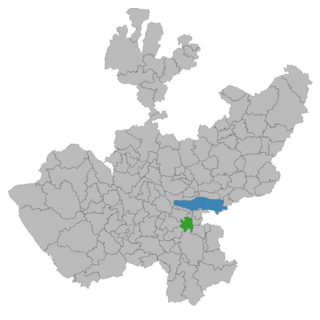
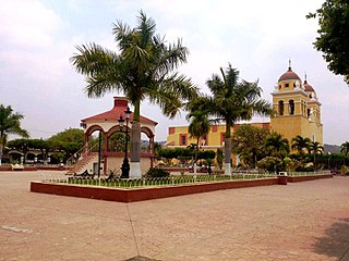
Pihuamo is a town and municipality located in the state of Jalisco in Mexico.
Pihuamo is a municipality located in the southeast region of the state of Jalisco. At one time this region belonged to another town in Jalisco known as Tzapotlán. The occupants of this town have had various origins: toltecas, zapotecas and purépechas. The purépechas arrived to that region in 1480, and they dominated the town of Tzapotlán for some years, but before the Spanish conquest they were defeated by the indigenous of Zapotlán, Zacoalco, Sayula, and Colima in the Saltpeter War (1480-1510) (Guerra del Salitre).
This territory was discovered and conquered by the Captain Cristóbal de Olid with the aid of Juan Rodríguez de Villafuerte in early 1522 when they were sent there by Hernán Cortés to explore the western region of what is today known as Jalisco. In 1598 the town of Santiago of Pivámoc was on the bank of a river, in a valley between the high hills. It was inhabited by seven married aborigines. They spoke the Mexican language and the popoloca language. They lived in Tuxpan. Xilollancini was a little town that was in a deep valley; however Xilollancini was destroyed by a heavy rain that lasted various hours and it divided La Cajita hill. Today, this town is called Pueblo Viejo. This incident caused Xilollancini to be changed from its old location to its current location called Las Lomas. This place belonged to a man named Pío, who his workers called "owner", and with the time these 2 words were converted into the current name of this town: Pihuamo. During Mexico's Independence from Spain 1810–1821, the parroquial files were burned. Antonio Cañas escaped because frequently, in the church, he gave the orders to the insurgent movement. In 1825 he was in the town hall because at that time the town was controlled by the army, the "4º Cantón de Sayula" and in 1890 the town was controlled by other army, the name of that army was the "9º Cantón de Ciudad Guzmán". In the development of Pihuamo, there isn't information about the history of this municipality between 1825 and 1890. In April 1891 this place became a municipality, and the territorial limits were established. This was under the 472 decree on 29 April of the sale year. The 7341 decree published on 27 January 1959 granted the title of "Villa". In Pihuamo, Dr. Atl presented the chimerical city of the Universal Culture with the name of "Olinka". Olinka is a náhuatl word and it means place where movement is generated. The objective of Olinka was that artists and intellectual people could live there. [2]
Municipal president | Term | Political party | Notes |
Ignacio Castellanos [3] | 1908–1910 | ||
Manuel Mora Urzúa | 1910 | ||
Gabriel de la Mora | 1910 | ||
Anastacio Carrillo Orozco | 1911 | ||
J. Trinidad L. Fernández | 1911 | ||
Catarino Ceballos | 1912 | ||
Leopoldo Magaña | 1912 | ||
Florencio Amezcua | 1912 | ||
Longinos Nuño | 1913 | ||
J. Luz E. Ceballos | 1913 | ||
Sóstenes Carrillo | 1913 | ||
Gabriel de la Mora | 1913 | ||
Leopoldo Magaña | 1914–1917 | ||
Juan Ceballos | 1918 | ||
Francisco Chávez | 1918 | ||
Manuel Oliveros | 1918 | ||
José Ochoa Amezcua | 1919 | ||
Margarito O. Casillas | 1919 | ||
José Encarnación Ochoa | 1919 | ||
Teodoro Gutiérrez | 1919 | ||
Telésforo Reyes | 1919 | ||
José Ochoa Amezcua | 1919 | ||
Gabriel de la Mora | 1919 | ||
Teodoro Gutiérrez | 1920 | ||
José de Jesús Ceballos | 1920 | ||
Leopoldo Magaña | 1921 | ||
Juan Ceballos | 1921 | ||
J. Luis Gutiérrez | 1921 | ||
Leopoldo Magaña | 1921–1922 | ||
Teodoro Gutiérrez | 1922 | ||
Anastacio Carrillo Orozco | 1923 | ||
Pedro de la Mora | 1924 | ||
J. Jesús Gutiérrez | 1924 | ||
José Ma. Ceballos | 1924 | ||
Leopoldo M. Álvarez | 1924 | ||
Nemesio Valencia | 1924–1925 | ||
José Ma. Ceballos | 1925 | ||
José de Jesús Gutiérrez | 1925 | ||
N/A | 1926 | ||
Heliodoro Ruvalcaba | 1927 | ||
J. Encarnación Arellano | 1927 | ||
Ramón Vergara | 1928 | ||
Fidencio Vergara | 1928 | ||
Ramón Vergara | 1929 | ||
Donaciano Cárdenas | 1929 | PNR | |
Juan G. Rodríguez | 1930 | PNR | |
Luciano Ceballos | 1931 | PNR | |
Ramón Vergara | 1932 | PNR | |
Nemesio Valencia | 1933 | PNR | |
Fidencio Vergara | 1933 | PNR | |
J. Encarnación Ochoa Arellano | 1933 | PNR | |
J. Miguel Quintero | 1933 | PNR | |
Jacobo Godínez | 1934 | PNR | |
Emiliano Ochoa | 1935–1936 | PNR | |
Heliodoro Ceballos Pérez | 1937 | PNR | |
Luciano Ceballos Luna | 1938 | PNR | |
Antonio Ramos Ramírez | 1938 | PRM | |
José Ma. Ceballos | 1939 | PRM | |
Macario Mora Barajas | 1940 | PRM | |
Daniel Estrada | 1941 | PRM | |
Eusebio Llamas | 1942 | PRM | |
Ángel Ramírez Barón | 1943 | PRM | |
Salvador Arellano | 1944 | PRM | |
Luis Amezcua Zárate | 1945–1946 | PRM | |
Severiano Casillas Ochoa | 1947 | PRI | |
Ramón Vergara Anguiano | 1948 | PRI | |
Cristóbal Lepe S. | 1949 | PRI | |
Manuel Sánchez Araujo | 1950–1952 | PRI | |
Severiano Casillas Ochoa | 1953–1955 | PRI | |
Simón Gálvez Larios | 1956–1958 | PRI | |
Luis Amezcua Zárate | 1959–1961 | PRI | |
Florencio Amezcua Martínez | 1961 | PRI | Acting municipal president |
Luis Amezcua Zárate | 1961 | PRI | Acting municipal president |
Abel Bautista Peña | 01-01-1962–31-12-1964 | PRI | |
Ismael Ortiz Ochoa | 01-01-1965–31-12-1967 | PRI | |
Raúl Mejía Valencia | 01-01-1968–31-12-1970 | PRI | |
Abel Bautista Peña | 01-01-1971–31-12-1973 | PRI | |
Humberto Amezcua Bautista | 01-01-1974–31-12-1976 | PRI | |
Pedro Flores Verduzco | 01-01-1977–31-12-1979 | PRI | |
Mercedes Chavira L. | 01-01-1980–31-12-1982 | PRI | |
Raúl Mejía Valencia [4] | 01-01-1983–31-12-1985 | PDM | |
Gonzalo Rodríguez Hinojosa | 01-01-1986–31-12-1988 | PRI | |
Eduardo Ramírez Jiménez [5] | 01-01-1989–1992 | PRI | |
Alfredo Casillas Mendoza [6] | 1992–1995 | PRI | |
Jesús Cuevas Morfín [7] | 1995–1997 | PRI | |
Mario Héctor González Flores [8] | 01-01-1998–31-12-2000 | PRI | |
Jesús Solórzano Castellanos [9] | 01-01-2001–31-12-2003 | Convergencia Democrática (CD) | |
Felipe de Jesús Mayoral Landín [10] | 01-01-2004–31-12-2006 | PRI | |
Mario Héctor González Flores [11] [12] | 01-01-2007–31-12-2009 | PRI | |
Felipe de Jesús Mayoral Landín [13] | 01-01-2010–30-09-2012 | PRI Panal | Coalition "Alliance for Jalisco" |
Everardo Contreras López [14] | 01-10-2012–30-09-2015 | PT MC | Coalition "Progressive Alliance for Jalisco" |
María Elizabeth Alcaraz Virgen [15] | 01-10-2015–31-03-2018 | MC | She applied for a temporary leave, to run backed by the "Front for Mexico" (PAN-PRD-MC) towards the deputation of the local electoral district 19 of Jalisco, which she got |
Abel Larios Jiménez [16] | 01-04-2018–2018 | MC | Acting municipal president |
Juan Alcaraz Virgen [17] | 01-10-2018–05-03-2021 | PT Morena PES | Coalition "Together We Will Make History" |
Humberto Amezcua Bautista | 01-10-2021–28-02-2024 | PRI | Applied for a leave in order to seek reelection. Was murdered on the night of 15 March 2024 in downtown Pihuamo [18] |
Mario Ceballos Córdova [19] | 01-03-2024– | PRI | Acting municipal president |
Yahualica is a town and municipality in the northeastern part of Jalisco, Mexico. It is one of the 125 municipalities that make up the state of Jalisco.
Sayula is a town and municipality in the Mexican state of Jalisco, approximately 100 kilometers south of Guadalajara. It is surrounded by smaller towns, such as Usmajac, San Andres, El Reparo, and Amacueca.
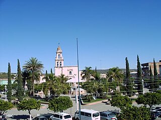
Cocula is a city and municipality in the Mexican state of Jalisco. It is located 35 mi (56 km) southwest of Guadalajara, on Mexico Highway 80. It sits at an elevation of 4,460 feet (1,360 m). According to the 2020 census, the population of the municipality was 29,267 with 16,550 inhabitants living in the city. Other important towns in the municipality are Cofradía de la Luz, La Sauceda, and Santa Teresa.
Chiquilistlán is a small town in the Mexican state of Jalisco. It is located in the Sierra Tapalpa mountains, at the foot of a hill called Chiquilichi, some 75 kilometres to the south-west of state capital Guadalajara.
Amatitán is the seat of a municipality in the Mexican state of Jalisco, and is home to one of the world's largest tequila distilleries.
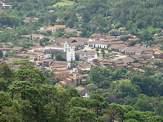
San Sebastián del Oeste is a town and municipality, located on the western part of Jalisco state, Mexico, between 20°39’45’’ - 21°02’30’’ N and 104°35’00’’ - 104°51’00’’ W, at a height of 1,480 metres (4,856 ft).
Zapotlanejo is a town and municipality in the Mexican state of Jalisco.
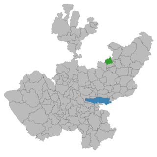
Mexticacán is a town and municipality in the Southern Zone of Los Altos Region of Jalisco. Mexticacán comes from the Nahuatl language and means "place where the temple for the worship of the moon".
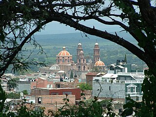
Teocaltiche is a town and municipality in the central-western Mexican state of Jalisco. It is located in the northeastern highlands region of Jalisco, commonly referred to in Spanish as "Los Altos de Jalisco". The grasshopper or "chapulin" is a popular icon for the town.
Zapotiltic is a town and municipality in the south region of the state of Jalisco, Mexico. It is located approximately 115 km south of Guadalajara. According to the "Conteo de Poblacion y Vivienda of 2015" the municipality had a population of 29,190.
Acatic is a town and municipality, in Jalisco in central-western Mexico. The municipality covers an area of 339.2 km². The town produces mainly Spanish style shingles, brick, adobe floor tile, chia, corn, and tequila. Pueblo Viejo Tequila is bottled near by. The town is the entry "gate" to Los Altos of Jalisco.
Acatlán de Juárez is a town and municipality, in Jalisco in central-western Mexico. The municipality covers an area of 154 km².
Amacueca is a town and municipality, in Jalisco in central-western Mexico. The municipality covers an area of 124.8 km2.
Concepción de Buenos Aires is a town and municipality, in Jalisco in central-western Mexico. The municipality covers an area of 265.6 km2.
San Marcos is a town and municipality, in Jalisco in central-western Mexico. The municipality covers an area of 305.5 km2.
Villa Purificación is a town and municipality, in Jalisco in central-western Mexico. The municipality covers an area of 1,848 km².
Zacoalco de Torres, formerly Zacoalco, is a town and municipality in Jalisco, Mexico. The municipality covers an area of 479.1 km2. It is the primary production region of the equipal-style wood and pigskin furniture.
Zapotitlán de Vadillo is a town and municipality, in Jalisco in central-western Mexico. The municipality covers an area of 305.8 km².
San Martín de Hidalgo Municipality is a municipality located in the Región Valles of the state of Jalisco, Mexico. As of 2010, the population was 26,306. The municipal seat is San Martín de Hidalgo. Other administrative communities include 5 delegations and 18 agencies.