Villa Hidalgo, Jalisco

Last updated
Villa Hidalgo, Jalisco
Plaza of Villa Hidalgo.JPG
Main plaza of Villa Hidalgo
Escudo villa hidalgo jalisco.jpg
Coat of arms
Nickname(s): 
Villa
Motto(s): 
"Heart of the Textile Industry in Mexico"
Mexico Jalisco location map.svg
Red pog.svg
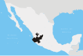
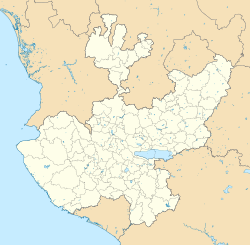
Villa Hidalgo, Jalisco
Location in Mexico
Mexico States blank map.svg
Red pog.svg
Villa Hidalgo, Jalisco
Villa Hidalgo, Jalisco (Mexico)
Coordinates: 21°40′N102°36′W / 21.667°N 102.600°W / 21.667; -102.600
CountryFlag of Mexico.svg  Mexico
State Jalisco
Area
  Total496.6 km2 (191.7 sq mi)
Population
 (2005)
  Total17,291
Time zone UTC-6 (Central Standard Time)
  Summer (DST) UTC-5 (Central Daylight Time)

Villa Hidalgo (formerly, Paso de Sotos) is a town and municipality in the state of Jalisco in Mexico.

Villa Hidalgo gets its name in honor of Mexican hero Miguel Hidalgo y Costilla.

There is an annual celebration in Villa Hidalgo on the last Sunday in January including the week leading to it. It is in celebration of the Virgin of Guadalupe.

Approximately 45 minutes away from the state of Aguascalientes.

Coordinates: 21°40′N102°36′W / 21.667°N 102.600°W / 21.667; -102.600

Related Research Articles

Hidalgo County, Texas County in Texas

Hidalgo County (; Spanish pronunciation: [iˈðalɣo]) is a county in the U.S. state of Texas. The county seat is Edinburg and the largest city is McAllen. The county is named for Miguel Hidalgo y Costilla, the priest who raised the call for Mexico's independence from Spain. It is located in the Rio Grande Valley of South Texas and is one of the fastest-growing counties in the United States. As of the 2010 census, the population of Hidalgo County was 774,769, making it the eighth-most populous county in Texas. Hidalgo County is designated by the U.S. Census Bureau as the McAllen-Edinburg-Mission Metropolitan Statistical Area, which itself is part of the McAllen-Edinburg-Mission-Rio Grande City Combined Statistical Area with neighboring Starr County.

Hidalgo may refer to:

Parral, Chihuahua City in Chihuahua, Mexico

Hidalgo del Parral, is a city and seat of the municipality of Hidalgo del Parral in the Mexican state of Chihuahua. It is located in the southern part of the state, 220 kilometres (140 mi) from the state capital, the city of Chihuahua, Chih. As of 2015, the city of Hidalgo del Parral had a population of 109,510 inhabitants, while the metro area has a population of 129,688 inhabitants. The city was founded as San José del Parral. The name was changed after independence from Spain, in honour of Fr Miguel Hidalgo, widely considered the 'Father of the Country'.

Colonia Villa de Guadalupe is a former separate town, now a neighborhood in northern Mexico City which in 1531 was the site of the apparition of Our Lady of Guadalupe, the most renowned Marian apparition in the Americas. She is venerated in the Our Lady of Guadalupe Shrine, located in the villa (town).

Actopan, Hidalgo Municipality and city in Hidalgo, Mexico

Actopan s a city and one of the 84 municipalities of Hidalgo, in central-eastern Mexico. The municipality covers an area of 280.1 km2. It is crossed by the federal road that runs from Mexico City to Nuevo Laredo and it is located 30 km northwest of Pachuca, the capital city of the state of Hidalgo.

Cerritos, San Luis Potosí City in San Luis Potosi, Mexico

San Juan de Los Cerritos, commonly known as Cerritos, is a city located in the central part of San Luis Potosí, a state of Mexico. It was founded in 1826 by the state's Congress. It is within the mid-zone of the state called La Zona Media. Within its municipality, which is the center of, it holds about 51 other small towns. According to the 2010 census, the municipality has 21,394 people; having experienced tremendous growth. Much of its recent growth can be credited to the construction of the cement factory, Cemento Moctezuma, An industry that was dominated by Casa Gloria During the decades of the 1960s and 1970s. Nowadays Cerritos is expanding its population and more housing is being built near the outskirts of the city due to the influx of new residents.

Sierra Madre de Oaxaca

The Sierra Madre de Oaxaca is a mountain range in southern Mexico. It is primarily in the state of Oaxaca, and extends north into the states of Puebla and Veracruz.

Villa Hidalgo Municipality is a municipality, in the north-east of the Mexican state of Sonora.

Hidalgo, Tamaulipas Place in Tamaulipas, Mexico

Hidalgo Municipality is a municipality located in the Mexican state of Tamaulipas. El Chorrito is a centre of pilgrimage in the municipality.

Villa Hidalgo Municipality is a municipality in Zacatecas, Mexico.

Villa Hidalgo, Durango Municipal seat and city in Durango, Mexico

Villa Hidalgo is a town in the Mexican state of Durango. It serves as the head town of Hidalgo Municipality. As of 2010, the town had a population of 614.

Villa de Hidalgo, San Luis Potosí human settlement

Villa de Hidalgo is a village in San Luis Potosí, Mexico.

Chalcatongo de Hidalgo Municipality and town in Oaxaca, Mexico

Chalcatongo de Hidalgo is a municipality in the Mexican state of Oaxaca. It is part of the Tlaxiaco District in the south of the Mixteca Region.

San Bernardo is the name of two villages in the Mexican state of Hidalgo.

Villa del Carbón Town & Municipality in State of Mexico, Mexico

Villa del Carbón is a town and municipality located in the northern part of Mexico State, just northwest of Mexico City. While the town of Villa del Carbón is the largest in the municipality, it is not the oldest. The municipality contains a number of villages of Otomí and Nahua origins, in which much of the indigenous culture still survives. The municipality's territory was defined in 1714 when a region known as Chiapan, split into what is now Chapa de Mota and Villa del Carbón. At that time, however, the community which is now a municipal seat did not have an official name; it was known first only by the name of its church Nuestra Señora de la Peña de Francia, and later by being a major supplier of charcoal. This would lead to the name of Villanueva del Carbón de Nuestra Señora Santa María de la Peña de Francia, which eventually shortened to Villa del Carbón. The major portions of the municipality's glyph, which serves as it coat-of-arms, does not reflect the town of Villa del Carbón but rather two of its oldest communities: Taxhimay and San Lorenzo Pueblo Nuevo.

Ilamatlán City and municipality in Veracruz, Mexico

Ilamatlán is a municipality in Veracruz, Mexico. It is located in central zone of the State of Veracruz, about 210 km from state capital Xalapa. It has a surface of 188.63 km2. It is located at 20°47′N98°27′W.

Oteapan is a Municipality in Veracruz, Mexico. It is in south-east zone of the State of Veracruz, about 394 km from state capital Xalapa. It has an area of 27.97 km2. It is located at 18°00′N94°40′W.

Huásabas Municipality is a municipality in Sonora in north-western Mexico.

Colonia Valle Gómez is a colonia or neighborhood in the Venustiano Carranza borough of Mexico City, just north of the city’s historic center. The boundaries of the colonia are marked by the following streets: Ferrocarril Hidalgo to the east, Calzada de Guadalupe to the west, Río Consulado to the north and Platino Street to the south. Schools include Campanitas Preschool (public), Cendi Gdf Mapimi Primary (public), Centro de Estudios Tecnologicos Manchester Technical School (private), Cideco Preschool (private), Felipe Carrillo Puerto Primary (public), and Joaquin Miranda Carreon Primary (private).

Pabellón de Hidalgo is a town of 4,006 inhabitants in the municipality of Rincón de Romos, Aguascalientes, Mexico.