Cabo Corrientes Municipality

Last updated
Cabo Corrientes
Cabo Corrientes en Jalisco.svg
Location in Jalisco
Mexico States blank map.svg
Red pog.svg
Cabo Corrientes
Location in Mexico
Coordinates: 20°23′33″N105°25′13″W / 20.392545°N 105.420259°W / 20.392545; -105.420259 Coordinates: 20°23′33″N105°25′13″W / 20.392545°N 105.420259°W / 20.392545; -105.420259
Country Flag of Mexico.svg  Mexico
State Coat of arms of Jalisco.svg Jalisco
Municipality Cabo Corrientes
Government
  Municipal presidentMiguel Ángel Silva Ramírez [1] (PVEM PVE logo (Mexico).svg )
Area
  Total2,001.06 km2 (772.61 sq mi)
Population
 (2015)
  Total10,303
  Density5.1/km2 (13/sq mi)
Time zone UTC-6 (Central Standard Time)
  Summer (DST) UTC-5 (Central Daylight Time)

Cabo Corrientes is a municipality in the state of Jalisco, Mexico. It is named after the cape of the same name, Cabo Corrientes. The municipal seat is a town named El Tuito.

Contents

History

Before the arrival of the Spaniards the region was already populated by Nahua people.

After the Spanish invasion. by March 1525 the peninsular had submitted to the province of Xalisco. When the Spanish troops went down to the sea, a large aboriginal army arrived. They were armed with bows, clubs, throwing darts, and each one wore a banderilla with multicolored feathers in his hand and on his face. They were so numerous that Captain Francisco Cortés de San Buenaventura was afraid. He proposed to avoid fighting, since he calculated that each Spaniard would have to confront a thousand Aborigines, but one of his captains, Angel de Villafana, persuaded him to fight, under four royal banners and others of crimson and apricot On one side the cross and on the other the image of the Purísima. The struggle was about to begin, but when the banners were uncovered the virgin appeared bright and glittering. The Indians were amazed by that portent. Instead of attacking they gathered together, dragged their flags and placed them at the foot of the holy and old priest Juan de Villa Diego, bearer of the banner, and surrendered their arms before Cortes, declared themselves his vassals and celebrated with songs, dances and the sound of boleros and atabales. In memory of this event the place is called the "Valle de Banderas".

In November 1847 the indigenous people raised a large army when they heard news of the American invasion. With the rallying cry of "Long live the Virgin of Guadalajara!" they rebelled against the government. In this place, Rojas raised an army of 2000 indigenous people who fought against the conservative chief Francisco Tovar. In 1872, Porfirio Díaz took refuge in these lands.

From 1825 to 1890 the region belonged to the 6th canton of Autlan, later to the 10th canton of Mascota. On 1 April 1944, by decree number 4955, it was elevated to category of municipality with the name it takes today. Before that it was called El Tuito (Jalisco) and in 1843 was called San Pedro El Tuito (Jalisco).

Geography

Land

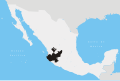
Cabo Corrientes is in the west of the state, on the Pacific Ocean. Elevations range from sea level to 1,085 metres (3,560 ft). The Bahía de Banderas is to the north, Puerto Vallarta to the northeast, Talpa de Allende to the east, Tomatlán to the south, and the Pacific Ocean to the west.

70% of the municipality is rugged, with hills from 800 to 1,800 metres (2,600 to 5,900 ft) above sea level. Lower down the land is flatter. The rocks were formed in the Triassic and Jurassic. Soils are mostly Eutric Regosol or Feozem Háplico, with Luvisol and Litosol in some areas. The municipality covers 200,106 hectares (494,470 acres), of which 7,009 hectares (17,320 acres) are used for agriculture, 36,500 hectares (90,000 acres) for livestock, 146,770 hectares (362,700 acres) for forest, 293 hectares (720 acres) urban land and 9,534 hectares (23,560 acres) other uses.

Hydrology

The municipality is in the Central Pacific basin and the Ameca-Tomatlán-Cuale River sub-basin. Its hydrological resources are provided by the rivers Las Juntas, El Tuito (Jalisco), Horcones and Tecolotlán. Streams are Ipaña, La Boquita, Puchiteca, Tabo Pilero, Maxeque and La Peñita. There are thermal springs including Los Carrizalillos. In addition are the estuaries of Maito, La Boquita and Tecolotlán.

Climate

The climate, in the western coastal, is semi dry, with dry winter and spring, and warm without marked changes in temperature. In the east, it is humid, with dry winter and spring, and warm, with no defined winter season. The average annual temperature is 25.6 °C (78.1 °F) with a maximum of 28.5 °C (83.3 °F) and minimum of 22.7 °C (72.9 °F). Most rainfall is in June, July, August and September, with average precipitation of 878.3 millimetres (34.58 in). The dominant winds are in the northwest direction.

Government

Municipal presidents

Municipal presidentTermPolitical partyNotes
Alfonso C. García [2] 1944 PRM Logo Partido de la Revolucion Mexicana.svg
Braulio Quintero1945–1946PRM Logo Partido de la Revolucion Mexicana.svg
Salvador Ahumada1947 PRI PRI Party (Mexico).svg
Efrén Castillón1947–1948PRI PRI Party (Mexico).svg
Alfonso C. García1949–1952PRI PRI Party (Mexico).svg
Abel Castillón Ríos01-01-1953–31-12-1955PRI PRI Party (Mexico).svg
Rodamiro González Ríos01-01-1956–31-12-1958PRI PRI Party (Mexico).svg
Héctor Rangel Roblés Castillón01-01-1959–31-12-1961PRI PRI Party (Mexico).svg
N/A01-01-1962–31-12-1964
N/A01-01-1965–31-12-1967
Juan Guerra Arrizon01-01-1968–31-12-1970PRI PRI Party (Mexico).svg
Roberto Ávalos Castillón01-01-1971–31-12-1973PRI PRI Party (Mexico).svg
Antonio Zepeda Pacheco01-01-1974–1975PRI PRI Party (Mexico).svg
Juan Rodríguez Aguirre1975–31-12-1976PRI PRI Party (Mexico).svg Acting municipal president
Elías García Palacios01-01-1977–31-12-1979PRI PRI Party (Mexico).svg
Flavio García Bravo01-01-1980–31-12-1982PRI PRI Party (Mexico).svg
Darío Romero León [3] 01-01-1983–31-12-1985PRI PRI Party (Mexico).svg
Francisco Estrada Rodríguez01-01-1986–1987PRI PRI Party (Mexico).svg
Ricardo Hernández Servín1987–31-12-1988PRI PRI Party (Mexico).svg Acting municipal president
Óscar Castillón Romero [4] 01-01-1989–1992PRI PRI Party (Mexico).svg
Miguel Valdés Rodríguez [5] 1992–1995PRI PRI Party (Mexico).svg
Gonzalo Millán Curiel Alcaraz [6] 1995–1997PRI PRI Party (Mexico).svg
Alfredo Antuna Márquez [7] 01-01-1998–31-12-2000 PT PT logo (Mexico).svg
Juan García Michel [8] 01-01-2001–31-12-2003 PAN PAN Party (Mexico).svg
Macedonio León Rodríguez [9] 01-01-2004–31-12-2006PAN PAN Party (Mexico).svg
Carlos Alberto Orozco Madrigal [10] [11] 01-01-2007–31-12-2009PRI PRI Party (Mexico).svg
Óscar Castillón Romero [12] 01-01-2010–30-09-2012PRI PRI Party (Mexico).svg
Panal PNA logo (Mexico).svg
Alliance for Jalisco
Homero Romero Almaral [13] 01-10-2012–30-09-2015PRI PRI Party (Mexico).svg
PVEM PVE logo (Mexico).svg
Coalition "Compromise for Jalisco"
Prisciliano Ramírez Gordián [14] 01-10-2015–2018PRI PRI Party (Mexico).svg Applied for a temporary leave, to run for reelection, which he got
Manuel Gómez García2018–30-09-2018PRI PRI Party (Mexico).svg Acting municipal president
Prisciliano Ramírez Gordián [15] 01-10-2018–30-09-2021PRI PRI Party (Mexico).svg Was reelected on 01-07-2018
Miguel Ángel Silva Ramírez01-10-2021–PVEM PVE logo (Mexico).svg

Related Research Articles

<span class="mw-page-title-main">Sayula, Jalisco</span> Municipality and city in Jalisco, Mexico

Sayula is a town and municipality in the Mexican state of Jalisco, approximately 100 kilometers south of Guadalajara. It is surrounded by smaller towns, such as Usmajac, San Andres, El Reparo, and Amacueca.

<span class="mw-page-title-main">Cocula, Jalisco</span> Municipality and city in Jalisco, Mexico

Cocula is a city and municipality in the Mexican state of Jalisco. It is located 35 mi (56 km) southwest of Guadalajara, on Mexico Highway 80. It sits at an elevation of 4,460 feet (1,360 m). According to the 2020 census, the population of the municipality was 29,267 with 16,550 inhabitants living in the city. Other important towns in the municipality are Cofradía de la Luz, La Sauceda, and Santa Teresa.

<span class="mw-page-title-main">Chiquilistlán</span> Municipality and town in Jalisco, Mexico

Chiquilistlán is a small town in the Mexican state of Jalisco. It is located in the Sierra Tapalpa mountains, at the foot of a hill called Chiquilichi, some 75 kilometres to the south-west of state capital Guadalajara.

<span class="mw-page-title-main">Amatitán</span> Municipality and town in Jalisco, Mexico

Amatitán is the head of a municipality in the Mexican state of Jalisco, and is home to one of the world's largest tequila distilleries.

<span class="mw-page-title-main">San Sebastián del Oeste</span> Municipality and city in Jalisco, Mexico

San Sebastián del Oeste is a town and municipality, located on the western part of Jalisco state, Mexico, between 20°39’45’’ - 21°02’30’’ N and 104°35’00’’ - 104°51’00’’ W, at a height of 1,480 metres (4,856 ft).

<span class="mw-page-title-main">Pihuamo</span> Municipality and city in Jalisco, Mexico

Pihuamo is a town and municipality located in the state of Jalisco in Mexico.

<span class="mw-page-title-main">Zapotlanejo</span> Place in Jalisco, Mexico

Zapotlanejo is a town and municipality in the Mexican state of Jalisco.

<span class="mw-page-title-main">Mexticacan</span> Municipality and Town in Jalisco, Mexico

Mexticacán is a town and municipality in the Southern Zone of Los Altos Region of Jalisco. Mexticacán comes from the Nahuatl language and means "place where the temple for the worship of the moon".

<span class="mw-page-title-main">Teocaltiche</span> Municipality and Town in Jalisco, Mexico

Teocaltiche is a town and municipality in the central-western Mexican state of Jalisco. It is located in the northeastern highlands region of Jalisco, commonly referred to in Spanish as "Los Altos de Jalisco". The grasshopper or "chapulin" is a popular icon for the town.

<span class="mw-page-title-main">Zapotiltic</span> Place in Jalisco, Mexico

Zapotiltic is a town and municipality in the south region of the state of Jalisco, Mexico. It is approximately 115 km south of Guadalajara. According to the "Conteo de Poblacion y Vivienda of 2015" the town has a population of 29,190.

<span class="mw-page-title-main">Acatic</span> Municipality and Town in Jalisco, Mexico

Acatic is a town and municipality, in Jalisco in central-western Mexico. The municipality covers an area of 362.39 km². The town produces mainly Spanish style shingles, brick, adobe floor tile, chia, corn, and tequila. Pueblo Viejo Tequila is bottled near by. The town is the entry "gate" to Los Altos of Jalisco.

<span class="mw-page-title-main">Acatlán de Juárez</span> Municipality and city in Jalisco, Mexico

Acatlán de Juárez is a town and municipality, in Jalisco in central-western Mexico. The municipality covers an area of 166.68 km².

<span class="mw-page-title-main">Amacueca</span> Municipality and city in Jalisco, Mexico

Amacueca is a town and municipality, in Jalisco in central-western Mexico. The municipality covers an area of 131.79 km2.

<span class="mw-page-title-main">El Arenal, Jalisco</span> Municipality and city in Jalisco, Mexico

El Arenal is a town and municipality in the state of Jalisco in central-western Mexico. El Arenal is known as the gateway to the so-called "blue agave" region in the Jaliscan Highlands. The municipality has an area of approximately 182 square kilometres (70 sq mi).

<span class="mw-page-title-main">Santa María del Oro, Jalisco</span> Municipality and city in Jalisco, Mexico

Santa María del Oro is a town and municipality, in Jalisco in central-western Mexico. The municipality covers an area of 403.88 km².

<span class="mw-page-title-main">Villa Purificación</span> Municipality and city in Jalisco, Mexico

Villa Purificación is a town and municipality, in Jalisco in central-western Mexico. The municipality covers an area of 1937.61 km².

<span class="mw-page-title-main">Zacoalco de Torres</span> City and Municipality in Jalisco, Mexico

Zacoalco de Torres, formerly Zacoalco, is a town and municipality in Jalisco, Mexico. The municipality covers an area of 491.27 km2. It is the primary production region of the equipal-style wood and pigskin furniture.

<span class="mw-page-title-main">Zapotitlán de Vadillo</span> Municipality and city in Jalisco, Mexico

Zapotitlán de Vadillo is a town and municipality, in Jalisco in central-western Mexico. The municipality covers an area of 480.74 km².

<span class="mw-page-title-main">San Martín de Hidalgo Municipality, Jalisco</span> Municipality in Jalisco, Mexico

San Martín de Hidalgo Municipality is a municipality located in the Región Valles of the state of Jalisco, Mexico. As of 2010, the population was 26,306. The municipal seat is San Martín de Hidalgo. Other administrative communities include 5 delegations and 18 agencies.

References

  1. "Alternativa Consultores. Resultados Electorales Jalisco 2021. Alternancia partidista por municipio: Cabo Corrientes: PRI → PVEM" (PDF) (in Spanish). Archived (PDF) from the original on 9 December 2021. Retrieved 10 December 2021.
  2. "Enciclopedia de los Municipios y Delegaciones de México. Jalisco. Cabo Corrientes" (in Spanish). Archived from the original on 15 September 2019. Retrieved 8 December 2021.
  3. "Consejo Electoral del Estado de Jalisco. CEEJ. Cómputo del Consejo Electoral del Estado de Jalisco en las Elecciones de munícipes, 1982. Cabo Corrientes. PRI: 2514 votos" (PDF) (in Spanish). Archived (PDF) from the original on 25 September 2021. Retrieved 8 December 2021.
  4. "Consejo Electoral del Estado de Jalisco. CEEJ. Resultados de la elección de munícipes, 1988. Cabo Corrientes. PRI: 1446 votos. Coalición Cardenista Jalisciense (CCJ): 443 votos. PAN: 19 votos" (PDF) (in Spanish). Archived (PDF) from the original on 25 September 2021. Retrieved 8 December 2021.
  5. "Consejo Electoral del Estado de Jalisco. CEEJ. Elección de munícipes, 1992. Cabo Corrientes. PRI: 1513 votos. PAN: 22 votos. PRD: 20 votos" (PDF) (in Spanish). Archived (PDF) from the original on 25 September 2021. Retrieved 8 December 2021.
  6. "Consejo Electoral del Estado de Jalisco. CEEJ. Elección de munícipes, 1995. Cabo Corrientes. PRI: 1621 votos. Partido del Trabajo (PT): 1503 votos. PAN: 94 votos. PRD: 59 votos" (PDF) (in Spanish). Archived (PDF) from the original on 25 September 2021. Retrieved 8 December 2021.
  7. "Consejo Electoral del Estado de Jalisco. CEEJ. Resultados de la elección de munícipes, 1997. Cabo Corrientes. Partido del Trabajo (PT): 1896 votos. PRI: 1644 votos. PAN: 226 votos. PRD: 104 votos" (PDF) (in Spanish). Archived (PDF) from the original on 25 September 2021. Retrieved 8 December 2021.
  8. "Consejo Electoral del Estado de Jalisco. CEEJ. Resultados de la elección de munícipes del 12 de noviembre de 2000. Cabo Corrientes. PAN: 1606 votos. PRI: 1603 votos. PT: 659 votos. PRD: 26 votos" (PDF) (in Spanish). Archived (PDF) from the original on 25 September 2021. Retrieved 8 December 2021.
  9. "Consejo Electoral del Estado de Jalisco. CEEJ. Integración de votos correspondientes a cada partido por municipio, elecciones del año 2003. Cabo Corrientes. PAN: 2467 votos. PRI: 1959 votos. Partido del Trabajo (PT): 37 votos. Partido Alianza Social (PAS) 10 votos" (PDF) (in Spanish). Archived (PDF) from the original on 25 September 2021. Retrieved 8 December 2021.
  10. "Listado de presidentes municipales electos, Jalisco. Cabo Corrientes, PRI" (PDF) (in Spanish). Archived (PDF) from the original on 27 January 2022. Retrieved 8 December 2021.
  11. "Instituto Electoral del Estado de Jalisco, IEEJ. Resultado de los cómputos municipales [del domingo 2 de julio de 2006], dado a conocer el miércoles 5 de julio de 2006. Cabo Corrientes. PRI: 2740 votos. PAN: 1746 votos. PRD-PT (Coalición "Por el Bien de Todos"): 207 votos" (PDF). 5 July 2006. Archived (PDF) from the original on 25 September 2021. Retrieved 8 December 2021.
  12. "Instituto Electoral y de Participación Ciudadana del Estado de Jalisco. IEPC Jalisco. Proceso electoral 2009. Ayuntamiento de Cabo Corrientes. PRI-Partido Nueva Alianza (Panal): 2496 votos. PAN: 2431 votos. PT-Convergencia: 323 votos. PRD: 43 votos" (PDF) (in Spanish). Archived (PDF) from the original on 25 September 2021. Retrieved 8 December 2021.
  13. "Instituto Electoral y de Participación Ciudadana del Estado de Jalisco. IEPC Jalisco. Integración ayuntamientos 2012. Anexo V. Cabo Corrientes. PRI-PVEM: 2539 votos. PT-MC: 1973 votos. PAN: 1477 votos. PRD: 113 votos" (PDF) (in Spanish). Archived (PDF) from the original on 25 September 2021. Retrieved 8 December 2021.
  14. "Instituto Electoral y de Participación Ciudadana del Estado de Jalisco. IEPC Jalisco. Resultados de la elección de munícipes. Proceso electoral local ordinario 2015. Integración de ayuntamientos 2015. Cabo Corrientes. PRI: 2417 votos. PVEM: 1969 votos. MC: 1583 votos. Partido Humanista (PH): 314 votos" (PDF) (in Spanish). Archived (PDF) from the original on 29 June 2021. Retrieved 8 December 2021.
  15. "Instituto Electoral y de Participación Ciudadana del Estado de Jalisco. IEPC Jalisco. Integración de ayuntamientos, 2018. Anexo 4. Cabo Corrientes. PRI: 2503 votos. MC: 2258 votos. Morena: 802 votos. PT: 274 votos. PAN: 64 votos" (PDF) (in Spanish). Archived (PDF) from the original on 15 July 2018. Retrieved 8 December 2021.