Lamb Island, Queensland

Last updated

Lamb Island
Redland City,  Queensland
Lamb Island - panoramio.jpg
Lamb Island
Australia Queensland location map.svg
Red pog.svg
Lamb Island
Lamb Island, Queensland
Coordinates 27°37′34″S153°22′47″E / 27.6261°S 153.3796°E / -27.6261; 153.3796 (Lamb Island (town centre))
Population504 (SAL 2021) [1] [2]
Postcode(s) 4184
Area3.2 km2 (1.2 sq mi)
Time zone AEST (UTC+10:00)
LGA(s) Redland City
State electorate(s) Redlands
Federal division(s) Bowman
Suburbs around Lamb Island:
Thornlands Cleveland Moreton Island
Mount Cotton Lamb Island Stradbroke Island
Redland Bay Victoria Point Macleay Island

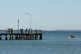
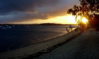
Lamb Island is an island, a town and a locality in Redland City, Queensland, Australia. [3] [4] [5] In the 2021 census, the locality of Lamb Island had a population of 504 people. [6]

Contents

Geography

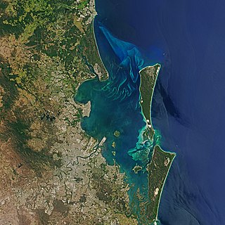
The island is in the southern part of Moreton Bay between the Queensland mainland and North Stradbroke Island. [7] It is within the Moreton Bay Marine Park. [8] The elevation ranges from 0 to 26 metres (0 to 85 ft) above sea level. The land use on the island is predominantly residential. [7]

Offshore from the south-east side of Lamb Island is a Protection and Conservation park zone which is home to protected species of marine life including dugong, dolphins and leatherback turtles.

History

Lamb Island has a rich history of food production dating back to the early 1900s. The island consisted of numerous small farms which supplied produce to the mainland Brisbane market. Due to the unique micro climate created by the islands geographic location, its extremely fertile volcanic soil and the pure sand aquifers that run beneath it, the farmers were able to supply superior produce to the mainland market earlier than their mainland competitors. There were several boats (including the well known historic vessels "Roo" and "Amazon") which travelled from the upper reaches of the Brisbane river out to the island to transport the produce. The Roo would also transport supplies from Brisbane for the island's residents and weekend trippers who would visit the island. One of the well known attractions was Peggy Saunders' garden parties. Peggy Saunders was the wife of one of the original farmers and was well known for her beautiful garden which was located on the Western waterfront of the island.[ citation needed ]

In the late 1970s, Lamb Island, like much of South East Queensland, was developed into small residential allotments. The majority of the original farm land was subdivided with only a handful of small farming lots remaining. The island has remained largely undeveloped with the majority of the small residential lots being left as vacant land. Residential development has been limited largely due to transport costs of materials for building. The small lot sub division is, to some degree, being undone, as a result of the Redland City Council's 2020 initiative to promote land buy buy back by residents who own neighboring lots to those held by the Council. [9] Additionally, due to the low price of land preceding 2020, it was not uncommon for resident land owners to buy multiple adjoining lots to increase lot sizes.[ citation needed ]

In recent years, with the popularity and resurgence of organic food, the island is gaining a reputation for its unique micro climate and organically grown produce. [10] In addition to commercial organic growing ventures on the island, there are a number of small community garden groups engaged in organic food and ornamental plant production together with a local artisan industry with an emphasis on Permaculture values.[ citation needed ]

The Island has a very active incorporated residents' association (LIRA - Lamb Island Resident's Association) which is regularly engaged in community improvement projects which have included native tree planting, heritage site restoration/maintenance and general facility upgrades.[ citation needed ]

Demographics

In the 2011 census, Lamb Island recorded a population of 427 people, 50.4% female and 49.6% male. [11] The median age of the Lamb Island population was 51 years, 14 years above the national median of 37. 69.4% of people living in Lamb Island were born in Australia. The other top responses for country of birth were England 6.8%, New Zealand 6.5%, Philippines 2.3%, Netherlands 1.6%, Germany 1.2%. 90.4% of people spoke only English at home; the next most common languages were 2.8% Tagalog, 0.9% German, 0.9% French, 0.9% Samoan, 0.9% Spanish. [11]

In the 2016 census, Lamb Island recorded a population of 432 people, 49% female and 51% male. The median age of the Lamb Island population was 59 years. The number of private dwellings on the island was 330. [12]

In the 2021 census, the locality of Lamb Island had a population of 504 people. [6]

Heritage listings

Lamb Island Pioneer Hall, 1994 Lamb Island Pioneer Hall (1994).jpg
Lamb Island Pioneer Hall, 1994

Lamb Island has a number of heritage-listed sites, including:

Education

There are no schools on Lamb Island. The nearest government primary school is Macleay Island State Island on neighbouring Macleay Island to the north-west. The nearest government secondary school is Victoria Point State High School in Victoria Point on the mainland to the north-west. [16]

Transportation

Transportation to Lamb Island is by high speed passenger ferry and vehicular barge service. The high speed passenger ferries run approximately every half hour from approximately 4 am – midnight, 7 days per week (subject to changing timetables) and numerous residents commute daily to the mainland. The Lamb Island terminal is located on the Southern end of Lucas Drive which is the central main road ( 27°37′51″S153°22′21″E / 27.63083°S 153.37245°E / -27.63083; 153.37245 (Lamb Island ferry terminal) ). The high speed passenger ferry takes approximately 15 minutes from the Redland Bay marina on the mainland. [17]

The vehicular barge transports all motor vehicles and is capable of transporting large semi trailers. The barge takes approximately 45 minutes from the mainland.[ citation needed ]

The cost of travel on the high speed ferry between the other Southern Moreton Bay Islands is free of charge. The high speed ferry service uses the Queensland Government's Translink go card system.[ citation needed ]

In late 2019, a private locally operated mini bus service was introduced to the island to provide transport to and from the island's ferry terminal.[ citation needed ]

Also in late 2019 trials of Australia's first driverless bus were conducted on the smaller neighboring Karragarra Island with a view to introducing the service to the islands' communities. [18]

Services

The island has a wide range of services:[ citation needed ]

Residents also have access to an online car share service located on the mainland. Share cars are available at the mainland ferry terminal, using a mobile phone app. [19]

Arts & Culture

Lamb Island was the title and subject of a 2010 short film by film maker Tim Marshall. [20]

Peter Ludlow's book entitled "Moreton Bay People" features historical figures and features of Lamb Island. [21]

The island forms part of the Redland City Council's heritage trail which identifies significant local heritage sites. [22]

Numerous art installations are located around the island including artist Antone Bruinsma's "Island Girl" which is located close to the ferry terminal. [23]

The "Girt by Sea" visual arts competition is held annually with a prize pool of approximately $90,000. The competition is supported by the Redland City Council which has acquired several of the entries in the Girt by Sea competition and located them on Lamb Island. [24]

Related Research Articles

<span class="mw-page-title-main">Moreton Bay</span> Inlet in southern Queensland, Australia

Moreton Bay is a bay located on the eastern coast of Australia 14 kilometres (8.7 mi) from central Brisbane, Queensland. It is one of Queensland's most important coastal resources. The waters of Moreton Bay are a popular destination for recreational anglers and are used by commercial operators who provide seafood to market.

<span class="mw-page-title-main">Moreton Island</span> Island off the Queensland coast, Australia

Moreton Island (Mulgumpin) is an island on the eastern side of Moreton Bay on the coast of South East Queensland, Australia. The Coral Sea lies on the east coast of the island. Moreton Island lies 58 kilometres (36 mi) northeast of the Queensland capital, Brisbane. 98% of the island is contained within a national park and a popular destination for day trippers, four wheel driving, camping, recreational angling and whale watching and a 75-minute ferry ride from Brisbane. It is the third largest sand island in the world. Together with Fraser Island, Moreton Island forms the largest sand structure in the world. It was the traditional country of the Ngugi before settlement.

<span class="mw-page-title-main">South Stradbroke Island</span> Suburb of City of Gold Coast, Queensland, Australia

South Stradbroke Island, colloquially South Straddie, is an island that lies within Moreton Bay in the Australian state of Queensland, south of Brisbane and forms the northern end of Gold Coast. The island is a locality within the City of Gold Coast. In the 2021 census, South Stradbroke had a population of 142 people.
<span class="mw-page-title-main">North Stradbroke Island</span> Island that lies within Moreton Bay in the Australian state of Queensland

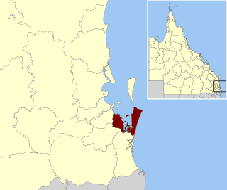
North Stradbroke Island, colloquially Straddie or North Straddie, is an island that lies within Moreton Bay in the Australian state of Queensland, 30 kilometres (19 mi) southeast of the centre of Brisbane. Originally there was only one Stradbroke Island but in 1896 it split into North Stradbroke Island and South Stradbroke Island separated by the Jumpinpin Channel. The Quandamooka people are the traditional owners of North Stradbroke island.

<span class="mw-page-title-main">Redland City</span> Local government area in Queensland, Australia

Redland City, better known as the Redlands and formerly known as Redland Shire, is a local government area and a part of the Brisbane metropolitan area in South East Queensland, Australia. With a population of 159,222 in June 2021, the city is spread along the southern coast of Moreton Bay, covering 537.2 square kilometres (207.4 sq mi). Its mainland borders the City of Brisbane to the west and north-west, and Logan City to the south-west and south, while its islands are situated north of the City of Gold Coast.

<span class="mw-page-title-main">Russell Island (Moreton Bay)</span> Suburb of Redland City, Queensland, Australia

Russell Island is an island, a town and a locality in the City of Redland, Queensland, Australia. The island is also known by its traditional Aboriginal name of Canaipa. In the 2021 census, Russell Island had a population of 3,698 people.

<span class="mw-page-title-main">Southern Moreton Bay Islands (Redland City)</span>

The Southern Moreton Bay Islands, abbreviated as SMBI, also known as the Bay Islands, are the four inhabited southern Moreton Bay islands located in South East Queensland, Australia. The group is part of the Redland City with a permanent population of 7,635 as of the 2021 census. However, nearly one-third of all dwellings on the islands were unoccupied, suggesting a high proportion of "second homes" that are owned by people who were elsewhere on the night of the census.

Moreton Bay is a locality split between the City of Brisbane and the City of Redland, both in Queensland, Australia. The locality includes all of the bay Moreton Bay between the mainland of the City of Brisbane and the City of Redland across to the western coast of Moreton Island and the western coast of North Stradbroke Island. In the 2021 census, Moreton Bay had a population of 0 people.

<span class="mw-page-title-main">Victoria Point, Queensland</span> Suburb of Redland City, Queensland, Australia

Victoria Point is a coastal locality in Redland City, Queensland, Australia. In the 2021 census, Victoria Point had a population of 15,140 people.

<span class="mw-page-title-main">Cleveland, Queensland</span> Suburb of Redland City, Queensland, Australia

Cleveland is a coastal and central locality in the City of Redland, Queensland, Australia. In the 2016 census, Cleveland had a population of 14,801 people.

<span class="mw-page-title-main">Dunwich, Queensland</span> Town in Queensland, Australia

Dunwich is a town and locality on the western side of North Stradbroke Island in Queensland, Australia. Dunwich is part of the Redland City local government area, administered from the bayside town of Cleveland on the Queensland mainland. In the 2016 census, Dunwich had a population of 864 people.

<span class="mw-page-title-main">Redland Bay, Queensland</span> Suburb of Redland City, Queensland, Australia

Redland Bay is a coastal semi-rural locality in the City of Redland, Queensland, Australia. In the 2021 census, Redland Bay had a population of 17,056 people.
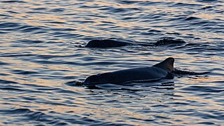
Amity is a rural town and locality in the City of Redland, Queensland, Australia. In the 2016 census, the locality of Amity had a population of 387 people.

<span class="mw-page-title-main">Thorneside, Queensland</span> Suburb of Redland City, Queensland, Australia

Thorneside is a coastal urban locality in the City of Redland, Queensland, Australia. In the 2016 census, Thorneside had a population of 3,761 people.
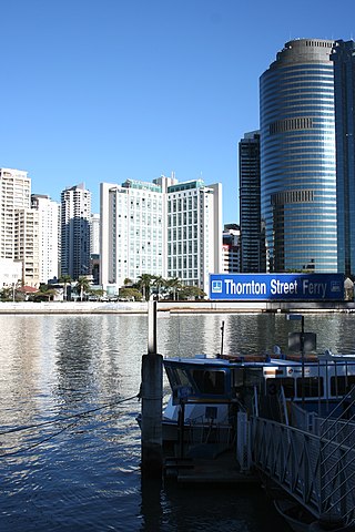
<span class="mw-page-title-main">Wellington Point, Queensland</span> Suburb of Redland City, Queensland, Australia

Wellington Point is a residential locality in the City of Redland, Queensland, Australia. In the 2016 census, Wellington Point had a population of 12,350 people. The suburb is a popular seaside destination within the Brisbane metropolitan area and is notable for a popular walk along a sandbar to King Island which emerges at low tide.

<span class="mw-page-title-main">Macleay Island</span> Suburb of Brisbane, Queensland, Australia

Macleay Island is an island in Moreton Bay, South East Queensland, Australia. The island constitutes a town and locality within the City of Redland. In the 2016 census, the locality of Macleay Island had a population of 2,681 people.

<span class="mw-page-title-main">Coochiemudlo Island</span> Suburb of Redland City, Queensland, Australia

Coochiemudlo Island is a small island in the southern part of Moreton Bay, near Brisbane, in South East Queensland, Australia. It is also the name of the locality upon the island, which is within the local government area of Redland City.

Karragarra Island is one of the inhabited Southern Moreton Bay Islands, near Brisbane, in Queensland, Australia. It is also a town and locality in the City of Redland, Queensland, Australia. In the 2016 census, the locality of Karragarra Island had a population of 204 people.

<span class="mw-page-title-main">Southern Moreton Bay Islands, Queensland</span> Suburb of Gold Coast, Queensland, Australia

Southern Moreton Bay Islands is an island group locality in the north-east of the City of Gold Coast, Queensland, Australia. In the 2021 census, Southern Moreton Bay Islands had no people.

<span class="mw-page-title-main">Lamb Island Pioneer Hall</span> Historic site in Queensland, Australia

Lamb Island Pioneer Hall is a heritage-listed former house and now community hall at Lucas Drive, Lamb Island, City of Redland, Queensland, Australia. It was built from c. 1924 to 1930s. It was added to the Queensland Heritage Register on 3 April 1995.

References

  1. Australian Bureau of Statistics (28 June 2022). "Lamb Island (suburb and locality)". Australian Census 2021 QuickStats. Retrieved 28 June 2022.  OOjs UI icon edit-ltr-progressive.svg
  2. Australian Bureau of Statistics (28 June 2022). "Lamb Island (suburb and locality)". Australian Census 2021.  OOjs UI icon edit-ltr-progressive.svg
  3. "Lamb Island – island (entry 18846)". Queensland Place Names. Queensland Government . Retrieved 14 November 2016.
  4. "Lamb Island – town (entry 39098)". Queensland Place Names. Queensland Government . Retrieved 14 November 2016.
  5. "Lamb Island – locality (entry 43643)". Queensland Place Names. Queensland Government . Retrieved 14 November 2016.
  6. 1 2 Australian Bureau of Statistics (28 June 2022). "Lamb Island (SAL)". 2021 Census QuickStats. Retrieved 28 February 2023. OOjs UI icon edit-ltr-progressive.svg
  7. 1 2 "Layers: Locality; Protected areas and forests; Land use". Queensland Globe. Queensland Government . Retrieved 10 April 2024.
  8. "Moreton Bay Marine Park". Parks and forests. Queensland Government. 6 October 2009. Retrieved 10 April 2024.
  9. "Island land up for sale". Redland City Bulletin. 11 June 2020. Archived from the original on 30 August 2020. Retrieved 29 July 2020.
  10. Williams, Brian (20 September 2016). "An island farmer couple has won a national food award for delicious produce". Redland City Bulletin . Archived from the original on 11 September 2017. Retrieved 11 September 2017.
  11. 1 2 Australian Bureau of Statistics (31 October 2012). "Lamb Island (SSC)". 2011 Census QuickStats. Retrieved 2 August 2019. OOjs UI icon edit-ltr-progressive.svg
  12. Australian Bureau of Statistics (27 June 2017). "Lamb Island (SSC)". 2016 Census QuickStats. Retrieved 20 October 2018. OOjs UI icon edit-ltr-progressive.svg
  13. 1 2 "Lamb Island Pioneer Hall (entry 601493)". Queensland Heritage Register . Queensland Heritage Council. Retrieved 12 July 2013.
  14. 1 2 3 "Schedule 4 - Heritage Places Register" (PDF). Redland City Council. March 2006. p. 4. Archived (PDF) from the original on 15 April 2020. Retrieved 5 September 2020.
  15. "Lamb Island". Archived from the original on 4 February 2015. Retrieved 3 February 2015.
  16. "Queensland Globe". State of Queensland . Retrieved 10 August 2023.
  17. "Bay Islands passenger ferries". SeaLink Bay Islands. Archived from the original on 28 June 2023. Retrieved 10 August 2023.
  18. Goodenough, Cheryl (19 August 2019). "Driverless bus trial for bay island". Redland City Bulletin . Archived from the original on 22 September 2019. Retrieved 26 January 2020.
  19. "Bay Islands Car Share | Redland Bay | Victoria Point | Car hire". Bay Island Car Share. Archived from the original on 2 August 2019. Retrieved 2 August 2019.
  20. Marshall, Tim (26 October 2009), Lamb Island (short film), archived from the original on 5 September 2020, retrieved 29 June 2019
  21. Ludlow, Peter (2000). Moreton Bay people : the complete collection. P. Ludlow. ISBN   978-0-9577260-3-1.
  22. Council, Redland City. "Heritage trails". www.redland.qld.gov.au. Archived from the original on 29 June 2019. Retrieved 29 June 2019.
  23. Goodenough, Cheryl (8 August 2018). "Sculptures yet to be installed after Girt by Sea competitions in 2016 and 2017". Redland City Bulletin . Archived from the original on 8 August 2019. Retrieved 8 August 2019.
  24. "Girt by Sea competition a Bay Island art boon". Redland City Council News. 10 February 2017. Archived from the original on 8 August 2019. Retrieved 8 August 2019.

Commons-logo.svg Media related to Lamb Island, Queensland at Wikimedia Commons