Moreton Island, Queensland

Last updated

Map all coordinates using: OpenStreetMap
Moreton Island
Brisbane,  Queensland
Moreton Island, QLD.jpg
Moreton Island, 2016
Australia Queensland location map.svg
Red pog.svg
Moreton Island
Moreton Island, Queensland
Coordinates 27°10′07″S153°24′04″E / 27.1686°S 153.4011°E / -27.1686; 153.4011 (Moreton Island (centre of locality))
Population180 (SAL 2021) [1]
Postcode(s) 4025
Area174.6 km2 (67.4 sq mi)
Time zone AEST (UTC+10:00)
LGA(s) City of Brisbane (Deagon Ward)
State electorate(s) Redcliffe
Federal division(s) Bonner
Suburbs around Moreton Island:
Bulwer Moreton Bay Coral Sea
Cowan Cowan Moreton Island Coral Sea
Kooringal Moreton Bay Coral Sea

Moreton Island is the largest locality on the island Moreton Island within the City of Brisbane, Queensland, Australia. [2] In the 2021 census, Moreton Island had a population of 180 people. [3]

Contents

Geography

The boundary of the locality is that of Moreton Island as a whole with the exception of the three separate localities of Bulwer (on the north-west coast), Cowan Cowan (on the west coast) and Kooringal (on the south-west coast). Apart from the Tangalooma Resort, almost all of the locality is within the Moreton Island National Park. [4]

Cape Moreton Lighthouse is on Cape Moreton, the north-eastern point of the island ( 27°01′54″S153°27′57″E / 27.0318°S 153.4659°E / -27.0318; 153.4659 (Cape Moreton Lighthouse) ). [5]

There are many named features and places on the island (from north to south):

History

Cape Moreton lighthouse, 1910 Cape Moreton lighthouse, Moreton Island (7877937738).jpg
Cape Moreton lighthouse, 1910

The locality name of Moreton Island takes its name from the island of the same name, which was named by Lieutenant Matthew Flinders of HM Colonial Sloop Norfolk on 28 July 1799, taking its name from Moreton Bay. The bay was named by Lieutenant James Cook of HMS Endeavour in 1770 after James Douglas, 14th Earl of Morton, who was President of the Royal Society and was influential in obtaining the grant that enables Cook's voyage. The misspelling of the name Morton as Moreton occurred in the published records of the voyage. [2]

With increasing amounts of shipping coming into Moreton Bay during the 1840s, the New South Wales Government decided to build a lighthouse on the north-east corner of the island (Cape Moreton). It was designed by architect Edmund Blacket in 1854 and completed in 1857. The Cape Moreton Lighthouse is the oldest lighthouse in Queensland and the only one built prior to the Separation of Queensland and the establishment of the Queensland Government in 1859. It is also the only lighthouse in Queensland built from stone. It is still operational. [43]

Cricket match at Bulwer State School, 1899, with the teacher's residence on the right StateLibQld 1 168831 Cricket match at Bulwer State School, Queensland, 1899.jpg
Cricket match at Bulwer State School, 1899, with the teacher's residence on the right

Moreton Island State School opened circa 1876, being renamed Bulwer State School in 1878. In 1891, it was downgraded to Bulwer Provisional School, but by 1895 was Bulwer State School again. When the pilot station families were relocated in 1909, the school was closed. [44]

Students pictured with their teacher at Cape Moreton State School, circa 1913 Students pictured with their teacher at Cape Moreton State School, circa 1913.jpg
Students pictured with their teacher at Cape Moreton State School, circa 1913

Cape Moreton Provisional School opened on 28 August 1876 but closed in 1884. It reopened on 15 February 1886 and permanently closed in December 1925. [44]

Demographics

In the 2016 census, Moreton Island had a population of 243 people. [45]

In the 2021 census, Moreton Island had a population of 180 people. [3]

Education

There are no schools on the island. The options are distance education and boarding schools. [4]

Transport

There are no road or rail bridges to the island. The island is accessed by boat (ferries and barges) or by air. Only 4WD verhicles are suitable for driving on the island. [46]

There are a number of air transport facilities (from north to south)

Related Research Articles

<span class="mw-page-title-main">Gheebulum Kunungai (Moreton Island) National Park</span> Protected area in Queensland, Australia

Gheebulum Kunungai is a national park which covers 98% of Moreton Island (Mulgumpin) in Queensland, Australia, 58km northeast of Brisbane. It has three main townships, Bulwer, Cowan Cowan and Kooringal.

<span class="mw-page-title-main">Moreton Island</span> Island off the Queensland coast, Australia

Moreton Island (Mulgumpin) is an island on the eastern side of Moreton Bay on the coast of South East Queensland, Australia. The Coral Sea lies on the east coast of the island. Moreton Island lies 58 kilometres (36 mi) northeast of the Queensland capital, Brisbane. 98% of the island is contained within a national park and a popular destination for day trippers, four wheel driving, camping, recreational angling and whale watching and a 75-minute ferry ride from Brisbane. It is the third largest sand island in the world. Together with Fraser Island, Moreton Island forms the largest sand structure in the world. It was the traditional country of the Ngugi before settlement.

<span class="mw-page-title-main">Scarborough, Queensland</span> Suburb of City of Moreton Bay, Queensland, Australia

Scarborough is a coastal suburb on the Redcliffe Peninsula in the City of Moreton Bay, Queensland, Australia. In the 2021 census, Scarborough had a population of 9,178 people.

<span class="mw-page-title-main">Pinkenba, Queensland</span> Suburb of Brisbane, Queensland, Australia

Pinkenba is a town and eastern coastal suburb within the City of Brisbane, Queensland, Australia. In the 2016 census, Pinkenba had a population of 368 people.

Moreton Bay is a locality split between the City of Brisbane and the City of Redland, both in Queensland, Australia. The locality includes all of the bay Moreton Bay between the mainland of the City of Brisbane and the City of Redland across to the western coast of Moreton Island and the western coast of North Stradbroke Island. In the 2021 census, Moreton Bay had a population of 0 people.

<span class="mw-page-title-main">Mount Glorious</span> Suburb of City of Moreton Bay, Queensland, Australia

Mount Glorious is a rural locality in the City of Moreton Bay, Queensland, Australia. In the 2016 census, Mount Glorious had a population of 296 people.

<span class="mw-page-title-main">Tangalooma, Queensland</span>

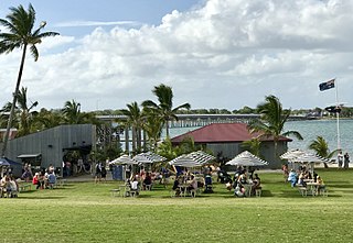
Originally a whaling station, Tangalooma Island Resort is a resort on the west side of Moreton Island in Queensland, Australia. It lies on the eastern shore of Moreton Bay and is known for its resort accommodation, dolphin-feeding program, sand dunes and wreck diving. Swimming is popular along the white beaches. It has a population of over 300 and receives more than 3,500 visitors every week as it is about 70 minutes from Brisbane by express catamaran. Moreton Island National Park covers 98% of the island, though there are three small townships including Bulwer, Kooringal and Cowan Cowan. The adjacent waters are protected as the Moreton Bay Marine Park. Tangalooma is the aboriginal word meaning "where the fish gather".

<span class="mw-page-title-main">Fraser Island, Queensland</span> Town in Queensland, Australia

K'gari, also known as Fraser Island, is a locality on the island of K'gari in the Fraser Coast Region, Queensland, Australia. In the 2016 census the locality then known as Fraser Island had a population of 182 people.

<span class="mw-page-title-main">Lytton, Queensland</span> Suburb of Brisbane, Queensland, Australia

Lytton is an outer riverside suburb in the City of Brisbane, Queensland, Australia. In the 2016 census, Lytton had a population of 6 people.

<span class="mw-page-title-main">Manly West, Queensland</span> Suburb of Brisbane, Queensland, Australia

Manly West is a suburb in the City of Brisbane, Queensland, Australia. In the 2016 census, Manly West had a population of 11,978 people.

<span class="mw-page-title-main">Sandstone Point, Queensland</span> Suburb of City of Moreton Bay, Queensland, Australia

Sandstone Point is a coastal locality in the City of Moreton Bay, Queensland, Australia. In the 2016 census, Sandstone Point had a population of 3,959 people.

<span class="mw-page-title-main">Bulwer, Queensland</span> Suburb of City of Brisbane (Deagon Ward), Queensland, Australia

Bulwer is a coastal town and locality at the north-western end of Moreton Island in the City of Brisbane, Queensland, Australia. In the 2016 census the locality of Bulwer had a population of 49 people.

<span class="mw-page-title-main">Cowan Cowan Point Light</span> Lighthouse in Queensland, Australia

Cowan Cowan Point Light, was also known as Cowan Cowan Light or Cowan Point Light, was located on Cowan Cowan Point, on the western shore of Moreton Island, Queensland, Australia.

Cowan Cowan is an island town and locality in the City of Brisbane, Queensland, Australia. In the 2016 census, the locality of Cowan Cowan had a population of 28 people.

<span class="mw-page-title-main">Woorim, Queensland</span> Suburb of Bribie Island, Queensland, Australia

Woorim is a town and suburb of Bribie Island in the City of Moreton Bay, Queensland, Australia. In the 2016 census, Woorim had a population of 1,829 people.

Karragarra Island is one of the inhabited Southern Moreton Bay Islands, near Brisbane, in Queensland, Australia. It is also a town and locality in the City of Redland, Queensland, Australia. In the 2016 census, the locality of Karragarra Island had a population of 204 people.

<span class="mw-page-title-main">Welsby, Queensland</span> Suburb of Bribie Island, Queensland, Australia

Welsby is a coastal locality on Bribie Island in the City of Moreton Bay, Queensland, Australia. In the 2016 census Welsby had a population of 5 people.

Kooringal is a coastal town and locality on the south-west coast of Moreton Island within the City of Brisbane, Queensland, Australia. In the 2016 census the locality of Kooringal had a population of 45 people.

Evanslea is a rural locality in the Toowoomba Region, Queensland, Australia. In the 2016 census Evanslea had a population of 41 people.

<span class="mw-page-title-main">Inskip, Queensland</span> Suburb of Gympie Region, Queensland, Australia

Inskip is a coastal locality in the Gympie Region, Queensland, Australia. Inskip Point at the north of the locality is a vehicular gateway to Fraser Island. In the 2021 census, Inskip had a population of 22 people.

References

  1. Australian Bureau of Statistics (28 June 2022). "Moreton Island (suburb and locality)". Australian Census 2021 QuickStats. Retrieved 28 June 2022.  OOjs UI icon edit-ltr-progressive.svg
  2. 1 2 "Moreton Island – locality in City of Brisbane (entry 49462)". Queensland Place Names. Queensland Government . Retrieved 19 November 2018.
  3. 1 2 Australian Bureau of Statistics (28 June 2022). "Moreton Island (SAL)". 2021 Census QuickStats. Retrieved 28 February 2023. OOjs UI icon edit-ltr-progressive.svg
  4. 1 2 "Queensland Globe". State of Queensland . Retrieved 13 August 2023.
  5. "Lighthouses - Queensland". Queensland Open Data. Queensland Government. 18 November 2020. Archived from the original on 24 November 2020. Retrieved 24 November 2020.
  6. 1 2 3 4 5 6 7 8 9 10 11 12 13 14 15 16 17 18 19 20 21 22 23 24 "Mountain peaks and capes - Queensland". Queensland Open Data. Queensland Government. 12 November 2020. Archived from the original on 25 November 2020. Retrieved 25 November 2020.
  7. "North Point – mountain in Brisbane City (entry 24698)". Queensland Place Names. Queensland Government . Retrieved 25 November 2020.
  8. "Rocky Hill – mountain in Brisbane City (entry 28832)". Queensland Place Names. Queensland Government . Retrieved 25 November 2020.
  9. "Cape Moreton – mountain in Brisbane City (entry 22813)". Queensland Place Names. Queensland Government . Retrieved 25 November 2020.
  10. "Tungewa – locality unbounded in City of Brisbane (entry 35335)". Queensland Place Names. Queensland Government . Retrieved 7 March 2023.
  11. "Yellow Patch – locality unbounded in City of Brisbane (entry 38620)". Queensland Place Names. Queensland Government . Retrieved 7 March 2023.
  12. "Cape Cliff – mountain in Brisbane City (entry 7429)". Queensland Place Names. Queensland Government . Retrieved 25 November 2020.
  13. "Five Hills – mountain in Brisbane City (entry 12567)". Queensland Place Names. Queensland Government . Retrieved 25 November 2020.
  14. "Comboyuro Point – mountain in Brisbane City (entry 7822)". Queensland Place Names. Queensland Government . Retrieved 25 November 2020.
  15. "Smith – mountain in Brisbane City (entry 31198)". Queensland Place Names. Queensland Government . Retrieved 25 November 2020.
  16. "Tabilbulla – locality unbounded in City of Brisbane (entry 33057)". Queensland Place Names. Queensland Government . Retrieved 7 March 2023.
  17. "Diagram Hills – mountain in Brisbane City (entry 9852)". Queensland Place Names. Queensland Government . Retrieved 25 November 2020.
  18. "Hutchison Peak – mountain in Brisbane City (entry 16540)". Queensland Place Names. Queensland Government . Retrieved 25 November 2020.
  19. "Jessie Peak – mountain in Brisbane City (entry 17162)". Queensland Place Names. Queensland Government . Retrieved 25 November 2020.
  20. "Mount Campbell – mountain in Brisbane City (entry 5988)". Queensland Place Names. Queensland Government . Retrieved 25 November 2020.
  21. "Russels Top – mountain in Brisbane City (entry 29360)". Queensland Place Names. Queensland Government . Retrieved 25 November 2020.
  22. "The Nek – locality unbounded in City of Brisbane (entry 34034)". Queensland Place Names. Queensland Government . Retrieved 7 March 2023.
  23. "Round Hill – mountain in Brisbane City (entry 29163)". Queensland Place Names. Queensland Government . Retrieved 25 November 2020.
  24. "Cowan Cowan Point – mountain in Brisbane City (entry 8591)". Queensland Place Names. Queensland Government . Retrieved 25 November 2020.
  25. "Chanuk Bair – locality unbounded in City of Brisbane (entry 6859)". Queensland Place Names. Queensland Government . Retrieved 7 March 2023.
  26. "Hell Spit – locality unbounded in City of Brisbane (entry 15680)". Queensland Place Names. Queensland Government . Retrieved 7 March 2023.
  27. "Storm Mountain – mountain in Brisbane City (entry 32614)". Queensland Place Names. Queensland Government . Retrieved 25 November 2020.
  28. "Mount Tempest – mountain in Brisbane City (entry 33608)". Queensland Place Names. Queensland Government . Retrieved 25 November 2020.
  29. "Pimple – locality unbounded in City of Brisbane (entry 26756)". Queensland Place Names. Queensland Government . Retrieved 7 March 2023.
  30. "Flat Iron – mountain in Brisbane City (entry 12723)". Queensland Place Names. Queensland Government . Retrieved 25 November 2020.
  31. "Cone Hill – mountain in Brisbane City (entry 7891)". Queensland Place Names. Queensland Government . Retrieved 25 November 2020.
  32. "Tangalooma – locality unbounded in City of Brisbane (entry 33275)". Queensland Place Names. Queensland Government . Retrieved 7 March 2023.
  33. "The Desert – locality unbounded in City of Brisbane (entry 33917)". Queensland Place Names. Queensland Government . Retrieved 7 March 2023.
  34. "Tangalooma Point – mountain in Brisbane City (entry 33276)". Queensland Place Names. Queensland Government . Retrieved 25 November 2020.
  35. "Sandy Peak – mountain in Brisbane City (entry 29921)". Queensland Place Names. Queensland Government . Retrieved 25 November 2020.
  36. "Big Sandhills – mountain in Brisbane City (entry 2521)". Queensland Place Names. Queensland Government . Retrieved 25 November 2020.
  37. "Gebelum – locality unbounded in City of Brisbane (entry 13535)". Queensland Place Names. Queensland Government . Retrieved 7 March 2023.
  38. "Kounungai – locality unbounded in City of Brisbane (entry 18526)". Queensland Place Names. Queensland Government . Retrieved 7 March 2023.
  39. "Little Sandhills – mountain in Brisbane City (entry 19707)". Queensland Place Names. Queensland Government . Retrieved 25 November 2020.
  40. "Toulkerrie – locality unbounded in City of Brisbane (entry 35048)". Queensland Place Names. Queensland Government . Retrieved 7 March 2023.
  41. "Umbounba – locality unbounded in City of Brisbane (entry 35766)". Queensland Place Names. Queensland Government . Retrieved 7 March 2023.
  42. "Reeders Point – mountain in Brisbane City (entry 28288)". Queensland Place Names. Queensland Government . Retrieved 25 November 2020.
  43. "Cape Moreton Lightstation (entry 600257)". Queensland Heritage Register . Queensland Heritage Council. Retrieved 6 July 2013.
  44. 1 2 Queensland Family History Society (2010), Queensland schools past and present (Version 1.01 ed.), Queensland Family History Society, ISBN   978-1-921171-26-0
  45. Australian Bureau of Statistics (27 June 2017). "Moreton Island (SSC)". 2016 Census QuickStats. Retrieved 20 October 2018. OOjs UI icon edit-ltr-progressive.svg
  46. "Visiting safely | Gheebulum Kunungai (Moreton Island) National Park and Moreton Island Recreation Area". Parks and forests. Queensland Government. 7 October 2009. Archived from the original on 4 June 2023. Retrieved 13 August 2023.
  47. 1 2 "Airports - Queensland". Queensland Open Data. Queensland Government. 22 October 2020. Archived from the original on 15 November 2020. Retrieved 3 November 2020.
  48. 1 2 3 4 "Heliports and landing grounds - Queensland". Queensland Open Data. Queensland Government. 22 October 2020. Archived from the original on 16 November 2020. Retrieved 3 November 2020.

Further reading