UNESCO World Heritage Site | |
---|---|
Location | Pico Island, Azores, Portugal |
Criteria | Cultural: (iii)(v) |
Reference | 1117rev |
Inscription | 2004 (28th session) |
Area | 987 ha (2,440 acres) |
Buffer zone | 1,924 ha (4,750 acres) |
Coordinates | 38°33′05.6″N28°28′05.2″W / 38.551556°N 28.468111°W Coordinates: 38°33′05.6″N28°28′05.2″W / 38.551556°N 28.468111°W |
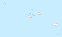
The Landscape of the Pico Island Vineyard Culture is a Unesco World Heritage Site on Pico Island, part of the archipelago of the Azores, Portugal. The landscape, with 987 ha, and the surrounding buffer zone with 1,924 ha, extend through most of the island's western, northwestern and southwestern coasts, with the majority on the municipality of Madalena and the rest on São Roque do Pico, at the foothills of Mount Pico. [1] [2] [3]
The landscape is characterized by an extensive network of long, spaced apart black basalt stone walls that run parallel to the coast and penetrate towards the interior of the island. These walls were erected to protect the vines from the wind and the salty sea spray, which are planted in thousands of small rectangular enclosures locally called currais. Also part of the landscape are the buildings (manor houses, wine cellars, warehouses, conventional houses, and churches), pathways and wells, ports and ramps, that were produced by generations of farmers enabling the production of wine. This landscape has evolved over 500 years and is exceptionally well-preserved and fully authentic in its setting, materials, continued use, function, traditions, techniques, and management systems. [1] [2]
Pico Island, is an island in the Central Group of the Portuguese Azores. The landscape features an eponymous volcano, Ponta do Pico, which is the highest mountain in Portugal, the Azores, and the highest elevation of the Mid-Atlantic Ridge. In the tradition of the Portuguese poet, Raul Brandão, Pico is referred to as the Ilha Preta, for its black volcanic earth, responsible for its UNESCO-designated historical vineyards that allowed the development of the island. Pico is the second largest and, geologically speaking, the most recently formed island of the Azores, being around 300,000 years old.
São Miguel Island, nicknamed "The Green Island", is the largest and most populous island in the Portuguese archipelago of the Azores. The island covers 760 km2 (290 sq mi) and has around 140,000 inhabitants, with 45,000 people residing in Ponta Delgada, the archipelago's largest city.
Terceira is a volcanic island in the Azores archipelago, in the middle of the North Atlantic Ocean. It is one of the larger islands of the archipelago, with a population of 56,000 inhabitants in an area of approximately 396.75 square kilometres. It is the location of the Azores' oldest city, Angra do Heroísmo, the historical capital of the archipelago and UNESCO World Heritage Site; the seat of the judicial system ; and the main Air Force base, Base Aérea nº 4 at Lajes, with a United States Air Force detachment.
Verdelho is a white wine grape grown throughout Portugal, though most associated with the island of Madeira, and also gives its name to one of the four main types of Madeira wine. At the turn of the 20th century it was the most widely planted white grape in Madeira.
São Jorge is an island in the central group of the Azores archipelago and part of the autonomous region of Portugal. Separated from its nearest neighbors by the 15-kilometre (9.3 mi) Pico-São Jorge Channel, the central group is often referred colloquially as part of the Triangulo ("Triangle") group or just "The Triangle". São Jorge is a relatively long thin island with tall cliffs, whose 9500 inhabitants are concentrated on various geological debris fields (fajãs) along the north and south coasts; from east to west, the island is 53 kilometres (33 mi) long and, north to south, 8 kilometres (5.0 mi) wide: its area is 237.59 square kilometres (91.73 sq mi).
Madalena is a municipality along the western coast of the island of Pico, in the Portuguese Azores. The population in 2011 was 6,049, in an area of 147.12 km². The municipality is fronted by the stratovolcano Pico in the eastern frontier, and the Faial Channel which divides Pico from the island of Faial seven kilometers away. It is encircled almost entirely by the Atlantic Ocean except in the east, where it is bordered by São João in the southeast, and Santo António in the northeast.
Criação Velha is a civil parish in the municipality of Madalena on the island of Pico in the Azores. The population in 2011 was 768, in an area of 18.36 km². It contains the localities Alto da Cêrca, Canada de Beatriz, Canada de Pedro Nunes, Canada do Bacelo, Canada do Costa, Canada do Japão, Canada do Monte, João Lima, Lajidos, Rosário and Tapadas.
São Roque do Pico is a municipality in the northern part of the island of Pico, in the Portuguese archipelago of the Azores. The population in 2011 was 3,388, in an area of 142.36 km².
Lajes do Pico is a municipality in the southern part of the Azores. The municipality is located is on the southern part of the Pico Island. The population in 2011 was 4,711, in an area of 155.31 km². It is bordered by Madalena to the west and by São Roque do Pico to the north.
Portuguese wine is the result of traditions introduced to the region by ancient civilizations, such as the Phoenicians, Carthaginians, Greeks, and mostly the Romans. Portugal started to export its wines to Rome during the Roman Empire. Modern exports developed with trade to England after the Methuen Treaty in 1703. From this commerce a wide variety of wines started to be grown in Portugal. And, in 1758, one of the first wine-producing regions of the world, the Região Demarcada do Douro was created under the orientation of Marquis of Pombal, in the Douro Valley. Portugal has two wine-producing regions protected by UNESCO as World Heritage: the Douro Valley Wine Region and Pico Island Wine Region. Portugal has a big variety of local kinds, producing a very wide variety of different wines with distinctive personality.
Mount Pico is a stratovolcano located on Pico Island, in the mid-Atlantic archipelago of the Azores. It is the highest mountain of Portugal, at 2,351 metres (7,713 ft) above sea level, and is one of the highest Atlantic mountains; it is more than twice the elevation of any other peak in the Azores. Pico is a dormant volcano and had its last eruption in 1720. It is a designated nature reserve since 1972.
Monte Brasil is the remnants of a tuff volcano connecting the south coast of Terceira in the central Azores, overlooking the city of Angra do Heroísmo. Monte Brasil is flanked by two bays: the Bay of Angra to its east, and the Bay of Fanal to its west, and was used as a defensive point during the history of Angra, resulting in the construction of various forts and redoubts, including the Fortress of São João Baptista overlooking the city.
The Pico IPR is a Portuguese wine region located on the island of Pico in the Portuguese archipelago of the Azores. The region is designated a second-tier Indicação de Proveniencia Regulamentada (IPR) classification, and potentially may be reclassified as a product of Denominação de Origem Controlada (DOC).
The Açores VR is a Portuguese wine region located in the archipelago of the Azores. This region is classified as a Vinho Regional (VR), which corresponds to table wines with a geographical indication under European Union wine regulations, similar to a French vin de pays region.
Gruta das Torres, is a lava cave, a geological formation of volcanic origin formed from the flow and cooling of subterranean magma rivers. This formation is located outside the parish of Criação Velha, in the municipality of Madalena, on the western flanks of the island of Pico. The cave system formed from a series of pāhoehoe lava flows which originating from the Cabeço Bravo parasitic cone about 500 to 1500 years ago. The caves are a group of interconnected lava tubes between 0.5–22 metres (2–72 ft) width, created from both pāhoehoe and ʻaʻā types of lavas generated during different geological periods. It has a height between 1.1 and 15 metres (3.6–49 ft) and is located at an elevation of 300 metres (980 ft). With an estimated length of over 5.2 km (3.2 mi) it is the longest lava cave in the Azores. Access to the cave was managed by the Mountaineering Association. Starting in 2011, AZORINA, SA took over the management and organization of the cave.
Terra Chã is a civil parish in the municipality of Angra do Heroísmo on the island of Terceira in the Portuguese Azores. The population in 2011 was 2,915, in an area of 10.07 km2.
The Nature Park of Terceira, or simply the Terceira Nature Park (PNTER) developed from the intention of better managing the protected areas of the island of Terceira, and was instituted by the "Secretaria Regional do Ambiente e do Mar", of the Autonomous Regional Government of the Azores. It includes an area of approximately 22% of the island classified under the International Union for Conservation of Nature's Nature Reserve designation.
Madalena is a civil parish in the municipality (concelho) of Madalena in the Portuguese archipelago of the Azores. The population in 2011 was 2,581, in an area of 35.59 km². The parish of Madalena is the authority responsible for the administration and distribution of social services and economic programs in the local seat of the municipality of the same name. It contains the localities Areia Larga, Barca, Cabo Branco, Madalena, Sete Cidades, Toledos and Valverde.
The Azores Geopark is a network of 121 geographically-dispersed sites of geographic heritage and marine areas that covers the nine volcanic islands of the archipelago of the Azores. This network is managed by the Azores Geopark Association, a non-profit association, with its headquarters in Horta on the island of Faial, established 19 May 2010. It is part of the European Geoparks Network and the UNESCO Global Geoparks Network. The Association's mission is to ensure the geological conservation, environmental education and sustainable development, while promoting the well-being of the population and a respect for the environment.