Le Ménil

Last updated • 1 min readFrom Wikipedia, The Free Encyclopedia
Le Ménil
Mairie du Menil.jpg
The town hall in Le Ménil
Blason ville fr Le Menil (Vosges).svg
Location of Le Ménil
Le Menil
France location map-Regions and departements-2016.svg
Red pog.svg
Le Ménil
Grand Est region location map.svg
Red pog.svg
Le Ménil
Coordinates: 47°54′29″N6°47′01″E / 47.9081°N 6.7836°E / 47.9081; 6.7836
Country France
Region Grand Est
Department Vosges
Arrondissement Épinal
Canton Le Thillot
Intercommunality CC Ballons des Hautes-Vosges
Government
  Mayor (20202026) Jean-François Viry [1]
Area
1
20.38 km2 (7.87 sq mi)
Population
 (2021) [2]
993
  Density49/km2 (130/sq mi)
Time zone UTC+01:00 (CET)
  Summer (DST) UTC+02:00 (CEST)
INSEE/Postal code
88302 /88160
Elevation509–1,106 m (1,670–3,629 ft)
1 French Land Register data, which excludes lakes, ponds, glaciers > 1 km2 (0.386 sq mi or 247 acres) and river estuaries.

Le Ménil (French pronunciation: [menil] ) is a commune in the Vosges department in Grand Est in northeastern France. It is sometimes called Le Ménil-Thillot to distinguish it from nearby Ménil-de-Senones.

Contents

Inhabitants are called Guédons.

Geography

The commune is positioned in the southeast of the département, some 6 kilometres (4 mi) to the west of the source of the Moselle at Bussang. The intervening presence of a 952-meter mountain peak means that for motorists the drive to Bussang covers approximately 15 kilometres (9 mi) however. Across the Ménil Pass to the northeast, and approached by smaller roads, is the less well known Moselotte River. The pass connects the seat of the canton, Le Thillot, with Cornimont and a number of smaller mountain villages.

The surrounding mountain summits offer superb views, and tourism has become a defining pillar of the local economy. Registered tourist accommodation exceeds 1,000 beds. The presence of a covered go-kart track in a village with a registered population of barely above 1,000 provides further evidence of the importance of tourism.

History

For a long time Le Ménil was a hamlet controlled by Ramonchamp, but it became a parish in its own right in 1735, and acquired the statute on a commune under the French Revolution.

See also

Related Research Articles

<span class="mw-page-title-main">Vosges (department)</span> Department of France in Grand Est

Vosges is a department in the Grand Est region, Northeastern France. It covers part of the Vosges mountain range, after which it is named. Vosges consists of three arrondissements, 17 cantons and 507 communes, including Domrémy-la-Pucelle, where Joan of Arc was born. In 2019, it had a population of 364,499 with an area of 5,874 km2 (2,268 sq mi); its prefecture is Épinal.

<span class="mw-page-title-main">Raon-l'Étape</span> Commune in Grand Est, France

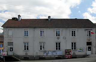
Raon-l'Étape is a commune in the Vosges Department in Grand Est in northeastern France.

<span class="mw-page-title-main">Arrondissement of Épinal</span> Arrondissement in Grand Est, France

The arrondissement of Épinal is an arrondissement of France in the Vosges department in the Grand Est region. It has 236 communes. Its population is 204,222 (2016), and its area is 2,598.2 km2 (1,003.2 sq mi).

<span class="mw-page-title-main">Mandray</span> Commune in Grand Est, France

Mandray is a commune in the Vosges department in Grand Est in northeastern France.

<span class="mw-page-title-main">Maxey-sur-Meuse</span> Commune in Grand Est, France

Maxey-sur-Meuse is a commune in the Vosges department in Grand Est in northeastern France.

<span class="mw-page-title-main">Ménil-de-Senones</span> Commune in Grand Est, France

Ménil-de-Senones is a commune in the Vosges department in Grand Est in northeastern France.

<span class="mw-page-title-main">Ménil-en-Xaintois</span> Commune in Grand Est, France

Ménil-en-Xaintois is a commune in the Vosges department in Grand Est in northeastern France.

<span class="mw-page-title-main">Ménil-sur-Belvitte</span> Commune in Grand Est, France

Ménil-sur-Belvitte is a commune in the Vosges department in Grand Est in northeastern France.

<span class="mw-page-title-main">Mont-lès-Lamarche</span> Commune in Grand Est, France

Mont-lès-Lamarche is a commune in the Vosges department in Grand Est in northeastern France.

<span class="mw-page-title-main">Moyemont</span> Commune in Grand Est, France

Moyemont is a commune in the Vosges department in Grand Est in northeastern France.

<span class="mw-page-title-main">Nomexy</span> Commune in Grand Est, France

Nomexy is a commune in the Vosges department in Grand Est in northeastern France.

<span class="mw-page-title-main">Racécourt</span> Commune in Grand Est, France

Racécourt is a commune in the Vosges department in Grand Est in northeastern France.

<span class="mw-page-title-main">Ramecourt, Vosges</span> Commune in Grand Est, France

Ramecourt is a commune in the Vosges department in Grand Est in northeastern France.

<span class="mw-page-title-main">Ramonchamp</span> Commune in Grand Est, France

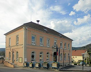
Ramonchamp is a large commune in the Vosges department in Grand Est in northeastern France.

<span class="mw-page-title-main">Le Thillot</span> Commune in Grand Est, France

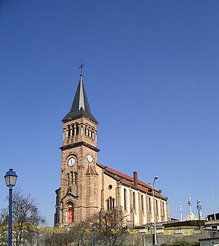
Le Thillot is a commune in the Vosges department in Grand Est in northeastern France.

<span class="mw-page-title-main">Fresse-sur-Moselle</span> Commune in Grand Est, France

Fresse-sur-Moselle is a commune in the Vosges department of Grand Est in northeastern France. The name Moselle refers to the river Moselle that bypasses. In the left of Fresse sur Moselle is situated Le Thillot and in the right of Fresse of Moselle is situated Bussang.In the top is situated Le Menil and in the bottom is situated Saint-Maurice-sur-Moselle.

<span class="mw-page-title-main">Puzieux, Vosges</span> Commune in Grand Est, France

Puzieux is a commune in the Vosges department in Grand Est in northeastern France.

<span class="mw-page-title-main">Canton of Le Thillot</span> Canton in Grand Est, France

The Canton of Le Thillot is a French administrative and electoral grouping of communes in the Vosges département of eastern France and in the region of Grand Est.

The Association of the Mynes and southern Upper Vosges communes is a former administrative association of communes in the Vosges département of eastern France and in the region of Lorraine. It was merged into the new Communauté de communes des Ballons des Hautes-Vosges in January 2013.

The Communauté de communes des Ballons des Hautes-Vosges is an administrative association of rural communes in the Vosges department of eastern France. It was created in 2012 by the merger of the former Communauté de communes des Mynes et Hautes-Vosges du sud and Communauté de communes des Ballons des Hautes Vosges et de la Source de la Moselle. It consists of 8 communes, and has its administrative offices at Le Thillot. Its area is 194.5 km2, and its population was 14,987 in 2019.

References

  1. "Répertoire national des élus: les maires" (in French). data.gouv.fr, Plateforme ouverte des données publiques françaises. 13 September 2022.
  2. "Populations légales 2021" (in French). The National Institute of Statistics and Economic Studies. 28 December 2023.