
In the mountaineering parlance of the Western United States, a fourteener is a mountain peak with an elevation of at least 14,000 ft (4267 m). The 96 fourteeners in the United States are all west of the Mississippi River. Colorado has the most (53) of any single state; Alaska is second with 29. Many peak baggers try to climb all fourteeners in the contiguous United States, one particular state, or another region.
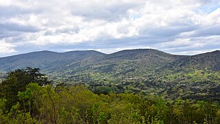
Cheaha Mountain, often called Mount Cheaha, is the highest natural point in the U.S. state of Alabama. It is located a few miles northwest of the town of Delta in Cheaha State Park, which offers a lodge, a restaurant, and other amenities. The nearest higher peak is Brushy Top in Gilmer County, Georgia, 106.72 miles away.
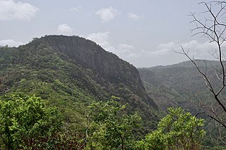
Mount Afadja, known as Afadjato to the Ewe people of Ghana and Togo, is one of the highest mountains in Ghana. The summit is located in the Volta Region, near the border with Togo, close to the villages of Liati Wote and Gbledi Gbogame in the Afadjato South District and Hohoe Municipality, respectively. It is about 178 kilometers (111 mi) northeast of Accra, and 178 kilometers (111 mi) northwest of Lomé. Part of the Agumatsa sub-range of the West Africa Mountains, its summit is often cited at 885 metres (2,904 ft) above sea level, but in reality is only 587 metres (1,926 ft). The summit of Mount Aduadu lies 3.5 kilometers (2 mi) to the east, while Ghana's highest peak, Leklata, lies about 4.6 kilometers to the east.
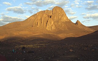
Mount Tahat is the highest mountain in Algeria. It sits at an elevation of 2,908 metres. Other sources indicate an elevation of 3,003 metres (9,852 ft). Tahat is also the highest peak in the Hoggar Mountains. Its nearest city is Tamanrasset which is located 56 kilometres (35 mi) to the south.
Mount Bazardüzü is a mountain peak in the Greater Caucasus range on the border between Russia (Dagestan) and Azerbaijan. At 4,466 metres (14,652 ft) above sea level, it is the highest peak in both Dagestan and Azerbaijan, and is located in the Qusar region. The southernmost point of Dagestan is located about seven kilometers southwest of the peak. Translated from Azerbaijani, Bazarduzu means “market square”, more precisely as a specific landmark - “turn to the market, bazaar”. In the Middle Ages in the Shahnabad Valley, located east of this peak, annual large multinational fairs were held.
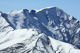
The Rimo massif lies in the northern part of the remote Rimo Muztagh, a subrange of the Karakoram range. It is located about 20 km northeast of the snout of the Siachen Glacier and its main summit, Rimo I is the world's 71st highest mountain with an elevation of 7,385 metres (24,229 ft). The massif heads the large Central Rimo Glacier and South Rimo Glacier, as well as the smaller North Terong Glacier.
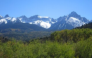
The Southern Rocky Mountains are a major subregion of the Rocky Mountains of North America located in the southeastern portion of the U.S. state of Wyoming, the central and western portions of Colorado, the northern portion of New Mexico, and extreme eastern portions of Utah. The Southern Rocky Mountains are also commonly known as the Southern Rockies, and since the highest peaks are located in the State of Colorado, they are sometimes known as the Colorado Rockies, although many important ranges and peaks rise in the other three states. The Southern Rockies include the highest mountain ranges of the Rocky Mountains and include all 30 of the highest major peaks of the Rockies.
Mont Bengoué is the highest mountain in Gabon. Mont Bengoué is located in the Ogooué-Ivindo Province, at an elevation of 1,070 m.

Afadjato South is one of the constituencies represented in the Parliament of Ghana. It elects one Member of Parliament (MP) by the first past the post system of election. Afadjato South is located in the Afadzato South district of the Volta Region of Ghana. It was created in 2012 by the Electoral Commission of Ghana prior to the Ghanaian general election.
Mount Aduadu is a mountain in Ghana, standing at an elevation of c. 746 metres (2,448 ft). The mountain is located in the Agumatsa Range near the villages of Gblede, Liati Wote and Wli, in the Volta Region of Ghana at the border with Togo.

Angela Oforiwa Alorwu-Tay is a Ghanaian politician and member of the Seventh Parliament of the Fourth Republic of Ghana representing the Afadjato South Constituency in the Volta Region on the ticket of the National Democratic Congress (Ghana). She was one of the five women elected out of nine that contested during the 2016 general elections in the Volta Region.
Mont Atilakoutse is the highest point in Togo, with an elevation of 991 metres (3,251 ft). It is located in the Plateaux Region of southwestern Togo in close proximity to the border with Ghana.
Felo Barkere, also known as the Baunez Ridge, is the highest point in Senegal, with an elevation of 638 metres (2,093 ft). The mountain is located on the border of Senegal's Kédougou Region & Guinea's Labé Region.
