Liberty Harbor | |
|---|---|
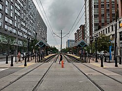 Marin Boulevard station looking west | |
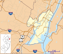 Liberty Harbor Location of Liberty Harbor in Hudson County, New Jersey | |
| Coordinates: 40°42′55″N74°02′53″W / 40.715391°N 74.048077°W | |
| Country | |
| State | |
| City | Jersey City |
| Time zone | Eastern (EST) |
| • Summer (DST) | Eastern (EDT) |
| Website | https://www.libertyharbor.com/ |

Liberty Harbor is a neighborhood in Jersey City, New Jersey situated on the Morris Canal's Big Basin opposite Liberty State Park. [1] [2] [3] [4] [5] [6] The harbor was originally conceived in the 1970s to replace disused land and brownfields. [7]
The neighborhood masterplan follows concepts of new urbanism; [8] the masterplan was originally created by architectural firm Duany and Plater-Zyberk. [9]
The Marin Boulevard station and Jersey Avenue station of the Hudson–Bergen Light Rail serve the neighborhood. [10] A NY Waterway ferry route between Lower Manhattan and Liberty Harbor was inaugurated in 2009. [11] [12] Liberty Landing Ferry operates from the foot of Warren Street.