Communipaw

Last updated

Communipaw, Jersey City
Location map of Hudson County, New Jersey.svg
Red pog.svg
Communipaw, Jersey City
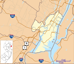
Location of Communipaw in Hudson County Inset: Location of county in the state of New Jersey
Coordinates: 40°42′31″N74°03′40″W / 40.70861°N 74.06111°W / 40.70861; -74.06111
Country United States
State Flag of New Jersey.svg  New Jersey
County Hudson
City Jersey City
Elevation
[1]
20 ft (6 m)
GNIS feature ID875597 [1]

Communipaw is a neighborhood in Jersey City in Hudson County, in the U.S. state of New Jersey. [2] It is located west of Liberty State Park and east of Bergen Hill, [3] [4] and the site of one of the earliest European settlements in North America. It gives its name to the historic avenue which runs from its eastern end near Liberty State Park Station through the neighborhoods of Bergen-Lafayette and the West Side that then becomes the Lincoln Highway. Communipaw Junction, or simply The Junction, is an intersection where Communipaw, Summit Avenue, Garfield Avenue, and Grand Street meet, and where the toll house for the Bergen Point Plank Road was situated. Communipaw Cove at Upper New York Bay, is part of the 36-acre (150,000 m2) state nature preserve in the park and one of the few remaining tidal salt marshes in the Hudson River estuary.

Contents

Communipaw-Lafayette

Communipaw was part of Bergen City, New Jersey between 1855-1870 before merging with Jersey City, and was urbanized during the late half of the 19th century. Some streets of the neighborhood are part of the Communipaw-Lafayette Historic District. [5] Lafayette Park is likely named for the Marquis de Lafayette, who was stationed in Bergen in 1799, [6] and later re-visited in 1824. [7] [8] [9] It is a city square, similar to Van Vorst Park and Hamilton Park; the buildings surrounding it were constructed in different periods. Whitlock Cordage [10] is an intact complex of industrial buildings built in the Lafayette section along the long ago filled Morris Canal. [11] [12] The Housing Trust of America purchased the property to preserve the structures as affordable housing. The section near Johnston Avenue was the site of a stop on the Underground Railroad and African-American burial ground. [13] Ficken's Warehouse, once the site of Bergen City's main post office, is on the National Register of Historic Places listings in Hudson County, New Jersey. Berry Lane Park was formerly an industrial area.

History

Map (c1639) Manhattan situated on the North Rivier with numbered key showing settlements: 27. Farm of Van Vorst; 28. v [sic): 29. Farm of Evertsen; 30. Plantation at Lacher's Hook; 31. Plantation at Paulus Hook; 32. Plantation of Maerytensen. Manatvs gelegen op de Noot Riuier.jpg
Map (c1639) Manhattan situated on the North Rivier with numbered key showing settlements: 27. Farm of Van Vorst; 28. v [sic): 29. Farm of Evertsen; 30. Plantation at Lacher's Hook; 31. Plantation at Paulus Hook; 32. Plantation of Maerytensen.
1910 map of the area showing the village on the cove surrounded by rail-infrastructure Lehigh Valley Jersey City Terminal.png
1910 map of the area showing the village on the cove surrounded by rail-infrastructure

Lenape

At the time of European settlement in the 17th century, Communipaw was the site of the summer encampment and council fire of the Hackensack Indians, [14] a phratry of the Lenape. They, along with the Raritan, Tappan, Wecquaesgeek, Canarsee and other groups who circulated in the region were collectively known as the River Indians by the immigrating population.

It is likely that the name is based in the Algonquian language Lenape. Earlier spellings are numerous and have included Gamoenapa, [14] Gemonepan, [15] Gemoenepaen, [15] Gamenepaw, Comounepaw, Comounepan [16] Communipau, [17] Goneuipan [18] There are a variety of interpretations of the meaning, though most sources relate it to being from gamunk, "on the other side of the river", and pe-auke, "water-land", meaning "big landing-place from the other side of the river". [19] (Current: "gamuck" meaning "other side of the water" or "otherside of the river" [20] or "landing place at the side of a river" [21] ).

New Netherland

Henry Hudson, commissioned by the Dutch East India Company, anchored along the shore at Communipaw in 1609 during his explorations of the Upper New York Bay, North River (Hudson River) and Hudson Valley. [22] On September 12 he sailed up to Communipaw, where Robert Juet, his mate, wrote in the log that it was "...a very good land to fall in with, and a pleasant land to see." [23] In 1634 one of the first "bouweries", or homesteads, in the colony of New Netherland was built at Communipaw as part of Pavonia, a patroonship of Amsterdam businessman Michiel Pauw. (Some have suggested that the name comes from Community of Pauw, which likely is more a coincidence than a fact. [24] [25] [26] [27] ) For a time it bore the name of the Dutchman who settled there, Jan Everts Bout, [28] and was called Jan de Lacher's Hoeck, [29] or "Jan the Laugher's Point", apparently in reference to his boisterous character. Plantations, worked by enslaved Africans, spread across the low-lying areas between the shoreline and the hill. [30] It was here that Tappan and Wecquaesgeek fleeing dominant tribes from the north had taken refuge in 1643. They were attacked in the incident known as the Pavonia Massacre, subsequently leading to Kieft's War. [31]

Originally the village of Communipaw was part of the colony under the jurisdiction of the Dutch West India Company. In 1653 it became part of the Commonality of New Amsterdam, [32] which included all the settlements at Pavonia, Manhattan, Staten Island, and Long Island). It became a separate village in 1658, [33] [34] [35] under the jurisdiction of Bergen, established at contemporary Bergen Square. By 1669, regulated ferry service to New Amsterdam had been established. [36] [37] After the last English takeover of New Netherland in 1674 it became part of the Province of New Jersey, in the county of Bergen, though it retained its Dutch character for hundreds of years. Washington Irving visited it often (at least once with future US president Martin van Buren) for inspiration. Writing in the early 19th century, he often referred to Communipaw as being the stronghold of traditional Dutch culture.; [38] he refers to it in The Legend of Sleepy Hollow . James Fenimore Cooper's The Water-Witch and Herman Melville's The Confidence-Man both mention Communipaw as stronghold in a similar vein. John Quidor, an American Romantic painter, created works inspired the village: Embarkation from Communipaw and The Voyage from Communipaw to Hell Gate. Suydam Street, which can be translated as "south dam", runs for one block south of Communipaw Avenue is taken early Dutch family, whose descendant, Rev. J. Howard Suydam, D.D, was member and historian of the Holland Society of New York. [39]

Railroads

Originally, the waters of the Upper New York Bay facing the village (situated near the site of today's Liberty Science Center) hosted vast oyster beds that were harvested well into the 19th century. [40] As it was industrialized, first with the construction of ports and later with rail infrastructure, the shoreline was expanded with landfill, notably by the Lehigh Valley Railroad and the Central Railroad of New Jersey. Communipaw Terminal, officially known as the Central Railroad of New Jersey Terminal, was the waterfront terminus. The cove just to the south of the station is sometimes still called Communipaw Cove. The railroad also maintained a Communipaw Station in the neighborhood farther inland along the right of way now used by the Hudson Bergen Light Rail. Johnston Avenue is named for an early president of the company.

Transportation

Buses traveling southbound through The Junction are New Jersey Transit routes 6, [41] and 81 [42] through Greenville to Curries Woods, with the 81 continuing to Bayonne. On some trips the 6 alternates its routes along the Lafayette Loop. Northbound the 6 travels to Journal Square, while the 81 travel through Downtown Jersey City to Exchange Place. The nearest stations of the Hudson Bergen Light Rail are located along the southern periphery of the neighborhood at Garfield Avenue in Claremont neighborhood and at Liberty State Park.

See also

Related Research Articles

<span class="mw-page-title-main">Paulus Hook</span> Neighborhood of Jersey City, New Jersey, U.S.

Paulus Hook is a community on the Hudson River waterfront in Jersey City, New Jersey. It is located one mile across the river from Manhattan. The name Hook comes from the Dutch word "hoeck", which translates to "point of land." This "point of land" has been described as an elevated area, the location of which today is bounded by Montgomery, Hudson, Dudley, and Van Vorst Streets.

Bergen Township was a township that existed in the U.S. state of New Jersey, from 1661 to 1862, first as Bergen, New Netherland, then as part Bergen County, and later as part of Hudson County. Several places still bear the name: the township of North Bergen; Bergen Square, Old Bergen Road, Bergen Avenue, Bergen Junction, Bergen Hill and Bergen Arches in Jersey City; Bergen Point in Bayonne; and Bergenline Avenue and Bergen Turnpike in North Hudson.

<span class="mw-page-title-main">Central Railroad of New Jersey Terminal</span> Former intermodal terminal in Jersey City, New Jersey

The Central Railroad of New Jersey Terminal, also known as Communipaw Terminal and Jersey City Terminal, was the Central Railroad of New Jersey's waterfront passenger terminal in Jersey City, New Jersey. The terminal was built in 1889, replacing an earlier one that had been in use since 1864. It operated until April 30, 1967.

<span class="mw-page-title-main">Pavonia Terminal</span> Former intermodal terminal in Jersey City, New Jersey

Pavonia Terminal was the Erie Railroad terminal on the Hudson River located in the Harsimus section of Jersey City, New Jersey. The station opened in 1861 and closed in 1958 when the Erie Railroad moved its passenger services to nearby Hoboken Terminal. The New York, Susquehanna and Western Railway also ran commuter trains from the terminal and various street cars, ferries and the underground Hudson and Manhattan Railroad serviced the station. The station was abandoned in 1958 and demolished in 1961. The site was eventually redeveloped into the Newport district in the late 20th century.

<span class="mw-page-title-main">Bergen Hill</span> Lower part of the Hudson Palisades, New Jersey, United States

Bergen Hill refers to the lower Hudson Palisades in New Jersey, where they emerge on Bergen Neck, which in turn is the peninsula between the Hackensack and Hudson Rivers, and their bays. In Hudson County, it reaches a height of 260 feet.

<span class="mw-page-title-main">Bergen Square</span> Populated place in Hudson County, New Jersey, US

Bergen Square, at the intersection of Bergen Avenue and Academy Street in Jersey City, is in the southwestern part of the much larger Journal Square district. A commercial residential area, it contains an eclectic array of architectural styles including 19th-century row houses, Art Deco retail and office buildings, and is the site of the longest continually-used school site in the United States. Nearby are the Van Wagenen House and Old Bergen Church, two structures from the colonial period. St. George & St. Shenouda Coptic Orthodox Church founded by early Egyptian immigrants was one of the original Coptic congregations in New Jersey.

<span class="mw-page-title-main">Pavonia, New Netherland</span> European settlement on the Hudson River

Pavonia was the first European settlement on the west bank of the North River that was part of the seventeenth-century province of New Netherland in what would become the present Hudson County, New Jersey.

<span class="mw-page-title-main">Vriessendael, New Netherland</span>

Vriessendael was a patroonship on the west bank of the Hudson River in New Netherland, the seventeenth century North American colonial province of the Dutch Empire. The homestead or plantation was located on a tract of about 500 acres (2.0 km2) about an hour's walk north of Communipaw at today's Edgewater. It has also been known as Tappan, which referred to the wider region of the New Jersey Palisades, rising above the river on both sides of the New York/New Jersey state line, and to the indigenous people who lived there and were part of wider group known as Lenape. It was established in 1640 by David Pietersen de Vries, a Dutch sea captain, explorer, and trader who had also established settlements at the Zwaanendael Colony and on Staten Island. The name can roughly be translated as De Vries' Valley. De Vries also owned flatlands along the Hackensack River, in the area named by the Dutch settlers Achter Col. Parts of Vriessendael were destroyed in 1643 in reprisal for the slaughter of Tappan and Wecquaesgeek Native Americans who had taken refuge at Pavonia and Corlears Hook. The patroon's relatively good relations with the Lenape prevented the murder of the plantation's residents, who were able to seek sanctuary in the main house, and later flee to New Amsterdam. The incident was one of the first of many to take place during Kieft's War, a series of often bloody conflicts with bands of Lenape, who had united in face of attacks ordered by the Director of New Netherland.

<span class="mw-page-title-main">Achter Kol, New Netherland</span>

Achter Kol was the name given to the region around the Newark Bay and Hackensack River in northeastern New Jersey by the first European settlers to it and was part of the 17th century province of New Netherland, administered by the Dutch West India Company. At the time of their arrival, the area was inhabited by the Hackensack and Raritan groups of Lenape natives.

<span class="mw-page-title-main">Bergen, New Netherland</span> Origin of the New Jersey settlement

Bergen was a part of the 17th century province of New Netherland, in the area in northeastern New Jersey along the Hudson and Hackensack Rivers that would become contemporary Hudson and Bergen Counties. Though it only officially existed as an independent municipality from 1661, with the founding of a village at Bergen Square, Bergen began as a factory at Communipaw circa 1615 and was first settled in 1630 as Pavonia. These early settlements were along the banks of the North River across from New Amsterdam, under whose jurisdiction they fell.

Oratam was sagamore, or sachem, of the Hackensack Indians living in northeastern New Jersey during the period of early European colonization in the 17th century. Documentation shows that he lived an unusually long life and was quite influential among indigenous and immigrant populations.

<span class="mw-page-title-main">Harsimus</span> Populated place in Hudson County, New Jersey, US

Harsimus is a neighborhood within Downtown Jersey City, Hudson County, in the U.S. state of New Jersey. The neighborhood stretches from the Harsimus Stem Embankment on the north to Christopher Columbus Drive on the south between Coles Street and Grove Street or more broadly, to Marin Boulevard. It borders the neighborhoods of Hamilton Park to the north, Van Vorst Park to the south, the Village to the west, and the Powerhouse Arts District to the east. Newark Avenue has traditionally been its main street. The name is from the Lenape, used by the Hackensack Indians who inhabited the region and could be translated as Crow's Marsh. From many years, the neighborhood was part of the "Horseshoe", a political delineation created by its position between the converging rail lines and political gerrymandering.

<span class="mw-page-title-main">Van Vorst Park</span> Populated place in Essex County, New Jersey, US

Van Vorst Park is a neighborhood in the Historic Downtown of Jersey City, Hudson County, New Jersey, centered on a park sharing the same name. The neighborhood is located west of Paulus Hook and Marin Boulevard, north of Grand Street, east of the Turnpike Extension, and south of The Village and Christopher Columbus Drive. Much of it is included in the Van Vorst Park Historical District.

Curries Woods is a neighborhood in the southern part of Greenville in Jersey City, New Jersey bordering Bayonne. It was named after James Curie, who was on the town Committee for Greenville when it was its own Township in the 19th century. The area remained rural until the later part of the century when the Central Railroad of New Jersey built a line connecting ferries to Elizabeth, New Jersey and New York City. Currie's Woods still remained untouched through the late part of the century and it was valued for its woods, rocky shore and dunes on Newark Bay. A lot of the land was eventually lost, but a tract was set aside in the early part of the 20th century. A small cemetery, the Old Greenville Cemetery, was nearby. This park lost much of its land to the city's largest Housing Authority project in 1959, except a small tract in Bayonne, Mercer Park.

<span class="mw-page-title-main">Jan Everts Bout</span>

Jan Evertsz Bout, was an early and prominent Dutch settler in the 17th century colonial province of New Netherland.

Bergen-Lafayette is a section of Jersey City, New Jersey.

<span class="mw-page-title-main">Summit Avenue (Hudson Palisades)</span> Road in Hudson County, New Jersey, US

County Route 617 is 4.55-mile (7.32 km) long and follows one street, Summit Avenue along the ridge of the Hudson Palisades in Hudson County, New Jersey. Its southern end is CR 622, or Grand Street, at Communipaw Junction in the Bergen-Lafayette Section of Jersey City. Its northern end is CR 691, 32nd Street, a section of the Bergen Turnpike, in Union City.

<span class="mw-page-title-main">Bergen Hill, Jersey City</span> Populated place in Hudson County, New Jersey, US

Bergen Hill is the name given to the emergence of the Hudson Palisades along the Bergen Neck peninsula in Hudson County, New Jersey and the inland neighborhood of Jersey City, New Jersey, where they rise from the coastal plain at the Upper New York Bay. The name is taken from the original 17th-century New Netherland settlement of Bergen, which in Dutch means hills.

References

  1. 1 2 "Communipaw". Geographic Names Information System . United States Geological Survey, United States Department of the Interior.
  2. Locality Search, State of New Jersey. Accessed February 7, 2015.
  3. "· HC areas map" (PDF). Archived from the original (PDF) on July 27, 2011. Retrieved August 25, 2009.
  4. "Communipaw, NJ, USA, Earth - Things to do in Communipaw - Geody". www.geody.com. Retrieved June 26, 2024.
  5. "NJ State Register of Historic Places in Hudson" (PDF). Archived from the original (PDF) on July 5, 2010.
  6. Battle with British
  7. "Apple-Tree House".
  8. Harriet Phillips Eaton, Jersey City And Its Historic Sites, 1899:
  9. Grundy, J. Owen (1975). The History of Jersey City (1609 - 1976). Jersey City: Walter E. Knight; Progress Printing Company.
  10. "Jersey City History: The Whitlock Cordage". The Jersey City Landmarks Conservancy. 2007. Retrieved June 24, 2009.[ dead link ]
  11. "In Bergen-Lafayette, a canal runs through it - The Real Deal".
  12. "Jersey City Online - Everything you want to know about Jersey City New Jersey "Let Jersey City Prosper Online'". Archived from the original on March 8, 2018.
  13. "Underground Railroad in Jersey City". Archived from the original on January 2, 2018.
  14. 1 2 Edward Manning Ruttenber (July 1, 1992). Indian Tribes of Hudson's River: To 1700. North Country Books. ISBN   978-0-910746-98-4.
  15. 1 2 Joan Doherty Lovero (March 1986). Hudson County: The Left Bank. Windsor Publications. ISBN   978-0-89781-172-9.
  16. New Jersey Colonial Records, East Jersey Records: Part 1-Volume 21, Calendar of Records 1664-1702
  17. "Jersey City History - Old Bergen - Chapter XV".
  18. "Archived copy" (PDF). Archived from the original (PDF) on March 27, 2009. Retrieved November 1, 2008.{{cite web}}: CS1 maint: archived copy as title (link)
  19. Shriner, Charles Anthony (1919). Four chapters of Paterson history: I. The war for independence. II. The early white settlers. III. Struggle for industrial supremacy. IV. Municipal administration. The Library of Congress. Paterson, N.J., Lont & Overkamp Pub. Co., Printers.
  20. "gilwell.com: The Lenape / English Dictionary". www.gilwell.com. Retrieved June 26, 2024.
  21. "Indian Place Names in New Jersey".
  22. "History of Jersey City New Jersey".
  23. "JERSEY CITY HISTORY OF FORMS OF GOVERNMENT FROM EARLY DUTCH DAYS TO THE PRESENT TIMEThe territory comprising what is now known as Jersey City was a wilderness, occupied by the Lenni Lenape or Delawares, and governed by their tribal laws, until Henry Hudson, an English navigator, in the employ of the Dutch East India Company, seeking another route that would not require the passing of the Spanish coast to the East Indies, and failing in his mission, found these shores". Archived from the original on March 9, 2018.
  24. "Archived copy". Archived from the original on May 9, 2012. Retrieved November 4, 2008.{{cite web}}: CS1 maint: archived copy as title (link)
  25. "Ron-C-Myers - User Trees - Genealogy.com". www.genealogy.com. Retrieved June 26, 2024.
  26. Gannett, Ganett, Henry, The Origin of Certain Place Names in The United States
  27. "New Jersey State Library - The Origin of New Jersey Place Names". Archived from the original on February 23, 2007.
  28. "Jan Evertsen Bout at Pavonia". Archived from the original on September 4, 2017. Retrieved January 11, 2009.
  29. "Communipaw". Archived from the original on June 4, 2016. Retrieved November 4, 2008.
  30. Hodges, Graham Rusell (1999). "Free People and Slaves, 1613-1664". Dutch New York:Roots and Branch:African Americans in New York and East Jersey. Chapel Hill: University of North Carolina Press. p. 9. ISBN   0-8078-4778-X.
  31. "Jan Evertszen Bout". Archived from the original on September 4, 2017. Retrieved January 11, 2009.
  32. Russell Shorto (April 12, 2005). The Island at the Center of the World: The Epic Story of Dutch Manhattan and the Forgotten Colony that Shaped America. Random House. ISBN   1-4000-7867-9.
  33. "Register of New Netherland, Annals of New Netherland". Archived from the original on October 17, 2008. Retrieved December 14, 2008.
  34. "History Of Jersey City New Jersey". Archived from the original on January 12, 2016.
  35. "The Project Gutenberg eBook of Journal of Jasper Danckaerts, 1679-1680, by Jasper Danckaerts".
  36. Arthur G. Adams (April 1, 1996). The Hudson River Through the Years . Fordham University Press. p.  174. ISBN   978-0-8232-1677-2.
  37. william a. whitehead (1856). contributions to the early history of perth amboy. D. Appleton & Company. p.  272.
  38. "Knickerbocker's History of New York/Book II/Chapter II - Wikisource, the free online library". en.wikisource.org. Retrieved June 26, 2024.
  39. Vookles, Laura (June 12, 2009). Roger Panetta (ed.). Dutch New York The Roots of Hudson Valley Culture. Yonkers, New York: Hudson River Museum. pp. 275, 279. ISBN   978-0-8232-3039-6.
  40. Mark Kurlansky (January 9, 2007). The Big Oyster: History on the Half Shell . Random House Trade Paperbacks. ISBN   978-0-345-47639-5.
  41. "NJT bus 6 schedule" (PDF). Archived from the original (PDF) on March 28, 2018. Retrieved March 16, 2010.
  42. "NJT 81 schedule" (PDF). Archived from the original (PDF) on July 4, 2009. Retrieved March 16, 2010.