Related Research Articles

Indian Territory and the Indian Territories are terms that generally described an evolving land area set aside by the United States government for the relocation of Native Americans who held original Indian title to their land as an independent nation-state. The concept of an Indian territory was an outcome of the U.S. federal government's 18th- and 19th-century policy of Indian removal. After the American Civil War (1861–1865), the policy of the U.S. government was one of assimilation.

Clark County is a county located in the south-central part of the U.S. state of Arkansas. As of the 2020 census, the population was 21,446. The county seat is Arkadelphia. The Arkadelphia, AR Micropolitan Statistical Area includes all of Clark County.

Bradley County is a county located in the U.S. state of Arkansas. As of the 2020 census, the population was 10,545. The county seat is Warren. It is Arkansas's 43rd county, formed on December 18, 1840, and named for Captain Hugh Bradley, who fought in the War of 1812.

Ouachita Parish is located in the northern part of the U.S. state of Louisiana. As of the 2020 census, the population was 160,368. The parish seat is Monroe. The parish was formed in 1807.

The Ouachita Mountains, simply referred to as the Ouachitas, are a mountain range in western Arkansas and southeastern Oklahoma. They are formed by a thick succession of highly deformed Paleozoic strata constituting the Ouachita Fold and Thrust Belt, one of the important orogenic belts of North America. The Ouachitas continue in the subsurface to the northeast, where they make a poorly understood connection with the Appalachians and to the southwest, where they join with the Marathon uplift area of West Texas. Together with the Ozark Plateaus, the Ouachitas form the U.S. Interior Highlands. The highest natural point is Mount Magazine at 2,753 feet (839 m).

The Ouachita River is a 605-mile-long (974 km) river that runs south and east through the U.S. states of Arkansas and Louisiana, joining the Tensas River to form the Black River near Jonesville, Louisiana. It is the 25th-longest river in the United States.

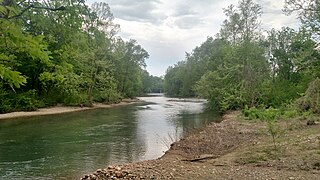
The Caddo River is a tributary of the Ouachita River in the U.S. state of Arkansas. The river is about 82 miles (132 km) long.

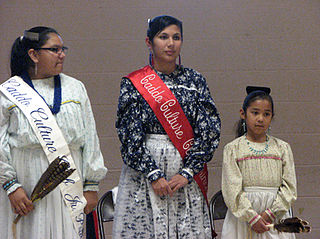
The Caddo people comprise the Caddo Nation of Oklahoma, a federally recognized tribe headquartered in Binger, Oklahoma. They speak the Caddo language.

The Mississippian culture was a Native American civilization that flourished in what is now the Midwestern, Eastern, and Southeastern United States from approximately 800 to 1600, varying regionally. It was known for building large, earthen platform mounds, and often other shaped mounds as well. It was composed of a series of urban settlements and satellite villages linked together by loose trading networks. The largest city was Cahokia, believed to be a major religious center located in what is present-day southern Illinois.

The Quapaw or Arkansas, officially the Quapaw Nation, is a U.S. federally recognized tribe comprising about 5,600 citizens. Also known as the Ogáxpa or “Downstream” people, their ancestral homelands are traced from what is now the Ohio River, west to the Mississippi River to present-day St. Louis, south across present-day Arkansas and eastern and southern Oklahoma. The government forcibly removed them from Arkansas Territory in 1834. The tribal capital is Quapaw, Oklahoma.
The Battle of Claremore Mound, also known as the Battle of the Strawberry Moon, or the Claremore Mound Massacre, was one of the chief battles of the war between the Osage and Cherokee Indians. It occurred in June 1817, when a band of Western Cherokee and their allies under Chief Spring Frog (Too-an-tuh) attacked Pasuga, an Osage village at the foot of Claremore Mound. The village was nearly empty; only women, children, and the very sick and elderly remained there. Most of the village was currently away on a seasonal hunt that often lasted up to three or four months. The Cherokee killed or captured every remaining member of Chief Clermont's band and destroyed everything they could not carry away. Historians consider it one of the bloodiest Native American massacres in modern history.

The geography of Arkansas varies widely. The state is covered by mountains, river valleys, forests, lakes, and bayous in addition to the cities of Arkansas. Hot Springs National Park features bubbling springs of hot water, formerly sought across the country for their healing properties. Crowley's Ridge is a geological anomaly rising above the surrounding lowlands of the Mississippi embayment.
The Yowani were a historical group of Choctaw people who lived in Texas. Yowani was also the name of a preremoval Choctaw village.
The Ouachita are a Native American tribe who lived in northeastern Louisiana along the Ouachita River. Their name has also been pronounced as Washita by English speakers. The spelling "Ouachita" and pronunciation "Wah-sha-taw" came about as a result of French settlers and their influence. Many landscape features and places have been named for them since colonization of the region by Europeans and Americans.

The Arkansas River Valley is a region in Arkansas defined by the Arkansas River in the western part of the state. Generally defined as the area between the Ozark and Ouachita Mountains, the River Valley is characterized by flat lowlands covered in fertile farmland and lakes periodically interrupted by high peaks. Mount Magazine, Mount Nebo, and Petit Jean Mountain compose the Tri-Peaks Region, a further subdivision of the River Valley popular with hikers and outdoors enthusiasts. In addition to the outdoor recreational activities available to residents and visitors of the region, the River Valley contains Arkansas's wine country as well as hundreds of historical sites throughout the area. It is one of six natural divisions of Arkansas.
References
Citations
- ↑ Bright (2004), p. 47.
Sources
- Bright, William (2004). Native American placenames of the United States. Norman: University of Oklahoma Press. ISBN 0-8061-3576-X. OCLC 53019644.