List of Irish local government areas 1898–1921

Last updated

The system of local government Ireland, then wholly within the United Kingdom of Great Britain and Ireland, was reformed by the Local Government (Ireland) Act 1898, which came into force in 1899. The new system divided Ireland into the following entities:

Contents

At the county level:

Within the administrative counties:

Some counties contained rural districts only, with no municipal boroughs or urban districts.

A number of small towns located in rural districts also had town commissioners with limited powers under the Towns Improvement (Ireland) Act 1854.

Map of Local Government Areas in 1898 Ireland1898Administrative.png
Map of Local Government Areas in 1898

County boroughs

Name of county boroughElectoral areasNotes
Belfast Cromac, Duncairn, Falls, Ormeau, Pottinger, St. Anne's, Shankill, Victoria, and Woodvale [1]
Cork Centre, North-East, North-West No. 1, North-West No. 2, North-West No. 3, South No. 1, and South No. 2 [1]
Dublin Dublin No. 1, Dublin No. 2, Dublin No. 3, Dublin No. 4, Dublin No. 5, Dublin No. 6, Dublin No. 7, Dublin No. 8, Dublin No. 9, and Dublin No. 10 [1] Absorbed three urban districts in County Dublin 1900
Limerick Limerick No. 1, Limerick No. 2, Limerick No. 3, Limerick No. 4, and Limerick No. 5 [1]
Londonderry East and South, North, Waterside, and West [2] Commonly called Derry
Waterford Waterford No. 1, Waterford No. 2, Waterford No. 3, Waterford No. 4, and Waterford No. 5 [2]

County Antrim

Name of administrative areaElectoral areasNotes
Ballycastle Urban DistrictEstablished as an Urban District on 1 April 1921 from part of Ballycastle RD [3]
Ballyclare Urban DistrictEstablished as an Urban District on 1 October 1905 [4]
Ballymena Urban DistrictHarryville, Market, and Town Hall [5]
Ballymoney Urban DistrictBallymoney North Urban, and Ballymoney South Urban [5]
Carrickfergus Urban DistrictCarrickfergus Central Urban, Carrickfergus East Urban, and Carrickfergus West Urban [6]
Larne Urban DistrictCentral, Curran, Gardenmore, and Townparks [sic] [7]
Lisburn Urban DistrictLisburn Central Urban, Lisburn North Urban, and Lisburn South East [sic] Urban [7]
Portrush Urban DistrictPortrush East Urban, Portrush North Urban, and Portrush West Urban [8]
Aghalee Rural District Originally known as Lurgan No. 3 Rural District; renamed by 1902; [9] incorporated into Lisburn RD on 1 April 1920 [10]
Antrim Rural District Antrim, Ballyclare Rural, Crumlin, Randalstown, and Templepatrick [11]
Ballycastle Rural District Ballintoy, Ballycastle, and Cushendall [11]
Ballymena Rural District Broughshane, Clogh, Galgorm, Kells, and Portglenone [11]
Ballymoney Rural District Bushmills, Castle Quarter, Dervock, Enagh, and Killoquin [11]
Belfast Rural District Belfast Rural (sole electoral area) [11] Originally known as Belfast No. 1 Rural District; renamed by 1902 [9]
Larne Rural District Carrickfergus Rural, Island Magee, and Kilwaughter [11]
Lisburn Rural District Aghalee, Glenavy, Knocknadona, and Malone [11] Originally known as Lisburn No. 1 Rural District; renamed by 1902 [9]

County Armagh

Name of administrative areaElectoral areasNotes
Armagh Urban DistrictArmagh East Urban, Armagh North Urban, and Armagh South Urban [5]
Keady Urban DistrictKeady Urban (sole electoral area) [12] Constituted Urban District 1903 [13]
Lurgan Urban DistrictLurgan North Urban, Lurgan South East Urban, and Lurgan South West Urban [7]
Portadown Urban DistrictPortadown North Urban, Portadown South East Urban, and Portadown South West Urban [8]
Tanderagee Urban DistrictTanderagee Urban (sole electoral area) [14]
Armagh Rural District Armagh Rural, Keady Rural, Loughgall, Markethill, and Tynan [15]
Crossmaglen Rural District Crossmaglen, and Newtown Hamilton [15] Originally known as Castleblayney No. 2 Rural District; renamed in June 1899 [16] [17] incorporated into Newry No. 2 Rural District on 1 April 1921 [18]
Lurgan Rural District Lurgan Rural, Portadown Rural, and Tartaraghan [15] Originally known as Lurgan No. 1 Rural District; renamed by 1902 [17]
Newry No. 2 Rural District Camlough, and Poyntz Pass [15]
Tandragee Rural District Tanderagee Rural (sole electoral area) [15] Briefly known as Banbridge No. 2 Rural District; renamed Tandragee Rural District in June 1899, [16] sometimes spelt Tanderagee. [17]

County Carlow

Name of administrative areaElectoral areasNotes
Carlow Urban DistrictCarlow North Urban, Carlow South Urban, and Graiguecullen [6]
Baltinglass No. 2 Rural District Hacketstown, and Rathvilly [15]
Carlow Rural District Bagenalstown, Borris, Carlow Rural, Clonegall, Fennagh & Myshall, Leighlinbridge, and Tullow [15] Originally known as Carlow No. 1 Rural District; renamed by 1912 [19]
Idrone Rural District Idrone Rural (sole electoral area) [15] Originally known as New Ross No. 3 Rural District; renamed 1899 [20] [19]

County Cavan

Name of administrative areaElectoral areasNotes
Belturbet Urban DistrictBelturbet Urban (sole electoral area) [6]
Cavan Urban DistrictCavan East Urban, Cavan North West Urban, and Cavan South West [sic] [21] Created in 1900
Cootehill Urban DistrictCootehill Urban (sole electoral area) [22]
Bailieborough Rural District Bailieborough, Crossbane, and Kingscourt [15]
Bawnboy Rural District Bawnboy, and Swanlinbar [23] Originally known as Bawnboy No. 1 Rural District; renamed by 1902 [24]
Castlerahan Rural District Castlerahan (sole electoral area) [23] Originally known as Oldcastle No. 2 Rural District; renamed between 1902 [17] and 1912 [25]
Cavan Rural District Arvagh, Ballyhaise, Bellananagh, Cavan Rural, Cootehill Rural, Drumcarn, Killeshandra, Kilnaleck, Larah, and Stradone [23]
Cootehill No. 1 Rural District Absorbed into Cavan Rural District some time between 1911 [25] and 1925. [26]
Enniskillen No. 2 Rural District Enniskillen No. 2 Rural (sole electoral area) [23]
Mullaghoran Rural District Mullaghoran Rural (sole electoral area) [23] Originally known as Granard No. 2 Rural District; renamed between 1902 [17] and 1912 [25]

County Clare

Name of administrative areaElectoral areasNotes
Ennis Urban DistrictEnnis North East Urban, and Ennis South West Urban [22]
Kilrush Urban DistrictKilrush East Urban, and Kilrush West Urban [12]
Ballyvaghan Rural DistrictDrumcreehy, and Lisdoonvarna [23]
Corrofin Rural District Corrofin, and Muckanagh [23]
Ennis Rural District Ennis Rural, Killanniv, Newmarket, and Templemaley [23]
Ennistymon Rural District Ennistymon, Killilagh, Magherareagh, and Miltown Malbay [23]
Killadysert Rural District Coolmeen, and Killadysert [27]
Kilrush Rural District Doonbeg, Kilkee, Kilmihil, Kilrush Rural, Moyarta, and Mullagh [27]
Limerick No. 2 Rural District Mountievers, and O'Briensbridge [27]
Scariff Rural District Feakle, Killaloe, and Scariff [27]
Tulla Rural District Caher, Kilkishen, Quinn, and Tulla [27]

County Cork

Name of administrative areaElectoral areasNotes
Clonakilty Urban DistrictClonakilty Urban (sole electoral area) [21]
Fermoy Urban DistrictFermoy Central Urban, Fermoy North Urban, and Fermoy South Urban [12]
Kinsale Urban DistrictKinsale North Urban, and Kinsale South Urban [7]
Macroom Urban DistrictMacroom Urban (sole electoral area) [28] Created in 1901 from part of Macroom Rural District
Mallow Urban DistrictMallow East Urban, Mallow North West Urban, and Mallow South [sic] Urban [28] Constituted Urban District 1902
Midleton Urban DistrictMidleton Urban (sole electoral area) [28] Created in 1900
Passage West Urban DistrictCreated in 1921 [29] from part of Cork Rural District, by virtue of an Order made by the Local Government Board for Ireland on 28 June 1921 [30]
Queenstown Urban DistrictQueenstown East Urban, and Queenstown West Urban [8]
Skibbereen Urban DistrictSkibbereen Urban (sole electoral area) [8] Created in 1900
Youghal Urban DistrictYoughal Central Urban, Youghal North Urban, and Youghal South Urban [31]
Bandon Rural DistrictBallymodan, Bandon, Inishannon, Kilbrittain, Teadies, and Templemartin [27]
Bantry Rural District Bantry, Bantry Rural, Durrus, and Glengarriff [27]
Castletown Rural DistrictCastletown Rural (sole electoral area) [27]
Charleville Rural District Charleville (sole electoral area) [32] Originally known as Kilmallock No. 2 Rural District; renamed by 1902 [33]
Clonakilty Rural District Clonakilty Rural, Rosscarbery, and Timoleague [32]
Cork Rural District Ballincollig, Bishopstown, Blackrock, Blarney, Queenstown Rural, and Whitechurch [32]
Dunmanway Rural District Carrigboy, Coolmountain, Dunmanway, and Kinneigh [32]
Fermoy Rural District Ballyhooly, Ballynoe, Fermoy Rural, Kilworth, and Rathcormack [32]
Kanturk Rural District Banteer, Boherboy, Kanturk, Knockatooan, Milford, and Newmarket [32]
Kinsale Rural District Ballinspittle, Ballymartle, Carrigaline, and Kinsale Rural [32]
Macroom Rural District Clonmoyle, Inchigeelagh, Macloneigh, Rahalisk, and Slievereagh [34]
Mallow Rural District Buttevant, Doneraile, Kilshannig, and Mallow Rural [34]
Midleton Rural District Cloyne, Lisgoold, and Midleton Rural [34]
Millstreet Rural DistrictCullen, and Drishane [34]
Mitchelstown No. 1 Rural District Kildorrery, and Mitchelstown [34]
Skibbereen Rural District Aghadown, Castlehaven, Clonkeen, Dromdaleague, and Skibbereen Rural [34]
Skull Rural District Goleen, and Skull [34]
Youghal No. 1 Rural District Youghal No. 1 Rural (sole electoral area) [34]

County Donegal

Name of administrative areaElectoral areasNotes
Buncrana Urban DistrictBuncrana North Urban, and Buncrana South Urban [6] Created in 1914
Bundoran Urban DistrictBundoran North Urban, and Bundoran South Urban [6] Created in 1915
Letterkenny Urban DistrictLetterkenny Urban (sole electoral area) [7]
Ballyshannon Rural District Ballyshannon Rural (sole electoral area) [35] Originally known as Ballyshannon No. 1 Rural District; renamed by 1902 [36]
Donegal Rural District Donegal, Dunkineely, Laghy, and Mountcharles [35]
Dunfanaghy Rural District Dunfanaghy, and Gortahork [35]
Glenties Rural District Annagarry, Ardara, Dunglow, Glencolumbkille, Glenties, and Killybegs [35]
Inishowen Rural District Buncrana Rural, Carndonagh, Malin, and Moville [35]
Letterkenny Rural District Letterkenny Rural, and Temple Douglas [35]
Londonderry No. 2 Rural District Londonderry No. 2 Rural (sole electoral area) [35] Absorbed into Inishowen Rural District [26]
Milford Rural District Carrickart, Fanad, Milford, and Rathmullan [35]
Strabane No. 2 Rural District Castlefinn, and Raphoe [37] Absorbed into Stranorlar Rural District some time between 1911 [38] and 1925 [26]
Stranorlar Rural District Cloghan, and Stranorlar [37]

County Down

AreaElectoral areaNotes
Banbridge Urban DistrictBanbridge East Urban, Banbridge North West Urban, and Banbridge South West Urban [5]
Bangor Urban DistrictCastle, Clifton, and Dufferin [6]
Donaghadee Urban DistrictDonaghadee North Urban, and Donaghadee South Urban [22] Established as an Urban District on 1 January 1906 [4]
Dromore Urban DistrictDromore Urban (sole electoral area) [22] Created in 1902 (?)
Holywood Urban DistrictHolywood Urban (sole electoral area) [12]
Newcastle Urban DistrictNewcastle North Urban, and Newcastle South Urban [28] Established as an Urban District on 1 October 1905 [4]
Newry Urban DistrictNewry North Urban, Newry South Urban, and Newry West Urban [28]
Newtownards Urban DistrictCastle, Central, and Victoria [28]
Warrenpoint Urban DistrictWarrenpoint East Urban, and Warrenpoint West Urban [14]
Banbridge Rural District Banbridge Rural, Dromore Rural, Gilford, Loughbrickland, and Moneyslane [39] Originally known as Banbridge No. 1 Rural District; renamed by 1902 [40]
Castlereagh Rural DistrictCastlereagh Rural (sole electoral area) [37] Originally known as Belfast No. 2 Rural District; renamed by 1902 [40]
Downpatrick Rural District Ballynahinch, Castlewellan, Downpatrick, Killyleagh, Portaferry, and Strangford [37]
Hillsborough Rural District Drumbeg, and Hillsborough [37] Originally known as Lisburn No. 2 Rural District; renamed by 1902 [40]
Kilkeel Rural District Kilkeel, and Rostrevor [37]
Moira Rural DistrictMoira Rural (sole electoral area) [37] Originally known as Lurgan No. 2 Rural District; renamed by 1902 [40]
Newry No. 1 Rural District Newry Rural, and Rathfriland [37]
Newtownards Rural District Comber, Grey Abbey, and Newtownards Rural [37]

County Dublin

Name of administrative areaElectoral areasNotes
Blackrock Urban DistrictBlackrock No. 1 Urban, Blackrock No. 2 Urban, Booterstown, and Monkstown [6]
Clontarf Urban DistrictAbsorbed by Dublin county borough 1900
Dalkey Urban DistrictDalkey North Urban, and Dalkey South Urban [22]
Drumcondra, Clonliffe and Glasnevin Urban DistrictAbsorbed by Dublin county borough 1900
Howth Urban DistrictHowth East Urban, and Howth West Urban [12] Established in 1919
Killiney and Ballybrack Urban DistrictKilliney and Ballybrack North Urban, and Killiney and Ballybrack South Urban [12]
Kingstown Urban DistrictGlasthule, Kingstown East Urban, Kingstown West Urban, and Monkstown [7]
New Kilmainham Urban DistrictAbsorbed by Dublin county borough 1900
Pembroke Urban DistrictPembroke East Urban, and Pembroke West Urban [8]
Rathmines and Rathgar Urban DistrictRathmines and Rathgar No. 1 East Urban, Rathmines and Rathgar No. 2 East Urban, Rathmines and Rathgar No. 1 West Urban, and Rathmines and Rathgar No. 2 West Urban [8]
Balrothery Rural District Balbriggan, Malahide, and Skerries [41]
Celbridge No. 2 Rural District Celbridge No. 2 Rural (sole electoral area) [41]
North Dublin Rural District North Dublin Rural (sole electoral area) [41]
Rathdown No. 1 Rural DistrictRathdown No. 1 Rural (sole electoral area) [41]
South Dublin Rural District South Dublin Rural (sole electoral area) [41]

County Fermanagh

Name of administrative areaElectoral areasNotes
Enniskillen Urban DistrictEnniskillen East Urban, Enniskillen North Urban, and Enniskillen South Urban [22]
Belleek Rural DistrictBelleek Rural (sole electoral area) [41] Originally known as Ballyshannon No. 2 Rural District; renamed by 1902; [42] incorporated into Irvinestown Rural District on 1 April 1921 [43]
Clones No. 2 Rural District Clones No. 2 Rural (sole electoral area) [41] Incorporated into Lisnaskea Rural District on 1 April 1921 [43]
Enniskillen Rural District Ely, Enniskillen, Florencecourt, Holywell, Lisbellaw, Newporton, and Tempo [41] Originally known as Enniskillen No. 1 Rural District; renamed by 1902 [42]
Irvinestown Rural District Clonelly, Ederny, and Irvinestown [41] Originally known as Irvinestown No. 1 Rural District; renamed by 1902 [42]
Lisnaskea Rural District Brookeborough, Doon, and Lisnaskea [44]

County Galway

Name of administrative areaElectoral areasNotes
Ballinasloe Urban DistrictBallinasloe North East Urban, Ballinalsoe South East Urban, and Ballinasloe West Urban [5]
Galway Urban DistrictGalway East Urban, Galway North Urban, Galway South Urban, and Galway West Urban [12]
Ballinasloe No. 1 Rural District Ballinasloe Rural, Killallaghtan, Kiltormer, and Laurencetown [44]
Clifden Rural District Clifden, Owengowla, Rinvyle, and Roundstone [44]
Galway Rural District Clare Galway, Galway Rural, Inishmore, Moycullen, Oranmore, and Spiddle [44]
Glennamaddy Rural District Glennamaddy, Kilcroan, Raheen, and Toberroe [44]
Gort Rural District Ardrahan, Ballycahalan, Gort, and Kinvarra [44]
Loughrea Rural District Athenry, Bullaun, Cappalusk, Kilteskill, Loughrea, Loughrea Rural, and Woodford [44]
Mountbellew [sic] Rural District Clonbrook, Killeroran, and Mount Bellew [sic] [45]
Oughterard Rural District Cloonbur, Lettermore, and Oughterard [45]
Portumna Rural District Drummin, Eyrecourt, and Portumna [45]
Tuam Rural District Abbey, Belclare, Dunmore, Headford, Hillsbrook, Tuam, and Tuam Rural [45]

County Kerry

Name of administrative areaElectoral areasNotes
Killarney Urban DistrictKillarney East Urban, and Killarney West Urban [12]
Listowel Urban DistrictListowel East Urban, and Listowel West Urban [7]
Tralee Urban DistrictTralee North East Urban, Tralee South East Urban, and Tralee West Urban [14]
Caherciveen Rural DistrictCaher, Glanbehy, Loughcurrane, and Portmagee [45]
Dingle Rural District Ballinvoher, Castlegregory, Dingle, and Ventry [45]
Kenmare Rural District Ardea, Kenmare, Kilgarvan, and Sneem [45]
Killarney Rural DistrictCoom, Killarney Rural, Killorglin, Milltown, and Molahiffe [46]
Listowel Rural District Ballyduff, Ballyhorgan, Killehenny, Lisselton, Listowel Rural, and Tarbert [46] Originally known as Listowel No. 1 Rural District; renamed between 1901 [47] and 1912 [48]
Tralee Rural DistrictArdfert, Brosna, Castleisland, Kilgarrylander, Ratass, Scartaglin, and Tralee Rural [46]

County Kildare

Name of administrative areaElectoral areasNotes
Athy Urban DistrictAthy East Urban, and Athy West Urban [5] Created in 1900 from part of Athy No. 1 Rural District
Naas Urban DistrictNaas (sole electoral area) [28] Created in 1900
Athy No. 1 Rural District Athy Rural, Ballitore, Castledermot, Fontstown, Harristown, and Monasterevin [46]
Baltinglass No. 3 Rural District Absorbed into Athy No.1 Rural District some time between 1911 [49] and 1925. [50]
Celbridge No. 1 Rural District Celbridge, and Kilcock [46]
Edenderry No. 2 Rural District Cadamstown, Carbury, and Rathangan [46]
Naas No. 1 Rural District Ballymore Eustace, Kilcullen, Kildare, Kilmeage, Naas Rural, and Newbridge [46]

County Kilkenny

Name of administrative areaElectoral areasNotes
Kilkenny Borough (City)Kilkenny No. 1, and Kilkenny No. 2 [2]
Callan Rural District Callan, and Kilmaganny [51] Originally known as Callan No. 1 Rural District; renamed by 1901 [52]
Carrick-on-Suir No. 3 Rural District Carrick-on-Suir No. 3 Rural (sole electoral area) [51]
Castlecomer Rural DistrictCastlecomer Rural (sole electoral area) [51]
Ida Rural District Ida Rural (sole electoral area) [51] Briefly known as New Ross No. 2 Rural District; renamed 1899. [53]
Kilkenny Rural District Freshford, Kilkenny Rural, and Tiscoffin [51]
Thomastown Rural District Graiguenamanagh, Inistioge, Knocktopher, Thomastown, and Woolengrange [51]
Urlingford No. 1 Rural District Balleen, and Urlingford [51]
Waterford No. 2 Rural District Dunkitt, and Kilmakevoge [51]

King's County

Name of administrative areaElectoral areasNotes
Birr Urban DistrictBirr North East Urban, Birr South East Urban, and Birr West Urban [6]
Tullamore Urban DistrictTullamore East Urban, and Tullamore West Urban [14] Created in 1900
Birr No. 1 Rural District Banagher, Birr Rural, Clonmacnoise, Ferbane, Frankford, and Kinnity [51]
Clonygowan Rural District Originally known as Mountmellick No. 2 Rural District; renamed between 1901 [54] and 1912; [55] absorbed into Tullamore Rural District by 1925. [56]
Edenderry No. 1 Rural District Ballyburley, Clonbulloge, and Edenderry [57]
Roscrea No. 2 Rural District Mountheaton, and Shinrone [57]
Tullamore Rural District Clara, Clonygowan, Killoughy, Philipstown, and Tullamore Rural [57] Originally known as Tullamore No. 1 Rural District; renamed between 1901 [54] and 1912 [55]

County Leitrim

Name of administrative areaElectoral areasNotes
Ballinamore Rural District Ballinamore, and Newtowngore [57] Originally known as Bawnboy No. 2 Rural District; renamed by 1902 [58]
Carrick-on-Shannon No. 1 Rural District Carrick-on-Shannon, Drumreilly, and Drumshanbo [57]
Kinlough Rural DistrictKinlough Rural (sole electoral area) [57] Originally known as Ballyshannon No. 3 Rural District; renamed by 1902 [58]
Manorhamilton Rural District Drumahaire, Drumkeeran, Lurganboy, Manorhamilton, and Munakill [57]
Mohill Rural District Carrigallen, Drumod, Mohill, Rinn, and Rowan [57]

County Limerick

Name of administrative areaElectoral areasNotes
Croom Rural District Adare, Castletown, and Croom [59]
Glin Rural District Glin (sole electoral area) [59] Originally known as Listowel No. 2 Rural District; renamed by 1902 [60]
Kilmallock Rural District Bruff, Bruree, Hospital, Kilfinnane, and Kilmallock [59] Originally known as Kilmallock No. 1 Rural District; renamed between 1901 [60] and 1912 [61]
Limerick No. 1 Rural District Caherconlish, Cappamore, Castleconnell, and Limerick Rural [59]
Mitchelstown No. 2 Rural District Mitchelstown No. 2 Rural (sole electoral area) [59]
Newcastle Rural District Abbeyfeale, Ardagh, Broadford, Monagay, and Newcastle [59]
Rathkeale Rural District Askeaton, Pallaskenry, Rathkeale, Rathkeale Rural, and Shanagolden [59]
Tipperary No. 2 Rural District Tipperary No. 2 Rural (sole electoral area) [59]

County Londonderry

Name of administrative areaElectoral areasNotes
Coleraine Urban DistrictColeraine North East Urban, Coleraine South East Urban, and Coleraine West Urban [21]
Limavady Urban DistrictLimavady Urban (sole electoral area) [7]
Portstewart Urban DistrictPortstewart East Urban, and Portstewart West Urban [8] Established as an Urban District on 1 April 1916 from part of Coleraine RD [62]
Coleraine Rural District Aghadowey, Articlave, Garvagh, Kilrea, and Knockantern [63]
Limavady Rural District Ballykelly, Bellarena, Dungiven, and Fruithill [63]
Londonderry No. 1 Rural District Claudy, Eglinton, and Waterside [63]
Magherafelt Rural District Bellaghy, Draperstown, Maghera, Magherafelt, and Moneymore [63]

County Longford

Name of administrative areaElectoral areasNotes
Granard Urban DistrictGranard Urban (sole electoral area) [12]
Longford Urban DistrictLongford North West Urban, and Longford South East Urban [7] Created in 1900
Ballymahon Rural District Ballymahon, and Kilglass [63] Originally known as Ballymahon No. 1 Rural District; renamed between 1901 [64] and 1912 [65]
Granard No. 1 Rural DistrictBallinalee, Columbkille, Edgeworthstown, and Granard Rural [63]
Longford Rural District Ballinamuck, Drumlish, Killashee, and Longford Rural [63]

County Louth

Name of administrative areaElectoral areasNotes
Drogheda BoroughDuleek Gate, St. Lawrence Gate, and West Gate [2]
Dundalk Urban DistrictDundalk Middle Urban, Dundalk North Urban, Dundalk South Urban, and Seatown [22]
Ardee No. 1 Rural District Ardee, Castlebellingham, and Dunleer [66]
Dundalk Rural District Carlingford, Dromiskin, and Dundalk Rural [66]
Louth Rural DistrictLouth Rural (sole electoral area) [66] Originally known as Drogheda No. 1 Rural District; renamed between 1901 [67] and 1912 [68]

County Mayo

Name of administrative areaElectoral areasNotes
Ballina Urban DistrictArdnaree, Ballina North West Urban, and Ballina South West Urban [5] Created in 1900
Castlebar Urban DistrictCastlebar East Urban, and Castlebar West Urban [21] Created in 1900
Westport Urban DistrictWestport East Urban, Westport South Urban, and Westport West Urban [14] Created in 1900
Ballina Rural District Ballina Rural, Ballycastle, Crossmolina, Killala, and Mount Falcon [66]
Ballinrobe Rural District Ballinrobe, Cappaghduff, Cong, and Hollymount [66]
Belmullet Rural District Bangor, Belmullet, and Knocknalower [66]
Castlebar Rural District Bellavary, Castlebar Rural, Clonkeen, and Pontoon [66]
Claremorris Rural District Ballyhaunis, Ballindine, and Claremorris [66]
Killala Rural DistrictAbsorbed into Ballina Rural District some time between 1911 [69] and 1925. [26]
Swineford Rural District Kilkelly, Kiltamagh, Meelick, Sonnagh, and Swineford [66]
Westport Rural DistrictAchill, Ballycroy, Islandeady, Louisburgh, Newport, and Westport Rural [66]

County Meath

Name of administrative areaElectoral areasNotes
Kells Urban DistrictKells North Urban, and Kells South Urban [12]
Navan Urban DistrictNavan North Urban, and Navan South Urban [28]
Trim Urban DistrictTrim Urban (sole electoral area) [14]
Ardee No. 2 Rural District Ardee No. 2 Rural (sole electoral area) [70]
Dunshaughlin Rural District Dunboyne, and Dunshaughlin [70]
Edenderry No. 3 Rural District Absorbed into Trim Rural District some time between 1911 [71] and 1925. [56]
Kells Rural District Kells Rural, Kilskeer, Moynalty, and Nobber [70]
Meath Rural DistrictMeath Rural (sole electoral area) [70] Originally known as Drogheda No. 2 Rural District; renamed between 1901 [72] and 1912 [71]
Navan Rural District Castletown, Navan Rural, and Painestown [70]
Oldcastle Rural District Oldcastle (sole electoral area) [70] Originally known as Oldcastle No. 1 Rural District; renamed between 1901 [72] and 1912 [71]
Trim Rural District Athboy, Ballyboggan, Innfield, Summerhill, and Trim Rural [73]

County Monaghan

Name of administrative areaElectoral areasNotes
Carrickmacross Urban DistrictCarrickmacross Urban (sole electoral area) [21] Created in 1900
Castleblayney Urban DistrictCastleblayney Urban (sole electoral area) [21] Created in 1900
Clones Urban DistrictClones Urban (sole electoral area) [21]
Monaghan Urban DistrictMonaghan East Urban, and Monaghan West Urban [28]
Carrickmacross Rural District Carrickmacross Rural, and Donaghmoyne [73]
Castleblayney Rural District Ballybay, and Castleblayney Rural [73] Originally known as Castleblayney No. 1 Rural District; renamed by 1902 [74]
Clones No. 1 Rural District Clones Rural, and Dawsongrove [73]
Cootehill No. 2 Rural District
Monaghan Rural District Castleshane, Emyvale, Kilmore, Monaghan Rural, and Scotstown [73]

Queen's County

Name of administrative areaElectoral areasNotes
Abbeyleix Rural District Abbeyleix, Ballinakill, Ballyroan, Castletown, Durrow, and Rathdowney [73]
Athy No. 2 Rural District Ballylynan, and Stradbally [73]
Mountmelick [sic] Rural District Ballybrittas, Clonaslee, Coolrain, Emo, Maryborough, Mountmellick, [sic] and Mountrath [73] Originally known as Mountmelick [sic] No. 1 Rural District; renamed by 1902 [75]
Roscrea No. 3 Rural District Roscrea No. 3 Rural (sole electoral area) [76]
Slievemargy Rural DistrictSlievemargy Rural (sole electoral area) [76] Originally known as Carlow No. 2 Rural District; renamed by 1902 [75]

County Roscommon

Name of administrative areaElectoral areasNotes
Athlone No. 2 Rural District Athlone West Rural, Creagh, Dysart, and Kiltoom [76]
Ballinasloe No. 2 Rural District Absorbed into Athlone No. 2 Rural District some time between 1911 [77] and 1925. [26]
Boyle No. 1 Rural District Boyle, Boyle Rural, Croghan, and Keadew [76]
Carrick-on-Shannon No. 2 Rural District Aughrim, and Danesfort [76] Absorbed into Boyle No. 1 Rural District some time between 1911 [77] and 1925. [26]
Castlerea Rural District Ballaghaderreen, Ballinlough, Castlerea, and Frenchpark [76]
Roscommon Rural District Athleague, Cams, Drumdaff, and Roscommon [76]
Strokestown Rural District Elphin, Roosky, Strokestown, and Tulsk [76] Absorbed into Roscommon Rural District some time between 1911 [77] and 1925. [26]

County Sligo

Name of administrative areaElectoral areasNotes
Sligo BoroughSligo East, Sligo North, and Sligo West [2]
Boyle Rural District Ballymote, Carney, Cliffony, Collooney, Knockaree, and Riverstown [78] Originally known as Sligo Rural District (?)
Boyle No. 2 Rural District Coolavin, Kilmactranny, and Templevanny [78]
Dromore West Rural DistrictCastleconor, Dromor, and Skreen [78]
Tobercurry Rural District Achonry, Aclaire, Coolaney, and Tobercurry [78]

Tipperary (North Riding)

Name of administrative areaElectoral areasNotes
Nenagh Urban DistrictCreated in 1900
Templemore Urban DistrictTemplemore East Urban, Templemore North West Urban, Templemore South [sic] Urban [14]
Thurles Urban DistrictThurles North Urban, and Thurles South Urban [14]
Birr No. 2 Rural District Absorbed into Borrisokane Rural District some time between 1911 [79] and 1925. [80]
Borrisokane Rural District Borrisokane, Clougjordan, Riverstown, and Terryglass [78]
Nenagh Rural District Ballina, Birdhill, Kilmore, Latteragh, Nenagh Rural, and Newport [78]
Roscrea No. 1 Rural District Bourney, and Roscrea [78]
Thurles Rural DistrictBorrisoleigh, Holycross, Littleton, Templetuohy, and Thurles Rural [78]

Tipperary (South Riding)

Name of administrative areaElectoral areasNotes
Clonmel BoroughSt. Mary's North, St. Mary's South, St. Patrick's, and St. Peter's [2]
Carrick-on-Suir Urban DistrictCarrick-on-Suir East Urban, Carrick-on-Suir West Urban, and Carrickbeg [21]
Cashel Urban DistrictCashel East Urban, Cashel North West Urban, and Cashel South West Urban [21]
Tipperary Urban DistrictTipperary East Urban, and Tipperary West Urban [14] Created in 1900
Carrick-on-Suir No. 1 Rural District Carrick-on-Suir No. 1 Rural (sole electoral area) [81]
Cashel Rural District Cashel Rural, Fethard, Killenaule, Kilpatrick, and Tullamain [81]
Clogheen Rural District Ardfinnan, Caher, and Clogheen [81]
Clonmel No. 1 Rural District Clonmel No. 1 Rural (sole electoral area) [81]
Gortnahoe Rural District Originally known as Urlingford No. 2 Rural District; renamed between 1901 [82] and 1912; [79] absorbed into Slievardagh Rural District by 1925. [80]
Slievardagh Rural DistrictBallingarry, Kilcooly, and Mullinahone [81] Briefly known as Callan No. 2 Rural District; renamed 1899. [83]
Tipperary No. 1 Rural District Bansha, Cappagh, Emly, Golden, and Tipperary Rural [81]

County Tyrone

Name of administrative areaElectoral areasNotes
Cookstown Urban DistrictCookstown North Urban, and Cookstown South Urban [21] Created in 1900
Dungannon Urban DistrictDungannon Centre Urban, Dungannon East Urban, and Dungannon West Urban [22] Created in 1900
Omagh Urban DistrictOmagh North Urban, Omagh South Urban, and Omagh West Urban [8] Created in 1900
Strabane Urban DistrictStrabane North Urban, and Strabane South Urban [8] Created in 1900
Castlederg Rural District Castlederg, Clare, and Killeter [81]
Clogher Rural District Augher, Aughnacloy, Ballygawley, Clogher, and Fivemiletown [81]
Cookstown Rural District Coagh, Cookstown Rural, Pomeroy, and Stewartstown [84]
Dungannon Rural District Caledon, Clonavaddy, Donaghmore, Moy, and Tullyniskan [84]
Omagh Rural District Carrickmore, Dromore, Drumquin, Fintona, Gortin, Mountjoy, Omagh Rural, Six Mile Cross, and Trillick [84]
Strabane No. 1 Rural District Altaclady, Camus, Dunnamanagh, Newtown Stewart, and Plumb Bridge [84]
Trillick Rural District Originally known as Irvinestown No. 2 Rural District; renamed by 1902; [85] incorporated into Omagh RD on 1 April 1920 [86]

County Waterford

Name of administrative areaElectoral areasNotes

Dungarvan Urban District

Abbeyside, Dungarvan Central Urban, and Dungarvan South West Urban [22]
Carrick-on-Suir No. 2 Rural District Portlaw, and Rathgormuck [84]
Clonmel No. 2 Rural District Clonmel No. 2 Rural [84]
Dungarvan Rural District Dungarvan Rural, Ringville, Seskinan, and Whitechurch [84]
Kilmacthomas Rural District Comeragh, Gardenmorris, and Kilmacthomas [87]
Lismore Rural District Ballyduff, Cappoquin, Lismore, and Tallow [87]
Waterford No. 1 Rural DistrictKilmeadan, Tramore, Waterford Rural, and Woodstown [87]
Youghal No. 2 Rural District Youghal No. 2 Rural (sole electoral area) [87]

County Westmeath

Name of administrative areaElectoral areasNotes
Athlone Urban DistrictAthlone East Urban, and Athlone West Urban [5]
Athlone No. 1 Rural District Athlone East Rural, Glassan, and Moate [87]
Ballymore Rural District Ballymore (sole electoral area) [87] Originally known as Ballymahon No. 2 Rural District; renamed between 1901 [88] and 1912 [89]
Coole Rural District Coole (sole electoral area) [87] Originally known as Granard No. 3 Rural District; renamed between 1901 [88] and 1912 [89]
Delvin Rural District Clonarney, Delvin, Fore, and Kinturk [87]
Kilbeggan Rural District Originally known as Tullamore No. 2 Rural District; renamed between 1901 [88] and 1912; [89] absorbed into Mullingar Rural District by 1925. [56]
Mullingar Rural District Castletown, Clonfad, Enniscoffey, Kilbeggan, Killucan, Knockdrin, Mullingar, Mullingar Rural, Multyfarnham, and Rathconrath [90]

County Wexford

Name of administrative areaElectoral areasNotes
Wexford BoroughWexford No. 1, Wexford No. 2, and Wexford No. 3 [2]
Enniscorthy Urban DistrictEnniscorthy East Urban, Enniscorthy North West Urban, and Enniscorthy South West Urban [22]
New Ross Urban DistrictNew Ross North East Urban, and New Ross South West Urban [28]
Enniscorthy Rural District Ballyhuskard, Clonroche, Enniscorthy Rural, Ferns, Killann, and Newtownbarry [90]
Gorey Rural District Coolgreany, Gorey, Gorey Rural, Kilcomb, and Monamolin [90]
New Ross Rural District Carrigbyrne, Fethard, New Ross Rural, and Old Ross [90] Originally known as New Ross No. 1 Rural District; renamed by 1902 [91]
Wexford Rural District Ardcavan, Bannow, Bridgetown, Rosslare, Tagmon, and Wexford Rural [90]

County Wicklow

Name of administrative areaElectoral areasNotes
Arklow Urban DistrictArklow East Urban, and Arklow West Urban [5] Constituted an Urban District some time between 1901 [92] and 1912 [93]
Bray Urban DistrictBray East Urban, Bray West Urban, and Little Bray [6]
Wicklow Urban DistrictAbbey, Castle, and Kilmartin [31]
Baltinglass No. 1 Rural District Baltinglass, Blessington, Dunlavin, and Rathdangan [90]
Naas No. 2 Rural District Absorbed into Baltinglass No. 1 Rural District some time between 1911 [93] and 1925. [56]
Rathdown No. 2 Rural DistrictRathdown No. 2 Rural (sole electoral area) [94]
Rathdrum Rural District Arklow Rural, Dunganstown, Glendalough, Newcastle, Rathdrum, and Wicklow Rural [94]
Shillelagh Rural DistrictCoolattin, Killinure, and Tinahely [94]

See also

Sources

Citations

  1. 1 2 3 4 Annual Report of the Local Government Board for Ireland, for the Year Ended 31st March, 1920 (Cmd 1432), publ. HMSO, Dublin, 1921, Appendix p. 1
  2. 1 2 3 4 5 6 7 Annual Report of the Local Government Board for Ireland, for the Year Ended 31st March, 1920 (Cmd 1432), publ. HMSO, Dublin, 1921, Appendix p. 2
  3. Census of Northern Ireland 1926 (County of Antrim), publ. HMSO, Belfast, 1928, p. vii
  4. 1 2 3 Annual Report of the Local Government Board for Ireland, for the Year Ended 31st March, 1905 (Cd 2655), publ. HMSO, Dublin, 1905, p. xxxix
  5. 1 2 3 4 5 6 7 8 9 Annual Report of the Local Government Board for Ireland, for the Year Ended 31st March, 1920 (Cmd 1432), publ. HMSO, Dublin, 1921, Appendix p. 3
  6. 1 2 3 4 5 6 7 8 9 Annual Report of the Local Government Board for Ireland, for the Year Ended 31st March, 1920 (Cmd 1432), publ. HMSO, Dublin, 1921, Appendix p. 4
  7. 1 2 3 4 5 6 7 8 9 Annual Report of the Local Government Board for Ireland, for the Year Ended 31st March, 1920 (Cmd 1432), publ. HMSO, Dublin, 1921, Appendix p. 8
  8. 1 2 3 4 5 6 7 8 9 Annual Report of the Local Government Board for Ireland, for the Year Ended 31st March, 1920 (Cmd 1432), publ. HMSO, Dublin, 1921, Appendix p. 10
  9. 1 2 3 Census of Ireland, 1901, Part I, Vol. III, No. 1 (County of Antrim) (Cd 1123), publ. HMSO, Dublin, 1902, p. vii
  10. Census of Northern Ireland 1926 (County of Antrim), publ. HMSO, Belfast, 1928, p. vi
  11. 1 2 3 4 5 6 7 Annual Report of the Local Government Board for Ireland, for the Year Ended 31st March, 1920 (Cmd 1432), publ. HMSO, Dublin, 1921, Appendix p. 20
  12. 1 2 3 4 5 6 7 8 9 10 Annual Report of the Local Government Board for Ireland, for the Year Ended 31st March, 1920 (Cmd 1432), publ. HMSO, Dublin, 1921, Appendix p. 7
  13. Gould, M. H. (1981). "The Administrative Units Used for Water Supply Purposes in Northern Ireland from 1828". Journal of the Royal Society of Health. 101 (3): 119–122. doi:10.1177/146642408110100310. PMID   7022550. S2CID   30451524.
  14. 1 2 3 4 5 6 7 8 9 Annual Report of the Local Government Board for Ireland, for the Year Ended 31st March, 1920 (Cmd 1432), publ. HMSO, Dublin, 1921, Appendix p. 11
  15. 1 2 3 4 5 6 7 8 9 Annual Report of the Local Government Board for Ireland, for the Year Ended 31st March, 1920 (Cmd 1432), publ. HMSO, Dublin, 1921, Appendix p. 21
  16. 1 2 "Armagh County Council". Belfast Newsletter . 13 June 1899. p. 6.
  17. 1 2 3 4 5 Census of Ireland, 1901, Part I, Vol. III, No. 2 (County of Armagh) (Cd 1123-I), publ. HMSO, Dublin, 1902, p. vii
  18. Census of Northern Ireland 1926 (County of Armagh), publ. HMSO, Belfast, 1928, p. vi
  19. 1 2 Census of Ireland, 1911 (County of Carlow) (Cd 6049), publ. HMSO, London, 1912, p. vi
  20. "Idrone (County Carlow) Rural District Council". Nationalist and Leinster Times. 17 June 1899. p. 8.
  21. 1 2 3 4 5 6 7 8 9 10 Annual Report of the Local Government Board for Ireland, for the Year Ended 31st March, 1920 (Cmd 1432), publ. HMSO, Dublin, 1921, Appendix p. 5
  22. 1 2 3 4 5 6 7 8 9 10 Annual Report of the Local Government Board for Ireland, for the Year Ended 31st March, 1920 (Cmd 1432), publ. HMSO, Dublin, 1921, Appendix p. 6
  23. 1 2 3 4 5 6 7 8 9 Annual Report of the Local Government Board for Ireland, for the Year Ended 31st March, 1920 (Cmd 1432), publ. HMSO, Dublin, 1921, Appendix p. 22
  24. Census of Ireland, 1901, Part I, Vol. III, No. 3 (County of Cavan) (Cd 1123-II), publ. HMSO, Dublin, 1902, p. vii
  25. 1 2 3 Census of Ireland, 1911 (County of Cavan) (Cd 6051-III), publ. HMSO, London, 1912, p. vi
  26. 1 2 3 4 5 6 7 Census 1926 pp.28–29
  27. 1 2 3 4 5 6 7 8 Annual Report of the Local Government Board for Ireland, for the Year Ended 31st March, 1920 (Cmd 1432), publ. HMSO, Dublin, 1921, Appendix p. 23
  28. 1 2 3 4 5 6 7 8 9 10 Annual Report of the Local Government Board for Ireland, for the Year Ended 31st March, 1920 (Cmd 1432), publ. HMSO, Dublin, 1921, Appendix p. 9
  29. Census of Population 1926 (Vol. I), publ. by the Stationery Office, Dublin, 1928, p. 25
  30. Local Government and Public Health Provisional Order Confirmation Act, 1928 (Schedule)
  31. 1 2 Annual Report of the Local Government Board for Ireland, for the Year Ended 31st March, 1920 (Cmd 1432), publ. HMSO, Dublin, 1921, Appendix p. 12
  32. 1 2 3 4 5 6 7 Annual Report of the Local Government Board for Ireland, for the Year Ended 31st March, 1920 (Cmd 1432), publ. HMSO, Dublin, 1921, Appendix p. 24
  33. Census of Ireland, 1901, Part I, Vol. II, No. 2 (County and City of Cork) (Cd 1058-I), publ. HMSO, Dublin, 1902, p. vi
  34. 1 2 3 4 5 6 7 8 Annual Report of the Local Government Board for Ireland, for the Year Ended 31st March, 1920 (Cmd 1432), publ. HMSO, Dublin, 1921, Appendix p. 25
  35. 1 2 3 4 5 6 7 8 Annual Report of the Local Government Board for Ireland, for the Year Ended 31st March, 1920 (Cmd 1432), publ. HMSO, Dublin, 1921, Appendix p. 26
  36. Census of Ireland, 1901, Part I, Vol. III, No. 4 (County of Donegal) (Cd 1123-III), publ. HMSO, Dublin, 1902, p. vii
  37. 1 2 3 4 5 6 7 8 9 Annual Report of the Local Government Board for Ireland, for the Year Ended 31st March, 1920 (Cmd 1432), publ. HMSO, Dublin, 1921, Appendix p. 27
  38. Census of Ireland, 1911 (County of Donegal) (Cd 6051-IV), publ. HMSO, London, 1912, p. vi
  39. Annual Report of the Local Government Board for Ireland, for the Year Ended 31st March, 1920 (Cmd 1432), publ. HMSO, Dublin, 1921, Appendix p. 27
  40. 1 2 3 4 Census of Ireland, 1901, Part I, Vol. III, No. 5 (County of Down) (Cd 1123-IV), publ. HMSO, Dublin, 1902, p. vii
  41. 1 2 3 4 5 6 7 8 9 Annual Report of the Local Government Board for Ireland, for the Year Ended 31st March, 1920 (Cmd 1432), publ. HMSO, Dublin, 1921, Appendix p. 28
  42. 1 2 3 Census of Ireland, 1901, Part I, Vol. III, No. 6 (County of Fermanagh) (Cd 1123-V), publ. HMSO, Dublin, 1902, p. vii
  43. 1 2 Census of Northern Ireland 1926 (County of Fermanagh), publ. HMSO, Belfast, 1928, p. vii
  44. 1 2 3 4 5 6 7 Annual Report of the Local Government Board for Ireland, for the Year Ended 31st March, 1920 (Cmd 1432), publ. HMSO, Dublin, 1921, Appendix p. 29
  45. 1 2 3 4 5 6 7 Annual Report of the Local Government Board for Ireland, for the Year Ended 31st March, 1920 (Cmd 1432), publ. HMSO, Dublin, 1921, Appendix p. 30
  46. 1 2 3 4 5 6 7 Annual Report of the Local Government Board for Ireland, for the Year Ended 31st March, 1920 (Cmd 1432), publ. HMSO, Dublin, 1921, Appendix p. 31
  47. Census of Ireland, 1901, Part I, Vol. II, No. 3 (County of Kerry) (Cd 1058-I), publ. HMSO, Dublin, 1902, p. vii
  48. Census of Ireland, 1911 (County of Kerry) (Cd 6050-II), publ. HMSO, London, 1912, p. vi
  49. Census of Ireland, 1911 (County of Kildare) (Cd 6049-III), publ. HMSO, London, 1912, p. vi
  50. Census 1926 pp.20–21
  51. 1 2 3 4 5 6 7 8 9 Annual Report of the Local Government Board for Ireland, for the Year Ended 31st March, 1920 (Cmd 1432), publ. HMSO, Dublin, 1921, Appendix p. 32
  52. Census of Ireland, 1901, Part I, Vol. I, No. 4 (County of Kilkenny) (Cd 847-III), publ. HMSO, Dublin, 1901, p. vii
  53. "Contracts Advertised". Irish County Council Gazette. 30 August 1899. p. 15.
  54. 1 2 Census of Ireland, 1901, Part I, Vol. I, No. 5 (King's County) (Cd 847-IV), publ. HMSO, Dublin, 1901, p. vii
  55. 1 2 Census of Ireland, 1911 (King's County) (Cd 6049-V), publ. HMSO, London, 1912, p. vi
  56. 1 2 3 4 Census 1926 pp.22–23
  57. 1 2 3 4 5 6 7 8 Annual Report of the Local Government Board for Ireland, for the Year Ended 31st March, 1920 (Cmd 1432), publ. HMSO, Dublin, 1921, Appendix p. 33
  58. 1 2 Census of Ireland, 1901, Part I, Vol. IV, No. 2 (County of Leitrim) (Cd 1059-I), publ. HMSO, Dublin, 1902, p. vii
  59. 1 2 3 4 5 6 7 8 Annual Report of the Local Government Board for Ireland, for the Year Ended 31st March, 1920 (Cmd 1432), publ. HMSO, Dublin, 1921, Appendix p. 34
  60. 1 2 Census of Ireland, 1901, Part I, Vol. II, No. 4 (County and City of Limerick) (Cd 1058-III), publ. HMSO, Dublin, 1902, p. vii
  61. Census of Ireland, 1911 (County and City of Limerick) (Cd 6050-III), publ. HMSO, London, 1912, p. vi
  62. Census of Northern Ireland 1926 (County and County Borough of Londonderry), publ. HMSO, Belfast, 1928, p. vii
  63. 1 2 3 4 5 6 7 Annual Report of the Local Government Board for Ireland, for the Year Ended 31st March, 1920 (Cmd 1432), publ. HMSO, Dublin, 1921, Appendix p. 35
  64. Census of Ireland, 1901, Part I, Vol. I, No. 6 (County of Longford) (Cd 847-V), publ. HMSO, Dublin, 1901, p. vii
  65. Census of Ireland, 1911 (County of Longford) (Cd 6049-VI), publ. HMSO, London, 1912, p. vi
  66. 1 2 3 4 5 6 7 8 9 10 Annual Report of the Local Government Board for Ireland, for the Year Ended 31st March, 1920 (Cmd 1432), publ. HMSO, Dublin, 1921, Appendix p. 36
  67. Census of Ireland, 1901, Part I, Vol. I, No. 7 (County of Louth) (Cd 847-VI), publ. HMSO, Dublin, 1901, p. vii
  68. Census of Ireland, 1911 (County of Louth) (Cd 6049-VII), publ. HMSO, London, 1912, p. vi
  69. Census of Ireland, 1911 (County of Mayo) (Cd 6052-II), publ. HMSO, London, 1912, p. vi
  70. 1 2 3 4 5 6 Annual Report of the Local Government Board for Ireland, for the Year Ended 31st March, 1920 (Cmd 1432), publ. HMSO, Dublin, 1921, Appendix p. 37
  71. 1 2 3 Census of Ireland, 1911 (County of Meath) (Cd 6049-VIII), publ. HMSO, London, 1912, p. vi
  72. 1 2 Census of Ireland, 1901, Part I, Vol. I, No. 8 (County of Meath) (Cd 847-VII), publ. HMSO, Dublin, 1901, p. vii
  73. 1 2 3 4 5 6 7 8 Annual Report of the Local Government Board for Ireland, for the Year Ended 31st March, 1920 (Cmd 1432), publ. HMSO, Dublin, 1921, Appendix p. 38
  74. Census of Ireland, 1901, Part I, Vol. III, No. 8 (County of Monaghan) (Cd 1123-VII), publ. HMSO, Dublin, 1902, p. vii
  75. 1 2 Census of Ireland, 1901, Part I, Vol. I, No. 9 (Queen's County) (Cd 847-VIII), publ. HMSO, Dublin, 1902, p. vii
  76. 1 2 3 4 5 6 7 8 Annual Report of the Local Government Board for Ireland, for the Year Ended 31st March, 1920 (Cmd 1432), publ. HMSO, Dublin, 1921, Appendix p. 39
  77. 1 2 3 Census of Ireland, 1911 (County of Roscommon) (Cd 6052-III), publ. HMSO, London, 1912, p. vi
  78. 1 2 3 4 5 6 7 8 Annual Report of the Local Government Board for Ireland, for the Year Ended 31st March, 1920 (Cmd 1432), publ. HMSO, Dublin, 1921, Appendix p. 40
  79. 1 2 Census of Ireland, 1911 (County of Tipperary) (Cd 6050-IV), publ. HMSO, London, 1912, p. vi
  80. 1 2 Census 1926 p.26–27
  81. 1 2 3 4 5 6 7 8 Annual Report of the Local Government Board for Ireland, for the Year Ended 31st March, 1920 (Cmd 1432), publ. HMSO, Dublin, 1921, Appendix p. 41
  82. Census of Ireland, 1901, Part I, Vol. II, No. 5 (County of Tipperary) (Cd 1058-IV), publ. HMSO, Dublin, 1902, p. vi
  83. "Slievardagh Rural District Council". Nationalist and Munster Advertiser. 21 October 1899. p. 4.
  84. 1 2 3 4 5 6 7 Annual Report of the Local Government Board for Ireland, for the Year Ended 31st March, 1920 (Cmd 1432), publ. HMSO, Dublin, 1921, Appendix p. 42
  85. Census of Ireland, 1901, Part I, Vol. III, No. 9 (County of Tyrone) (Cd 1123-VIII), publ. HMSO, Dublin, 1902, p. vii
  86. Census of Northern Ireland 1926 (County of Tyrone), publ. HMSO, Belfast, 1928, p. vi
  87. 1 2 3 4 5 6 7 8 Annual Report of the Local Government Board for Ireland, for the Year Ended 31st March, 1920 (Cmd 1432), publ. HMSO, Dublin, 1921, Appendix p. 43
  88. 1 2 3 Census of Ireland, 1901, Part I, Vol. I, No. 10 (County of Westmeath) (Cd 847-IX), publ. HMSO, Dublin, 1901, p. vii
  89. 1 2 3 Census of Ireland, 1911 (County of Westmeath) (Cd 6049-X), publ. HMSO, London, 1912, p. vi
  90. 1 2 3 4 5 6 Annual Report of the Local Government Board for Ireland, for the Year Ended 31st March, 1920 (Cmd 1432), publ. HMSO, Dublin, 1921, Appendix p. 44
  91. Census of Ireland, 1901, Part I, Vol. I, No. 11 (County of Wexford) (Cd 847-X), publ. HMSO, Dublin, 1902, p. vii
  92. Census of Ireland, 1901, Part I, Vol. I, No. 12 (County of Wicklow) (Cd 847-XI), publ. HMSO, Dublin, 1902, p. vii
  93. 1 2 Census of Ireland, 1911 (County of Wicklow) (Cd 6049-XII), publ. HMSO, London, 1912, p. vi
  94. 1 2 3 Annual Report of the Local Government Board for Ireland, for the Year Ended 31st March, 1920 (Cmd 1432), publ. HMSO, Dublin, 1921, Appendix p. 45

Related Research Articles

<span class="mw-page-title-main">Local Government (Ireland) Act 1898</span> UK legislation establishing local government in Ireland

The Local Government (Ireland) Act 1898 was an Act of the Parliament of the United Kingdom of Great Britain and Ireland that established a system of local government in Ireland similar to that already created for England, Wales and Scotland by legislation in 1888 and 1889. The Act effectively ended landlord control of local government in Ireland.

<span class="mw-page-title-main">Electoral division (Ireland)</span> Statistical division in Ireland

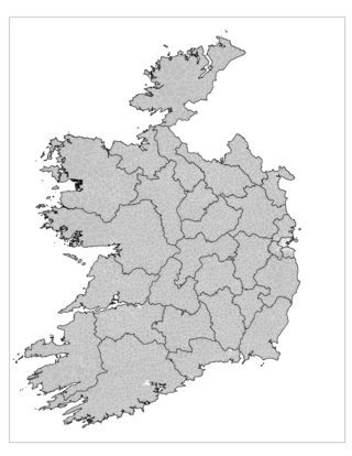
An electoral division is a legally defined administrative area in the Republic of Ireland, generally comprising multiple townlands, and formerly a subdivision of urban and rural districts. Until 1996, EDs were known as district electoral divisions in the 29 county council areas and wards in the five county boroughs. Until 1972, DEDs also existed in Northern Ireland. The predecessor poor law electoral divisions were introduced throughout the island of Ireland in the 1830s. The divisions were used as local-government electoral areas until 1919 in what is now the Republic and until 1972 in Northern Ireland.

<span class="mw-page-title-main">Cavan County Council</span> Local government authority for county of Cavan in Ireland

Cavan County Council is the authority responsible for local government in County Cavan, Ireland. As a county council, it is governed by the Local Government Act 2001. The council is responsible for housing and community, roads and transportation, urban planning and development, amenity and culture, and environment. The council has 18 elected members. Elections are held every five years and are by single transferable vote. The head of the council has the title of Cathaoirleach (chairperson). The county administration is headed by a Chief Executive, Tommy Ryan. The county town is Cavan.

<span class="mw-page-title-main">Carlow County Council</span> Local authority for County Carlow, Ireland

Carlow County Council is the local authority of County Carlow, Ireland. As a county council, it is governed by the Local Government Act 2001. The council is responsible for housing and community, roads and transportation, urban planning and development, amenity and culture, and environment. The council has 18 elected members. The head of the council has the title of Cathaoirleach (chairperson). The county administration is headed by a Chief Executive, Kathleen Holohan. The county town is Carlow.

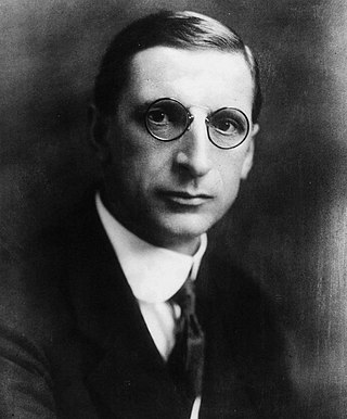
Francis Elrington Ball, known as F. Elrington Ball (1863–1928), was an Irish author and legal historian, best known for his work The Judges in Ireland 1221–1921 (1926).

<span class="mw-page-title-main">Carrickfergus (barony)</span> Place in Northern Ireland, United Kingdom

Carrickfergus is a barony in County Antrim, Northern Ireland. It is bounded on the south-east by Belfast Lough, and otherwise surrounded by the barony of Belfast Lower. It is coextensive with the civil parish of Carrickfergus or St Nicholas and corresponds to the former county of the town of Carrickfergus, a county corporate encompassing Carrickfergus town.

<span class="mw-page-title-main">Kilculliheen</span> Civil parish in County Kilkenny, Ireland

Kilculliheen is a civil parish, electoral division and barony in Ireland, on the north bank of the River Suir across from the centre of Waterford City. Historically, it has been transferred several times between the county of the city of Waterford and the counties of Kilkenny and Waterford. It now contains the only part of Waterford city on the left bank of the River Suir. The Parliamentary Gazetteer of 1846 states "as it lies on the left bank of the Suir, which, for the most part, divides co. Waterford from co. Kilkenny, most topographists mistakingly assign it to the barony of Ida, co. Kilkenny". It is now partly in County Kilkenny and partly in Waterford City. Of the barony's eleven townlands, five are entirely in Kilkenny and six are split between Kilkenny and Waterford. The city portion contains the formerly rural village of Ferrybank, which gives its name to a wider suburb which has spread across the county boundary.

<span class="mw-page-title-main">1920 Irish local elections</span> Local authority elections in Ireland

Elections were held in January and June 1920 for the various county and district councils of Ireland. The elections were organised by the Dublin Castle administration under the law of the then United Kingdom of Great Britain and Ireland (UK), and held while the Irish War of Independence was pitting UK forces against those of the Irish Republic proclaimed in 1919 by the First Dáil. Elections were held in two stages: borough and urban district councils in January; and county and rural district councils in June. Sinn Féin, which had established the First Dáil, won control of many of the councils, which subsequently broke contact with Dublin Castle's Local Government Board for Ireland and instead recognised the republican Department of Local Government. The election results provide historians with a barometer of public opinion in what would be the last elections administered on an all-island basis: the Government of Ireland Act 1920 passed at the end of the year effected the partition of Ireland from 1921, though the elections for the two home rule Parliaments envisaged by it were held on the same day; No further elections would be held simultaneously across the island of Ireland until 1979, when representatives of the Republic of Ireland and Northern Ireland to the European Parliament were elected. The next local elections were held in 1924 in Northern Ireland and in 1925 in the Irish Free State.

<span class="mw-page-title-main">Fermanagh County Council</span>

Fermanagh County Council was the authority responsible for local government in County Fermanagh, Northern Ireland, between 1899 and 1973. It was originally based at the Enniskillen Courthouse, but moved to County Buildings in East Bridge Street, Enniskillen, in 1960.

<span class="mw-page-title-main">1919 Sligo Corporation election</span> United Kingdom legislation

An election for all 24 members of Sligo Corporation took place on 15 January 1919, using the single transferable vote (STV). Urban districts in Ireland held annual elections on 15 January each year under the Local Government (Ireland) Act 1898, using plurality voting to replace a cohort of one-third or one-quarter of their councillors. Those elections for 1915–19 were postponed while the First World War was still in progress.

In the history of land use in Ireland, a townpark or town park was a smallholding near a town and farmed by someone resident in the town. Typically, a major landowner provided a contiguous area near the town which was subdivided into multiple townparks, each rented on a short-term lease, for a higher rent than that paid by a full-time resident farmer.

<span class="mw-page-title-main">Ankers Bower</span> Townland in County Westmeath, St. Marys

Ankers Bower is a townland and hill in St. Mary's civil parish in the barony of Brawny, County Westmeath, Ireland. It is partly within the former urban district of Athlone. The name may derive from John Ankers, who was vicar of St. Mary's in 1608.

<span class="mw-page-title-main">Drummully</span> Electoral district and pene-enclave in County Monaghan, Ireland

Drummully or Drumully is an electoral division (ED) in the west of County Monaghan in Ireland. Known as the Sixteen Townlands to locals and as Coleman's Island or the Clonoony salient to the security forces, it is a pene-enclave almost completely surrounded by County Fermanagh in Northern Ireland. Since the Partition of Ireland in the 1920s, the Fermanagh–Monaghan border has formed part of the international border between the United Kingdom and what is now the Republic of Ireland, leaving Drummully as a practical enclave, connected to the rest of the republic only by an unbridged 110-metre (360 ft) length of the Finn River. The area is accessed via the Clones–Butlersbridge road, numbered N54 in the Republic and A3 in Northern Ireland.

<span class="mw-page-title-main">Tyrone County Council</span>

Tyrone County Council was the authority responsible for local government in County Tyrone, Northern Ireland.

Elections to the Cork Corporation took place on Thursday 15 January 1920 as part of that year's Irish local elections.

<span class="mw-page-title-main">Harristown (civil parish)</span> Civil parish in County Kildare, formerly of Kings County

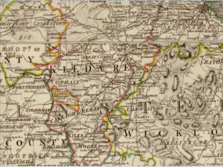
Harristown is a civil parish and electoral division (ED) in County Kildare in Ireland, about 4 miles (6.4 km) southwest of Kildare town.

<span class="mw-page-title-main">Raphoe North</span> Barony in County Donegal, Ireland

Raphoe North, or North Raphoe, is a barony in County Donegal, Ireland. Baronies were mainly cadastral rather than administrative units. They acquired modest local taxation and spending functions in the 19th century before being superseded by the Local Government (Ireland) Act 1898.

<span class="mw-page-title-main">Raphoe South</span> Barony in County Donegal, Ireland

Raphoe South, or South Raphoe, is a barony in County Donegal, Ireland. Baronies were mainly cadastral rather than administrative units. They acquired modest local taxation and spending functions in the 19th century before being superseded by the Local Government (Ireland) Act 1898.