
Coahuila is a state in Northeast Mexico that is divided into 38 municipalities. According to the 2020 Mexican census, Coahuila is the 15th most populous state with 3,146,771 inhabitants and the third largest by land area spanning 151,846.16 square kilometres (58,628.13 sq mi).
Aguascalientes is a state in North Central Mexico that is divided into eleven municipalities. According to the 2020 Mexican census, Aguascalientes is the sixth least populous state with 1,425,607 inhabitants and the fourth smallest by land area spanning 5,630.27 square kilometres (2,173.86 sq mi).

Chihuahua is a state in Northwest Mexico that is divided into 67 municipalities. According to the 2020 Mexican census, Chihuahua is the 12th most populous state with 3,741,869 inhabitants and the largest by land area spanning 247,798.08 square kilometres (95,675.37 sq mi).

Guanajuato is a state in North Central Mexico that is divided into 46 municipalities. According to the 2020 Mexican census, Guanajuato is the sixth most populous state with 6,166,934 inhabitants and the 22nd largest by land area spanning 30,691.61 square kilometres (11,850.10 sq mi).
Mexico City is one of the 32 federal entities of Mexico, the others being the 31 states. It was named Distrito Federal up to February 5, 2016, when it was officially renamed the Ciudad de México. According to the 2020 Mexican census, it is the second most populated entity with 9,209,944 inhabitants and the smallest by land area spanning 1,494.3 square kilometres (577.0 sq mi).

Tecate is a municipality in the Mexican state of Baja California. Its municipal seat is located in the city of Tecate. According to the 2020 census, it had a population of 108,440 inhabitants. The municipality has an area of 3,079.0 km².

Playas de Rosarito Municipality is located in the northwestern part of the Mexican state of Baja California comprising part of the Tijuana metropolitan area. It lies just south of the city of Tijuana. Its municipal seat is the city of Rosarito. According to the 2020 census, the municipality had a population of 126,890 inhabitants. Its area is 513.32 km².

The National Institute of Statistics and Geography is an autonomous agency of the Mexican Government dedicated to coordinate the National System of Statistical and Geographical Information of the country. It was created on January 25, 1983, by presidential decree of Miguel de la Madrid.

Mexico is a state in central Mexico that is divided into 125 municipalities. According to the 2020 Mexican census, it is the most populated state with 16,992,418 inhabitants and the 8th smallest by land area spanning 22,351.8 square kilometres (8,630.1 sq mi).
Juchitán is a settlement in Juchitán Municipality, in the Mexican state of Guerrero. It is part of the region of the state known as the Costa Chica.

Spanish Mexicans are citizens or residents of Mexico who identify as Spanish as a result of nationality or recent ancestry. Spanish immigration to Mexico began in the early 1500s and spans to the present day. The vast majority of Mexicans have at least partial Spanish ancestry; the Northern regions of Mexico have a higher prevalence of Spanish heritage. There are three recognized large-scale Spanish immigration waves to the territory which is now Mexico: the first arrived during the colonial period, the second during the Porfiriato and the third after the Spanish Civil War.

Zacatecas ( ), officially the Free and Sovereign State of Zacatecas, is one of the 31 states of Mexico. It is divided into 58 municipalities and its capital city is Zacatecas.
Vicente Guerrero is a municipality in the Mexican state of Puebla. The capital of the commune is Santa María del Monte.

Acapulco de Juárez is one of the 81 municipalities of Guerrero, in southwestern Mexico, along Acapulco Bay on the Pacific coast. The municipal seat lies at Acapulco.
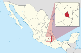
Tekom Municipality is a municipality in the Mexican state of Yucatán. Tekom is also the name of the municipality's largest settlement and seat of the municipal government. In the XII national census conducted by INEGI in 2000, Tekom municipality recorded a population of 2,660 inhabitants. In the intermediate census count undertaken by INEGI in 2005, the total municipal population was recorded as 2,933 inhabitants, 2,413 of whom spoke one of the recognised indigenous languages of Mexico.

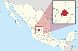
Espita Municipality is one of the 106 municipalities in the Mexican state of Yucatán Its municipal seat is located in the City of Espita and is located on the Litoral Oriente or Region 1 of the state. In 2005, the municipality had the 77th highest HDI in the state with 0.7320, the same as Honduras in 2007.
Lafragua Municipality is a municipality in the Mexican state of Puebla. According to the National Statistics Institute (INEGI), it had a population of 10,551 inhabitants in the 2005 census. By the 2010 census it had dropped to 7,767 inhabitants, 761 of whom lived in Saltillo, the municipal seat. Its total area is 128.85 km². The Saltillo name comes from the Nahuatl words Atlcholoa in atl, which means water, and Choloa, meaning drip. Therefore, means water that drips. The name Lafragua is in honor of José María Lafragua.
Chunhuhub is a town in the Mexican state of Quintana Roo, Mexico, localized in state center, in the municipality of Felipe Carrillo Puerto. The population was 4,644 inhabitants at the 2010 census.