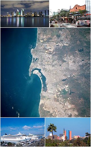
Tijuana, known also by the initials T.J., is a city and municipal seat of Tijuana Municipality, Baja California, located on the Pacific Coast of Mexico. It is part of the San Diego-Tijuana metro area and the larger Southern California megapolitan area.

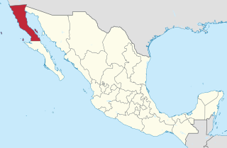
Baja California, officially the Free and Sovereign State of Baja California, is a state in Mexico. It is the northernmost and westernmost of the 32 federal entities of Mexico. Before becoming a state in 1952, the area was known as the North Territory of Baja California. It has an area of 70,113 km2 (27,071 sq mi) and comprises the northern half of the Baja California Peninsula, north of the 28th parallel, plus oceanic Guadalupe Island. The mainland portion of the state is bordered on the west by the Pacific Ocean; on the east by Sonora, the U.S. state of Arizona, and the Gulf of California; on the north by the U.S. state of California; and on the south by Baja California Sur.

Baja California Sur, officially the Free and Sovereign State of Baja California Sur, is the least populated state and the 31st admitted state of the 32 federal entities which comprise the 31 States of Mexico. It is also the ninth-largest Mexican state in terms of area.

The Pacific Coast Ranges are the series of mountain ranges that stretch along the West Coast of North America from Alaska south to Northern and Central Mexico. Although they are commonly thought to be the westernmost mountain range of the continental United States and Canada, the geologically distinct Insular Mountains of Vancouver Island lie farther west.

Mexicali is the capital city of the Mexican state of Baja California. The city, seat of the Mexicali Municipality, has a population of 689,775, according to the 2010 census, while the Calexico–Mexicali metropolitan area is home to 1,000,000 inhabitants on both sides of the United States-Mexico border. Mexicali is a regional economic and cultural hub for the border region of The Californias.

The Sonoran Desert is a desert in North America and ecoregion that covers the northwestern Mexican states of Sonora, Baja California, and Baja California Sur, as well as part of the southwestern United States. It is the hottest desert in both Mexico and the United States. It has an area of 260,000 square kilometers (100,000 sq mi).

La Paz is the capital city of the Mexican state of Baja California Sur. The city had a 2020 census population of 250,141 inhabitants, making it the most populous city in the state. Its metropolitan population is somewhat larger because of the surrounding towns, such as El Centenario, Chametla and San Pedro. It is in La Paz Municipality, which is the fourth-largest municipality in Mexico in geographical size and reported a population of 292,241 inhabitants on a land area of 20,275 km2 (7,828 sq mi).
The human history of the west coast of North America is believed to stretch back to the arrival of the earliest people over the Bering Strait, or alternately along a now-submerged coastal plain, through the development of significant pre-Columbian cultures and population densities, to the arrival of the European explorers and colonizers. The west coast of North America today is home to some of the largest and most important companies in the world, as well as being a center of world culture.

The 32 federal states of Mexico are ranked below according to population, size, population density, and GDP.

Municipalities are the second-level administrative divisions of Mexico, where the first-level administrative division is the state. They should not be confused with cities or towns that may share the same name as they are distinct entities and do not share geographical boundaries. As of January 2021, there are 2,454 municipalities in Mexico, excluding the 16 boroughs of Mexico City.

The municipality of Ensenada is the fourth-largest municipality in Mexico with a land area of 19,526.8 km2 (7,539.3 sq mi) in 2020, about the same size as Hidalgo state and larger than five Mexican states.

The Californias, occasionally known as The Three Californias or Two Californias, are a region of North America spanning the United States and Mexico, consisting of the U.S. state of California and the Mexican states of Baja California and Baja California Sur. Historically, the term Californias was used to define the vast northwestern region of Spanish America, as the Province of the Californias, and later as a collective term for Alta California and the Baja California Peninsula.

The following outline is provided as an overview of and topical guide to Mexico:
The 1892 Laguna Salada earthquake occurred at . It had an estimated moment magnitude of 7.1–7.2 and a maximum perceived intensity of VIII (Severe). The shock was centered near the Mexico–United States border and takes its name from a large dry lake bed in Baja California, Mexico. There were no reported casualties, but the event affected the then largely-uninhabited areas of northern Mexico and Southern California.

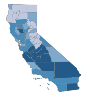
Hispanic and Latino Californians are residents of the state of California who are of Hispanic or Latino ancestry. As of the 2020 U.S. Census, Hispanics and Latinos of any race were 39.4% of the state's population, making it the largest ethnicity in California.
The Roman Catholic Diocese of California, also called the Diocese of the Californias or Diocese of Two Californias, is a former residential episcopal see that existed during 1840–1849, covering the Californias. After the Mexican–American War, the American portion became the Diocese of Monterey in California, while the Mexican portion was eventually reorganized into the Diocese of Tijuana. In 1996, the title was revived as a titular see of the Catholic Church.


